Los Flamencos National Reserve: Salar de Atacama, Valle de la Luna (Chile)
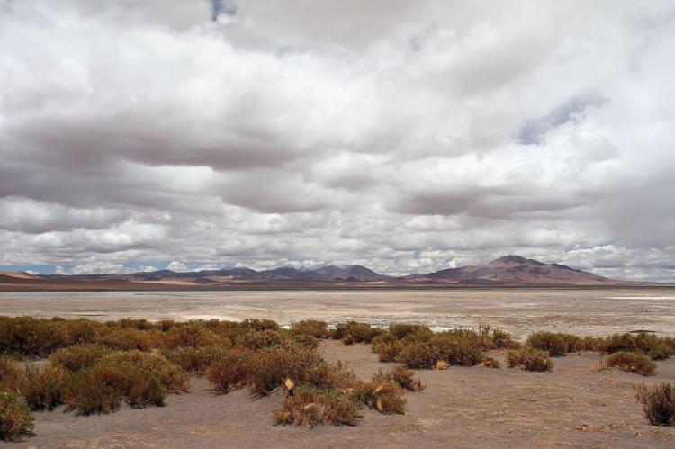
Los Flamencos National Reserve is a nature reserve in northern Chile's Antofagasta Region. The National Reserve has a desert climate and is divided into seven sectors. Notable sectors include the vast salt flats of Salar de Atacama and Valle de la Luna (Moon Valley).
Los Flamencos National Reserve
Los Flamencos National Reserve is a nature reserve located in the commune of San Pedro de Atacama, Antofagasta Region of northern Chile. The National Reserve covers 73,986 ha (182,823 acres) and is situated in the Central Andean Dry Puna and the Atacama Desert ecoregions.
Los Flamencos National Reserve has a desert climate, with temperatures varying dramatically between day and night. As a result, the average high temperature is 24.5°C (76°F), and the average low is 17.1°C (63°F). Rain is more frequent in summer, with an average total rainfall of 3 mm (.12 in).
Los Flamencos National Reserve was created in 1990 and is divided into seven areas or sections, each having different geography, flora, fauna, and hydrography.
Salar de Atacama
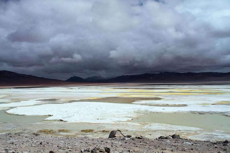
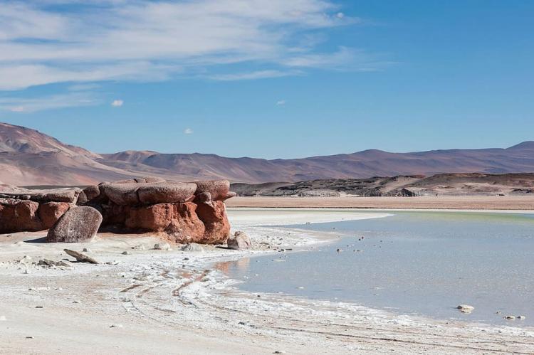
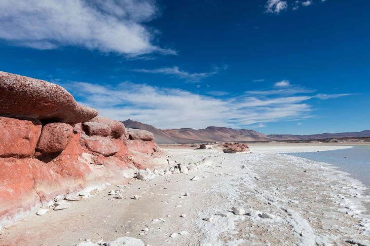
The Salar de Atacama area is formed by two sub-sections of the Los Flamencos National Reserve, Soncor and Quelana. Both comprise lagoons lying over the Salar at an altitude of 2,305 m (7,562 ft), with an extensive salt crust.
The entire salt flat encompasses 3,000 sq km (1,200 sq mi), is about 100 km (62 mi) long and 80 km (50 mi) wide. It is the third largest in the world, after Salar de Uyuni in Bolivia and Salinas Brandes in Argentina.
The topography of the core portion of the Salar exhibits a high level of roughness, the result of evaporation and temporary surface water, unlike most other salt flats, which are often periodically covered with shallow water.
-
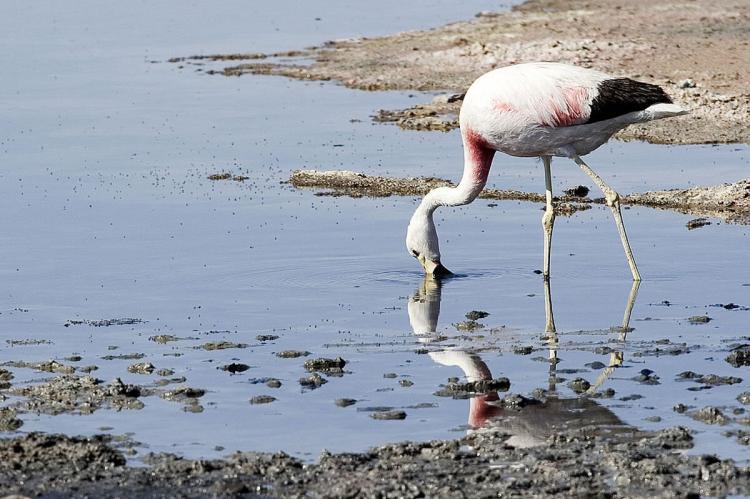
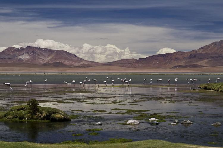
Soncor section: The Soncor section includes the Chaxa, Puilar and Barros Negros lagoons. Despite the extreme conditions, the Salar de Atacama sustains various species, including Chilean and Andean flamingos (the latter using it as an important nesting site), the Andean avocet, the yellow-billed teal, the crested duck, the puna plover and Baird's sandpiper.
Various plant species ground around the edges of the lagoons, such as Distichlis spicata, Ephedra and cachiyuyo (a species of the genus Atriplex), among others. The Sistema hidrológico de Soncor (Soncor hydrological system), like the Salar de Tara, is a Ramsar protected site. It comprises four shallow salt lakes.
-
Quelana section: Located 10 km (6 miles) from the path to Chaxa lagoon, the Quelana section features extensive salt crust and saline mud. The terrain is flat, with an average altitude of 2,300 m (7,546 ft).
{"preview_thumbnail":"/sites/default/files/styles/video_embed_wysiwyg_preview/public/video_thumbnails/84704332.jpg?itok=I3UCTMSf","video_url":"https://vimeo.com/84704332","settings":{"responsive":1,"width":"854","height":"480","autoplay":0},"settings_summary":["Embedded Video (Responsive)."]}
Valle de la Luna
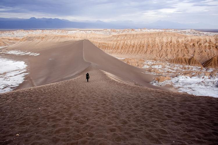
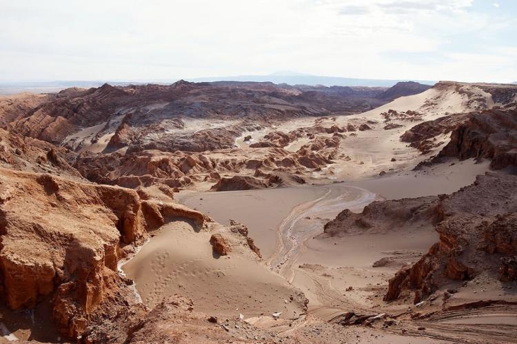
Valle de la Luna (Moon Valley) was declared a Nature Sanctuary in 1982 because of its natural environment and strange lunar landscape, from which its name is derived.
It has various stone and sand formations carved by wind and water. The area also has an impressive range of color and texture, looking somewhat similar to the moon's surface.
There are also dry lakes where the salt composition makes a white covering layer. It presents diverse saline outcrops which appear like artificial sculptures. There are also a great variety of caverns.
When the sun sinks, it defines the landscape while the wind blows among the rocks, and the sky passes from pink to purple and finally black.
Valle de la Luna includes archaeological sites such as the village of Tulor as well as the Cordillera de la Sal mountain range, which reaches altitudes of 2,624 m (8,609 ft).
{"preview_thumbnail":"/sites/default/files/styles/video_embed_wysiwyg_preview/public/video_thumbnails/77146490.jpg?itok=EWuTF2g6","video_url":"https://vimeo.com/77146490","settings":{"responsive":1,"width":"854","height":"480","autoplay":0},"settings_summary":["Embedded Video (Responsive)."]}
Salar de Tara / Salar de Aguas Calientes
This area is made up of two salt flats: Tara, located 120 km (75 miles) east of San Pedro de Atacama and 440 km (273 mi) northeast of Antofagasta, and Aguas Calientes, reaching an altitude of up to 4,860 m (15,944 ft) above sea level.
In 1996, the Ramsar Convention designated Salar de Tara (Tara Salt Flat) a Wetland of International Importance. It features both permanent and seasonal lakes. The largest of these is Tara Lake, which the Zapaleri River feeds.
The flora is characterized by the presence of bofedales, a kind of high-altitude wetland, as well as yellow straw, broom sedge, tola de agua and tola amaia (two species of parastrephia lepidophylla), and coirón (Festuca gracillima), which can be observed on flat and hilly terrain and the slopes of volcanoes and hills.
Salar de Tara provides a habitat for various rare and endangered wildlife species. Some, like the southern viscacha, vicuña and Darwin's rhea, are endangered species.
Others, such as the Andean goose, horned coot, Andean gull, puna tinamou and the three flamingo species inhabiting Chile (Andean flamingo, Chilean flamingo, and James's flamingo), are considered vulnerable.
The conservation status of the tawny tuco-tuco and the Andean fox is unknown. The latter lives in all the sections of the Reserve.
Salar de Pujsa
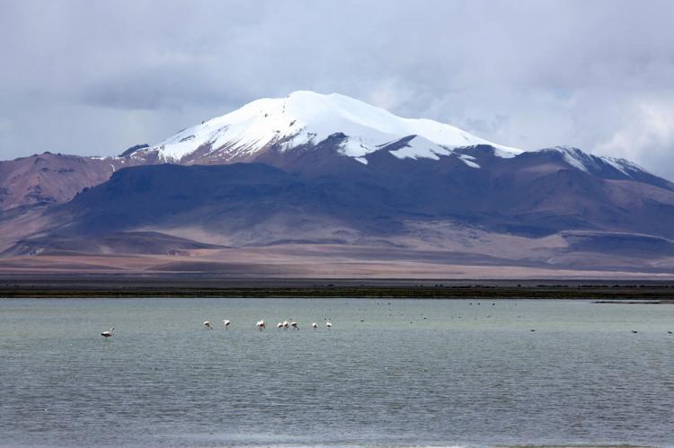
The Salar de Pujsa area is a salt flat southwest of Salar de Tara, 83 km (52 miles) from San Pedro de Atacama and northeast of the Acamarachi volcano. With a maximum altitude of 4,585 m (15,042 ft) above sea level, Pujsa is considered the most isolated section in the Reserve.
The salt flat receives the waters of the Quepiaco and Alitar creeks and was listed as a Ramsar site in 2009. Significant wind erosion occurs in this area.
Birds that migrate across the hemispheres use the salt flat and surrounding land as a staging area, including Wilson's phalarope.
The flora found here is similar to that found in the Tara and Aguas Calientes areas, characterized by bofedales, yellow straw, broom sedge, tola de agua and tola amaia (two species of parastrephia lepidophylla), and coirón (Festuca gracillima), which can be observed on flat and hilly terrain.
The fauna includes vizcachas, chululos, Andean foxes, cuyos, Andean flamingos, Chilean flamingos, ñandúes, Andean condors and eagles, among others.
Miscanti and Miñiques Lagoons
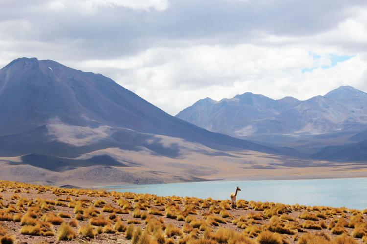
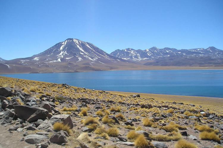
A lava flow from an eruption of Miñiques volcano separated Laguna Miscanti from Laguna Miñiques. They are located 25 km (16 miles) south of Socaire, 115 km (71 mi) southeast of San Pedro de Atacama and 431 km (268 mi) east of Antofagasta.
This area comprises Miscanti Lagoon and Miñiques Lagoon, situated in the foothills of Cerro Miscanti and the Miñiques Volcano. The lagoons are 4,100 - 4,350 m (13,451 - 14,272 ft) above sea level. This section is close to Salar de Talar and Laguna Lejía.
This portion of the Reserve is home to various birds, including the Andean flamingo, Chilean flamingo, horned coot, silvery grebe, Andean gull and greenish-yellow finch. Mammals include the vicuña, Andean fox, and Darwin's leaf-eared mouse.
Tambillo
The Tambillo area is nearest to San Pedro de Atacama and is characterized by an extended Tamarugo forest (Prosopis tamarugo) of 370 ha (914 acres), which is unique in this region.
Tambillo contains fauna similar to the other reserve sections, including the Andean flamingo, Chilean flamingo, horned coot, silvery grebe, Andean gull, greenish-yellow finch, grey fox, Andean fox, chincol (Zonotrichia capensis), swallows, and falcons.
