El Chaltén, Mount Fitz Roy, Cerro Torre, and Lago del Desierto: Discovering the Untamed Splendor of Argentine Patagonia
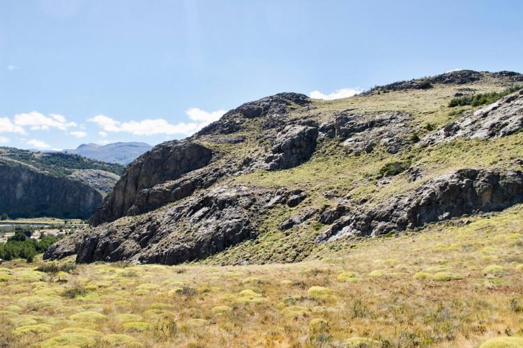
Argentine Patagonia's untamed beauty begins in El Chaltén, a small village in Los Glaciares National Park. This gateway leads to iconic peaks, including Cerro Torre and Cerro Fitz Roy, as well as Lago del Desierto, a tranquil lake surrounded by stunning landscapes.
El Chaltén, Mount Fitz Roy, Cerro Torre, and Lago del Desierto
Discovering the Untamed Splendor of Argentine Patagonia
Nestled amidst the rugged wilderness of Los Glaciares National Park, the village of El Chaltén stands as a beacon of adventure at the heart of Argentine Patagonia. This quaint village is the gateway to the region's most iconic and awe-inspiring natural wonders, beckoning travelers worldwide to explore its untamed beauty.
At the forefront of El Chaltén's allure are the legendary peaks of Cerro Torre and Cerro Fitz Roy, towering sentinels that dominate the skyline with their jagged silhouettes. These formidable mountains, shrouded in myth and mystery, have long captured the imaginations of mountaineers and outdoor enthusiasts alike, drawing them to the challenge of their rocky slopes and icy summits. From the moment they come into view, rising majestically above the surrounding landscape, visitors are captivated by the raw power and breathtaking grandeur of these Patagonian giants.
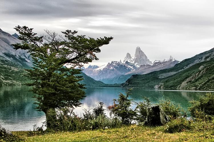
But El Chaltén's appeal extends beyond its towering peaks to the tranquil beauty of Lago del Desierto, a serene lake nestled amidst a landscape of rugged beauty. Here, the still waters mirror the surrounding mountains, reflecting the changing hues of the sky above and providing a sense of peace and tranquility that belies the wildness of the surrounding terrain. Whether exploring its shores by foot or embarking on a leisurely boat ride across its glassy surface, visitors are treated to unparalleled views of Patagonia's pristine landscapes, where jagged peaks and verdant forests converge in a symphony of natural beauty.
El Chaltén
A Gateway to Nature's Wonderland
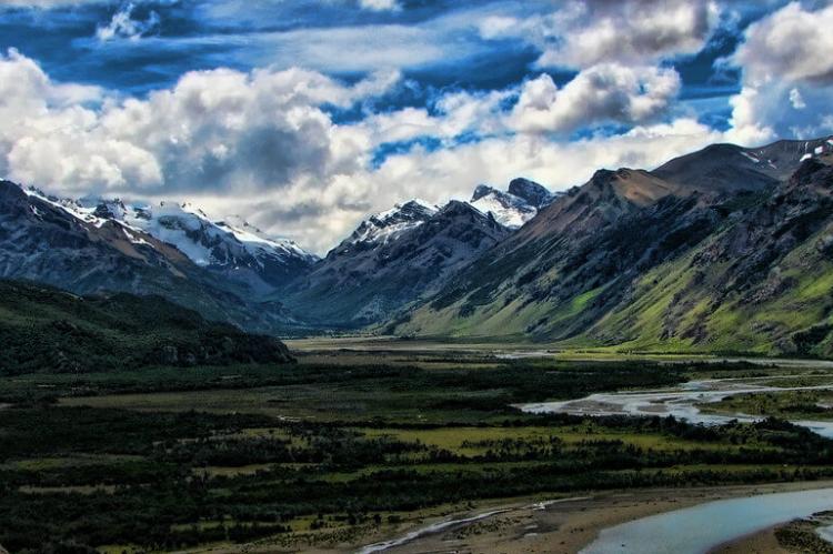
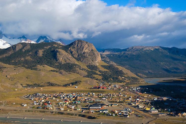
In the southern reaches of the Argentine Patagonia region lies the picturesque El Chaltén, a small mountain village that has blossomed into a haven for nature enthusiasts. Nestled along the Rio de las Vueltas within the Los Glaciares National Park, El Chaltén is the gateway to a realm of awe-inspiring landscapes.
Positioned at the base of the formidable Cerro Torre and Cerro Fitz Roy mountains, the village, founded in the late 1970s amid a border dispute with Chile, has evolved into a thriving hub for adventure seekers. Approximately 350 resilient inhabitants call El Chaltén home, braving the extremes of Patagonia's climate throughout the year.
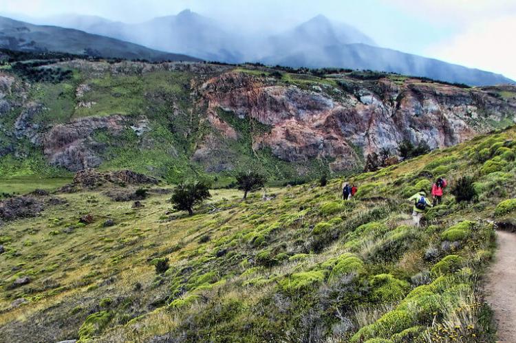
The village, strategically located on the edge of the vast Southern Patagonian Ice Field, offers a launching pad for exploration into the heart of Patagonia's wilderness. El Chaltén is renowned for its extensive network of hiking trails, inviting visitors to traverse paths leading to the base of towering peaks and glacial lakes.
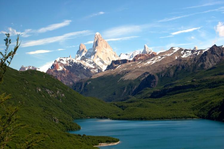
The mesmerizing Laguna Torre and Laguna de Los Tres, situated near the base of Fitz Roy, beckon travelers to witness nature's grandeur up close. With rocky trails leading to the Laguna de Los Tres viewpoint and the captivating shores of Laguna Capri offering mountain vistas, El Chaltén provides a perfect setting for both seasoned trekkers and casual adventurers.
Mount Fitz Roy
Patagonia's Majestic Sentinel
Mount Fitz Roy, also known as Cerro Fitz Roy, stands as a towering sentinel in the Patagonian landscape, marking the border between Argentina and Chile. Reaching a summit elevation of 3,375 meters (11,073 feet), this imposing peak is nestled within the Southern Patagonian Ice Field, near El Chaltén village and Viedma Lake. The mountain's unmistakable silhouette, often shrouded in mist and clouds, has earned it the moniker of one of Southern Patagonia's most recognizable and challenging mountains.
Discovered by the Spanish explorer Antonio de Viedma in 1783, Mount Fitz Roy received its current name in 1877 from Argentine explorer Francisco Moreno. The name pays homage to Captain Robert FitzRoy of the HMS Beagle, who explored the Patagonian coast during Charles Darwin's renowned voyage. The mountain stands as a symbol of the Santa Cruz Province, proudly represented on its coat of arms.
Argentina and Chile have agreed that their international border detours eastwards to pass over the main summit of Mount Fitz Roy. However, a significant portion of the border to the south of the summit, extending to Cerro Murallón, remains undefined, adding an element of intrigue to the region.
The climate around Mount Fitz Roy is as unpredictable as it is challenging, characterized by subpolar oceanic conditions. Summers bring extended daylight hours, intense winds, and cool temperatures, with daytime highs often below 18 °C (64.4 °F) and nighttime lows below 5 °C (41 °F). Even in summer, frost is not uncommon. Winters bring moderate snowfall, with average temperatures around 3 °C (37.4 °F) during the day and −4 °C (24.8 °F) during the night. The coldest nights can plunge much lower, creating a harsh yet breathtaking environment. Spring and fall introduce variable conditions but maintain a chilly ambiance.
Cerro Torre
Nature's Towering Challenge
Cerro Torre, a prominent peak in the Southern Patagonian Ice Field, is a testament to nature's sculpting prowess. Situated in a disputed region between Argentina and Chile, west of Fitz Roy, Cerro Torre is part of a four-peak chain that includes Torre Egger, Punta Herron, and Cerro Standhardt. Rising to an elevation of 3,128 meters (10,262 feet), Cerro Torre poses a considerable challenge to climbers, thanks to its unpredictable weather conditions and the constant, formidable winds.
The summit of Cerro Torre is often adorned with a distinctive mushroom of rime ice due to the persistent winds shaping the frozen landscape. This natural phenomenon enhances the mountain's allure and adds a layer of difficulty for those attempting to reach its summit. The region around Cerro Torre, with its dramatic peaks and icy landscapes, offers a thrilling playground for mountaineers and adventure enthusiasts.
Lago del Desierto
Tranquil Waters Amid Historical Ripples
Lago del Desierto, or the "Lake of the Desert," graces the Santa Cruz Province with its serene presence. Nestled in a valley between the Martínez de Rozas Range to the east and the Southern Patagonian Ice Field glaciers to the west, this pristine lake captures the essence of tranquility. Fed primarily by glacier melt, Lago del Desierto contributes to the picturesque landscape that characterizes this part of Patagonia.
The lake's runoff travels downstream via the Vueltas River, meandering southward to join Lago Viedma before reaching the Atlantic Ocean. The surrounding vistas, with the majestic Mount Fitz Roy nearby, create a stunning backdrop for the lake's tranquil waters.
Lago del Desierto was once at the center of a territorial dispute between Argentina and Chile, a historical ripple that was favorably settled for Argentina through arbitration in 1994. Today, the lake symbolizes undisturbed natural beauty and a testament to diplomatic resolutions.
As the sun sets over the Southern Patagonian landscape, casting its warm hues on the rugged peaks of Mount Fitz Roy and Cerro Torre and reflecting in the tranquil waters of Lago del Desierto, one cannot help but marvel at the untamed splendor of the Argentine Patagonia. These natural wonders, each with unique charm and story, beckon adventurers to embark on a journey into the heart of one of the world's last wild frontiers.
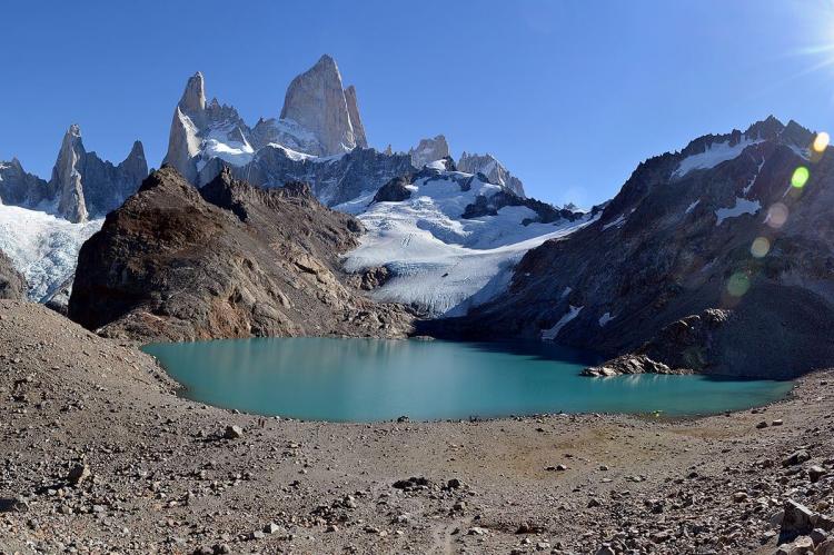
![Mount Fitz Roy, Los Glaciares National Park, Patagonia, Argentina - by own work (Todor Bozhinov) [CC BY-SA 4.0 (https://creativecommons.org/licenses/by-sa/4.0)] Mount Fitz Roy, Los Glaciares National Park, Patagonia, Argentina](/sites/default/files/styles/large/public/fitz_roy_chalten_argentina_chile_opt%20%281%29.jpg?itok=3QKR_prn)
![Cerro Torre, Torre Glacier and Laguna Torre by Stefan.straub [CC BY-SA 4.0 (https://creativecommons.org/licenses/by-sa/4.0)] Cerro Torre, Torre Glacier and Laguna Torre](/sites/default/files/styles/large/public/cerro_torre_laguna_torre_opt%20%281%29.jpg?itok=xmIIHSHL)
![Fitz Roy and Laguna Capri, Los Glaciares National Park, January 16, 2015 by Alejandro Dau [CC BY-SA 4.0 (https://creativecommons.org/licenses/by-sa/4.0)] Fitz Roy and Laguna Capri, Los Glaciares National Park, January 16, 2015](/sites/default/files/styles/large/public/fitz_roy_y_laguna_capri_opt%20%281%29.jpg?itok=LyoICIRb)
![Cerro Torre by Alex Proimos from Sydney, Australia [CC BY 2.0 (https://creativecommons.org/licenses/by/2.0)] Cerro Torre](/sites/default/files/styles/large/public/cerro_torre_opt%20%281%29.jpg?itok=Bkx2STVi)
