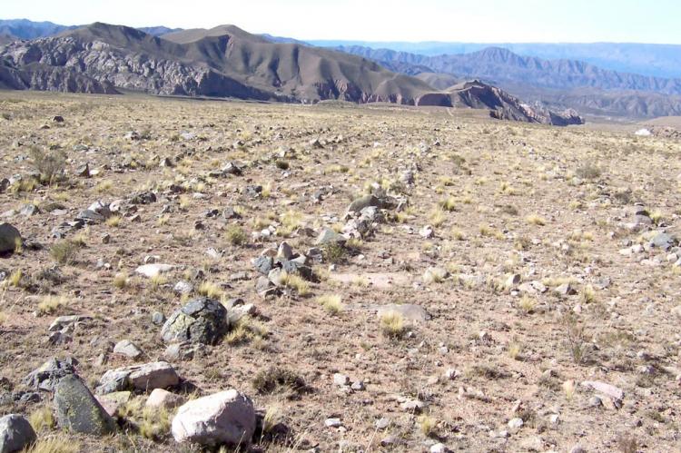
Qhapaq Ñan, Andean Road System (South America)
The Qhapaq Ñan, also known as the Andean Road System, is a marvel of engineering and culture that weaves together the diverse landscapes and societies of the Andes in South America. This intricate network of trails and roads traverses one of the world's most extreme geographical terrains.
Qhapaq Ñan, Andean Road System
The Qhapaq Ñan, also known as the Andean Road System, is a marvel of engineering and culture that weaves together the diverse landscapes and societies of the Andes Mountains in South America. This intricate network of trails and roads is a testament to the Inca civilization's exceptional ability to navigate, communicate, and unify their vast empire.
The Qhapaq Ñan is not just a road system. It is also a cultural landscape that includes hundreds of archaeological sites, such as temples, fortresses, and settlements. Recognized as a UNESCO World Heritage Site in 2014, the Qhapaq Ñan is a treasure trove of historical and cultural significance, showcasing the Inca's ingenuity and the role it played in the development and consolidation of their empire.
Main Andean Road
The Qhapaq Ñan, often called the Main Andean Road, was the lifeblood of the Inca Empire's political and economic power. This extensive network of roads, spanning at least 23,000 km (14,300 mi), connected various production, administrative, and ceremonial centers established over 2,000 years of pre-Inca Andean culture across South America.
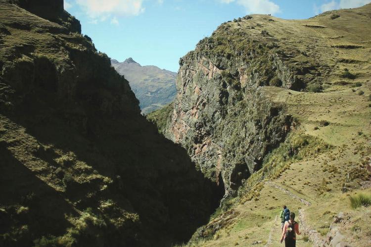
The backbone of the route, aptly named the "Royal Road," traversed the peaks of the Andes and is most discernible between Quito and Mendoza. In addition to this critical axis, other roads ran north-south along the Pacific coast. The famous "Inca Trail" to Machu Picchu is one of the best-known segments of this road system.
The Inca Empire orchestrated this network on a continent-wide scale, making their roads a tangible testament to the organizational and planning prowess of the available labor force. These roads were a key instrument in physically and organizationally unifying the empire, facilitating efficient communication and resource transport.
Architectural Marvels
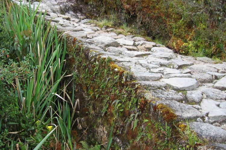
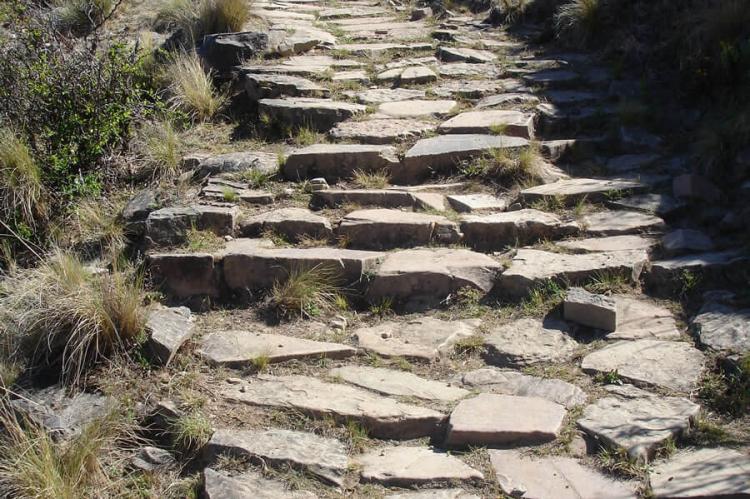
The Qhapaq Ñan showcases the Inca's exceptional architectural ingenuity. These roads were meticulously constructed, incorporating various techniques, including stone-paved pathways, woven grass suspension bridges, and retaining walls to prevent erosion. These features allowed the road system to endure the diverse and challenging landscapes it traversed.
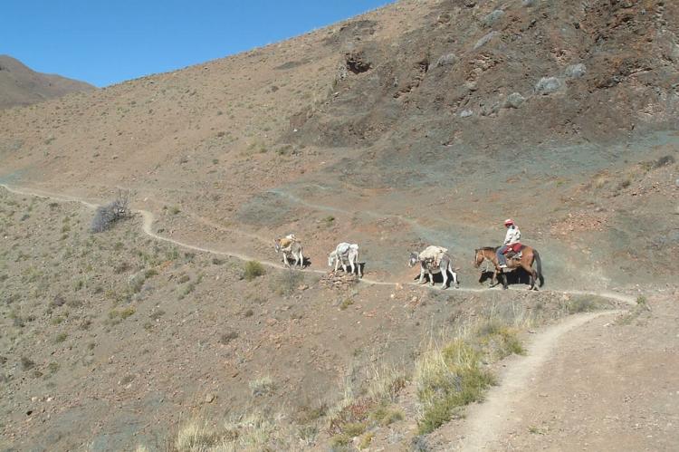
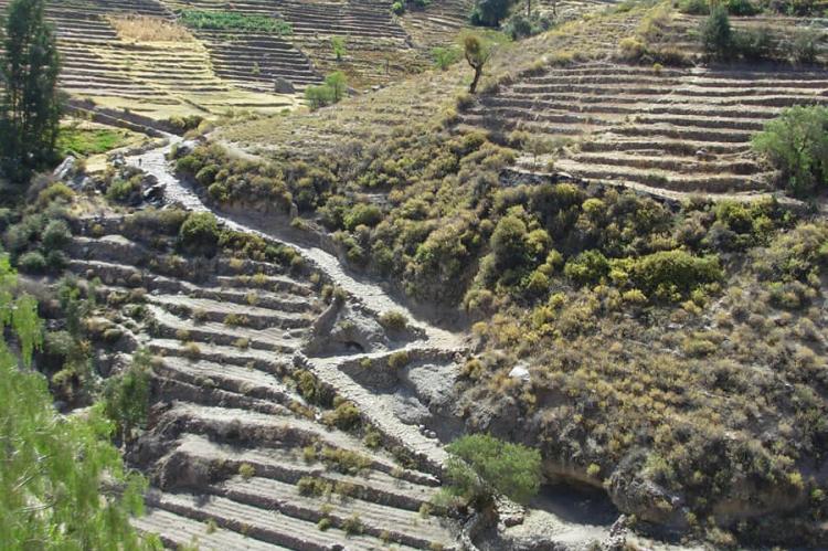
One of the most remarkable aspects of the Qhapaq Ñan is its capacity to navigate extreme elevations. The network reached over 6,600 m (21,650 ft) above sea level, making it one of the highest road systems globally. To achieve this, the Incas constructed switchbacks, terraced ascents, and various structures, demonstrating their advanced understanding of topography and geography.
The Qhapaq Ñan is not just a road system. It is also a cultural landscape that includes hundreds of archaeological sites, such as temples, fortresses, and settlements. Some of the most significant archaeological sites along the Qhapaq Ñan include:
-
Machu Picchu in Peru
-
Ingapirca in Ecuador
-
Pachacamac in Peru
-
Saqsayhuamán in Peru
-
Ollantaytambo in Peru
-
Tambomachay in Peru
-
Pumapungo in Ecuador
-
Incahuasi in Bolivia
-
Tilcara in Argentina
Cultural Importance
The Qhapaq Ñan transcends its utilitarian functions to hold profound cultural significance for the Andean region. It serves as a tangible bridge to the Inca way of life, their spiritual beliefs, and their profound connection with the natural world.
Evidence of this deep cultural bond can be found along these ancient routes in the form of archaeological sites, including tambo (roadside lodges) and huacas (sacred sites). These sites serve dual purposes as resting places for travelers and locations for sacred ceremonies, underscoring the Inca's spiritual relationship with the diverse landscapes they traversed.
Moreover, the Qhapaq Ñan serves as a poignant symbol of the Inca's unity and cohesion. It not only embodied the empire's strength but also symbolized the authority of the emperor. This extensive road network facilitated swift communication between distant provinces, centralized government control, and ensured the efficient flow of essential resources.
Intriguingly, the Qhapaq Ñan is not confined to the past; it lives on as a vibrant cultural heritage. Many indigenous communities continue to utilize these ancient roads today, preserving their traditions and way of life. The archaeological sites along the route remain vital places of pilgrimage and ceremony, where the Inca's cultural legacy endures through generations.
Conservation Efforts
While the Qhapaq Ñan has endured for centuries, it faces contemporary challenges, including erosion, landslides, and modern development. As a UNESCO World Heritage Site, countries in the Andean region are working diligently to preserve and restore segments of the road system. This effort involves the collaboration of local communities, archaeologists, and international organizations.
The increase in tourism has highlighted the need for responsible management of the Qhapaq Ñan, striking a balance between accessibility for visitors and preservation of the site's integrity. As the world gains a deeper understanding of the significance of this ancient road system, it becomes increasingly important to ensure its long-term protection and sustainable use.
