Moray: The Inca Empire's Mountain Laboratory of Agricultural Innovation
Moray is a fascinating archaeological site located on a high plateau in the Cusco region of Peru. Known for its unusual circular terraced depressions that have intrigued and puzzled archaeologists, the site is a testament to the innovative agricultural practices of the ancient Incas.
]")


The Circular Terraces of Moray: Where Ancient Science Meets Sacred Geometry
Fifty kilometers (31 miles) northwest of Cusco, within Peru's Sacred Valley, and carved into the high-altitude plateau at 3,500 meters (11,483 feet) above sea level, lies one of the Inca Empire's most scientifically sophisticated archaeological sites. Moray, with its striking series of concentric circular terraces, represents an extraordinary fusion of natural geology and human engineering that created what modern researchers recognize as an ancient agricultural laboratory of remarkable complexity and innovation.
The site occupies 37 hectares (92 acres) of highland terrain where natural limestone sinkholes have been transformed into precision-engineered amphitheaters through massive construction projects that required moving thousands of tons of soil and fitted stone. The largest circular complex descends 30 meters (98 feet) in depth, with twelve concentric terraces that create distinct microclimates enabling the cultivation of crops requiring vastly different environmental conditions within a single location.
Site Description and Layout
Moray consists of several terraced circular depressions of varying sizes, with the three main complexes known locally as Muyus. The largest and most impressive formation measures approximately 130 meters (426 feet) in diameter at its upper rim, with the terraced levels stepping down in concentric circles to create a dramatic stone amphitheater that captures and concentrates solar energy while providing protection from highland winds.
The site's terraces are constructed from precisely fitted limestone blocks quarried from local sources, with retaining walls built using the same mortarless construction techniques employed at major Inca ceremonial centers. Each terrace level varies in width from 3 to 15 meters (10 to 49 feet), creating cultivation areas that total approximately 8 hectares (20 acres) of productive agricultural land within the circular depressions.
Underground drainage systems carved into the bedrock and lined with fitted stones prevent waterlogging while maintaining optimal soil moisture levels. Surface irrigation channels distribute water throughout the complex through a network of carefully graded canals that demonstrate a sophisticated understanding of hydraulic engineering and water management principles.
The terraced walls range from 2 to 4 meters (6.5 to 13 feet) in height between levels, with each retaining wall constructed to precise specifications that enable the structures to withstand centuries of seismic activity, freeze-thaw cycles, and seasonal weather variations characteristic of high-altitude Andean environments.
Geological Foundation and Construction
Moray's terraces were built within natural limestone sinkholes created by subsurface water erosion over geological time periods. These karstic depressions, formed where underground streams dissolved soluble bedrock, provided natural amphitheaters that concentrated solar radiation while offering protection from highland temperature extremes and wind exposure.
Archaeological evidence indicates that construction occurred in multiple phases spanning several centuries. The bottom terraces show construction techniques and pottery fragments associated with the Wari culture (600-1000 CE), suggesting that the site's agricultural potential was recognized and initially developed before Inca imperial expansion into the region.
Inca engineers enhanced and expanded the original Wari construction during the 14th and 15th centuries CE, adding the sophisticated water management infrastructure and precision stonework that characterizes the site's current configuration. The visible terraced levels represent this Inca construction phase, incorporating an advanced understanding of microclimate creation and agricultural optimization.
Each terrace was constructed with carefully engineered soil compositions designed for specific crop types. Lower levels received richer soil mixtures with higher organic content suitable for crops requiring warmer, more humid conditions, while upper terraces utilized well-drained compositions appropriate for highland species adapted to intense solar radiation and temperature variations.
The Science of Agricultural Microclimates
Moray's most remarkable achievement lies in its creation of multiple distinct growing environments within the circular depressions. Temperature measurements have documented differences of up to 15°C (59°F) between the upper and lower terrace levels, effectively simulating growing conditions found across hundreds of kilometers of natural elevation change.
This temperature variation results from the circular configuration that concentrates solar radiation at the bottom of each depression. The stone retaining walls absorb solar energy during the day and release heat gradually during cool nights, moderating temperature extremes that would otherwise limit high-altitude agriculture. Lower terraces benefit from this thermal mass effect while remaining protected from wind exposure that increases evapotranspiration and plant stress.
The depth and orientation of each terrace level create different patterns of sun exposure throughout daily and seasonal cycles. Upper terraces receive direct sunlight for shorter periods while lower levels benefit from concentrated solar heating and reflected radiation from the surrounding stone walls, creating warmer growing conditions that enable the cultivation of crops normally requiring lower elevations.
Wind patterns are modified by the circular terraced walls that function as natural windbreaks, reducing desiccation stress on plants while creating more humid microclimates in the protected lower levels. This environmental modification is particularly crucial at Moray's elevation, where highland winds can damage crops and make agriculture challenging without protection.
Agricultural Innovation and Crop Diversity
Historical accounts and archaeological evidence indicate that Inca agricultural specialists cultivated over 250 different crop varieties at Moray, utilizing the site's microclimatic diversity to conduct systematic agricultural research that informed farming practices throughout their empire. The terraced levels functioned as individual experimental plots where different varieties could be tested under controlled environmental conditions.
Potato cultivation formed a central focus of research activities, with dozens of native Solanum species grown on different terrace levels to optimize production and develop varieties adapted to specific environmental conditions. The controlled microclimates enabled year-round cultivation of potatoes that normally required specific seasonal conditions, potentially increasing annual yields significantly.
Quinoa (Chenopodium quinoa) research contributed to developing high-altitude varieties capable of surviving frost conditions while producing the complete protein essential for highland populations. Different terrace levels allowed testing of quinoa varieties adapted to varying temperature and humidity regimes, contributing to the crop's cultivation throughout diverse ecological zones.
Maize (Zea mays) experiments focused on adapting lowland varieties to high-altitude conditions, enabling the cultivation of this culturally important crop at elevations where it would not naturally thrive. The protected microclimates within Moray's circular terraces provided the warmer temperatures necessary for successful maize cultivation at an elevation of 3,500 meters.
The site also supported the cultivation of medicinal and ceremonial plants, including coca (Erythroxylum coca) and various species used in traditional medicine and religious practices. The controlled growing conditions enabled optimization of active compound concentrations while ensuring reliable supplies for imperial ceremonial and medical requirements.
Architectural and Engineering Features
The construction of Moray required sophisticated engineering skills that demonstrate Inca mastery of stone working, hydraulic systems, and environmental manipulation. The terraced walls were built using limestone blocks shaped with bronze tools and fitted together with joints so precise that knife blades cannot be inserted between them—a construction technique that provides exceptional structural stability and optimal drainage.
Water management systems represent some of the site's most impressive engineering achievements. Underground channels carry excess water away from the terraces while maintaining controlled seepage that prevents drought stress during dry periods. Surface canals distribute irrigation water throughout the complex through gravity-fed systems that require no external energy sources or mechanical components.
The irrigation network features distribution gates and flow control structures that enable precise water management tailored to various crop requirements and seasonal conditions. These systems remain functional today, demonstrating the durability and effectiveness of Inca hydraulic engineering applied to agricultural purposes.
Drainage systems prevent soil erosion and structural damage while maintaining optimal growing conditions. Subsurface drainage channels lined with gravel and fitted stones carry excess precipitation away from the terraces while allowing controlled moisture retention that maintains soil structure and fertility.
Cultural and Astronomical Significance
Within Inca cosmology, the circular configuration of Moray held spiritual significance that complemented its practical agricultural functions. The concentric terraces reflected Andean concepts of cyclical time and reciprocity, with the circular form symbolizing eternal cycles of agricultural renewal that connected human activities with cosmic patterns.
The site's orientation incorporates astronomical alignments that enabled its use as an agricultural calendar synchronized with celestial events. The main terrace complex aligns with sunrise on the winter solstice, marking the beginning of the agricultural year when specific planting activities would commence according to traditional Andean farming calendars.
Ritual activities at Moray included ceremonies honoring agricultural deities, with offerings placed at strategic locations throughout the terraced complex. These practices maintained reciprocal relationships between human agricultural work and the natural forces believed to control crop growth, weather patterns, and seasonal cycles, which are essential for successful farming.
The site continues to hold sacred significance for local Indigenous communities, who conduct traditional ceremonies to honor ancestral agricultural knowledge and seek favorable conditions for contemporary farming activities. These practices have maintained cultural continuity for over 500 years, spanning the period since the site's abandonment during the Spanish colonial disruption of Indigenous agricultural systems.
Archaeological Research and Findings
Modern archaeological investigation at Moray began in the early 20th century, with systematic excavations revealing the site's construction chronology and agricultural functions. Research has documented the multi-phase construction process, identified crop remains that indicate the diversity of species cultivated, and analyzed soil compositions that demonstrate a sophisticated understanding of plant nutrition and growing medium optimization.
Excavations have recovered agricultural tools, pottery fragments, and organic remains that provide insights into daily activities and agricultural practices at the site. These findings include bronze implements used for soil preparation and plant cultivation, ceramic vessels for water storage and food processing, and preserved seeds that represent some of the crop varieties developed through research conducted at Moray.
Soil analysis has revealed distinct compositional differences between terrace levels that reflect deliberate engineering of growing media for specific crop types. These findings demonstrate that Inca agricultural specialists possessed detailed knowledge of plant nutrition requirements and soil chemistry, which enabled the optimization of growing conditions for diverse crop species.
Recent research has utilized modern technology, including ground-penetrating radar and 3D modeling, to document the site's construction details and identify areas that may contain additional archaeological deposits. These studies continue to reveal new information about the site's function while supporting conservation efforts through detailed structural documentation.
Conservation Status and Challenges
Moray is protected as part of Peru's national archaeological heritage system, with conservation efforts focused on maintaining the structural integrity of the ancient terraces while accommodating increasing tourist visitation. The site receives over 200,000 visitors annually, creating management challenges that require balancing public access with protection of the fragile archaeological remains.
Conservation work includes restoration of damaged terrace walls using traditional construction techniques and materials consistent with the original Inca stonework. These projects repair earthquake damage, tourist-related wear, and natural weathering while maintaining archaeological authenticity and structural stability.
Ongoing monitoring programs track environmental changes that may affect the site's preservation, including temperature variations, precipitation patterns, and soil conditions that influence the stability of the ancient structures. Climate change presents emerging challenges as altered weather patterns may increase erosion risks and affect the microclimate patterns that define the site's agricultural significance.
Management strategies include visitor pathway designation, group size limitations, and interpretive programs that educate visitors about the site's significance while promoting responsible behavior that minimizes impact on the archaeological remains. These efforts seek to maintain public access while ensuring long-term preservation of this unique archaeological resource.
Conclusion: An Ancient Laboratory's Enduring Significance
Moray represents one of the most innovative examples of pre-Columbian agricultural science, where natural geological formations were transformed through human engineering into sophisticated research facilities that enabled remarkable agricultural achievements. The site's circular terraces, carved into the Andean plateau over centuries of construction, demonstrate principles of environmental manipulation and crop optimization that continue to offer insights for contemporary agricultural challenges.
The precision stonework, sophisticated water management systems, and microclimate creation techniques employed at Moray reflect a level of scientific understanding that integrated knowledge of geology, hydrology, plant biology, and climatology in ways that achieved extraordinary agricultural productivity within natural environmental constraints. These achievements challenge assumptions about pre-industrial technological capabilities while demonstrating the value of traditional knowledge systems for addressing agricultural challenges.
As an archaeological site, Moray offers a unique window into Inca agricultural science and environmental management, which influenced food production throughout one of history's largest empires. The terraced amphitheaters continue to function as intended, creating the microclimatic conditions that enabled ancient agricultural experiments while serving as outdoor laboratories for modern research into traditional farming systems and their contemporary applications.
The enduring significance of Moray lies not only in its remarkable preservation of ancient agricultural infrastructure but also in its demonstration that sustainable intensification of food production is achievable through careful environmental observation, innovative design, and integration of human activities with natural processes. In an era facing agricultural challenges from climate change and population growth, this ancient site continues to inspire solutions that work in harmony with, rather than against, natural environmental systems.
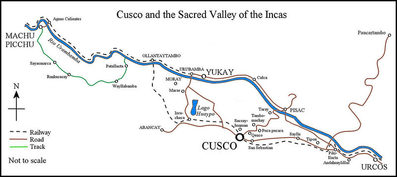
Map of Peru's Sacred Valley - Moray is located near the center of the map.