The Guaraní Aquifer System: South America's Hidden Ocean and the Future of Freshwater Security
Deep beneath four South American nations lies the Guaraní Aquifer System (GAS), one of Earth's most remarkable geological treasures. Spanning 1.2 million square kilometers of Argentina, Brazil, Paraguay, and Uruguay, it creates an underground hydrological empire rivaling the Mediterranean Sea.

Beneath the Surface: The Transboundary Waters of the Guaraní Aquifer System
Deep beneath the rolling landscapes of four South American nations lies one of Earth's most remarkable geological treasures: the Guaraní Aquifer System (GAS). This vast underground reservoir stretches across 1.2 million square kilometers (463,000 square miles) of Argentina, Brazil, Paraguay, and Uruguay, creating an invisible hydrological empire that rivals the size of the Mediterranean Sea. Named in honor of the Indigenous Guaraní people who inhabited these lands for millennia before European colonization, this aquifer system represents far more than a simple water source—it embodies the interconnected destiny of four nations and serves as a critical bulwark against regional water insecurity in an era of climate uncertainty.
A Geological Testament to Deep Time
The story of the Guaraní Aquifer begins not in the present but in the distant geological past, during the Mesozoic Era, approximately 130 to 200 million years ago. During the Triassic and Jurassic periods, vast deserts dominated the supercontinent Gondwana, and mighty rivers carved their way across ancient landscapes. These environments deposited layers of quartz sandstones through both fluvial (river-carried) and aeolian (wind-blown) processes, creating what geologists now recognize as the Piramboia and Botucatu formations. Over eons, these porous sandstones became locked beneath protective layers of dense basaltic rock, forming natural underground chambers that would eventually cradle one of the world's largest freshwater reserves.
The aquifer's geological architecture is both complex and elegant. Its thickness varies dramatically from 50 meters (164 feet) in some areas to an impressive 800 meters (2,625 feet) in others, with waters stored at depths ranging from 50 meters (164 feet) near the surface to 1,800 meters (5,906 feet) in the deepest sections. This vertical diversity creates a three-dimensional water system where different zones exhibit varying water quality, temperature, and flow characteristics.
The Scale of an Underground Continent
To truly comprehend the magnitude of the Guaraní Aquifer System, one must think beyond conventional measurements. With an estimated water volume of 37,000 to 40,000 cubic kilometers (8,900 to 9,600 cubic miles), the aquifer contains enough freshwater to supply the entire world's population for over 200 years at current consumption rates. This volume surpasses the combined water content of many of the world's largest lakes, making it the second-largest known aquifer system on the planet, exceeded only by the Great Artesian Basin in Australia.
The transboundary nature of this resource creates both opportunities and challenges for regional cooperation. Brazil dominates the aquifer's geography, with approximately 70% of the system lying beneath its territory, encompassing over 735,000 square kilometers (284,000 square miles). Argentina holds the second-largest share, followed by Paraguay and Uruguay, with each nation's portion reflecting the complex geological boundaries that pay no respect to the political borders established centuries later.
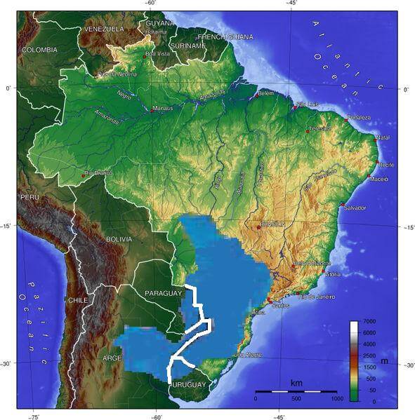
Topographic map depicting the location of the Guaraní Aquifer.
Thermal Signatures and Geothermal Potential
One of the most fascinating aspects of the Guaraní Aquifer lies in its thermal characteristics. Water temperatures within the system range from 33°C to 65°C (91°F to 149°F), creating natural geothermal resources that have been harnessed for both therapeutic and economic purposes. These elevated temperatures result from the aquifer's depth and the natural geothermal gradient of the Earth's crust, where temperatures increase approximately 25°C per kilometer of depth.
Throughout the region, thermal springs fed by the aquifer have created oases of wellness and economic activity. Cities like Termas de Río Hondo in Argentina and numerous Brazilian spa towns have built entire economies around these naturally heated waters. The therapeutic properties of these mineral-rich thermal waters have attracted visitors for generations, supporting a thriving balneological tourism industry that demonstrates the aquifer's value extends far beyond its role as a simple water supply.
A Lifeline for Millions
More than 25 million people reside directly within the boundaries of the Guaraní Aquifer System, their daily lives intimately connected to this underground resource. However, the aquifer's influence extends far beyond its immediate geological boundaries, affecting an estimated 70 million individuals across the four countries through complex hydrological relationships with surface water systems, economic activities, and regional climate patterns.
The aquifer serves multiple critical functions across its vast territory. In São Paulo State, Brazil's economic powerhouse, the Guaraní provides up to 80% of extracted groundwater for industrial and municipal uses, supporting one of South America's most densely populated urban corridors. Agricultural operations throughout the Pampa grasslands and Cerrado savannas depend on aquifer-fed irrigation systems to maintain productivity in regions where rainfall patterns have become increasingly unpredictable due to climate variability.
Rural communities, particularly in Paraguay and Uruguay, often rely entirely on wells tapping the aquifer for their domestic water needs. These communities represent some of the most vulnerable populations in terms of water security, as they lack the necessary infrastructure and financial resources to access alternative sources should the aquifer become compromised.
Ecological Interconnections
The Guaraní Aquifer exists not as an isolated underground sea, but as an integral component of South America's broader hydrological landscape. The system maintains complex hydraulic relationships with six major river systems: the Paraná, Paraguay, Uruguay, Bermejo/Salado, and Pilcomayo rivers. These surface waters both recharge and receive discharge from the aquifer, creating a dynamic equilibrium that supports diverse riparian ecosystems throughout the region.
The aquifer maintains a natural recharge rate of approximately 166 cubic kilometers per year, primarily through precipitation infiltration in outcrop areas where the sandstone formations reach the surface. However, recent research suggests that effective regional recharge rates may be significantly lower than previously estimated, highlighting the importance of protecting recharge zones from contamination and overexploitation.
The wetlands of the Pantanal, rivers of the Paraná Delta, and gallery forests throughout the region all depend partly on groundwater contributions from the aquifer system. These ecosystems support remarkable biodiversity, including numerous species of fish, birds, and mammals that have evolved in close relationship with the aquifer-influenced hydrology of their habitats.
Contemporary Challenges and Vulnerabilities
Despite its enormous size, the Guaraní Aquifer faces mounting pressures that threaten its long-term sustainability. Research indicates that 64% of the study area presents zones of high to very high vulnerability to contamination, primarily due to sandy soils and rocks that provide little filtration, combined with intensive agricultural activities, including large-scale sugar cane and eucalyptus plantations. These monoculture operations often employ significant quantities of pesticides, herbicides, and fertilizers that can infiltrate the aquifer system through permeable soils.
Urban and industrial development poses additional contamination risks. Cities like Buenos Aires, São Paulo, and Montevideo generate vast quantities of wastewater, much of which receives inadequate treatment before potential infiltration into groundwater systems. Industrial activities, particularly in Brazil's highly developed southeastern regions, introduce heavy metals, solvents, and other toxic compounds that could persist in the aquifer for decades or centuries.
Climate change adds another layer of complexity to aquifer management. Shifting precipitation patterns across South America affect recharge rates, while increasing temperatures accelerate evaporation from surface water bodies that interact with the aquifer. Extended drought periods, already observed across portions of the aquifer's territory, reduce natural recharge while simultaneously increasing demand for groundwater extraction.
International Cooperation and Governance
The transboundary nature of the Guaraní Aquifer has necessitated unprecedented cooperation among the four countries that share this resource. In 2010, Argentina, Brazil, Paraguay, and Uruguay signed the Guaraní Aquifer Agreement, establishing a framework for the joint management, environmental protection, and sustainable utilization of the aquifer. This agreement represents one of the few successful examples of international groundwater governance, serving as a model for other transboundary aquifer systems worldwide.
The agreement emphasizes several key principles: the right of each country to utilize aquifer waters within its territory, the obligation to prevent activities that might cause significant harm to other countries, the importance of environmental protection, and the necessity of information sharing and joint monitoring. These principles reflect a growing recognition that groundwater resources transcend political boundaries and require collaborative stewardship.
Technical cooperation has flourished under this framework, with joint research projects mapping aquifer characteristics, monitoring water quality, and assessing extraction rates across the entire system. International organizations, including the World Bank, the Organization of American States, and various United Nations agencies, have provided financial and technical support for these collaborative efforts.
Future Prospects and Regional Water Security
As South America confronts the challenges of population growth, economic development, and climate change, the Guaraní Aquifer System will play an increasingly critical role in regional water security. The aquifer's vast reserves provide a buffer against surface water variability, offering a reliable source of high-quality freshwater that could prove invaluable during extended drought periods or other climatic extremes.
However, realizing this potential requires continued commitment to sustainable management practices. This includes implementing comprehensive monitoring systems to track extraction rates and changes in water quality, establishing protected zones around critical recharge areas, developing treatment technologies for contaminated groundwater, and creating economic incentives for conservation and responsible use.
The thermal resources of the aquifer also present opportunities for sustainable development through geothermal energy production and expanded therapeutic tourism. These applications could generate economic benefits while maintaining the aquifer's primary function as a freshwater resource.
Conclusion: Legacy of the Deep
The Guaraní Aquifer System stands as both a testament to geological processes operating across deep time and a symbol of the possibilities for international cooperation in natural resource management. Named for Indigenous peoples who understood the interconnected nature of land and water long before European colonization, this underground realm continues to sustain millions of lives across four modern nations.
The aquifer's future depends on the choices made today by governments, communities, and individuals throughout its territory. Protection of recharge areas, implementation of sustainable extraction practices, prevention of contamination, and continued international cooperation will determine whether future generations inherit this liquid legacy intact or face the consequences of a degraded and overexploited resource.
As climate change intensifies water stress globally, the Guaraní Aquifer System represents both hope and responsibility. Its vast reserves could provide security and prosperity for millions, but only if managed with the wisdom that recognizes water as a shared heritage transcending all boundaries—political, economic, and temporal. The underground ocean beneath South America thus becomes not merely a geological phenomenon, but a profound test of humanity's capacity for stewardship and cooperation in safeguarding the resources upon which all life depends.