
San Pedro de Atacama's Los Flamencos Reserve: Flamingos, Salt Flats, and a Lithium Reckoning
Los Flamencos National Reserve protects seven non-contiguous sectors of salt flat, wetland, and high-Andean desert across Chile's Atacama region. Home to all three of Chile's flamingo species, the reserve also sits atop one of the world's largest lithium deposits, making it a focal point of an ongoing conflict between conservation, Indigenous water rights, and global battery-mineral demand.


Los Flamencos National Reserve: An Oasis in the Atacama, and a Battleground Beneath It
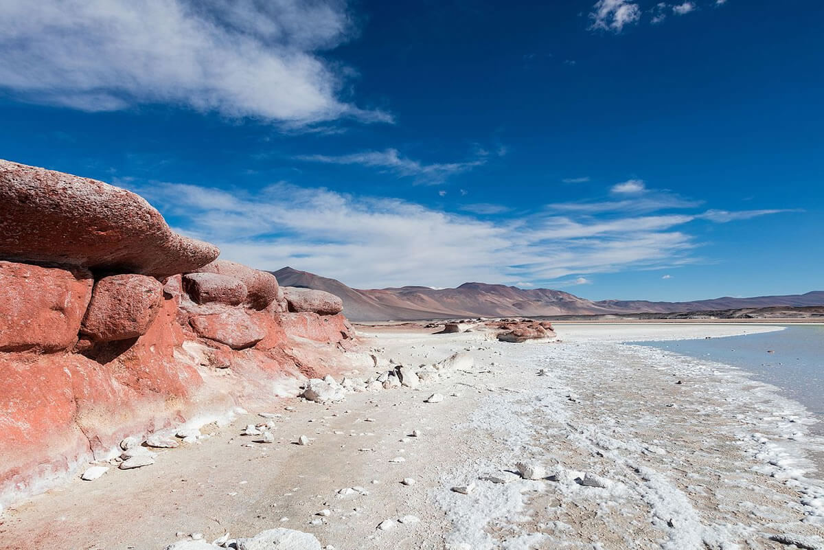
Deep within northern Chile's Atacama Desert, the driest non-polar desert on Earth, Los Flamencos National Reserve protects 73,986 hectares (182,823 acres) spread across seven non-contiguous sectors: Soncor, Aguas de Quelana, Salar de Tara, Salar de Aguas Calientes, Salar de Pujsa, Valle de la Luna, and Tambillo. Established in 1990 and administered by Chile's national forestry corporation, CONAF, the reserve exists chiefly to protect the salt flats and high-altitude wetlands of the Salar de Atacama basin, as well as the flamingo colonies, migratory birds, and Indigenous Atacameño (Lickanantay) communities whose lives remain tied to them. In recent years, the reserve has also become one of the most closely watched sites in the global lithium industry, since a significant share of one of the world's largest lithium deposits lies directly beneath its protected wetlands.
The Salar de Atacama and the Soncor Wetlands
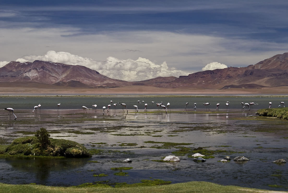
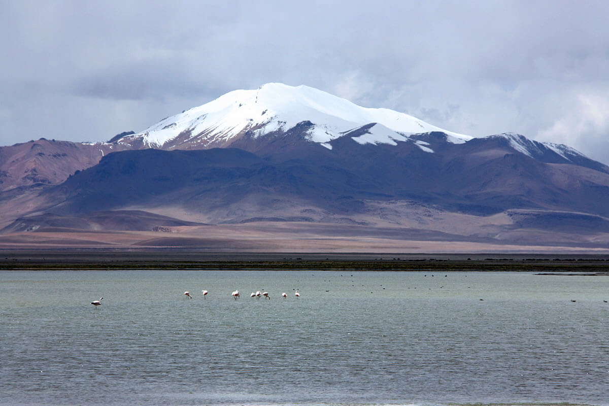
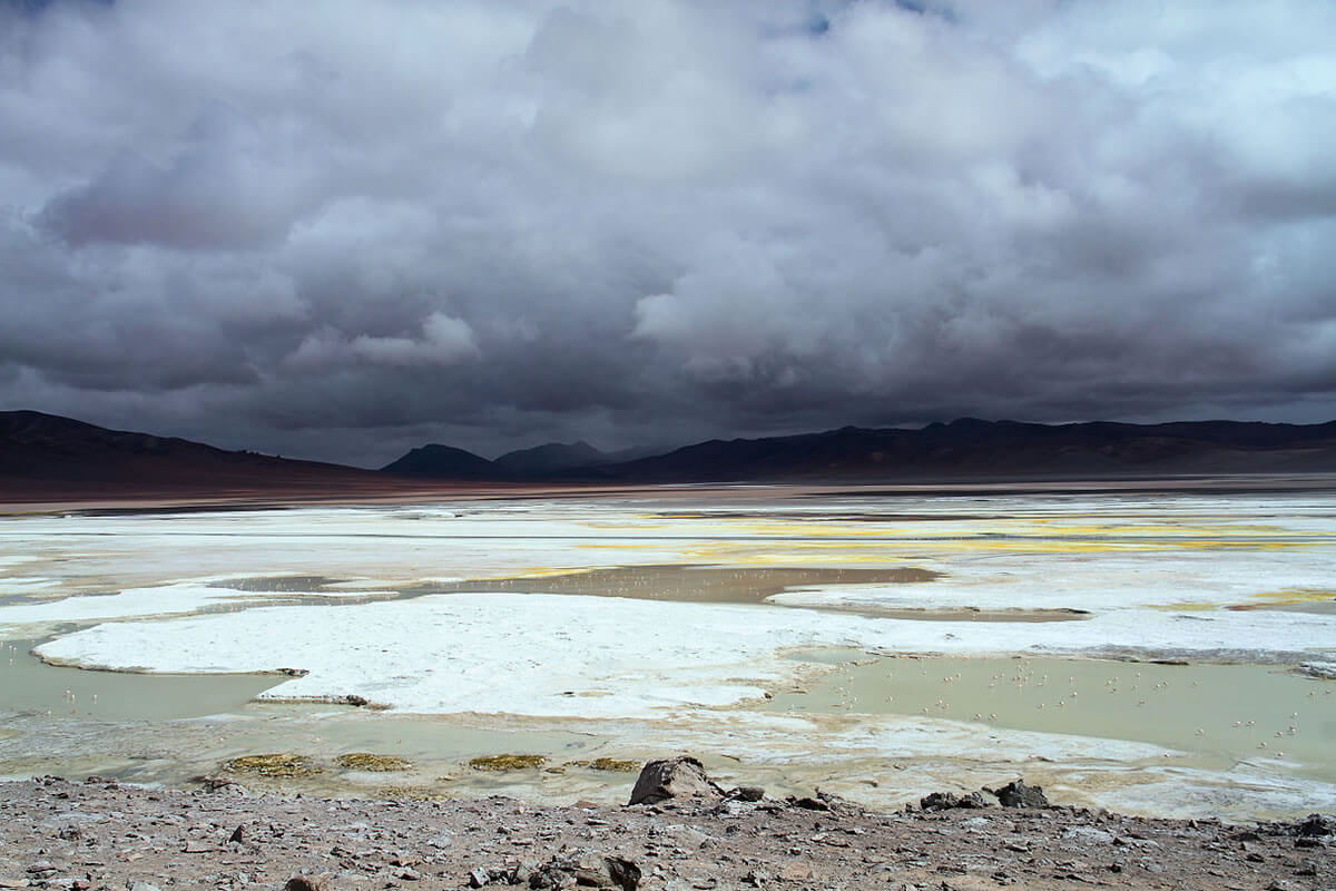
At the heart of the reserve lies the Salar de Atacama, a vast salt flat covering approximately 3,000 sq km (1,200 sq mi), making it the third-largest salt flat on Earth after Bolivia's Salar de Uyuni and Argentina's Salinas Grandes. Within its Soncor sector, four shallow salt lakes—Chaxa, Puilar, Barros Negros, and a fourth unnamed lagoon—form the Sistema Hidrológico de Soncor, designated a Wetland of International Importance under the Ramsar Convention in 1996. These lagoons are the reserve's most reliable site for observing all three of Chile's flamingo species together: the Chilean flamingo (Phoenicopterus chilensis), the Andean flamingo (Phoenicoparrus andinus), and the James's flamingo (Phoenicoparrus jamesi), the last of which was believed extinct for several decades until a small population was rediscovered in the 1950s. Laguna Chaxa in particular serves as an important Andean flamingo breeding site. Beyond the flamingos, the lagoons support the Andean avocet, yellow-billed teal, crested duck, puna plover, and Baird's sandpiper, while the salt-tolerant shrub cachiyuyo (Atriplex spp.), along with (Distichlis spicata) and (Ephedra) species, clings to the lagoon margins. Farther north, in Tarapacá, Salar del Huasco National Park protects another high-altitude wetland where all three flamingo species nest.
Lithium Beneath the Wetlands: A Reserve Under Pressure
The brine beneath the Salar de Atacama holds one of the largest and highest-grade lithium reserves on Earth, and for over two decades two companies—the Chilean firm SQM and the American producer Albemarle, the world's largest lithium miner—have extracted it under contracts with Chile's economic development agency, CORFO. Together, their operations have made the Salar de Atacama a critical node in the global battery supply chain, supplying an estimated 40% of United States lithium demand and 84% of Europe's. Both companies' extraction concessions lie within or immediately adjacent to the same basin that feeds Los Flamencos' protected lagoons.
This proximity has made the reserve a focal point of a serious and ongoing dispute. A government-commissioned study found the Atacama's water table losing an estimated 1,750 to 1,950 liters per second, attributing much of that loss to brine extraction; independent research has also linked mining activity to measurable land subsidence across parts of the salar. Albemarle has publicly disputed any causal relationship between its operations and the subsidence findings, noting that surface levels have risen in some areas where it operates. The Consejo de Pueblos Atacameños, representing 18 Lickanantay Indigenous communities in the basin, has filed multiple legal actions against the mining companies over unauthorized water withdrawals and inadequate consultation with local communities; one such case, decided in 2019, found that SQM had extracted more brine than its permit allowed and required the company to substantially revise its extraction practices. For the Atacameño people, whose identity and water rights are inseparable from the salar's lagoons and the flamingos that depend on them, the dispute is not merely regulatory but existential, a tension that is likely to intensify rather than ease as global demand for battery-grade lithium continues to grow.
Valle de la Luna and the Cordillera de la Sal
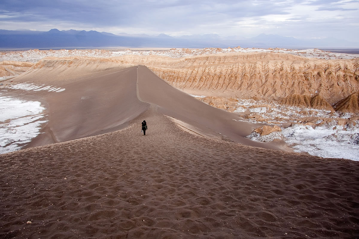
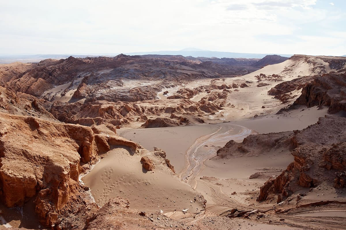
The Valle de la Luna (Moon Valley) sector, declared a Nature Sanctuary in 1982, contains some of the reserve's most striking geology: wind- and water-carved sand and stone formations in shades of red, ochre, and white, punctuated by salt-crusted dry lakebeds. The Cordillera de la Sal, or Salt Mountain Range, rises to 2,624 m (8,609 ft) within the valley, its slopes composed largely of gypsum and halite deposited as ancient lakes evaporated over millions of years. Nearby, the archaeological remains of the village of Tulor, with construction dated to as early as 800 BCE, offer physical evidence of the Atacameño presence in this landscape that long predates the reserve itself.
Salar de Tara and Salar de Aguas Calientes
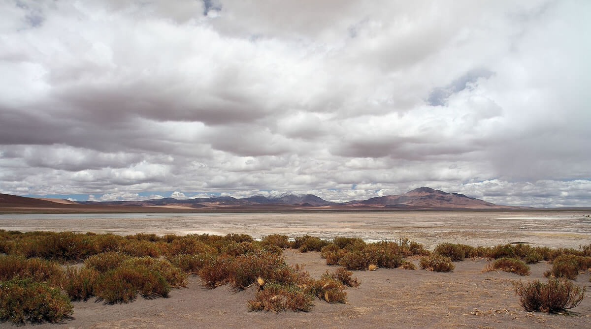
The Salar de Tara, roughly 120 km (75 mi) east of San Pedro de Atacama, was designated a Ramsar wetland in 1996; fed by the Zapaleri River, its network of permanent and seasonal lakes, the largest being Tara Lake, sits within a striking landscape of volcanic rock formations known as Los Monjes de la Pacana. Together with the neighboring Salar de Aguas Calientes, the area is defined by bofedales, high-altitude peat wetlands that support yellow straw, broom sedge, two species of the shrub genus Parastrephia known locally as tola, and coirón grass (Festuca gracillima). These wetlands sustain populations of the southern viscacha, vicuña (Vicugna vicugna), and Darwin's rhea (Rhea pennata), alongside the Andean goose, horned coot, Andean gull, puna tinamou, and all three of the reserve's flamingo species.
Salar de Pujsa
Southwest of Tara, the Salar de Pujsa sits at 4,585 m (15,042 ft) in the shadow of Cerro Acamarachi volcano, one of the reserve's most remote and wind-exposed sectors. Designated a Ramsar wetland in 2009, the salt flat serves as a critical stopover for long-distance migratory birds, including the Wilson's phalarope, which travels from breeding grounds in North America to South America and back each year. Alongside similar bofedal vegetation to Tara and Aguas Calientes, Pujsa supports vizcachas, the small rodent known locally as the chululo, Andean foxes (Lycalopex culpaeus), and domesticated cuys, or guinea pigs, historically an important food source for the region's Indigenous communities. The Andean condor (Vultur gryphus) is a regular sight overhead.
Miscanti and Miñiques Lagoons
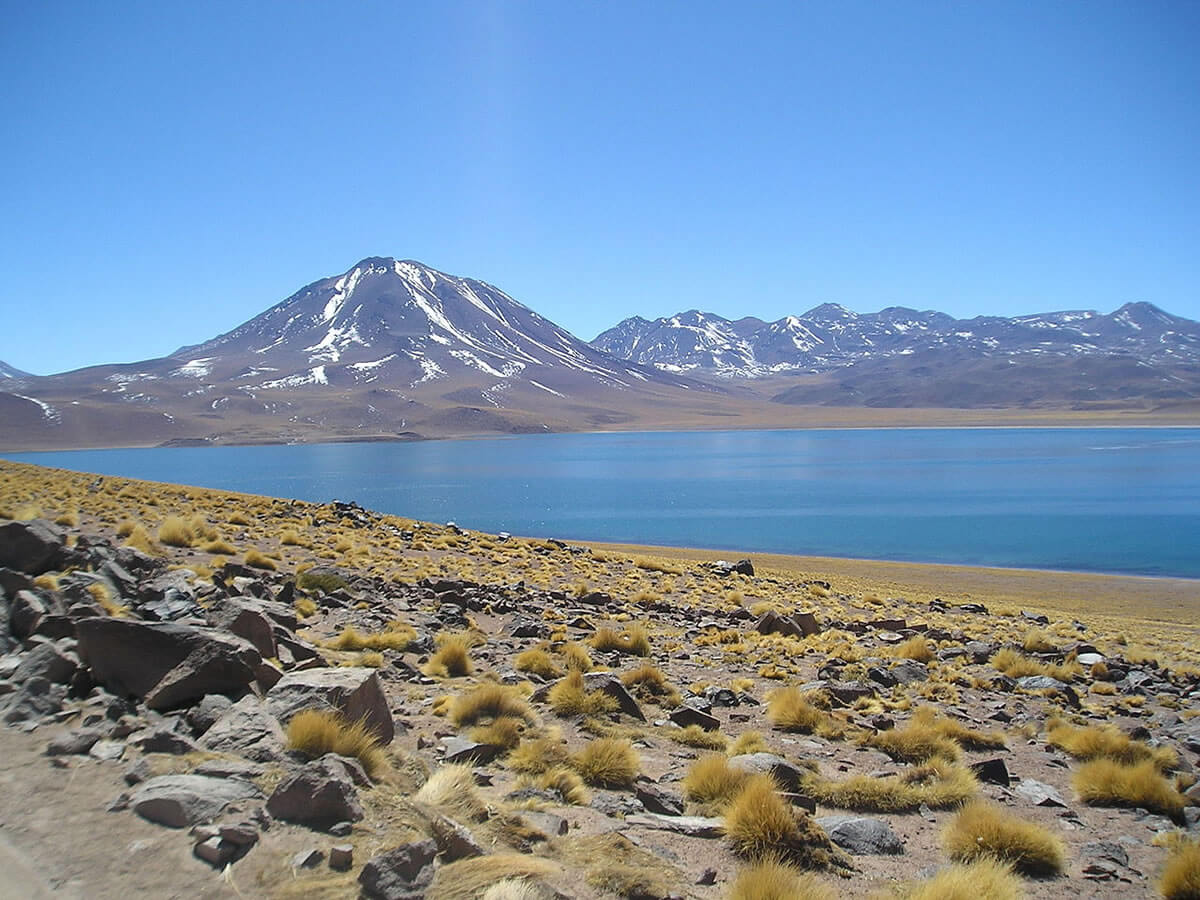
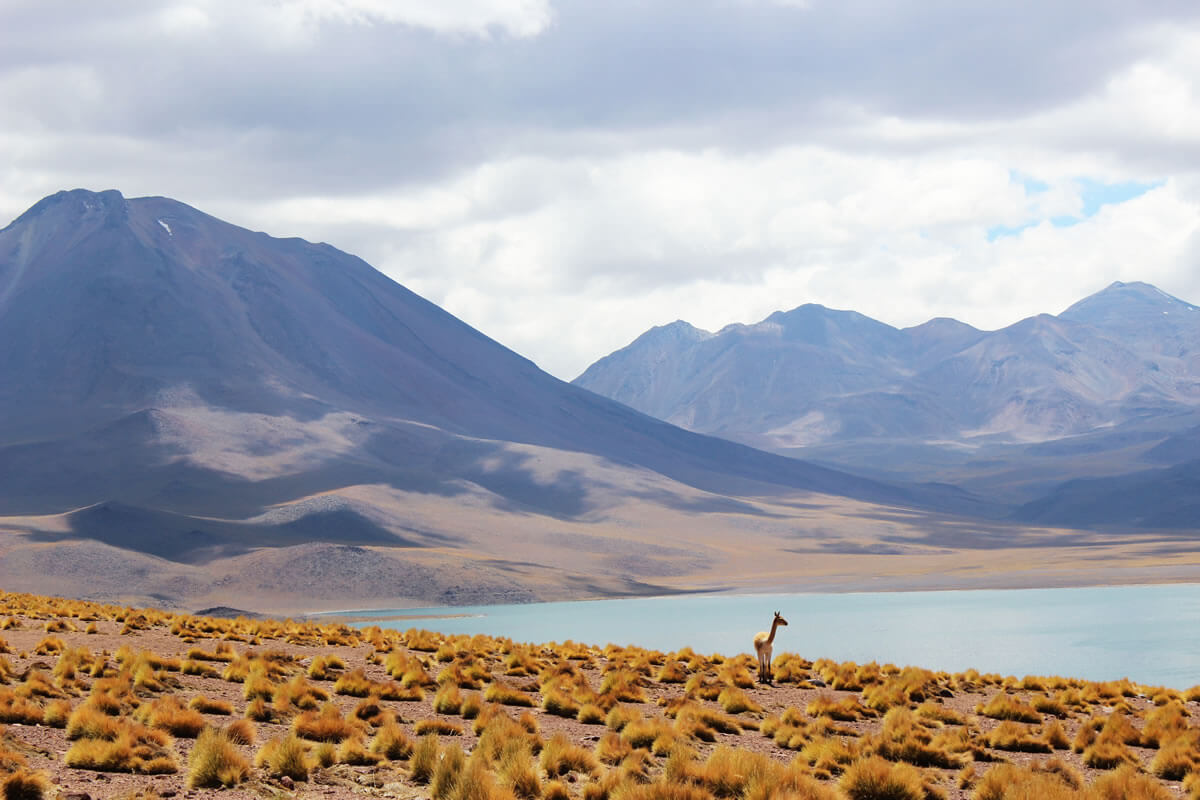
At elevations between 4,100 and 4,350 m (13,451 and 14,272 ft), the Miscanti and Miñiques lagoons sit roughly 115 km (71 mi) southeast of San Pedro de Atacama in the shadow of Cerro Miscanti and the Miñiques volcano. The two lakes were once a single body of water before an ancient lava flow from Miñiques divided them. Their clear, high-altitude waters support the Chilean and Andean flamingos, horned coot, silvery grebe, and Andean gull, while vicuña, Andean fox, and Darwin's leaf-eared mouse inhabit the surrounding terrain.
Tambillo
The Tambillo sector, closest to San Pedro de Atacama, is defined by a 370-hectare (914-acre) forest of tamarugo (Prosopis tamarugo), a deep-rooted, drought-tolerant tree whose presence creates a rare pocket of shade and structural habitat within the surrounding desert. The forest supports flamingos, horned coot, silvery grebe, Andean gull, and the greenish-yellow finch, alongside grey and Andean foxes and the chincol (Zonotrichia capensis), a common Andean sparrow.
Conclusion
Los Flamencos National Reserve protects an extraordinary concentration of high-Andean wetlands, salt flats, and volcanic desert within one of the driest places on Earth, and remains one of the most reliable places in South America to see all three Chilean flamingo species together. But the reserve also illustrates, as clearly as anywhere in the Andes, the tension now unfolding across the entire lithium triangle: the same brine that sustains its flamingo colonies and its Atacameño communities lies directly beneath one of the resources the world's transition to renewable energy and electric transportation depends on most. How Chile balances the reserve's ecological and cultural significance against the economic weight of its lithium reserves will likely shape not just this landscape, but the broader question of how extraction and conservation coexist across the high Andes in the years ahead.