Latest Entries

Stanley: Gateway to the Falklands' Rich History and Natural Beauty

Stanley, nestled along the southern shore of Port William Inlet on the northeast coast of East Falkland, serves as the vibrant capital of the Falkland Islands, also known as Islas Malvinas. This unique town is the administrative center and a cultural and historical hub, reflecting the islanders' rich heritage and resilient spirit. With a history of maritime significance, conflict, and modern development, Stanley offers a captivating blend of natural beauty, historical landmarks, and a thriving local community.

The Falkland Islands: Navigating History, Identity, and Nature in the South Atlantic

The Falkland Islands, or Islas Malvinas in Spanish, are a British Overseas Territory in the South Atlantic Ocean. This remote archipelago, located approximately 500 kilometers east of Argentina's southern coast, consists of two main islands—East and West Falkland—and hundreds of smaller islands and islets. The Falklands have garnered international attention due to their complex political history, unique cultural identity, and rich biodiversity.

South Georgia and the South Sandwich Islands: A Haven of Pristine Wilderness and Scientific Discovery

South Georgia and the South Sandwich Islands (SGSSI) is a British Overseas Territory in the southern Atlantic Ocean. Comprising two main island groups, this remote and uninhabited territory is renowned for its ecological significance and historical heritage. Managed by a commissioner based in the Falkland Islands, approximately 1,390 km east-southeast of South Georgia, SGSSI is a vital destination for scientific research and ecotourism and forms part of the wider Scotia Arc system.

The Lesser Antilles Volcanic Arc: Unlocking the Mysteries

The Lesser Antilles Volcanic Arc is a chain of volcanic islands stretching from the Virgin Islands to Grenada in the eastern Caribbean Sea. It forms where the North American Plate subducts beneath the Caribbean Plate, creating the volcanoes that make up the islands. This volcanic arc, along with other geological forces, helps shape the Caribbean Sea, and its ongoing activity has repeatedly reshaped the human history of the islands built on it.

The Scotia Sea and Scotia Arc: A Critical Ocean Gateway and Geological Barrier

Tucked away in the remote waters between South America and Antarctica lies a remarkable ocean region known as the Scotia Sea. This dynamic body of water is critical to global ocean and climate systems, serving as a key gateway between the Atlantic and Pacific Oceans. The Scotia Arc, an arc-shaped submarine ridge and island chain, surrounds the Scotia Sea and forms a biogeographic barrier that shapes marine life distribution and influences ocean-current flow.

The Altiplano–Puna Plateau and Basin: A High-Altitude Geological Wonderland in South America

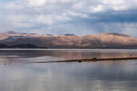
The Altiplano–Puna plateau is a remarkable, expansive, high-altitude region in west-central South America, where the Andes Mountains reach their greatest width. Spanning Bolivia, Peru, Chile, and Argentina, this vast expanse is the most extensive high plateau on Earth outside the Tibetan Plateau, sitting at an average elevation of around 3,650 m and consisting of a series of intermontane basins bounded by the towering Cordillera Occidental and Cordillera Oriental.

The Sonoran Desert: Oasis of Resilience

Spanning northwestern Mexico and the southwestern United States lies one of Earth's most biodiverse deserts, the Sonoran Desert. Known in Spanish as the Desierto de Sonora, and encompassing the more specific Desierto de Altar within its western reaches, this extraordinary ecosystem challenges every preconception about desert life. Here, towering saguaro and cardón cacti create forests in the sky, desert bighorn sheep navigate rocky outcrops, and brief winter rains transform barren landscapes into carpets of wildflowers.

The American Cordillera and the Continental Divide: A Geographical Backbone Shaping the Americas

Few geographical features illustrate the interconnectedness of an entire hemisphere as clearly as the American Cordillera, the nearly unbroken chain of mountains running along the western edge of North, Central, and South America from Alaska to the southern tip of Tierra del Fuego. Stretching more than 20,000 km, it ranks among the longest mountain systems on Earth, and its segments carry different regional names even though they form a single, geologically continuous backbone.

Valle Central and Valle del General: Unveiling Costa Rica's Highland Gems

Nestled amid Costa Rica's verdant landscapes, the Central Highlands stand as a testament to the country's rich natural heritage and cultural diversity. This region, encompassing the Valle Central (Central Valley) and Valle del General (General Valley), offers a striking blend of ecological richness, dramatic history, and productive agricultural land that together have shaped the country's identity long before Spanish contact.

Cordillera de Guanacaste: Costa Rica's Volcanic Highlands

The Cordillera de Guanacaste, located in northwestern Costa Rica near the border with Nicaragua, is a prominent volcanic mountain range known for its dramatic peaks, rich biodiversity, and significant geological history. As part of the Central America Volcanic Arc, this range offers a unique landscape of volcanic activity, geothermal energy potential, and protected natural areas. The range is vital to Costa Rica's environmental and cultural heritage and attracts researchers, tourists, and conservationists alike.