Latest Entries

The Southern Patagonian Ice Field: A Colossal Glacier of the Andes

The Southern Patagonian Ice Field is a breathtaking and monumental testament to the power of glacial forces, stretching along the southern Andes Mountains between Chile and Argentina. As the world's third-largest expanse of continental ice, after the Antarctic and Greenland ice sheets, it represents the grander of the two surviving remnants of the vast Patagonian Ice Sheet. Its immense scale, dramatic outlet glaciers, and profound ecological significance make it a jewel of the Patagonian wilderness.

The Northern Patagonian Ice Field: A Living Testament to Chile's Glacial Past

Nestled within the breathtaking and rugged landscapes of southern Chile, the Northern Patagonian Ice Field stands as a profound testament to the enduring power and legacy of the Andes Mountains. This immense ice mass, smaller than its southern counterpart but no less magnificent, represents one of the last major remnants of the once-vast Patagonian Ice Sheet. Its entirety lies protected within the boundaries of the Laguna San Rafael National Park, a designated UNESCO Biosphere Reserve, underscoring its immense ecological and scientific value.

The Green Heart of Colombia: Exploring the Amazon Natural Region

Colombia's Amazon Natural Region, a sprawling expanse in the country's southern reaches, is overwhelmingly dominated by dense, biodiverse tropical rainforest, bounded to the west by the eastern slopes of the Cordillera Oriental of the Colombian Andes and extending eastward to the borders with Venezuela and Brazil. As the most heavily forested and least populated of Colombia's natural regions, the Amazon Natural Region is a critical global lung, boasting unparalleled biodiversity and intricate ecological processes.

The Endless Horizon: Exploring Colombia's Orinoco Natural Region

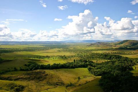
Colombia's Orinoco Natural Region, also known as the Orinoquía or the Eastern Plains, is a vast and sparsely populated expanse stretching east of the majestic Andes Mountains. Forming part of the immense Llanos, a tropical grassland plain shared with Venezuela, this region is defined by its flat, open savannas, integral connection to the Orinoco River watershed, and unique biodiversity adapted to the seasonal wet and dry cycles. While less densely populated than other Colombian regions, the Orinoquía holds significant ecological importance.

The Backbone of Colombia: Exploring the Andean Natural Region

Colombia's Andean Natural Region, the country's populous heartland, is a majestic tapestry of mountain ranges, valleys, and ecosystems shaped by altitude. This central region features three branches of the Andes Mountains, running from south to north. Beyond its topography, the Andean region is the historical and contemporary core of Colombian life, housing many urban centers, rich pre-Columbian Indigenous heritage, and a significant part of the vital Magdalena River basin.

The Emerald Embrace: Exploring Colombia's Pacific/Chocó Natural Region

Colombia's Pacific/Chocó Natural Region is a vital biodiversity sanctuary along the western coastline. Known as the "Colombian Chocó," it features a warm, humid climate, dense rainforests, river systems, swamps, and mangroves along the Pacific Ocean. Bordered by the Cordillera Occidental to the east and stretching from the Darién Gap and Panama in the north to Ecuador in the south, the Chocó showcases remarkable ecological diversity, influenced by unique evolutionary and environmental factors.

Where the Tropics Embrace the Coast: Exploring Colombia's Caribbean Natural Region

Colombia's Caribbean Natural Region, stretching from the Gulf of Urabá to the Guajira Peninsula, is where tropical warmth meets the Caribbean Sea. Known for its unique climate, diverse ecosystems, rich history, and vibrant culture, this region is key to Colombia's narrative. Once a gateway for European exploration, the Caribbean coast has transformed into a dynamic area of bustling port cities, stunning landscapes, and a unique cultural identity shaped by its history and coastal location.

The Wild Frontier: Exploring Chile's Zona Austral

Chile's Zona Austral, the "Far South," encompasses the vast and sparsely populated territory stretching south from the Guaitecas Archipelago to the legendary Cape Horn, representing the country's final frontier towards Antarctica. As the southernmost of its five distinct natural regions, this zone is characterized by a cold, wet climate, dramatic glaciated landscapes, rugged coastlines with intricate fjords and numerous islands, and subpolar conditions in its southernmost reaches.

Embracing the Emerald South: Exploring Chile's Zona Sur

Chile's Zona Sur, or "Southern Zone," stretches from the Biobío River to the Guaitecas Archipelago, showing a shift to increased humidity, lush forests, and striking volcanic landscapes. It features a temperate oceanic climate with heavy rainfall, many lakes and rivers, and the majestic southern Andes. The Zona Sur boasts rich biodiversity, including unique endemic species, and a cultural heritage shaped by indigenous Mapuche traditions and European influences.

The Mediterranean Heartbeat: Exploring Chile's Zona Central

Chile's Zona Central represents the vibrant and most densely populated core of the country. This zone embodies the nation's demographic, economic, and cultural center, characterized by a classic Mediterranean climate. It is a landscape where fertile valleys, bordered by prominent coastal ranges and the towering peaks of the Andes, have fostered intensive agriculture, significant urban development, and a rich biodiversity, all shaped by distinct seasonal rainfall patterns and the enduring presence of both mountains and sea.