
The Atacama Desert: Earth's Most Arid Frontier
The Atacama Desert, stretching along Chile's Pacific coast, is Earth's most arid non-polar environment, where some locations have never recorded measurable rainfall. Despite this, it supports remarkable biodiversity, ancient human cultures, and some of the most scientifically valuable land on the planet.

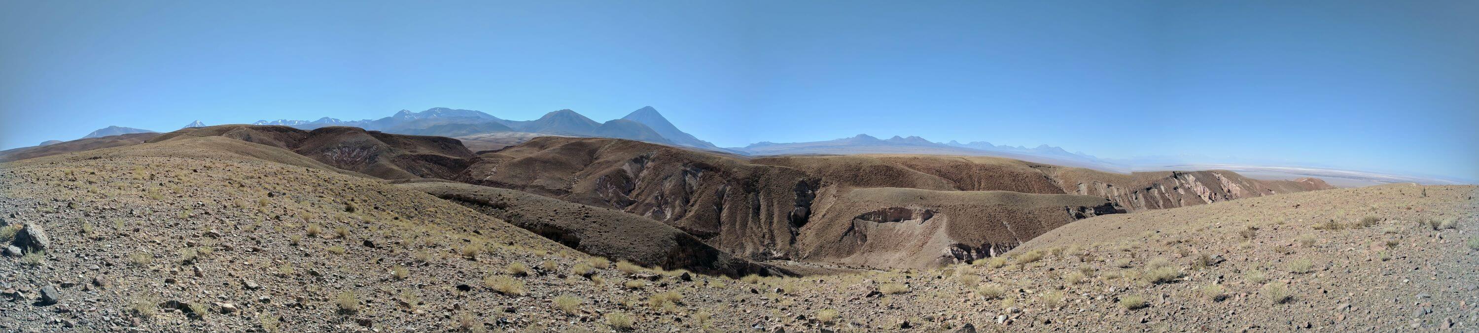
The Atacama Desert: Life, Lithium, and the Clearest Skies on Earth
Stretching along the western edge of South America, the Atacama Desert is the most arid non-polar region on Earth, where some weather stations have never recorded measurable precipitation, and others have gone over 400 years without rainfall. Extending approximately 1,600 km (995 mi) along Chile's Pacific coast and covering roughly 105,000 sq km (40,540 sq mi), the desert occupies a narrow strip between the Andes Mountains and the cold Pacific Ocean, creating conditions so extreme they serve as a terrestrial analog for Mars exploration research. Despite its reputation as a lifeless wasteland, the Atacama supports remarkable biodiversity, unique geology, and Indigenous cultures that have adapted to survive here for millennia; its pristine skies and mineral wealth have also made it a global center for astronomy, mining, and the ongoing tension between resource extraction and conservation.
Geographic Extent and Boundaries
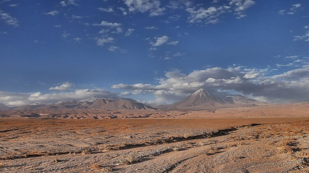
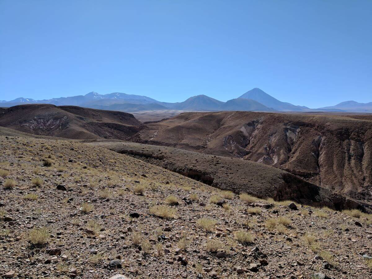
The Atacama Desert extends from the Loa River in northern Chile near the Peruvian border to the Aconcagua River north of Santiago, spanning the Arica y Parinacota, Tarapacá, Antofagasta, Atacama, and Coquimbo regions. Its northern boundary merges, across Peru's southern coastal desert, with Peru's Sechura Desert, while its southern limit transitions into the Mediterranean climate of central Chile. To the west, the cold Humboldt Current moderates coastal temperatures while driving the thermal inversion that helps produce the region's extreme aridity; to the east, the Andes rise into the high plateau covered in detail in our Puna de Atacama article. Within this framework, the desert encompasses a hyperarid core, coastal fog zones, salt flats, and high-altitude transition zones, each supporting distinct communities adapted to a specific combination of elevation, moisture, and substrate.
Where the Atacama begins is a matter of convention rather than a sharp line. Peru's coastal desert runs unbroken from the Sechura Desert in the north, through the Nazca region, and on toward the Chilean border, and climatological sources describe it as becoming the Atacama at an indefinite point in southern Peru. Some classifications therefore place the desert's northern limit inside Peruvian territory, while the definition used in this article follows the more common Chile-centered convention, which begins the desert near the border. For the Peruvian side of this continuous arid strip, see our article on the Sechura and Nazca deserts.
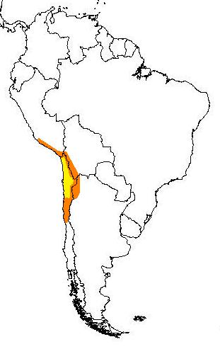
The area most commonly defined as the Atacama Desert is in yellow. The outlying arid regions are in orange.
Geological Foundation
The Atacama's geology reflects its position atop one of Earth's most tectonically active margins, where the oceanic Nazca Plate subducts beneath the continental South American Plate, a process that built the Andes and generated the copper deposits for which the region is now famous—the Chuquicamata mine, one of the largest open-pit copper mines on Earth, exemplifies the scale of mineral wealth here. Ancient basement rocks over 2 billion years old are exposed in portions of the coastal range, offering a rare window into South America's earliest geological history.
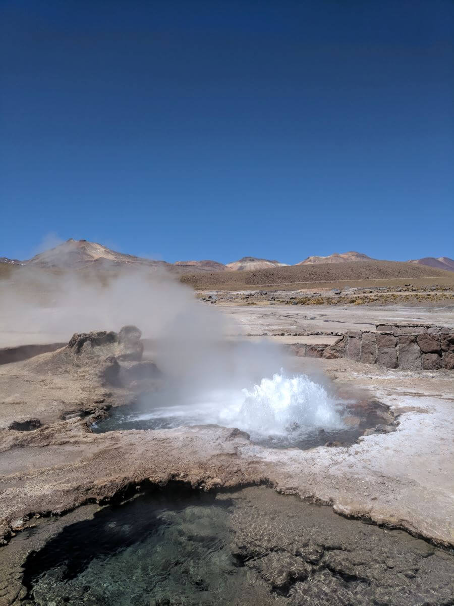
Volcanic activity has shaped much of the desert's surface, from lava flows and pyroclastic deposits to the El Tatio geyser field, which at over 4,300 m (14,100 ft) is one of the highest geyser fields in the world. The same volcanism and subsequent evaporation created the region's numerous salares, or salt flats, the largest and most significant being the Salar de Atacama, which holds one of the highest-grade lithium reserves on Earth and is covered in depth, including the ongoing conflict between extraction and conservation there, in our Los Flamencos National Reserve article. Other Andean salares within the broader lithium triangle, including Argentina's Salar del Hombre Muerto and Salinas Grandes, share this same evaporite geology and are covered in our dedicated article on those sites.
Climate Systems and Extreme Aridity
The Atacama's hyperaridity results from what climatologists describe as a perfect storm of drying forces converging in one place: the cold Humboldt Current generates coastal thermal inversions that suppress cloud formation, the Andes block moisture from the Amazon Basin to the east, and the persistent high pressure of the South Pacific Anticyclone maintains clear skies and atmospheric subsidence across most of the region year-round. Annual precipitation across much of the desert averages less than 1 mm (0.04 in), and the Calama weather station has recorded 0.0 mm of precipitation across multiple consecutive years.
Despite this extreme dryness, temperatures remain relatively moderate along the coast, generally ranging from 15-25°C (59-77°F) year-round, while inland and high-elevation areas see far greater diurnal swings, with nighttime temperatures dropping below freezing even as daytime highs exceed 25°C (77°F). Coastal fog, formed where warm moist Pacific air meets the cold Humboldt Current, penetrates several kilometers inland and delivers the equivalent of 50-200 mm (2-8 in) of annual precipitation to fog-zone ecosystems that receive essentially no rainfall at all—a crucial water source that specialized plants and animals have evolved to harvest directly from the air.
Life in the Driest Desert on Earth
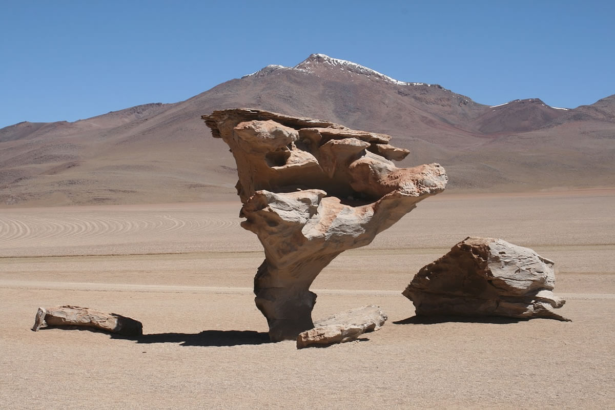
Vegetation across the Atacama closely tracks moisture availability. In the hyperarid core, plant life is sparse to the point of near-total absence in places, with landscapes that closely resemble lunar or Martian surfaces; where plants do survive, cryptobiotic soil crusts of cyanobacteria and lichens play an outsized ecological role, stabilizing soil, fixing nitrogen, and creating the microsites where seeds can germinate at all. The coastal fog zone supports far more vegetation, including the seasonal Lomas formations that bloom each winter when fog is heaviest and then retreat into dormancy through the dry months; during strong El Niño years, increased precipitation can trigger spectacular desierto florido, or flowering desert, events in which normally barren stretches of the coastal desert become carpeted in wildflowers almost overnight. At higher elevations approaching the Andes, cushion plants and bunch grasses dominate, some cushion plants estimated to be several centuries old, alongside seasonal wetlands fed by snowmelt.
The desert's most iconic endemic plants are its cacti: Copiapoa species, found nowhere outside the Atacama, can survive extended periods without any water input, with some individuals of Copiapoa cinerea estimated at over 100 years old. Salt-tolerant shrubs including Atriplex and Frankenia species exploit saline groundwater unavailable to less specialized plants, expanding the range of habitat available across the desert's many salt-affected soils.
Animal life, while sparse by the standards of more temperate ecosystems, is more diverse than the desert's barren reputation suggests. The vicuña (Vicugna vicugna) and guanaco (Lama guanicoe) range across high-elevation grasslands where seasonal precipitation supports enough vegetation to sustain them, while the culpeo fox (Lycalopex culpaeus) hunts across both desert and steppe as one of the region's principal predators. Reptile diversity is surprisingly high, with numerous endemic lizards in the genus Liolaemus occupying narrow microhabitat niches shaped by extreme temperature swings. High-altitude salt lakes draw all three South American flamingo species—covered in full, along with the broader lithium-triangle context that increasingly threatens their habitat, in our Los Flamencos article. Among invertebrates, darkling beetles of the family Tenebrionidae have evolved a striking fog-harvesting behavior, positioning themselves on ridge crests during fog events to let water condense directly onto their bodies before it runs down into their mouths, while some soil nematodes can survive years or even decades of complete desiccation through cryptobiosis, reviving fully once moisture finally returns.
Ecoregion Boundaries and Transition Zones
The WWF's Atacama Desert ecoregion designation covers the core hyperarid zone, recognizing it as one of the planet's most extreme terrestrial environments and distinguishing it ecologically from other desert systems worldwide. Its northern transition into Peru's Sechura Desert and its southern transition into the Mediterranean scrub of central Chile both support higher species diversity than the hyperarid core, since the mixing of floras from neighboring biomes creates ecological niches unavailable within the desert proper; both transition zones also face growing pressure from urban and agricultural expansion tied to Chile and Peru's coastal population centers. The high-elevation Puna zone to the east, where the desert grades into Andean plateau ecosystems, is covered separately and in greater depth in our Puna de Atacama article.
Protected Areas
Protected area coverage across the Atacama has expanded significantly in recent decades, partly because the desert's extreme conditions have historically limited human impact. Lauca National Park protects high-elevation wetlands and wildlife in the Andean north, Pan de Azúcar National Park conserves coastal desert ecosystems, and Llanos de Challe National Park safeguards some of the region's most significant fog-dependent plant communities. High-altitude salt lakes and wetlands within the Salar de Atacama basin, including the flamingo breeding habitat of Los Flamencos National Reserve, receive further protection and international recognition through Ramsar Convention wetland designations, though as detailed in our Los Flamencos article, that protection now sits in direct tension with the same basin's lithium reserves. Morro Moreno National Park, on the Mejillones Peninsula, protects a coastal fog oasis with cacti found nowhere else, and to the east, on the Tarapacá altiplano, Volcán Isluga and Salar del Huasco national parks protect high-puna landscapes beyond the desert proper.
Human History: Adaptation, Mining, and the Search for the Stars
People have lived in the Atacama for at least 10,000 years, developing some of the most sophisticated desert-survival cultures anywhere on Earth. The Atacameño (Lickanantay) people developed terraced farming, irrigation, and crop varieties suited to arid, high-elevation conditions, knowledge that remains directly relevant to water management in the region today. The Chinchorro culture, dating back over 7,000 years, developed the world's earliest known mummification techniques, taking advantage of the desert's natural preservative dryness—a practice that predates Egyptian mummification by roughly two millennia.
The desert's copper, lithium, and historic nitrate deposits have made it an economic engine for Chile for well over a century: 19th- and early 20th-century nitrate mining produced dramatic boom-and-bust cycles whose abandoned company towns still dot the landscape, while today's copper and lithium industries generate billions of dollars annually and position Chile as a critical supplier for global electronics and battery manufacturing—an economic significance that comes with real environmental costs, particularly around water use, detailed at length in our Los Flamencos and Salar del Hombre Muerto/Salinas Grandes articles.
The same atmospheric clarity that makes the Atacama so hostile to life also makes it one of the best places on Earth to observe the universe. Minimal cloud cover, low humidity, high elevation, and some of the least light-polluted skies remaining anywhere on the planet have drawn major observatories to the region, including ALMA, the Atacama Large Millimeter Array, one of the world's most powerful radio telescope arrays. The same extreme conditions that support this astronomical research have also made the desert a working analog for Mars exploration, with space agencies testing rover technology and biological instruments here under conditions that closely approximate the Martian surface.
Climate Change and Conservation Outlook
Climate change poses a genuine, if still uncertain, threat to an ecosystem that already exists at the outer edge of what life can tolerate. Rising temperatures could alter the thermal dynamics that drive coastal fog formation, with direct consequences for the fog-dependent plant and animal communities that depend on it as their primary water source, while any change to the rare, episodic rainfall events that occasionally trigger desert-wide flowering could disrupt species whose reproductive cycles are tightly timed to those events. Because so many Atacama species are narrow endemics with highly specific habitat requirements, they have limited capacity to shift range in response to changing conditions, making habitat connectivity and the protection of climate refugia—areas likely to retain suitable conditions longest—a growing conservation priority alongside the more immediate pressures of mining expansion and tourism growth.
At the same time, the Atacama's exceptional solar radiation and consistent winds give it outstanding renewable energy potential, and large-scale solar development is already underway across parts of the region—development that, like mining, requires careful siting to avoid the same sensitive habitats it could otherwise help protect by displacing fossil fuel use elsewhere in Chile's energy mix.
Conclusion
The Atacama Desert stands as one of Earth's most extreme yet scientifically vital landscapes: a place where the near-total absence of water has produced not an absence of life, but some of its most specialized and resilient forms, alongside human cultures, industries, and scientific institutions that have each found their own way to make use of a landscape most of the world would consider uninhabitable. Its future—as a mining frontier, a solar energy hub, an astronomical observatory, and a refuge for species found nowhere else on Earth—will depend on how well Chile and the international community balance these competing claims on one of the driest and most singular places on the planet.