The Icy Giants of the Colombian Andes: Exploring the Sierra Nevada de Güicán, El Cocuy, and Chita
The Sierra Nevada de Güicán, El Cocuy, and Chita is a breathtaking range within the Andes Mountains of Colombia. This range, known for its stunning snow-capped peaks and glacial landscapes, is Colombia's largest glacial mass and the largest in South America north of the equator.
The Majestic Sierra Nevada de Güicán, El Cocuy, and Chita: Colombia's Northern Glacial Treasure
The Sierra Nevada de Güicán, El Cocuy, and Chita is a breathtaking range within the Andes Mountains of Colombia. This range, known for its stunning snow-capped peaks and glacial landscapes, is Colombia's largest glacial mass and the largest in South America north of the equator. Spanning more than 25 ice-covered peaks, this range holds deep cultural significance for the indigenous U'wa people and is a haven for biodiversity. Its awe-inspiring beauty and ecological and cultural importance make it one of Colombia's most treasured natural landmarks.
Geographical and Geological Significance
A Northern Glacial Mass
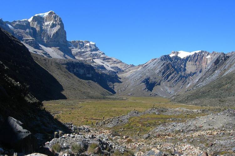
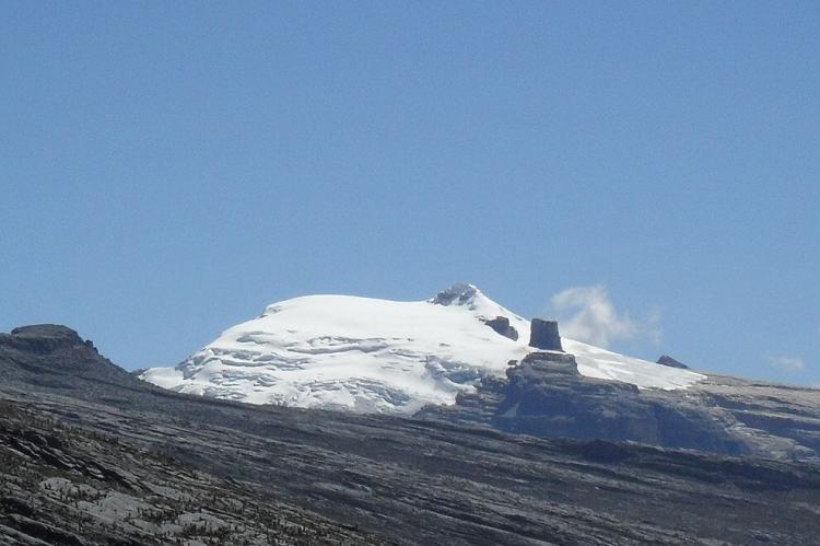
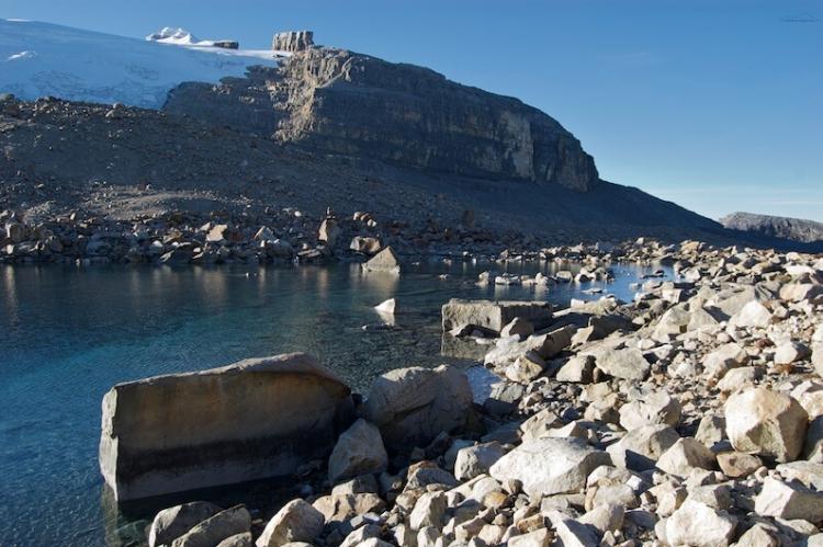
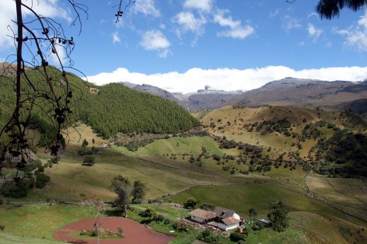
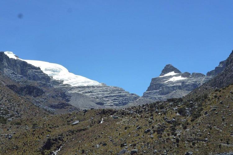
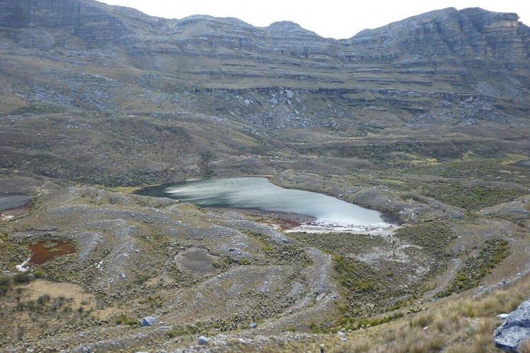
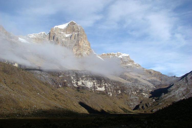
The Sierra Nevada de Güicán, El Cocuy, and Chita is a mountain range that extends approximately 25 kilometers (15.5 miles) in length and 4 kilometers (2.5 miles) in width. Located in the Cordillera Oriental of the Colombian Andes, it is characterized by a succession of peaks ranging in elevation from 4,800 to 5,330 meters (15,750 to 17,500 feet) above sea level. These peaks, including Campanillas Blanco, Pan de Azúcar, Púlpito del Diablo, and Ritakuwas, form a striking row that culminates at the Laguna Grande de los Verdes, a stunning glacial lake nestled among the mountains.
Glacial Morphology
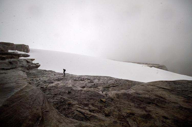
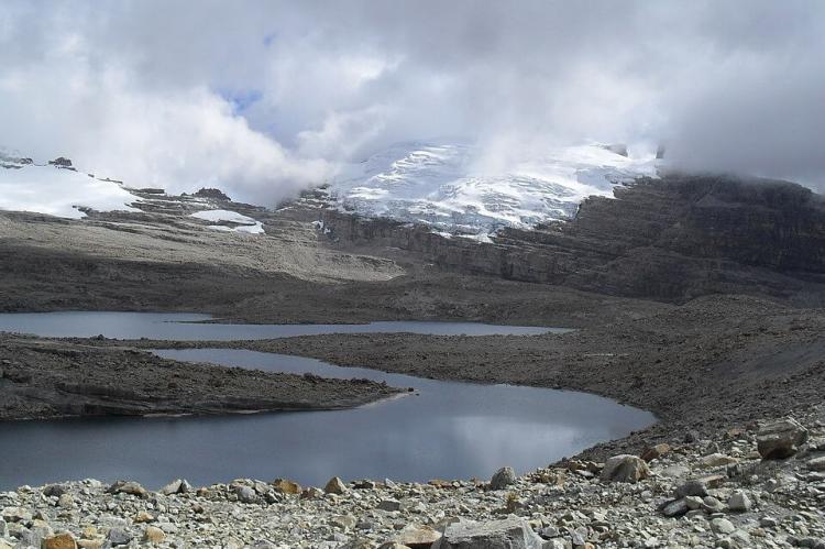
The Sierra Nevada de Güicán, El Cocuy, and Chita are prime examples of post-glacial geological morphology. The landscape is marked by steep slopes, cirques—deep hollows formed by glacial erosion—moraines, and glacier-gouged lakes such as La Pintada and La Cuadrada. These features reflect the powerful forces that shaped the region during the last ice age and continue to define its rugged terrain. Glaciers and permanent snowfields in this range are rare in tropical latitudes, making them unique and valuable glacial systems.
Ecological Importance
A Sanctuary for Biodiversity
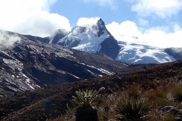
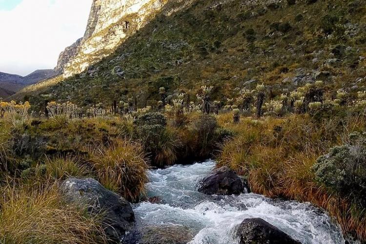
The Sierra Nevada del Cocuy, Chita o Guican National Natural Park, which encompasses much of the range, protects an area of 306,000 hectares (756,000 acres). Established in 1977, the park safeguards the fragile páramo ecosystems, which are characteristic of the high-altitude regions of the tropical Andes. The páramo is a unique high mountain tundra that acts as an ecological "island," harboring endemic species of flora and fauna. The Sierra Nevada de Güicán, El Cocuy, and Chita is dominated by these páramo ecosystems, which cover most of the area surrounding the glaciated peaks and over half of the national park.
Unique Flora and Fauna
One of the most iconic plants of the páramo ecosystem is the Frailejón (Espeletia lopezii), a yellow-flowered species that dominates the landscapes below the ice line. In addition to the Frailejón, the páramo is home to various other plant species, including those from the Compositae, Lamiaceae, Poaceae, and Rosaceae families. The fauna of the Sierra Nevada del Cocuy is equally diverse, with species such as tapirs, Andean condors, eagles, páramo deer, and the endangered Spectacled Bear (or Andean Bear) making their home in this protected area. The park's ecosystems provide critical habitats for these species, many of which are endemic to the region.
Cultural and Historical Significance
Sacred Territory of the U'wa People
The Sierra Nevada de Güicán, El Cocuy, and Chita hold profound cultural significance for the U'wa indigenous people, also known as the Tunebos. For the U'wa, these mountains are sacred, and their territory is intertwined with the spiritual and cultural practices passed down through generations. The U'wa reservation, which overlaps with part of the national park, is closed to tourism and travel, preserving their traditional ways of life and protecting their land from external influence. The U'wa use their territory for farming, grazing, hunting, and fishing, essential to their cultural identity and survival.
Recreational and Conservation Efforts
Sierra Nevada del Cocuy National Natural Park
Sierra Nevada del Cocuy, Chita o Guican National Natural Park is a popular destination for outdoor enthusiasts, including hikers, mountain climbers, and rock climbers of all skill levels. The park's topography, which spans 4,500 meters (15,000 feet) from its lowest point to its highest peaks, offers a variety of trails and routes that cater to different levels of experience. However, due to the overlap with the U'wa reservation, certain areas of the park, particularly on its eastern flank, are closed to tourism, ensuring the preservation of the U'wa's sacred sites and the integrity of the ecosystems.
Conservation Challenges and Initiatives
The Sierra Nevada de Güicán, El Cocuy, and Chita face several conservation challenges, including the impacts of climate change on its glaciers and the pressure from tourism-inaccessible areas. The park's fragile ecosystems, particularly the páramos, are sensitive to changes in temperature and precipitation, making them vulnerable to the effects of global warming. To address these challenges, conservation initiatives focus on preserving the park's biodiversity, managing tourism sustainably, and supporting the U'wa people in their efforts to protect their land.
Conclusion
The Sierra Nevada de Güicán, El Cocuy, and Chita symbolize Colombia's natural beauty and cultural heritage. Its towering peaks, sacred significance to the U'wa people, and rich biodiversity make it a unique and invaluable part of the Andean landscape. As both a natural wonder and a cultural treasure, the Sierra Nevada de Güicán, El Cocuy, and Chita inspire awe and respect, reminding us of the need to preserve such irreplaceable environments for future generations.
