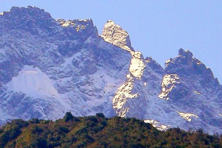
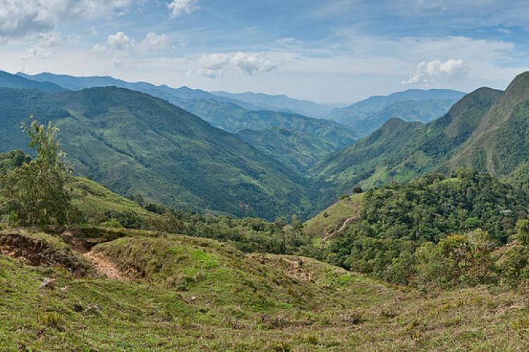
The Venezuelan Andes: A Jewel of the Tropical Andes
The Venezuelan Andes represent the northernmost extension of the Andes Mountain range. The Andean natural region, encompassing the Cordillera de Mérida and the Serranía del Perijá, is one of Venezuela's distinct natural regions, contributing to the country's biodiversity and cultural richness.
Exploring the Venezuelan Andean Cordillera: A Natural Treasure
The Venezuelan Andes, also known as the Venezuelan Andean Cordillera, represents the northernmost extension of the Andes Mountain range. This major mountain system runs along the western coast of South America. This region is vital to Venezuela's natural and geographic landscape, offering a rich tapestry of ecological diversity, geological significance, and cultural heritage. The Andean natural region, encompassing the Cordillera de Mérida and the Serranía del Perijá, is one of Venezuela's distinct natural regions, contributing significantly to the country's biodiversity and cultural richness.
Geological Origins and Tectonic Activity
The geological history of the Venezuelan Andes is a testament to the dynamic processes that have shaped the planet over millions of years. Their formation dates back to the Eocene period of the early Tertiary era, approximately 40 to 50 million years ago. This period marked the beginning of significant tectonic activity involving the interaction of three major tectonic plates: the Nazca Plate, the Caribbean Plate, and the South American Plate. The collision and subsequent interactions among these plates initiated the orogenic processes, or mountain-building events, that ultimately led to the formation of the Andes. This geological evolution not only sculpted the dramatic landscapes but also contributed to the region's rich mineral resources.
Regional Divisions of the Venezuelan Andes
The Venezuelan Andes can be divided into two main sections, each with unique characteristics and geographical significance.
Cordillera de Mérida
The Cordillera de Mérida is often regarded as the true heart of the Venezuelan Andes. This massif extends in a southwest-to-northeast direction, spanning a considerable portion of northwestern Venezuela. It encompasses almost all of the Venezuelan states of Táchira, Mérida, and Trujillo, as well as significant parts of the southern area of Lara, and portions of the higher regions on the western side of Barinas, Apure, and Portuguesa. The Cordillera de Mérida can be further subdivided into three subregions: the Western Venezuelan Andes, the Central Venezuelan Andes, and the Northeastern Venezuelan Andes.
The Western Venezuelan Andes include the Macizo del Tamá, the Páramos Batallón, and La Negra. The Macizo del Tamá, located at the border with Colombia, is renowned for its lush forests and diverse wildlife. The Páramos Batallón and La Negra are characterized by high-altitude grasslands that support unique plant and animal species that have adapted to the harsh climatic conditions.
The Central Venezuelan Andes are home to the Macizo del Sur, the Sierra Nevada de Mérida, the Sierra de la Culata, and the Sierra de Santo Domingo. The Macizo del Sur features rugged terrain with numerous peaks and valleys. The Sierra Nevada de Mérida is particularly noteworthy, as it includes Pico Bolívar, Venezuela's highest peak at 4,978 meters (16,332 feet). This subregion also houses the Humboldt Glacier, one of the few remaining glaciers in Venezuela. The Sierra de la Culata and Sierra de Santo Domingo are renowned for their stunning landscapes, attracting tourists and adventurers from around the world.
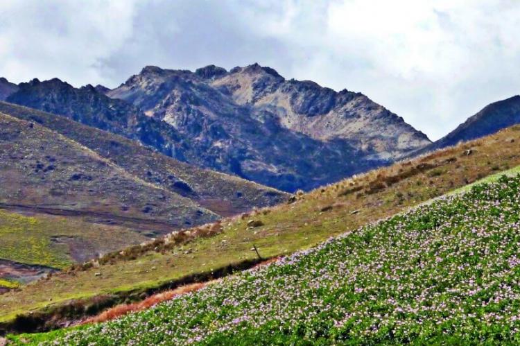
The Northeastern Venezuelan Andes comprise the Sierra de Trujillo, the Sierra de Portuguesa, and the Lara Andes. Its rolling hills and fertile valleys distinguish the Sierra de Trujillo, ideal for agriculture. The Sierra de Portuguesa features a mix of forested areas and open grasslands, providing habitats for a variety of wildlife. The Lara Andes are characterized by their arid climate and unique rock formations, which offer insights into the region's geological history.
Serranía del Perijá
The Serranía del Perijá, also known as the Sierra de Perijá, is a minor yet significant part of the Venezuelan Andes. Located along the border with Colombia in the state of Zulia, this mountain range serves as a natural boundary between the two countries. It includes notable peaks such as Cerro de Las Tetas, which rises to 3,630 meters (11,909 feet), and Cerro Irapa, at 3,540 meters (11,614 feet). The Serranía del Perijá separates the Maracaibo Basin from the Cesar-Ranchería Basin and extends into the Guajira Desert, highlighting its geographical importance. This range is known for its diverse topography, which includes cloud forests, high-altitude grasslands, and arid zones. The climate varies significantly with elevation, from tropical at lower altitudes to cold and temperate at higher elevations.
The Serranía del Perijá is home to several indigenous communities, including the Yukpa and Barí peoples, who have lived in the region for centuries. These communities have a deep connection to the land and have developed sustainable practices to manage their natural resources. The cultural heritage of the Serranía del Perijá is rich and diverse, reflecting the history and traditions of its indigenous inhabitants.
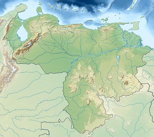
Relief map of Venezuela, showing the Cordillera de Mérida and Serranía del Perijá in the upper left.
Ecological and Climatic Characteristics
The Venezuelan Andes are part of the larger Tropical Andes, one of the most biodiverse regions on Earth. This area is characterized by a wide range of ecological zones, from lowland forests to high-altitude environments.
Tropical Andes and Montane Forests
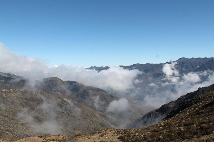
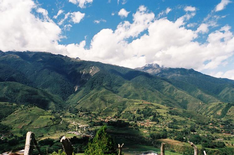
The Venezuelan Andes montane forests occupy the middle elevations of the region, featuring lush, moist forests and high-altitude cloud forests. These forests serve as an ecological barrier, separating the basins of Lake Maracaibo and Venezuela's expansive Llanos plains. The montane forests are home to a rich variety of flora and fauna, many of which are endemic to the region. The constant interplay between climate, altitude, and topography creates a unique environment that fosters biodiversity. This ecological richness highlights the importance of conserving these habitats, which are crucial for maintaining ecological balance and supporting local communities.
High-Altitude Environments
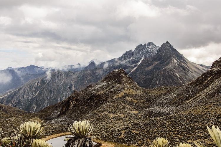
At elevations above 3,100 meters (10,170 feet), the tree line gives way to the páramo, a unique tropical alpine grassland ecosystem. The Cordillera de Mérida páramo is one of the significant enclaves of this ecosystem in the northern Andes. This region is characterized by its harsh climate, with cold temperatures and frequent fog. Despite these challenging conditions, the páramo supports a diverse array of specialized plant and animal species that are well-adapted to this environment. The Humboldt Glacier, located in this mountain range, is a notable feature, although it is rapidly retreating due to climate change. During July and August, snow often covers the mountains above 4,200 meters and occasionally at lower elevations of around 3,800 meters (12,500 feet), creating stunning landscapes and influencing local weather patterns.
National Parks and Conservation
The Venezuelan Andes are home to several protected areas that preserve their unique ecosystems and breathtaking landscapes. Among the most notable are the Sierra Nevada National Park and the Sierra La Culata National Park. These parks play a critical role in conserving the region's rich biodiversity, providing habitats for numerous plant and animal species. They also offer opportunities for scientific research and ecotourism, which can contribute to the local economy while promoting environmental awareness and conservation. The protected areas are crucial for preserving the natural beauty and ecological integrity of the Venezuelan Andes, ensuring that future generations can continue to appreciate and benefit from these natural treasures.
The Andean Natural Region
The Andean natural region of Venezuela, encompassing the Cordillera de Mérida and the Serranía del Perijá, constitutes just over 5% of Venezuela's territory. It is the fourth largest of the country's eight natural regions and includes its highest point, Pico Bolívar, which stands at 4,978 meters (16,332 feet). This region is crucial for its ecological significance, providing essential ecosystem services such as water regulation and carbon sequestration. The Andean region is also culturally significant, boasting a rich history and vibrant traditions that are deeply intertwined with the natural environment. The interplay between natural and cultural elements in the Andean region highlights the need for integrated conservation and sustainable development approaches.
Conclusion
The Venezuelan Andes are a remarkable segment of the broader Andean mountain system, distinguished by their geological origins, diverse ecosystems, and significant elevation. From the high-altitude páramo to the lush montane forests, these ranges offer a wealth of natural beauty and biodiversity. The region's geological history, ecological complexity, and cultural richness are vital to Venezuela's natural heritage. Ensuring the conservation and sustainable management of the Venezuelan Andes is essential for preserving their unique character and the numerous benefits they provide.
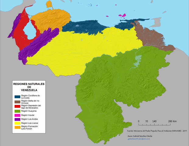
Map showing Venezuela's natural regions.
