The Leeward Antilles: The ABC Islands and Venezuela's Caribbean Territories
The Leeward Antilles are geographically, geologically, and culturally unlike any other island group in the region. Stretching along the northern coast of South America, this arc of low-lying, largely arid islands straddles the boundary between the Caribbean Sea and the South American continent.

The Southern Caribbean Arc: Aruba, Bonaire, Curaçao, and Venezuela's Island Territories
The Leeward Antilles occupy a singular position in the Caribbean — geographically, geologically, and culturally unlike any other island group in the region. Stretching approximately 800 km (500 mi) along the northern coast of South America from Aruba in the west to the Los Testigos Islands in the east, this arc of low-lying, largely arid islands straddles the boundary between the Caribbean Sea and the South American continent. The group divides naturally into two politically distinct but geologically related sub-groups: the Dutch ABC islands of Aruba, Bonaire, and Curaçao to the west, and the Venezuelan island territories — comprising the state of Nueva Esparta and the Federal Dependencies — to the east. Together they form one of the Caribbean's most complex and least-visited frontiers, where desert scrub meets turquoise reef, and Dutch colonial architecture stands within sight of Venezuelan fishing villages.
Unlike the volcanic arc islands of the Windward and Leeward Islands to the northeast, the Leeward Antilles bear no volcanic peaks, no cloud forests, and no geothermal activity. They were born not of fire but of ancient tectonic collision, and their character — sun-scorched, wind-scoured, reef-fringed — reflects a geological and ecological story quite different from the rest of the Lesser Antilles. Yet they are islands of extraordinary richness: the most pristine coral reefs in the Caribbean, some of the Atlantic world's oldest colonial sites, pearls that once funded the Spanish Crown, and a crescent of marine protected areas that rival anything the wider Caribbean has to offer.
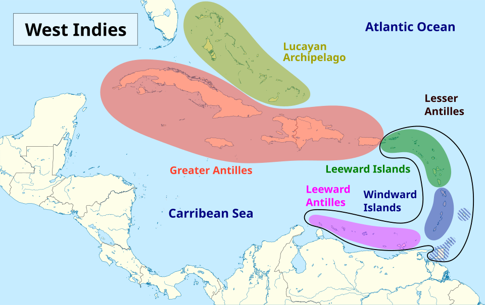
Map depicting the location of the Leeward Antilles (light purple).
Geological Origins
The ABC islands and the Venezuelan island chain formed approximately 90 million years ago, during the Late Cretaceous, as the Caribbean Plate collided obliquely with the South American Plate. This collision forced a segment of ancient oceanic crust — part of what geologists call the Great Arc of the Caribbean — to the surface, creating the Leeward Antilles Ridge, a submarine elevation along whose crest the islands sit. Their basement rocks are therefore not volcanic in the conventional sense, but consist of deformed oceanic crust — diabase, basalt, and metamorphic rocks — subsequently overlain by thick sequences of marine limestone formed as coral reefs grew over the emergent ridges and were exposed by tectonic uplift over millions of years. Recent studies indicate that the entire Leeward Antilles arc is slowly accreting to the South American mainland, gradually closing the narrow straits between the islands and the Venezuelan coast.
The result is a landscape of flatness remarkable by Caribbean standards. The highest point in the ABC islands is Christoffelberg on Curaçao at just 375 m (1,230 ft). In comparison, Margarita Island's Cerro San Juan reaches a more substantial 920 m (3,018 ft) — the tallest peak in the Leeward Antilles — though even this is modest compared to the volcanic summits of the Windward Islands. The islands' surfaces consist largely of fossil coral-reef limestone, and in many places the original reef-terrace structures are still visible, each terrace representing a former sea level during a past interglacial period.
Climate and Vegetation
The Leeward Antilles share a hot, semi-arid to arid climate shaped by the rain shadow of the Venezuelan Andes and the steady northeast trade winds that strip moisture from the air before it reaches the islands. Annual rainfall across most of the chain averages 250–550 mm (10–22 in), falling largely in brief, intense showers concentrated in the October–January period. In the driest years, some islands receive under 200 mm (8 in). Temperatures remain uniformly warm year-round at 28–37°C (82–99°F), somewhat moderated by the constant trade winds.
This aridity has shaped the islands' vegetation into distinctive xerophytic scrubland. The dominant plants throughout the chain are columnar cacti — particularly the kadushi cactus (Cereus repandus) — alongside thorny acacia and the divi-divi tree (Caesalpinia coriaria), whose canopy is permanently sculpted by the trade winds into a characteristic southwestward lean that historically served as a natural compass for sailors. Lignum vitae (Guaiacum officinale), one of the densest and hardest woods in the world, is the national tree of Bonaire. On the Venezuelan islands, the vegetation is broadly similar in the arid lowlands, but Margarita Island's interior highlands support a more varied flora that includes montane forest and freshwater springs quite unlike anything found on the ABC islands.
The ABC Islands: Aruba, Bonaire, and Curaçao
Historical Background
The ABC islands were inhabited for thousands of years before European contact by the Caquetío, an Arawakan-speaking people whose chiefdom extended across the islands and onto the Venezuelan mainland. The Caquetío were skilled seafarers and traders, and their presence is recorded in petroglyphs found on rock faces across all three islands — most accessibly in Aruba's Arikok National Park and in the caves of Curaçao's Christoffel Park. Spanish explorer Alonso de Ojeda reached the islands in 1499, and within two decades, the consequences for the Caquetío were catastrophic. Between 1513 and 1515, Spanish authorities ordered the forced deportation of an estimated 2,000 Caquetío to work in the copper mines of Hispaniola, describing the islands dismissively as islas inútiles (useless islands) for their lack of gold and silver. The islands were subsequently repopulated from the Venezuelan mainland and used for cattle ranching and salt extraction.
The Dutch West India Company seized Curaçao in 1634, Aruba and Bonaire in 1636, immediately recognising what the Spanish had missed: Curaçao's deep natural harbour at what would become Willemstad was one of the finest in the Caribbean. Under Dutch administration, Curaçao rapidly became a major hub of Atlantic commerce and, notoriously, one of the largest slave-trading centres in the Western Hemisphere. Between the mid-17th and late 18th centuries, tens of thousands of enslaved Africans passed through Curaçao's markets, many destined for the Spanish colonies on the South American mainland. On Bonaire, enslaved Africans harvested salt and cut dyewood. Dutch abolition of slavery in 1863 devastated the plantation-based economies, and the islands endured decades of economic stagnation until the discovery of Venezuelan oil transformed everything. By the 1940s, the refineries on Curaçao and Aruba were among the largest in the world, vital to the Allied war effort in World War II, and targeted by German U-boat shelling in February 1942 in one of the few direct attacks on Western Hemisphere infrastructure during the war.
Politically, the islands became part of the Netherlands Antilles in 1954. Aruba separated in 1986, becoming a distinct constituent country of the Kingdom of the Netherlands. When the Netherlands Antilles was dissolved on 10 October 2010, Curaçao followed Aruba's path to constituent country status, while Bonaire became a special municipality directly administered by the Netherlands.
Aruba
Aruba is the smallest of the ABC islands, covering 179 sq km (69 sq mi) and lying just 29 km (18 mi) north of Venezuela's Paraguaná Peninsula. With a population of approximately 113,000 and an economy almost entirely driven by tourism, Aruba is the most intensively developed of the three islands. Its Palm Beach and Eagle Beach on the calm leeward western coast are consistently rated among the Caribbean's finest — long, flat strips of powdery white coral sand sheltered from the Atlantic swells that batter the rugged northeastern coast, where wave-carved limestone formations, blowholes, and the remnants of a natural arch (the original Natural Bridge collapsed in 2005) create a dramatically different landscape.
Arikok National Park covers approximately 20% of Aruba's land area and protects the island's most significant natural and archaeological heritage, including Caquetío cave paintings and habitat for several endemic species. The Aruban cascabel (Crotalus unicolor), the island's endemic rattlesnake, is one of the world's rarest rattlesnakes; the Aruban burrowing owl (Athene cunicularia arubensis), known locally as the shoco, is a further island endemic that nests in burrows in the rocky ground and has become an unofficial symbol of the island. Aruba's capital, Oranjestad, features pastel-coloured Dutch-Caribbean colonial architecture along its waterfront. The island receives more than 2.5 million tourists annually, and its freshwater supply depends almost entirely on one of the world's largest seawater desalination plants.
Bonaire
Bonaire covers 288 sq km (111 sq mi) and, with a population of approximately 26,500, is by far the least developed of the three islands — a status that has preserved its extraordinary natural environment. Shaped somewhat like a boomerang, 38.6 km (24 mi) long from north to south, it lies just off its western coast from the small uninhabited satellite island of Klein Bonaire, about 6 sq km (2.3 sq mi) of flat coral limestone some 800 m (0.5 mi) from the main island.
The Bonaire National Marine Park, established in 1979 and expanded to encompass Klein Bonaire and all coastal waters to a depth of 60 m (197 ft), is one of the most successful marine protected areas in the Caribbean. Bonaire's fringing coral reefs begin at the surface of the water along much of the western coast, making shore diving possible without a boat and supporting over 350 fish species, 57 coral species, and abundant populations of queen conch (Aliger gigas), hawksbill turtles (Eretmochelys imbricata), green turtles (Chelonia mydas), and loggerhead turtles (Caretta caretta). Every diver who enters Bonaire's waters pays an annual Nature Fee that funds ongoing reef monitoring and coral outplanting programmes.
Washington-Slagbaai National Park, covering approximately 5,643 ha (13,944 acres) of Bonaire's northern third and established in 1969 as one of the first national parks in the Caribbean, protects diverse terrestrial habitats including rocky coastlines, dry forest, and salt lagoons. The park and the island's southern salt flats — operated commercially by the Cargill salt company, whose neon-pink evaporation ponds are tinted by salt-tolerant bacteria — support a substantial breeding population of American flamingos (Phoenicopterus ruber). The yellow-shouldered amazon parrot (Amazona barbadensis), listed as Vulnerable on the IUCN Red List, has its largest Caribbean population on Bonaire, with approximately 400 individuals, the result of sustained work by the conservation NGO Echo Bonaire to combat the pet trade and restore nesting habitat. The small stone slave huts along the salt flat road — structures barely large enough for a person to lie down in, where enslaved salt workers sheltered during the harvest season — stand as one of the Caribbean's most sobering heritage sites.
Curaçao
Curaçao is the largest of the ABC islands in both area and population, covering 444 sq km (171 sq mi) and home to approximately 158,000 people. Its capital, Willemstad, is a UNESCO World Heritage Site, celebrated for the Handelskade waterfront's row of brightly painted Dutch colonial merchant houses reflected in the waters of St. Anna Bay. The city is bisected by St. Anna Bay, crossed by the Queen Emma pontoon bridge — a floating pedestrian bridge that swings open to allow ships to pass — and the Queen Juliana Bridge, which at 56 m (184 ft) is the highest bridge in the Caribbean.
Curaçao's Sephardic Jewish community — one of the oldest in the Americas, descended from Portuguese Jews who arrived via the Netherlands and Brazil in the 17th century — built the Mikvé Israel-Emanuel Synagogue in 1732, the oldest synagogue in continuous use in the Western Hemisphere. The relationship between Curaçao's African-descended majority and its colonial minority was the source of deep tensions that erupted in the 1969 Trinta di Mei (Thirtieth of May) uprising, when widespread unrest over unemployment and racial discrimination led to the burning of parts of Willemstad and the intervention of Dutch marines, ultimately prompting significant political reforms. Inland, Christoffel National Park covers 1,870 ha (4,620 acres) of the island's northwestern tip, protecting an endemic subspecies of white-tailed deer (Odocoileus virginianus curassavicus) and notable bird diversity. Curaçao is also the origin of the laraha (Citrus ×aurantium), the bitter orange whose dried peel became the basis for the island's famous Curaçao liqueur.
Papiamentu
Perhaps the most remarkable cultural product of the ABC islands is Papiamentu — known as Papiamento on Aruba, reflecting a different spelling convention — a creole language spoken across all three islands and their diaspora. Emerging from Curaçao in the second half of the 17th century, it arose from contact between West African enslaved people, Sephardic Jewish traders, Dutch colonial officials, and the Caquetío-descended population, with substantial Spanish influence from the Venezuelan coast. The result is a language with Portuguese-based grammar that has absorbed elements of Spanish, Dutch, English, and several West African tongues — a linguistic record of the Atlantic world's convergence. What distinguishes Papiamentu from many other Caribbean creoles is its social vitality: spoken across all social classes, it has been an official language of Aruba since 2003 and of Curaçao and Bonaire since 2007, used in government, media, religious services, and literature.
The Venezuelan Islands
East of the ABC islands, stretching along the Venezuelan coast toward Trinidad, lies the Venezuelan portion of the Leeward Antilles: a scattered constellation of islands, archipelagos, and cays politically divided between the state of Nueva Esparta and the Federal Dependencies of Venezuela. These territories, though far less visited internationally than their Dutch counterparts, encompass some of the most ecologically intact marine environments in the Caribbean, as well as one of the region's most historically significant island groups.
Nueva Esparta: The Pearl Islands
The state of Nueva Esparta comprises three islands — Margarita, Coche, and Cubagua — lying off the northeastern coast of Venezuela near the Araya Peninsula. Margarita is by far the largest at 1,020 sq km (394 sq mi), 78 km (48 mi) long and up to 20 km (12 mi) wide, and with a population of approximately 420,000, it is the most populous island in the Leeward Antilles. The state takes its name — Nueva Esparta, or New Sparta — from the legendary resistance shown by its people during the Venezuelan War of Independence, earning them a comparison to the warriors of ancient Sparta.
Margarita was first encountered by Europeans when Christopher Columbus sighted it on 15 August 1498 during his third voyage — the same expedition on which he first saw the South American mainland. The island was then inhabited by the Guaiqueries, an Indigenous fishing people related to the Arawak, who had given it the name Paraguachoa, meaning 'fish in abundance.' Columbus named it La Asunción; the following year, the explorer Cristóbal de la Guerra renamed it Margarita, the Latin word for pearl, a reference to the extraordinary pearl oyster beds discovered in the surrounding shallows. Those pearls would shape the island's destiny for the next century: at the height of the colonial pearl trade in the early 16th century, the waters around Margarita and its tiny neighbour Cubagua supplied nearly a third of all New World tribute to the Spanish Crown.
Cubagua, the smallest of the three islands at just 18 sq km (7 sq mi), plays an outsized role in colonial history. In 1527, the Spanish established the city of Nueva Cádiz on Cubagua — the first formally constituted European city on South American soil, predating the permanent founding of any city on the Venezuelan mainland. The settlement thrived on the pearl trade; at its peak, it was home to several hundred settlers and thousands of enslaved Indigenous pearl divers. A catastrophic earthquake and tsunami in 1541 destroyed the city, which was never rebuilt. The ruins of Nueva Cádiz are today a National Monument of Venezuela, and the island remains uninhabited save for occasional fishermen. Coche, between Margarita and the mainland, covers 55 sq km (21 sq mi), is home to approximately 10,000 people, and is known for its excellent windsurfing conditions and its continuing pearl-fishing tradition — though the pearl oyster (Pinctada imbricata) beds that once made these waters famous are now significantly diminished by over-harvesting and environmental degradation.
Margarita Island itself is a study in ecological and topographic contrasts. The island consists of two distinct peninsulas — Paraguachoa to the east, more populous and mountainous, rising to 920 m (3,018 ft) at Cerro San Juan, and Macanao to the west, more arid and thinly populated, reaching 760 m (2,493 ft) at Macanao Peak — connected by a narrow 18 km (11 mi) isthmus that contains the Laguna de la Restinga, a 18,000 ha (44,479 acre) national park protecting a spectacular mangrove lagoon system with interconnected channels, cays, and beaches. The lagoon is an important habitat for herons, flamingos (Phoenicopterus ruber), and a rich fish and crustacean fauna. Cerro El Copey National Park, covering the island's highest interior ground, protects montane forest and freshwater springs that contrast strikingly with the arid lowlands — a miniature version of the ecological zonation found on the larger Windward Islands. Historically a tourist destination of regional importance, Margarita's tourism industry has declined substantially in recent decades due to Venezuela's prolonged economic and political crisis, though the island retains its free-port status established in 1974 and considerable potential for recovery.
The Federal Dependencies
The Federal Dependencies of Venezuela encompass more than 600 islands, cays, and islets administered directly by the Venezuelan federal government, most of them uninhabited or supporting only tiny fishing communities. They are grouped into several named archipelagos, each with its own character and ecological importance. Together with Nueva Esparta, they form what Venezuela formally designates as its Insular Region.
The most celebrated of the Federal Dependencies is the Archipiélago Los Roques, designated Venezuela's first national park — and one of the first marine national parks in Latin America — in 1972, and a Ramsar Wetland of International Importance since 1996. Located approximately 128 km (80 mi) north of the port of La Guaira on Venezuela's central coast, Los Roques is a coral atoll of remarkable size and ecological richness, spanning 46 km (29 mi) east to west and 27 km (17 mi) north to south and encompassing an estimated 2,250 sq km (869 sq mi) of protected marine area. The atoll consists of approximately 50 islands, 292 cays, and some 300 sandbanks arranged around a shallow central lagoon, protected by two long outer coral barrier reefs — one 24 km (15 mi) to the east, another 32 km (20 mi) to the south. The only permanently inhabited island is Gran Roque, home to approximately 1,250 people, a scattering of family-owned posadas (guesthouses), and a small airstrip served by regular flights from Caracas and Porlamar.
Los Roques' marine biodiversity is extraordinary: its reefs harbour 61 coral species, 280 fish species, 200 crustacean species, 140 mollusc species, 60 sponge species, and 45 echinoderm species. All four Atlantic sea turtle species nest on the islands — the green turtle (Chelonia mydas), loggerhead (Caretta caretta), hawksbill (Eretmochelys imbricata), and leatherback (Dermochelys coriacea) — and the shallow lagoon is an important nursery area for lemon sharks (Negaprion brevirostris). The archipelago has been designated an Important Bird Area by BirdLife International: 92 resident and visiting bird species have been recorded, including brown pelicans (Pelecanus occidentalis), red-footed boobies (Sula sula), brown boobies (Sula leucogaster), magnificent frigatebirds (Fregata magnificens), and flocks of American flamingos (Phoenicopterus ruber). Los Roques is also one of the Caribbean's premier destinations for fly-fishing, with exceptional bonefish (Albula vulpes), permit (Trachinotus falcatus), and tarpon (Megalops atlanticus) fishing on the extensive flats surrounding the atoll.
Other significant island groups within the Federal Dependencies include Las Aves (the Aves Archipelago), a remote cluster of coral cays approximately 250 km (155 mi) northwest of the Venezuelan coast that serves as an important nesting site for seabirds and sea turtles and is designated a Wildlife Refuge; La Orchila, a larger island used primarily as a Venezuelan naval and presidential retreat and closed to public access; La Blanquilla, 120 km (75 mi) offshore, known for its pristine beaches and seabird colonies; Los Frailes, a group of rugged basaltic islets near Margarita with dramatic coastal cliffs; Los Hermanos, a remote cluster with important green turtle nesting beaches; and Los Testigos, the easternmost islands of the Leeward Antilles chain, lying close to Tobago and known for their traditional fishing communities and healthy reef systems. Los Monjes, a cluster of tiny rocky outcrops near the Colombian border, has occasionally been a source of territorial tension between Venezuela and Colombia.
Shared Ecology and Conservation
Across both the Dutch ABC islands and the Venezuelan territories, the Leeward Antilles display a characteristic marine fauna shaped by their position on the South American continental shelf, their distance from major river systems that might bring sediment and nutrients, and their protection from the most intense hurricanes. American flamingos are conspicuous throughout the chain, breeding on Bonaire and occurring in large flocks at Los Roques and on Margarita's lagoons. The Venezuelan troupial (Icterus icterus), the national bird of Venezuela, a large, brilliant orange-and-black oriole, is found on all the major islands. The bare-eyed pigeon (Patagioenas corensis) is a species largely restricted to the arid islands of the Leeward Antilles and adjacent Venezuelan mainland, while the brown-throated parakeet (Eupsittula pertinax) is the most widespread psittacine across the chain.
Marine conservation across the Leeward Antilles has been more effective than in most of the Caribbean, in part because the relatively small human populations on the Venezuelan islands and the long-established protection regimes on Bonaire and at Los Roques have reduced fishing pressure and habitat damage. Nevertheless, the chain faces growing threats from climate-driven coral bleaching — Bonaire suffered a significant bleaching event in 2023 — invasive lionfish (Pterois volitans and P. miles), and, in the Venezuelan territories, the effects of reduced governmental conservation capacity during Venezuela's economic crisis, which has strained park management and enforcement on Los Roques and elsewhere.
Conclusion
The Leeward Antilles are, in many respects, the Caribbean's great paradox: sun-scorched and geologically ancient, culturally layered and ecologically exceptional, shaped by pearl trade and oil refining, slave labour and Dutch mercantilism, Venezuelan revolutionary history and Papiamentu creole song. From the UNESCO-listed streetscapes of Willemstad to the uninhabited pearl oyster grounds off Cubagua, from the coral gardens of Los Roques to the flamingo-pink salt pans of Bonaire, these islands at the edge of two continents have produced an identity that is irreducibly and unmistakably their own. They are not the Caribbean of the tourist brochure — but for those who look closely, they may well be the most remarkable islands in the sea.