Washington Slagbaai National Park: Preserving Bonaire's Ecological Diversity
Washington Slagbaai National Park covers almost 17% of Bonaire and offers diverse landscapes - from arid cactus scrub to sandy beaches. It's a sanctuary for rare species like parrots, flamingos, and sea turtles. The park also has historical landmarks and geological formations, blending nature and culture.


Washington Slagbaai National Park: Preserving Bonaire's Ecological Diversity
On the northwestern shores of the serene island of Bonaire in the Caribbean Netherlands, Washington Slagbaai National Park is a testament to its unwavering commitment to safeguarding its ecological treasures. Enveloping a sprawling 6,500 hectares (16,000 acres), this protected expanse blankets nearly 17% of Bonaire's diverse landscape, cradling its highest point, the majestic Mount Brandaris, which proudly reaches 241 meters (790 feet).
The island government entrusted the Bonaire National Parks Foundation (STINAPA) with watchful stewardship. The park emerges not merely as a biodiverse sanctuary but as a dual custodian, overseeing both the Washington Slagbaai National Park and the Bonaire National Marine Park.
Diverse Habitats Unveiled
Upon entering the park, visitors will discover a remarkable diversity of landscapes — from the arid cactus scrub and dry forests to the unique features of salt flats, caves, mangroves, and sandy beaches. While much of the park is dominated by thorny scrub and cacti adapted to dry conditions, it surprises visitors with distinctive environments such as dunes and saline ponds, creating a mosaic of habitats.
Biodiversity in Focus
Washington Slagbaai National Park is a haven for Bonaire's terrestrial and marine species. This sanctuary has been designated a safe habitat for the island's endemic and endangered species, including parrots, flamingos, parakeets, iguanas, and an array of birds and reptiles. Recognized by BirdLife International as an Important Bird Area (IBA), the park is a vital nesting, roosting, and foraging area for numerous avian species.
Seaside Sanctuary
The park's 15-kilometer (9.3-mile) shoreline boasts scenic beauty and is a critical nesting ground for globally endangered sea turtles, including the Green Turtle, Hawksbill, and Loggerhead. This coastal expanse is a refuge for seven endemic lizards, numerous endemic land snails, and two endemic plant species. The park's hypersaline lagoons (saliñas) become bustling nesting and foraging grounds for migratory waterbirds, including the endangered Caribbean Flamingo.
Historical and Cultural Significance
Beyond its ecological importance, Washington Slagbaai National Park is a living repository of Bonaire's history and culture. Once inhabited by native South Americans, the park later housed two of the most extensive plantations during the colonial period. It preserves significant historical landmarks today, offering a glimpse into the island's intriguing past.
Geological Marvels Unearthed
Delving into Bonaire's geological history, the park reveals the island's oldest formations. Shaped by submarine volcanic activity during the Cretaceous period, the central hills, limestone plateaus, and the island's highest point, Mount Brandaris, provide a geological narrative spanning millions of years. Terraces and limestone plateaus surrounding the central hills reflect changes in sea levels and coral reef formations over the last five million years.
In conclusion, Washington Slagbaai National Park is more than a protected area; it is a living testament to Bonaire's commitment to preserving its natural, cultural, and geological heritage. As you explore the park's diverse landscapes and witness its vibrant biodiversity, you become part of an ongoing story that intertwines this Caribbean ecological gem's past, present, and future.
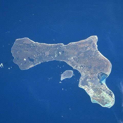
Satellite image of Bonaire and Klein Bonaire.