The Natural Geography of Central America: A Land Bridge Between Two Worlds
Central America is one of the most biologically rich regions on Earth — a narrow land bridge connecting two continents and separating two oceans. From the Talamanca range cloud forests to the Petén jungle and the Darién wilderness, its landscapes are as varied as they are irreplaceable.

Isthmus of Life: The Natural Regions and Ecosystems of Central America
Central America is, at its most fundamental, a bridge. Stretching approximately 2,000 kilometres (1,243 miles) from the Isthmus of Tehuantepec in southeastern Mexico to the Colombian border in eastern Panama, this narrow strip of land connects two continents, separates two oceans, and concentrates within its modest area a biological richness that is entirely out of proportion to its size. Covering roughly 518,000 square kilometres (200,000 square miles) — less than 1% of the world's land surface — the region harbours an estimated 7 to 10% of all known species on Earth.
That abundance is not accidental. It is the direct product of Central America's position, its topography, and its geological history. The region sits at the convergence of the North American and Caribbean tectonic plates, a collision that has produced a continuous chain of volcanoes, elevated mountain ranges, and sharp contrasts in climate and vegetation, making the isthmus so ecologically diverse. The same geology that built these mountains also, some three million years ago, closed the seaway that once separated the Atlantic from the Pacific — an event with consequences that reshaped the biology of two entire continents.
The Geological Foundation
Central America's physical geography cannot be understood without reference to tectonics. The region is geologically young and restless. It sits at the junction of several major tectonic plates — the North American, Caribbean, Cocos, and Nazca plates — and the interaction between them occurs along a complex network of subduction zones and fault lines that run the length of the isthmus. The subduction of the Cocos Plate beneath the Caribbean Plate is responsible for the volcanic arc that forms the backbone of Central America, a chain of more than thirty active volcanoes running in a rough line from Guatemala through El Salvador, Honduras, Nicaragua, Costa Rica, and into Panama.
This volcanic activity has both created and continues to reshape the landscape. Eruptions have built peaks exceeding 4,000 metres (13,100 feet) in Guatemala and have deposited fertile ash soils across the Pacific lowlands, which have long supported dense human populations and intensive agriculture. The same forces that make the region prone to earthquakes and volcanic hazards are responsible for the spectacular terrain — calderas, crater lakes, and geothermal features — that characterise so much of Central American highland geography.
The formation of the Isthmus of Panama approximately three million years ago was among the most consequential geological events of the Cenozoic Era. Prior to this, a seaway known as the Central American Seaway connected the Atlantic and Pacific Oceans, allowing ocean currents to flow freely between them. When the isthmus closed, that circulation was disrupted, intensifying the Gulf Stream and contributing to the Northern Hemisphere's glaciation cycles. Biologically, it created an overland passage between North and South America for the first time in tens of millions of years — triggering what scientists call the Great American Biotic Interchange, a massive two-way migration of species between the two continents whose effects are still visible in the fauna of the Americas today.
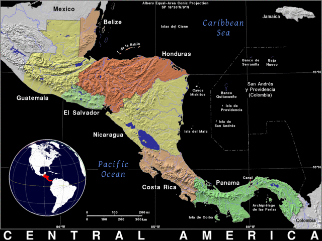
Relief map of Central America.
The Volcanic Spine and Highland Regions
The most visually dominant feature of Central America is its volcanic mountain backbone. In Guatemala, the Sierra Madre and the highlands of the Cuchumatanes reach elevations above 3,800 metres (12,500 feet), creating a cool, mist-covered environment quite unlike the tropical lowlands on either side. Guatemala's Tajumulco Volcano, at 4,220 metres (13,845 feet), is the highest peak in Central America and the highest point in all of North America outside Mexico. The Guatemalan highlands are home to dozens of active and dormant volcanoes, many of which are surrounded by large crater lakes — most famously Lake Atitlán, which occupies a vast caldera and is regarded as one of the most beautiful lakes in the world.
Further south, the volcanic chain continues through El Salvador, Honduras, and Nicaragua, where peaks are generally lower but no less geologically active. Nicaragua's volcanic landscape is particularly dramatic, with a chain of cones — including Concepción, Momotombo, and Masaya — running along the Pacific lowlands beside Lake Nicaragua, Central America's largest lake at 8,264 square kilometres (3,191 square miles). Masaya is among the most active volcanoes in the region, with a lava lake in its main crater that has been burning almost continuously for centuries.
In Costa Rica and western Panama, the character of the highlands changes. The Cordillera de Talamanca, which straddles the border between the two countries, is the largest non-volcanic mountain range in Central America and reaches 3,821 metres (12,536 feet) at Cerro Chirripó — Costa Rica's highest peak and the second highest in all of Central America. The Talamanca range is geologically older and more stable than the volcanic zones to the north, and its isolation has produced a degree of biological endemism — species found nowhere else — that rivals any comparable area in the hemisphere.
The Pacific Slope and Coastal Plain
West of the volcanic spine, facing the Pacific Ocean, lies a landscape of a very different character. The Pacific slope of Central America is drier than the Caribbean side, shaped by a pronounced dry season that typically lasts from November through April, limiting vegetation to ecosystems adapted to periodic moisture stress. The Pacific coastal plain is generally narrow — in places only a few tens of kilometres wide — and backed by foothills that rise steeply toward the volcanic highlands above.
Tropical dry forests once dominated the Pacific lowlands from southern Mexico through Guanacaste in northwestern Costa Rica, one of the longest continuous stretches of this ecosystem type in the Americas. These forests, characterised by deciduous trees that shed their leaves during the dry season, are among the most threatened ecosystems in the region. Centuries of conversion for cattle ranching and agriculture have reduced them to a fraction of their original extent, and what remains is highly fragmented. Guanacaste's remaining dry forests, now protected within a national park and surrounding reserves, represent one of the most significant conservation efforts to restore this ecosystem worldwide.
The Pacific coast itself is irregular, punctuated by peninsulas, gulfs, and estuaries that create productive coastal ecosystems. The Nicoya Peninsula in Costa Rica, the Gulf of Fonseca shared by El Salvador, Honduras, and Nicaragua, and the Azuero Peninsula in Panama are among the most prominent coastal features. Mangrove forests line much of the Pacific shore, providing critical nursery habitat for marine species and buffering coastal communities from storm surge.
The Caribbean Lowlands
The contrast between the Pacific and Caribbean sides of Central America is one of the defining features of the region's natural geography. Where the Pacific slope is dry and seasonally parched, the Caribbean lowlands receive rainfall year-round, fed by moisture-laden trade winds that arrive from the Atlantic and are forced upward by the mountain barrier. Annual precipitation in the lowlands can exceed 4,000 millimetres (157 inches) in the wettest areas, and parts of the Caribbean coast of Costa Rica and Panama receive more than 6,000 millimetres (236 inches) per year — among the highest rainfall totals in the Americas.
This sustained moisture supports dense tropical rainforest across a broad, flat coastal plain that extends from Belize through Guatemala, Honduras, Nicaragua, Costa Rica, and Panama. The forests of the Caribbean lowlands are structurally complex, with multiple canopy layers, an extraordinary diversity of tree species, and an understory rich in palms, bromeliads, orchids, and ferns. They form the largest remaining block of lowland tropical forest in Central America and provide critical habitat for jaguars, tapirs, giant anteaters, and hundreds of bird species.
Nicaragua's Caribbean coast — the Mosquito Coast, or Moskitia — is one of the most extensive and least disturbed lowland ecosystems in the entire region. Its combination of tropical forest, pine savannas, river systems, coastal lagoons, and wetlands supports exceptional biodiversity and is home to the Miskito, Mayangna, and other Indigenous peoples who have lived within it for centuries. The Honduran Mosquitia, contiguous with Nicaragua's, together constitute the largest roadless wilderness area in Central America.
The Petén and Yucatán Lowlands
In the north, the lowland rainforests of Guatemala's Petén department merge with those of Belize and the Yucatán Peninsula of Mexico, forming a vast expanse of tropical forest on a low limestone plain. The Petén is geologically distinct from the volcanic south — it sits on an ancient carbonate platform rather than volcanic rock, and its drainage is characterised by sinkholes, underground rivers, and shallow seasonal wetlands rather than the surface rivers of the volcanic highlands.
The Maya Biosphere Reserve in the Petén, covering some 2.1 million hectares (5.2 million acres), is the largest protected area in Central America and one of the largest tropical forest reserves north of the Amazon. Together with Belize's protected areas and the Calakmul Biosphere Reserve across the border in Mexico, it forms the Selva Maya — a transboundary forest block of approximately 4 million hectares (9.9 million acres) that represents the largest continuous tract of tropical forest in the Americas north of the Amazon Basin. This landscape is as culturally significant as it is ecologically important: it was the heartland of the Classic Maya civilisation, and hundreds of archaeological sites — including Tikal, Caracol, and Calakmul — lie within or adjacent to its forests.
Belize adds a further dimension to the region's natural geography. Its Caribbean coast is fringed by the Mesoamerican Barrier Reef, the largest coral reef system in the Western Hemisphere and the second largest in the world after Australia's Great Barrier Reef. The reef extends for approximately 300 kilometres (186 miles) from the Yucatán Peninsula to the Bay Islands of Honduras and encompasses atolls, lagoons, seagrass beds, and mangroves that support extraordinary marine biodiversity.
Montane Forests and Cloud Forest Ecosystems
Between the lowland forests and the open highland páramo lies one of the most biologically rich ecosystem types in the world: the cloud forest. Found along the middle elevations of Central America's mountain ranges, typically between 1,500 and 3,000 metres (4,900 and 9,800 feet), cloud forests are characterised by persistent low cloud and mist that keeps the air cool and saturated throughout the year. Trees are draped in mosses, lichens, and epiphytes — plants that grow on other plants rather than in the soil — and the effect is of extraordinary verdant density.
Cloud forests are critically important as water catchments, intercepting moisture from clouds and releasing it slowly into rivers and streams. They are also among the most species-rich environments in the region, particularly for birds, orchids, and amphibians. The resplendent quetzal — one of the most celebrated birds of the Americas, sacred to the ancient Maya and a national symbol of Guatemala — lives in these forests, feeding on the fruits of wild avocado trees and nesting in decaying trunks.
The Talamancan Montane Forests of Costa Rica and Panama are the most extensive and best-preserved cloud forest complex in Central America, and their designation recognises their biological significance as a UNESCO World Heritage Site alongside the adjacent La Amistad International Park — the largest protected area in Central America that spans both Costa Rica and Panama. At the highest elevations of the Talamanca range, above the treeline, páramo grasslands and shrublands appear — an ecosystem more typically associated with the Andes of South America, reaching its northernmost expression here in a region of windswept ridges, cushion plants, and dwarf shrubs.
The Darién: Where the Isthmus Meets the South
At the southern end of the Central American isthmus, where Panama meets Colombia, the landscape becomes exceptional even by the region's standards. The Darién is a vast lowland of dense tropical forest, mangrove coast, and cloud-covered mountain ranges that remains one of the least accessible and least disturbed areas in the Americas. The famous gap in the Pan-American Highway — which otherwise runs continuously from Alaska to southern Chile — falls here, a testament to the terrain's resistance to human infrastructure.
The Darién's biological significance derives directly from its position at the junction of two continents. Species from South America reach their northernmost limits here, while North American species extend to their southern edge, producing a zone of exceptional overlap and interchange. The Chocó-Darién, which extends into the Pacific lowlands of western Colombia, is recognised as one of the world's most biodiverse regions and a global conservation priority. Darién National Park, a UNESCO World Heritage Site covering 575,000 hectares (1.4 million acres), protects the core of this landscape, though its remoteness also makes effective management challenging.
A Region Under Pressure
Central America's natural geography is not static. The region is among the most heavily deforested in the tropics, and land-use change continues to reshape its landscapes at a pace that conservation efforts have struggled to match. The Pacific lowlands and much of the highland interior have been extensively cleared for cattle ranching, subsistence agriculture, and the cultivation of export crops, including coffee, sugarcane, and African palm oil. What remains of the original forest cover is often fragmented, isolated in patches too small to support the full range of species they once harboured.
Climate change adds a further dimension of pressure. Central America is identified as one of the world's most climate-vulnerable regions, exposed to intensifying hurricanes, shifting rainfall patterns, prolonged droughts in the Pacific dry corridor, and accelerating sea level rise along both coasts. The coral reefs of the Mesoamerican Barrier Reef system are threatened by warming ocean temperatures and increasing frequency and severity of bleaching events.
Against this, the region has also been a site of significant conservation innovation. Costa Rica reversed decades of deforestation through a payment-for-ecosystem-services programme that compensated landowners for maintaining forest cover, and today more than 25% of its territory is under formal protection. The Mesoamerican Biological Corridor — an ambitious transnational framework connecting protected areas from Mexico to Panama through a network of core zones, buffer areas, and wildlife corridors — is among the most geographically comprehensive conservation initiatives in the world, though its implementation has been uneven across the eight nations involved.
The Bridge Endures
Central America's role as a bridge between continents, between oceans, between the temperate zones of North America and the tropics of South America, is not merely a geographical fact. It is the organising principle of everything that makes the region biologically and ecologically remarkable. The volcanoes that built its highlands, the trade winds that drench its Caribbean slopes, the geological accident that closed the seaway and connected the continents: all of these forces have combined to create a landscape of exceptional diversity in an area small enough to traverse by road in a matter of days.
That diversity is both the region's greatest asset and the source of its greatest conservation urgency. Nowhere else in the world is so much biological richness concentrated in so narrow a corridor, and nowhere else is the intersection of human development pressure and ecological fragility quite so acute. The natural geography of Central America is, in the end, a story about connection — the connections between ecosystems, between species, between continents, and between the natural world and the human communities that have lived within it for thousands of years.