
The Guatemalan Highlands: A Geological and Cultural Crossroads
The Guatemalan Highlands extend from the Pacific plains to the Petén lowlands, characterized by volcanic peaks, valleys, lakes, and Indigenous communities. Their dramatic landscapes result from millions of years of tectonic activity, which has shaped both the environment and human culture.
Tierras Altas: Guatemala's Volcanic Spine and Maya Heartland
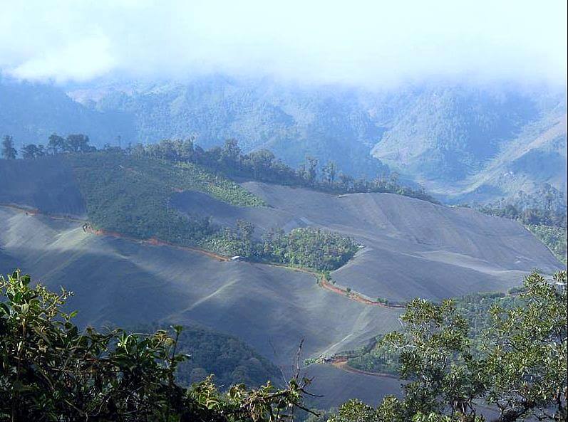
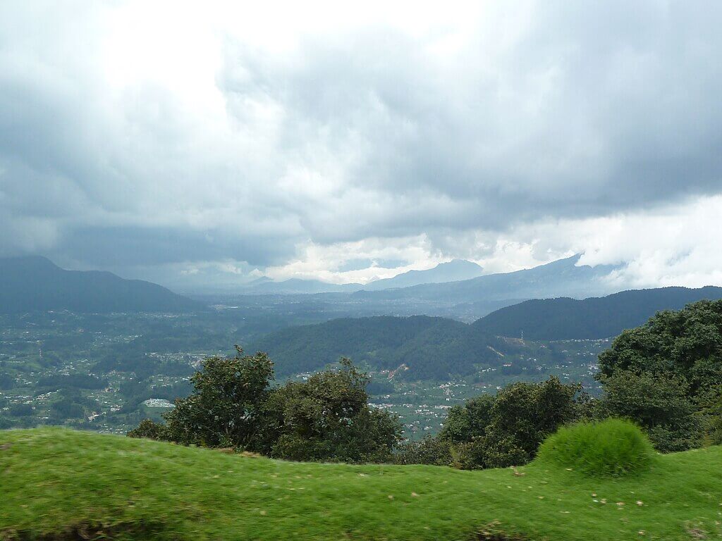
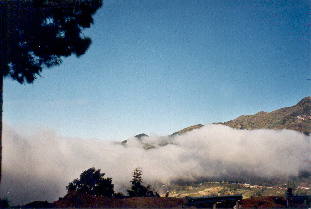
Stretching between the Pacific coastal plains and Guatemala's northern Petén lowlands, the Guatemalan Highlands are among Central America's most geologically complex and culturally significant regions. Known locally as Tierras Altas, this mountainous terrain—home to several million people, a substantial share of Guatemala's population of roughly 18 million—encompasses towering volcanic peaks, deep valleys, pristine highland lakes, and Indigenous communities whose traditions span millennia. The region's dramatic landscapes are the product of millions of years of tectonic activity, creating a natural laboratory where geological forces have shaped both the physical environment and the course of human civilization.
Geological Foundation and Tectonic Setting
The Guatemalan Highlands occupy a critical position along the boundary between the Caribbean Plate and the North American Plate, with additional influence from the Cocos Plate subduction zone to the south. This complex tectonic intersection has generated the mountain ranges, volcanic chains, and deep structural valleys that define the region's topography, and it makes the Highlands one of the most seismically active landscapes in Central America.
The subduction of the Cocos Plate beneath the Caribbean Plate has created the Central American Volcanic Arc, which extends through the southern Highlands and includes most of Guatemala's prominent volcanic peaks. Further inland, movement along strike-slip fault systems such as the Motagua Fault—part of the same boundary that separates the North American and Caribbean plates—has generated some of the deadliest earthquakes in the country's history. On February 4, 1976, a magnitude 7.5 rupture along the Motagua Fault killed an estimated 23,000 people, injured 76,000 more, and destroyed or damaged well over a million homes across the western highlands, triggering more than 10,000 landslides in the process. The disaster remains a defining event in the region's modern history and a lasting influence on Guatemalan building codes and emigration patterns.
Mountain Systems
Two primary mountain ranges dominate the Guatemalan Highlands: the Sierra Madre de Chiapas in the south and the Sierra de los Cuchumatanes in the north. These ranges represent different geological histories and formation processes that have contributed to the region's topographic diversity.
The Sierra Madre de Chiapas extends into Guatemala from Mexico, forming the backbone of the southern Highlands, and includes numerous volcanic peaks reaching elevations exceeding 4,000 m (13,120 ft). The Sierra de los Cuchumatanes, composed primarily of sedimentary rocks uplifted during regional mountain-building episodes rather than volcanic activity, dominates the northern Highlands and contains Guatemala's highest non-volcanic peaks, along with cold, wind-scoured páramo grasslands unlike anything else in the country.
Between these major ranges lie numerous smaller mountain chains, volcanic complexes, and structural valleys, creating a complex mosaic of highland terrain. Elevations throughout the region typically range from 1,000 to 4,220 m (3,280 to 13,845 ft), producing dramatic elevation gradients over relatively short distances.
Volcanic Landscape and Major Peaks
Volcán Tajumulco stands as the crown jewel of the Guatemalan Highlands, rising to 4,220 m (13,845 ft) to claim the title of Central America's highest peak. This stratovolcano, located near the Mexican border, represents the culmination of volcanic processes that have built much of the Highland landscape over millions of years. Despite its imposing height, Tajumulco has remained relatively quiet historically, with no recorded eruptions during the colonial or modern periods.
Volcán de Fuego, standing at 3,763 m (12,346 ft), maintains near-constant activity and ranks among Central America's most closely monitored volcanoes, with frequent small eruptions and periodic larger explosive events that pose ongoing hazards to nearby communities. Volcán Acatenango, rising to 3,976 m (13,045 ft), is Fuego's larger but currently dormant neighbor, and the contrast between the two illustrates how magmatic activity migrates over time within a single volcanic complex.
Other significant peaks include Volcán Agua, at 3,670 m (12,040 ft), which overlooks the colonial city of Antigua Guatemala, and the Volcán Atitlán complex, which forms part of the spectacular backdrop for Lake Atitlán. Guatemala's Instituto Nacional de Sismología, Vulcanología, Meteorología e Hidrología (INSIVUMEH) maintains a network of seismic stations, thermal cameras, and gas sensors across the volcanic Highlands, monitoring that has become increasingly critical as population growth brings more communities into proximity with active volcanic systems.
Lake Atitlán: A Volcanic Legacy
Lake Atitlán, often described as one of the world's most beautiful lakes, occupies a volcanic caldera formed approximately 84,000 years ago during one of the most explosive eruptions in Central American geological history. The Los Chocoyos eruption ejected an estimated 300 cubic km (72 cubic mi) of volcanic material, creating the depression that now contains the lake.
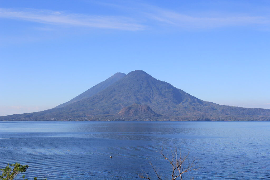
The lake reaches maximum depths of approximately 340 m (1,115 ft), making it Central America's deepest lake, its waters contained within steep volcanic walls that rise more than 1,500 m (4,920 ft) above the surface. Three volcanic peaks—Atitlán, Tolimán, and San Pedro—rise directly from the lake's southern shore. Lake Atitlán supports unique aquatic ecosystems that have evolved in isolation since the caldera's formation, its deep, oligotrophic waters maintaining distinct thermal layers that support endemic species found nowhere else. In recent years, however, the lake has faced periodic algae blooms linked to agricultural runoff and inadequate wastewater treatment in surrounding towns, a water-quality challenge that has drawn increasing concern from both local communities and the national government.
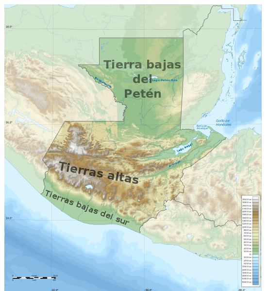
Map depicting the major geographic regions of Guatemala. The Guatemalan Highlands occupy the area labeled "Tierras Altas."
Cloud Forests and the Resplendent Quetzal
Guatemala's highland cloud forests, concentrated in the cooler, wetter zones of Alta Verapaz and along the flanks of the Sierra de las Minas and Cuchumatanes, harbor one of the country's most culturally resonant species: the resplendent quetzal (Pharomachrus mocinno), whose iridescent green plumage and meter-long tail streamers made it sacred to the Maya and later gave Guatemala's national currency its name. The bird's principal stronghold is the Biotopo del Quetzal (formally the Mario Dary Rivera Reserve) in Baja Verapaz, a moist montane forest reserve established in 1976 specifically to protect its dwindling habitat. The quetzal's continued survival depends heavily on old-growth cloud forest containing the wild avocado trees (Ocotea and Persea species) on which it feeds, making habitat fragmentation from agriculture and logging a direct threat to the species.
Cultural Heritage and Indigenous Communities
The Guatemalan Highlands have served as the heartland of Maya civilization for over two millennia. Archaeological evidence indicates continuous human occupation dating to the Pre-Classic period (2000 BCE–250 CE), with major ceremonial centers developing through the Classic (250–900 CE) and Post-Classic (900–1500 CE) periods. Sites such as Iximche, Mixco Viejo, and Zaculeu preserve architectural remnants of the highland Maya kingdoms that once controlled extensive territories and trade networks.
Modern Indigenous communities maintain direct cultural and linguistic connections to their Pre-Columbian ancestors. Major language groups include K'iche', Kaqchikel, Tz'utujil, Mam, Ixil, and Q'anjob'al, each preserving distinct traditions and relationships with the highland landscape. Chichicastenango, in the department of Quiché, hosts one of Latin America's largest and most renowned Indigenous markets, held every Thursday and Sunday, where K'iche' vendors sell textiles, pottery, and produce in a tradition of open-air commerce dating to the pre-conquest period.
Spanish colonization, beginning in the 16th century, introduced new architectural styles, economic systems, and cultural influences that created the distinctive blend of Indigenous and European elements visible throughout the Highlands today, exemplified by the colonial city of Antigua Guatemala. But the region's more recent history carries a far heavier legacy. During Guatemala's 36-year civil war (1960–1996), the Highlands—and Maya communities in particular—bore the brunt of the conflict's violence. A UN-backed truth commission later concluded that the army's scorched-earth campaigns of the early 1980s, concentrated in the Ixil region of Quiché and other highland departments, amounted to acts of genocide against the Maya population, with an estimated 200,000 people killed or disappeared over the course of the war and hundreds of villages destroyed. The 1996 Peace Accords formally ended the conflict, and the highland Maya activist Rigoberta Menchú, who lost family members to the violence, was awarded the Nobel Peace Prize in 1992 in recognition of her work documenting these events and advocating for Indigenous rights, work that continues to shape Guatemala's reckoning with this history today.
Economy and Land Use
Agriculture remains the economic foundation for most highland communities, with farming systems adapted to the region's diverse elevation zones and microclimates. Traditional crops, including maize, beans, and squash, continue to provide subsistence security, while coffee, vegetables, and flowers generate income for market participation. Coffee is the highlands' most significant commercial crop: the volcanic soils, elevation, and cloud cover of zones such as Antigua, Huehuetenango, and Cobán have earned each its own government-recognized denominación de origen, and Guatemalan highland Arabica regularly commands premium prices in specialty coffee markets worldwide.
Beyond agriculture, highland communities increasingly rely on artisanal production—woven textiles, wood carving, and ceramics—along with tourism and wage labor in regional urban centers. Lake Atitlán, Antigua Guatemala, and the region's volcanic peaks attract substantial numbers of domestic and international visitors, generating employment in hospitality, guiding, and transportation. However, highland agriculture continues to face pressure from climate variability, soil erosion on steep slopes, and volatile international coffee prices.
Conservation Challenges and Protected Areas
The Guatemalan Highlands face mounting environmental pressure from population growth, agricultural expansion, and deforestation, driven by demand for farmland, fuelwood, and construction materials. Soil erosion on steep highland slopes threatens agricultural productivity and contributes to sedimentation in rivers and lakes, including Atitlán. In contrast, water resources face growing competition between domestic use, irrigation, and hydroelectric generation.
Protected areas across the Highlands include the Biotopo del Quetzal and its surrounding cloud forest, the Sierra de las Minas Biosphere Reserve on the region's eastern edge, and a growing number of municipal and community-managed forest reserves in the Cuchumatanes, where local and Indigenous communities—often drawing on generations of traditional land management—play an increasingly central role in conservation planning. Community-based initiatives and payment-for-ecosystem-services programs have shown particular promise in the Highlands precisely because so much of the land remains under smallholder and communal, rather than state or private, ownership.
Conclusion
The Guatemalan Highlands represent a remarkable convergence of geological, biological, and cultural processes: a landscape built by the same tectonic forces that make it dangerous, shaped by volcanic eruptions and earthquakes as much as by the Maya kingdoms and colonial cities that grew across it, and marked in living memory by both extraordinary cultural resilience and profound historical violence. Its future will be shaped by the same forces that have always defined it—volcanic and seismic hazard, water and soil stewardship, and the choices of the Indigenous communities who have called these mountains home for millennia, and who remain the Highlands' most consistent stewards.