
The Chile Triple Junction and the Dynamic Taitao and Tres Montes Peninsulas
The Chile Triple Junction, where the South American, Nazca, and Antarctic plates converge off the Taitao Peninsula, marks the exact southern endpoint of the 1960 Valdivia earthquake's rupture zone, the largest earthquake ever recorded, and remains the only place on Earth where an active mid-ocean spreading ridge is being subducted directly beneath a continental margin.
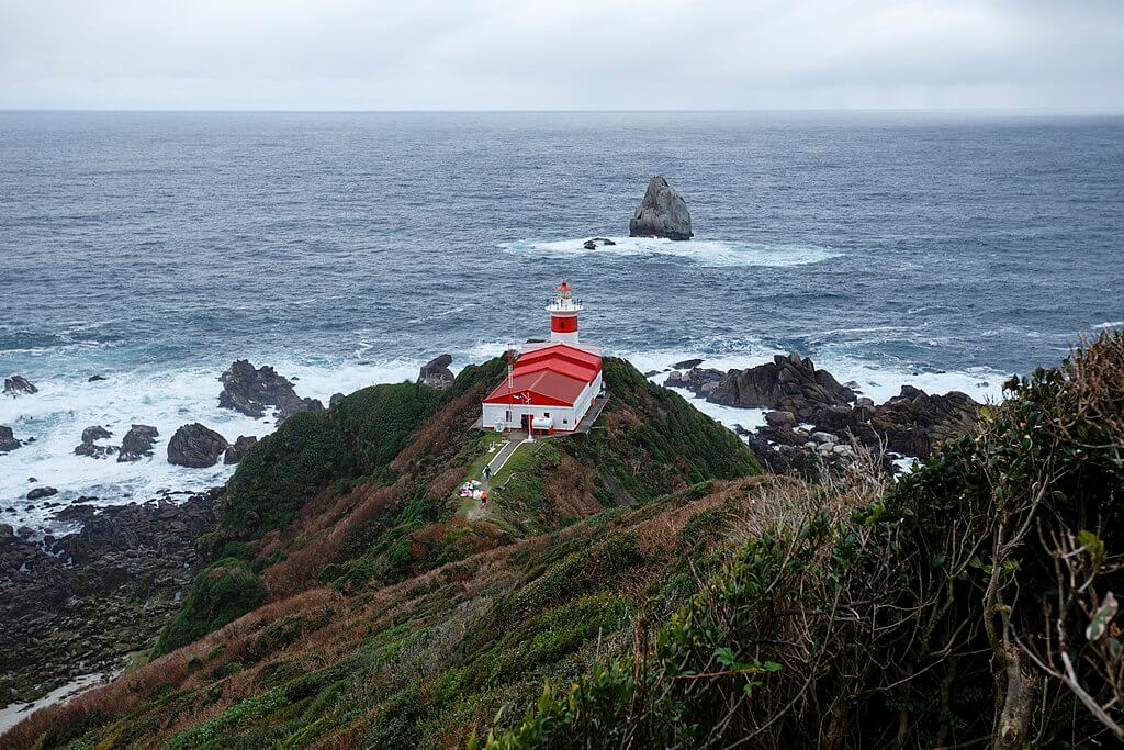
The Chile Triple Junction: Where the Largest Earthquake Ever Recorded Finally Stopped
The Chile Triple Junction, located on the Pacific Ocean seafloor off the Taitao and Tres Montes Peninsulas, serves as a remarkable convergence point for three major tectonic plates: the South American Plate, the Nazca Plate, and the Antarctic Plate. This geological triple junction showcases a rare interplay of subduction and divergence, with the mid-oceanic ridge, known as the Chile Rise, being subducted under the South American Plate at the Peru-Chile Trench. This junction's unique history, shaped over millions of years, has led to its current position off the Taitao Peninsula.
Subduction and Spreading Dynamics
What sets the Chile Triple Junction apart is its status as the only modern site on Earth where a subduction zone is actively swallowing a spreading mid-ocean ridge crest at a continental margin. As a result, the Chile Rise persists in its spreading motion even as it is thrust beneath the continental margin of South America. This unusual process has also exposed the Taitao ophiolite, a rare, well-preserved slice of oceanic crust and upper mantle rock now found on land at the peninsula's tip, giving geologists a natural laboratory to directly study rock that would normally remain buried deep beneath the seafloor, and making the region one of the most closely studied ophiolite complexes in the world specifically because of its direct connection to an active, ongoing ridge subduction process.
Historic Quake and Tsunami
In 1960, the Chilean subduction zone, home to the Chile Triple Junction, witnessed the largest earthquake ever recorded. With a magnitude of 9.5, the Valdivia earthquake ruptured approximately 1,000 kilometers (620 miles) of the plate boundary, its rupture zone extending precisely from the Arauco Peninsula in the north to the Taitao Peninsula itself in the south, making Taitao the exact point where this record-breaking rupture finally came to an end. The earthquake triggered a massive transpacific tsunami, killing 61 people in Hawaii roughly 15 hours later and 138 people in Japan some 22 hours after that, while the Puyehue volcano, further north along the same fault system, erupted just 47 hours after the main shock. The 1960 earthquake remains a seismic testament to the immense forces generated at this dynamic junction of three tectonic plates.
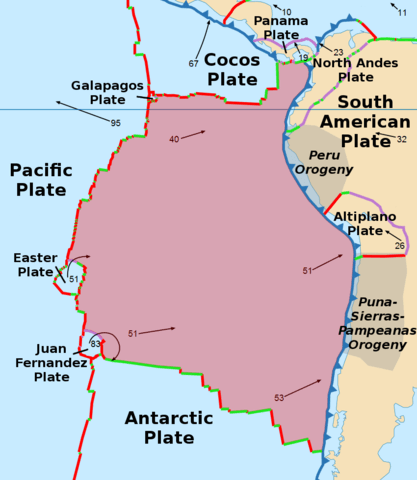
Map of the Nazca Plate: The Chile Triple Junction is located on the lower right where the Nazca meets the Antarctic and South American plates.
Taitao Peninsula: A Geological Spectacle
Near the Chile Triple Junction, the Taitao Peninsula emerges as a westward projection of the Chilean mainland, connected to the rest of the Aysén region by the narrow Isthmus of Ofqui. This low, marshy land bridge for centuries served as a critical overland portage route. The peninsula's surrounding waters and the open Pacific route around them are notoriously stormy and dangerous. The Chono people, an Indigenous canoe-based maritime culture who once inhabited the channels and archipelagos of this remote stretch of coast, along with later Spanish and Chilean expeditions, used the isthmus to drag boats overland rather than risk the exposed passage around Taitao and Tres Montes altogether.
This region, nestled within the Aysén del General Carlos Ibáñez del Campo Region, boasts diverse landscapes. From the shores of Presidente Ríos Lake to the higher mountains with cushion peatlands, the Taitao Peninsula is a geological spectacle, with features like the Taitao ophiolite reflecting the dynamics of the nearby triple junction described above.
The pristine Presidente Ríos Lake, with a surface area of 352 square kilometers (136 square miles), supports a rich biodiversity of fish and waterfowl species adapted to this remote, largely unstudied corner of Patagonia, and ongoing ecological studies emphasize the importance of preserving these unique habitats. Part of the peninsula lies within the boundaries of Laguna San Rafael National Park.
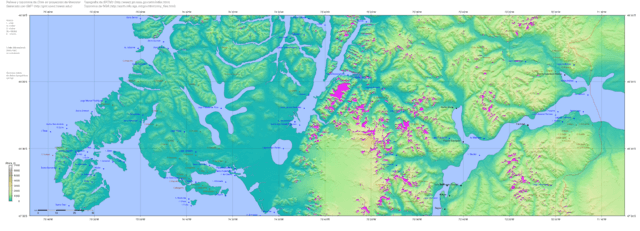
Topography map of southern Chile with Taitao and Tres Montes peninsulas at far lower left.
Tres Montes Peninsula: Southwestward Marvel
The Tres Montes Peninsula, a southwestward projection of the Taitao Peninsula, adds another layer to the geological narrative. Connected to the mainland by the same narrow Isthmus of Ofqui, this region in the Aysén del General Carlos Ibáñez del Campo Region is close to the Chile Triple Junction. Part of Chile's intricate landscape, the Tres Montes Peninsula features diverse vegetation, from shrublands to peatlands and forests, offering a visual spectacle at the meeting point of three major tectonic plates.
The peninsula's coastal cliffs and rock formations provide valuable insights into past tectonic activities and environmental changes, contributing to our understanding of the Earth's dynamic processes at exactly the kind of active plate margin more commonly studied only from beneath the ocean's surface.
Conclusion
The Chile Triple Junction and the adjoining Taitao and Tres Montes Peninsulas present an enthralling story of tectonic convergence, subduction, and spreading dynamics found nowhere else on Earth in quite this combination. From marking the precise endpoint of history's largest recorded earthquake to exposing rare oceanic crust for direct study on land, this remote and historically difficult-to-navigate stretch of the Chilean coast stands as a testament to the Earth's ever-evolving geological saga.
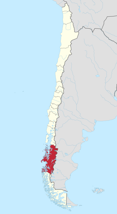
Map depicting the Región Aysén del General Carlos Ibáñez del Campo, Chile.