
The Ecuadorian Andes: Where the Equator Meets the Snow Line
The Ecuadorian Andes are divided into parallel volcanic cordilleras that form Ecuador's central Andean highlands region. This Sierra natural region contains ten major basins and roughly half of Ecuador's population, and includes the only point on Earth's equator with permanent snow.

Exploring the Ecuadorian Andes: Ecuador's Majestic Andean Highlands
Nestled within the heart of Ecuador, the majestic Andean highlands, known as La Sierra, stand as a breathtaking testament to nature's grandeur. This vast region, spanning approximately 70,000 sq km (27,000 sq mi), features towering peaks, deep valleys, and an array of geological wonders that have captivated explorers and scientists for centuries—nowhere more so than at the point where the Andes' permanent snowline meets the equator itself.
The Cordilleras: Towering Sentinels of the Andes
At the heart of the Ecuadorian Andes lies a network of parallel mountain ranges known as cordilleras. These imposing ranges form the backbone of the Tropical Andes, running in a slightly curved S-shape from Colombia's northern border to Peru's southern frontier. The subduction of the Nazca Plate beneath the South American Plate has given rise to these formations, sculpting the landscape with a profound and ongoing intensity. The Cordillera Occidental, the westernmost range, holds 19 volcanoes, while the Cordillera Central, further east, is home to 20, several capped with perpetual snow. A third, less prominent range, the Cordillera Oriental, extends into Ecuador's eastern jungle region, adding to the country's geological diversity.
Volcanic Wonders: Nature's Fiery Spectacle
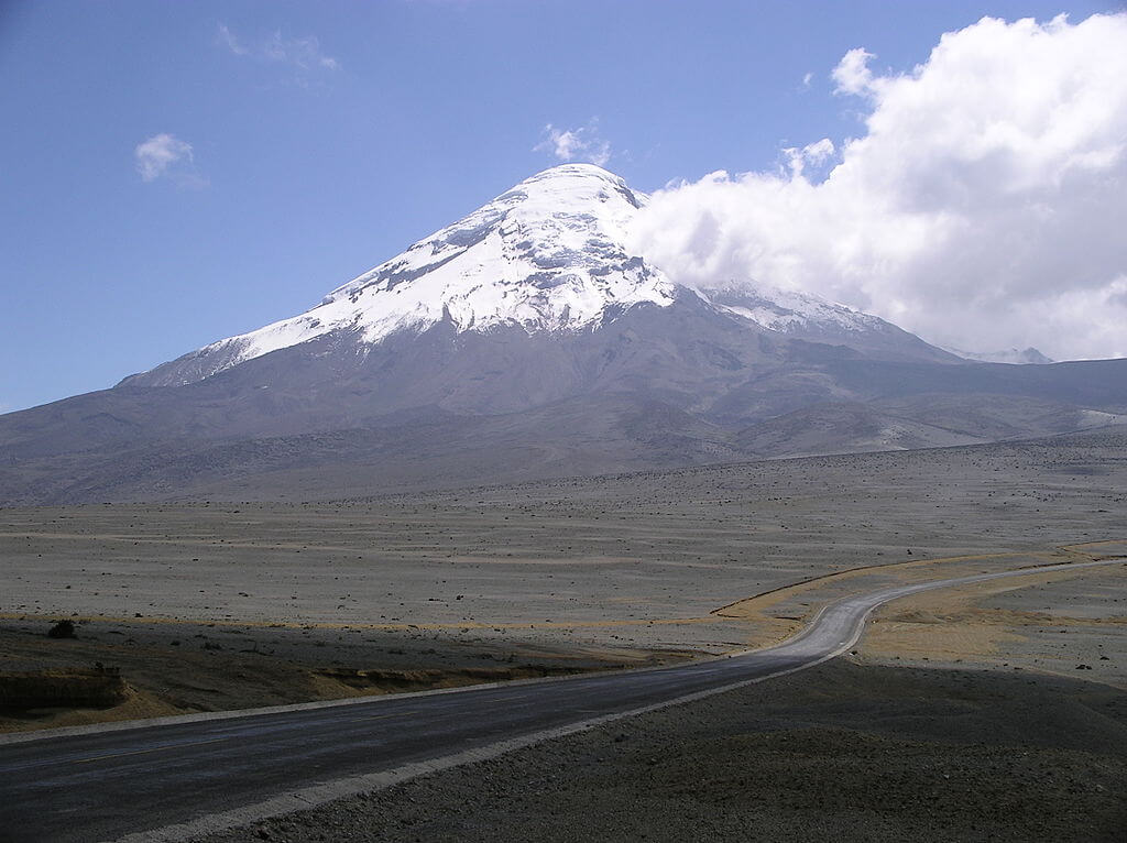
Among the iconic peaks that adorn the Ecuadorian Andes, several volcanoes stand out as true natural wonders. Chimborazo, an inactive volcanic giant towering 6,267 m (20,561 ft), holds a peculiar distinction: because Earth bulges at the equator, its summit is the single point on the planet's surface farthest from the planet's center—farther, in fact, than the summit of Everest. Cotopaxi, rising to 5,897 m (19,347 ft), ranks among the highest continuously active volcanoes in the world, its perfectly symmetrical, glaciated cone visible from Quito on a clear day.
Cayambe, at 5,790 m (18,996 ft), the third-highest peak in Ecuador, holds a distinction rarer still: its southern flank sits directly astride the equator. At 4,690 m (15,387 ft), it is the highest point on Earth's equator, and the only point on the equator anywhere in the world with permanent snow and glacial ice. Roughly 40% of Cayambe's ice cap has been lost over the past three decades, and Ecuadorian glaciologists project that its glaciers could disappear below 5,000 m entirely by 2030, a trajectory that closely echoes the fate of Venezuela's now-vanished Andean glaciers further north.
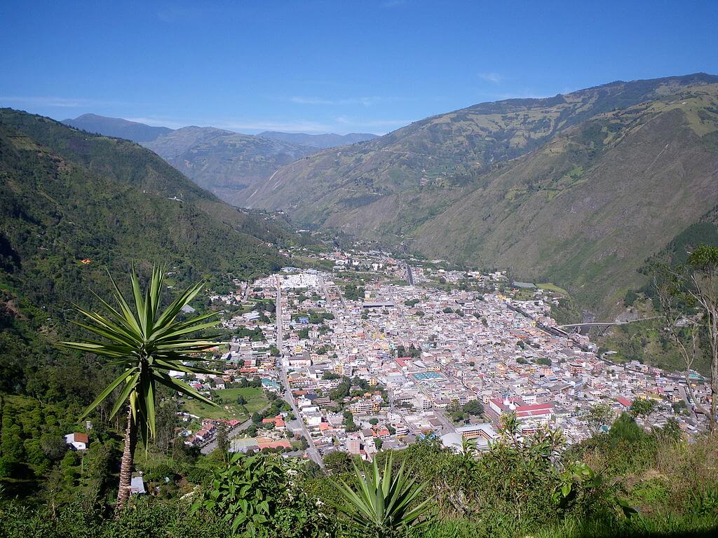
The twin volcanic peaks of Illiniza Sur (5,245 m / 17,208 ft) and Illiniza Norte (5,126 m / 16,817 ft), separated by a saddle roughly 1 km (0.6 mi) long, offer a striking and distinctive silhouette on the skyline south of Quito. Tungurahua, at 5,023 m (16,480 ft) and in a state of near-continuous eruption since 1998, looms over the popular tourist town of Baños de Agua Santa, drawing visitors eager to witness its activity from a safe distance. Further south, Sangay, one of the most persistently active volcanoes on Earth, has been erupting in some form for centuries; the surrounding Sangay National Park, a UNESCO World Heritage Site since 1983, protects one of the most dramatic elevational gradients anywhere in the Andes, spanning from glaciated summits above 5,000 m down to dense Amazonian foothill forest, though its remoteness and ongoing volcanic activity have periodically hindered conservation efforts within the park. And Pichincha, at 4,784 m (15,696 ft), stands sentinel directly over the capital city of Quito, a constant, close reminder of the region's geological volatility.
Páramo and Cloud Forest: Life Above and Below the Snowline
Between roughly 3,500 m and the permanent snowline, the Ecuadorian Andes host some of the world's most extensive and biodiverse páramo, a high-altitude tropical grassland ecosystem found only in the northern Andes and a handful of similarly isolated mountain enclaves worldwide. Ecuador's páramo, concentrated around protected areas such as Cayambe Coca and Cotopaxi National Park, is dominated by frailejones (Espeletia spp.), the giant, slow-growing rosette shrubs characteristic of the ecosystem, and supports the Andean condor (Vultur gryphus), which nests on inaccessible cliff faces throughout the range. Below the páramo, montane cloud forest harbors the spectacled bear (Tremarctos ornatus), South America's only native bear species, and the endangered mountain tapir (Tapirus pinchaque), both increasingly restricted to fragmented forest patches as agriculture and settlement expand up the Andean slopes.
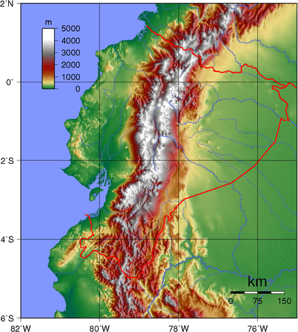
Topographic map of Ecuador.
The Basins and Valleys of La Sierra
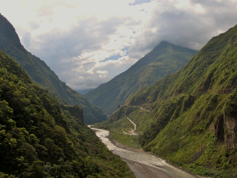
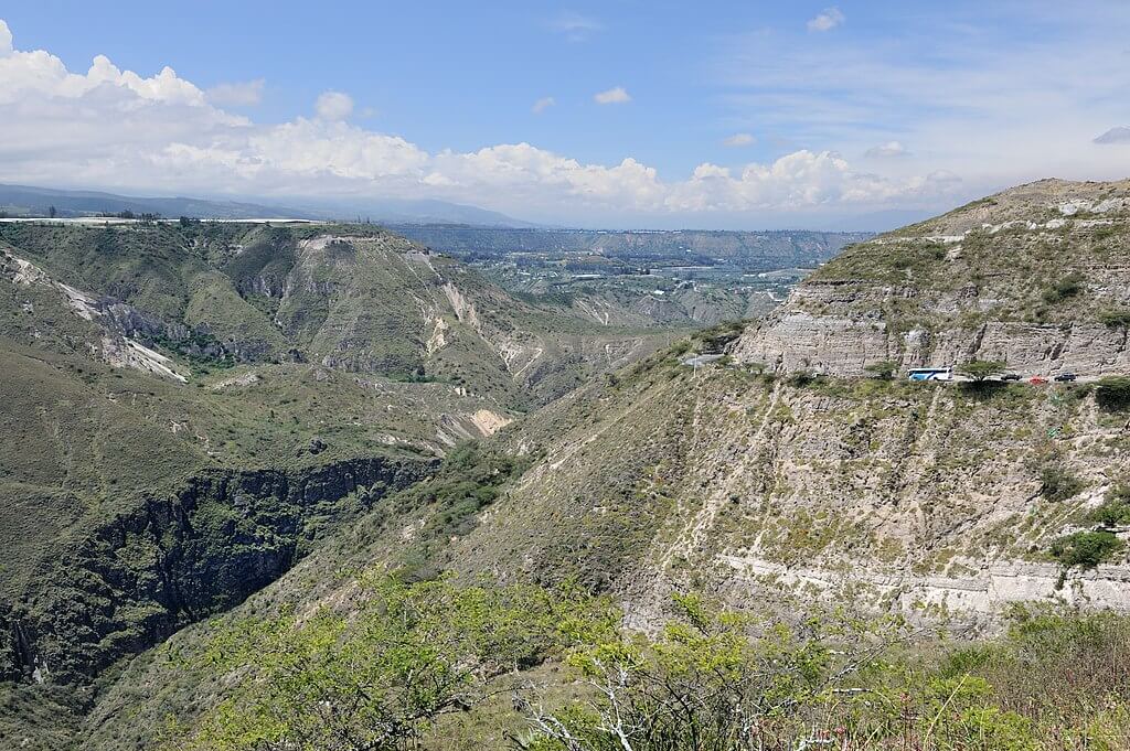
La Sierra, Ecuador's central Andean highlands region, is a patchwork of diverse landscapes and fertile basins. Transversal mountain spurs, known as nudos and formed by lava outpourings from the range's numerous volcanoes, divide the region into ten major basins. Among these, the Nudo del Azuay, at 4,500 m (14,763 ft), is the highest transversal spur, separating the Sierra into two distinct subregions: a northern zone of newer, higher mountains shaped by more recent volcanism, and a southern zone of older, more heavily eroded and consequently lower terrain.
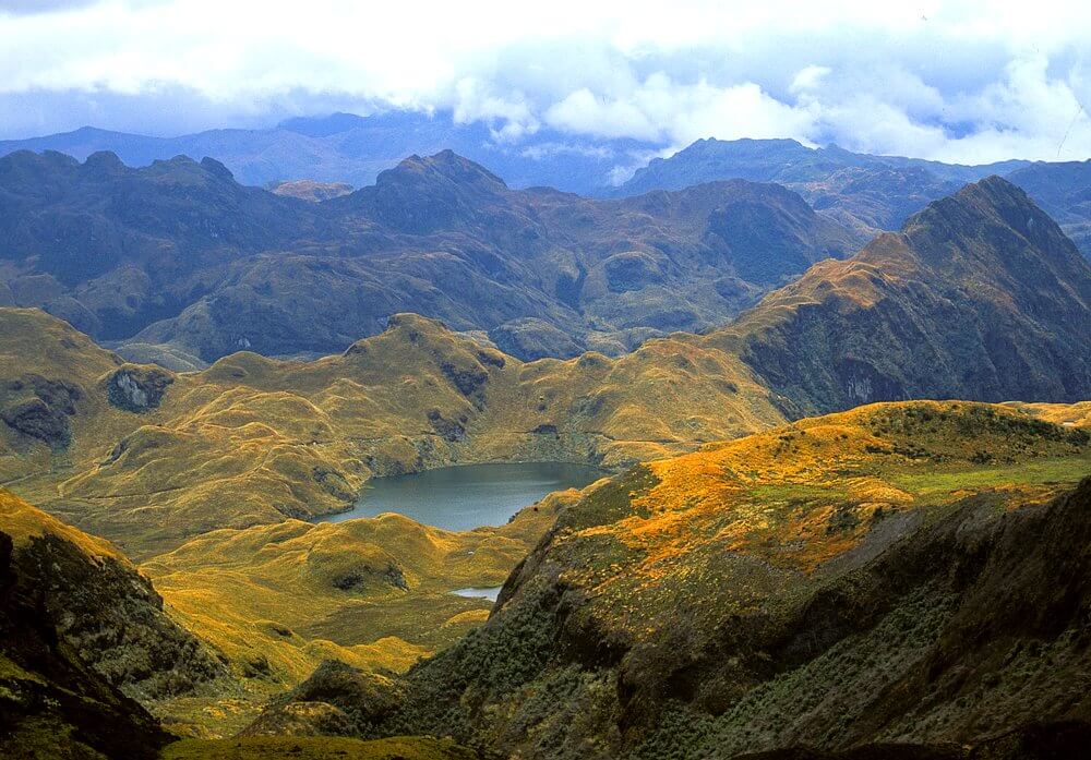
These basins and their adjacent slopes, intensively cultivated for centuries, are home to roughly half of Ecuador's population, with cities including Ibarra, Ambato, Riobamba, and Cuenca dotting the landscape. Near Ibarra, the town of Otavalo hosts one of South America's largest and most renowned Indigenous markets, where Kichwa vendors sell textiles woven using techniques passed down since well before the Spanish conquest, and the broader Otavalo Valley remains one of the most visible centers of Kichwa cultural identity in the country. High in the Cordillera Occidental west of Latacunga, the Quilotoa crater lake fills a volcanic caldera with strikingly turquoise, mineral-rich water, ranking among the most photographed natural landmarks in the Ecuadorian highlands. Near Cuenca, in the country's southern Sierra, Cajas National Park protects a stark, glacially carved landscape containing more than 200 lakes and lagoons within a relatively compact area, a legacy of Pleistocene glaciation that has left the southern Andes here strikingly different in character from the younger volcanic terrain further north.
Quito: A Jewel in the Highlands
Nestled in a high mountain valley at the foothills of Pichincha lies Quito, Ecuador's capital and, at roughly 2,850 m (9,350 ft), one of the highest-altitude capital cities in the world. Its historic center, with its rich colonial architecture and vibrant cultural life, was among the first sites ever designated a UNESCO World Heritage Site, in 1978. Just north of the city, the Mitad del Mundo (Middle of the World) monument marks the line of the equator as calculated by an 18th-century French geodesic expedition, a short distance from the more precise line established by modern GPS survey; both draw a steady stream of visitors eager to stand, quite literally, at zero latitude in the shadow of the Andes. From Quito, travelers can access the region's diverse ecosystems, archaeological sites, and the enduring traditions of the Indigenous communities who have called this landscape home for millennia.
Conclusion
Ecuador's Andean highlands, known as La Sierra, are a testament to nature's awe-inspiring power and to human adaptation across an extraordinary range of elevation and terrain. From the volcanic peaks of the Avenue of the Volcanoes to the páramo and cloud forest that clothe their flanks, and from the glacier that touches the equator at Cayambe to the ancient crater lakes of Quilotoa and Cajas, this region offers a tapestry of landscapes and cultures found nowhere else on Earth. As Ecuador's tropical glaciers continue to retreat—Cayambe's among them—the region stands as a vivid reminder of both the beauty and the fragility of the world's highest tropical mountains.