
The Bolivian Andes: Exploring Nature and Civilization Across the Cordilleras
Stretching across the western portion of Bolivia, the Bolivian Andes are among the most captivating and formidable mountains in the world. Forming a vital segment of the Andes, they consist of two principal cordilleras, each with its own unique geographical, ecological, and cultural significance.

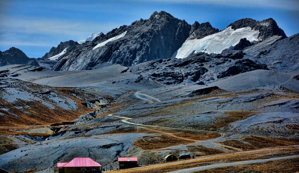
The Bolivian Andes: Two Ranges, One Ancient Plateau Between Them
Stretching across the western portion of Bolivia, the Bolivian Andes are among the most captivating and formidable mountains in the world. Forming a vital segment of the Andes Mountains, the most extended continental mountain range on Earth, the Bolivian Andes divide into two principal cordilleras, each with its own distinct geological origin, ecology, and cultural significance. These ranges are home to towering volcanic peaks, extensive glaciers, vast highland plateaus, and deep valleys that support diverse ecosystems and ancient cultures. From the rugged, volcanic beauty of the Cordillera Occidental to the icy granite heights of the Cordillera Real, the Bolivian Andes stand as a powerful symbol of natural grandeur, shaping the landscape and history of Bolivia for millennia.
Geography of the Bolivian Andes
The Bolivian Andes, covering the country's western regions, are divided into two main cordilleras: the geologically young, volcanically active Cordillera Occidental, and the considerably older Cordillera Oriental—whose glaciated northern section, running behind La Paz, is known specifically as the Cordillera Real. Between these two ranges lies the Altiplano, a vast high plateau that gives the region its distinctive character. Together, these features define Bolivia's dramatic topography and profoundly influence its climate, ecosystems, and human settlements.
Cordillera Occidental: The Western Volcanic Range
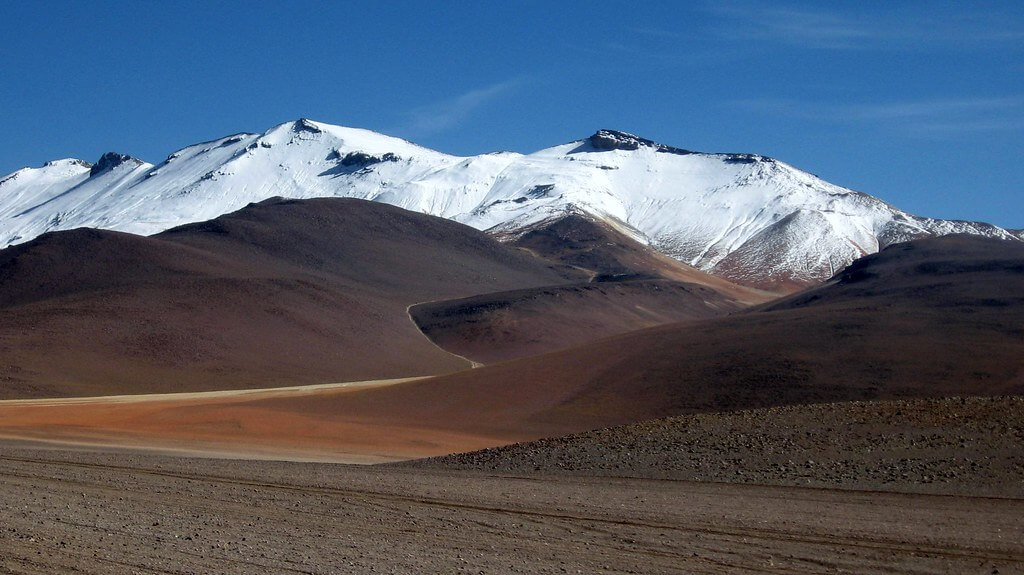
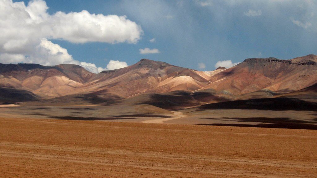
The Cordillera Occidental forms the western boundary of Bolivia, running parallel to the border with Chile. This range is geologically young, composed mainly of volcanic peaks, some of which remain active. The most prominent of these is Nevado Sajama, the highest peak in Bolivia, which rises to 6,542 m (21,463 ft). Other notable volcanoes include Parinacota and Pomerape, which straddle the Chilean-Bolivian border, and Licancabur, known for its near-perfect cone shape. The Cordillera Occidental's volcanic origins contribute to the region's arid and rugged nature, with landscapes characterized by barren slopes, geothermal fields, and extensive salt flats.
One of the Cordillera Occidental's most unique features is the Salar de Uyuni, the largest salt flat in the world. This vast expanse, covering over 10,000 sq km (3,900 sq mi), was once part of a prehistoric lake that evaporated thousands of years ago. Today, the Salar de Uyuni is a stunning natural wonder and an increasingly important economic resource: together with neighboring salt flats in Chile and Argentina, it forms part of the so-called lithium triangle, which together holds more than half of the world's known lithium reserves, a resource of growing strategic importance as global demand for battery materials accelerates.
Cordillera Oriental and Cordillera Real: The Eastern Glacial Range
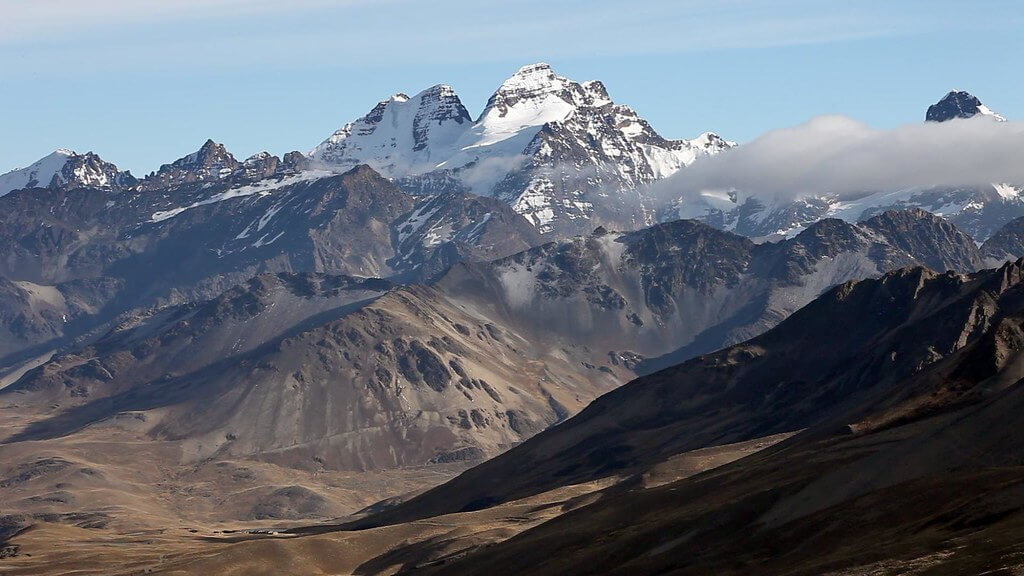
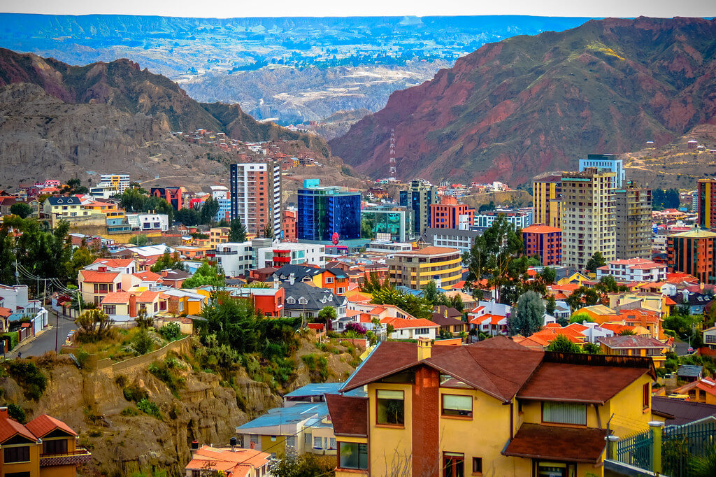
East of the Altiplano lies the Cordillera Oriental, whose glaciated northern section forms the renowned Cordillera Real, one of Bolivia's most dramatic and scenic mountain landscapes. The Cordillera Real is home to several of the country's highest peaks, including Illimani (6,438 m / 21,122 ft) and Huayna Potosí (6,088 m / 19,973 ft), both of which are iconic landmarks visible from the capital city of La Paz. Illimani's glaciers, in particular, remain a critical water source for La Paz and neighboring El Alto, and their accelerating retreat over the past several decades has become a genuine water-security concern for the roughly 2.3 million people living across the two cities' combined metropolitan area.
South of the Cordillera Real, the Cordillera Oriental continues, lower and less dramatic, through the departments of Chuquisaca and Tarija toward the Argentine border; while this southern stretch lacks the towering, glaciated summits of the Cordillera Real, it remains geologically significant, hosting the Bolivian tin belt, a mineral-rich zone that has been mined for centuries. Along its eastern flank, the Cordillera Oriental is characterized by deep valleys, sharp ridges, and lush slopes that descend into the Amazon Basin. In the northern section of this range lies the Yungas, a region where the arid highlands transition into humid subtropical forests. The Yungas are ecologically diverse and agriculturally important, supporting the cultivation of coca (Erythroxylum coca), coffee, and other crops within cloud forests that host a remarkable diversity of orchids, ferns, birds, and mammals.
The Altiplano: The High Andean Plateau
The Altiplano, or high plateau, is one of the most striking features of the Bolivian Andes. Situated between the Cordillera Occidental and the Cordillera Oriental, the Altiplano extends across a vast area, covering portions of both Bolivia and Peru. With elevations ranging from 3,600 to 4,200 m (11,800 to 13,800 ft), the Altiplano is the second-largest high plateau in the world, after the Tibetan Plateau. It is an area of extremes, with harsh, dry winters, strong winds, and wide temperature fluctuations between day and night.
Despite the challenging conditions, the Altiplano is home to several important lakes, most notably Lake Titicaca, the highest navigable lake in the world, straddling the border between Bolivia and Peru. Lake Titicaca is a critical water source and a sacred site for the Indigenous peoples of the Andes, particularly the Aymara and Quechua. The lake has been the center of Andean civilization for thousands of years, and its shores are dotted with archaeological sites, including Tiwanaku, the remains of a pre-Inca civilization that thrived in the region.
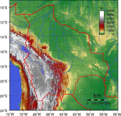
Topographic map of Bolivia showing (east to west) the plains of the Amazon Basin in green, the Sub-Andean Zone in red, the Cordillera Oriental in white, the Altiplano in gray, and the Cordillera Occidental in white.
Climate and Ecosystems of the Bolivian Andes
The Bolivian Andes encompass a wide range of climates and ecosystems, determined mainly by elevation and geographical position. The western Cordillera Occidental is predominantly arid, with desert-like conditions prevailing across much of the region. Temperatures fluctuate dramatically, with intense daytime heat followed by freezing nighttime temperatures. Vegetation is sparse, consisting mainly of hardy shrubs and grasses adapted to the high-altitude conditions.
In contrast, the eastern slopes of the Cordillera Oriental and the Yungas region are characterized by a more temperate, humid climate, especially at lower elevations. The Yungas, where moist air from the Amazon Basin rises to meet the mountains, support cloud forests teeming with biodiversity. These forests are home to countless species of plants, insects, and animals, many of which are endemic to the region.
At the highest altitudes, the Bolivian Andes are defined by puna grasslands and alpine tundra ecosystems. Above 4,500 m (14,800 ft), these landscapes are dominated by short grasses, mosses, and lichens, while glaciers and permanent snowfields crown the peaks of the Cordillera Real. Herds of vicuña (Vicugna vicugna) and domesticated llama (Lama glama) graze these high grasslands, much as they have for thousands of years. These high-altitude ecosystems are particularly vulnerable to the effects of climate change, as rising temperatures accelerate glacial melting and disrupt local water cycles.
Human Impact and Cultural Heritage
The Bolivian Andes have been a cradle of civilization for centuries, supporting diverse Indigenous cultures that have developed in harmony with the harsh mountain environment. Among Bolivia's most prominent Indigenous groups, the Aymara and Quechua peoples have lived in the region for millennia, practicing agriculture and animal husbandry in the highlands. They have perfected techniques such as terrace farming and vertical archipelagos, where crops are cultivated at different altitudes to take advantage of the diverse microclimates.
The Andes also played a significant role in the expansion of the Inca Empire, which extended into Bolivia in the 15th century. The Inca left an enduring legacy in the region, constructing roads, terraces, and fortresses that still dot the landscape today. Some roads form part of the Qhapaq Ñan, the extensive Inca road system that once connected the empire's vast territories.
In colonial times, the Bolivian Andes became synonymous with silver mining, particularly in the city of Potosí, home to the legendary Cerro Rico. During the 16th and 17th centuries, the silver extracted from Potosí's mines fueled the Spanish Empire's wealth, though it came at great cost to Indigenous laborers forced to work in the mines under brutal conditions. The legacy of Potosí's mining history is still evident today, with the city recognized as a UNESCO World Heritage Site for its role in global economic history.
Environmental Challenges and Conservation Efforts
The Bolivian Andes face several environmental challenges, many of which are exacerbated by climate change. Glacial retreat is one of the most pressing concerns, particularly in the Cordillera Real, where glaciers have receded significantly over the past few decades. These glaciers are a vital source of freshwater for cities such as La Paz and El Alto, as well as for rural communities and agriculture on the Altiplano.
In response to these threats, Bolivia has established several protected areas and national parks within the Andean region. Sajama National Park, Bolivia's first national park, protects high-altitude grasslands, wetlands, and volcanic landscapes in the Cordillera Occidental. The park is also home to vicuñas, llamas, and other species adapted to the harsh conditions of the puna. Similarly, the Eduardo Avaroa Andean Fauna National Reserve in the southwestern Altiplano is renowned for its flamingo populations and other wildlife that thrive in the high-altitude salt flats and lagoons; its Laguna Colorada, colored a deep red by algae and sediment, is one of the few places on Earth where all three South American flamingo species—the Chilean (Phoenicopterus chilensis), Andean (Phoenicoparrus andinus), and James's or puna flamingo (Phoenicoparrus jamesi)—can be observed together.
Conservation efforts are also focused on preserving the cultural heritage of the Andean region, including ancient agricultural practices and Indigenous knowledge systems that have sustained human communities for thousands of years.
Conclusion
The Bolivian Andes are a region of staggering diversity and significance, encompassing volcanic peaks, a vast intervening plateau, tropical valleys, and ancient cultural landscapes. From the desolate beauty of the Cordillera Occidental's salt flats to the snow-capped summits of the Cordillera Real, these two ranges and the Altiplano between them define Bolivia's geography and have shaped its history for millennia. As climate change accelerates and human activities continue to impact the environment, the need for sustainable development and conservation efforts is more critical than ever. Protecting the ecosystems and cultural heritage of the Bolivian Andes is essential not only for the people who call this region home but also for the world's collective natural and historical legacy.