La Paz: Bolivia's High-Altitude Metropolis
Bolivia's administrative capital, La Paz, exemplifies human resilience and cultural richness amid the breathtaking Andean landscape. This unique city, perched at dizzying heights, offers a blend of Indigenous traditions, colonial history, and modern urban life that captivates visitors and residents.
La Paz: A High-Altitude Tapestry of Culture and Resilience
Bolivia's administrative capital, La Paz, exemplifies human resilience and cultural richness amid the breathtaking landscape of the Andes Mountains. This unique city, perched at dizzying heights, offers a blend of Indigenous traditions, colonial history, and modern urban life that captivates both visitors and residents. Exploring La Paz reveals its geographical marvels, rich history, vibrant culture, and economic significance.
Geographical Marvel
Location and Elevation
La Paz is located in Bolivia's west-central region, nestled within a canyon formed by the Choqueyapu River. It is distinguished as the world's highest administrative capital, with elevations ranging from 3,250 to 4,100 meters (10,660 to 13,450 feet) above sea level. This extreme altitude presents challenges and unique characteristics that shape life in the city.
Surrounding Landscape
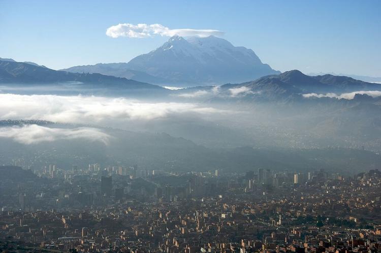
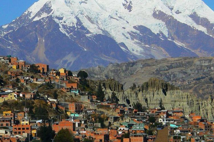
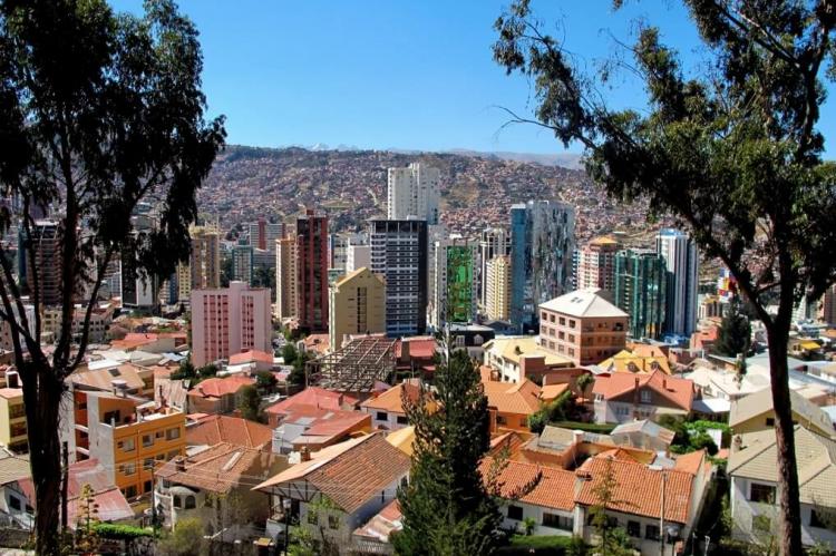
The city is cradled by the majestic Bolivian Andes, with the imposing presence of Nevado Illimani dominating the skyline. With its three distinct peaks, Illimani serves as a constant backdrop to city life, its snow-capped summit visible from nearly every corner of La Paz. This natural amphitheater created by the surrounding peaks provides a stunning visual and influences the city's climate and development patterns.
Topographical Influence
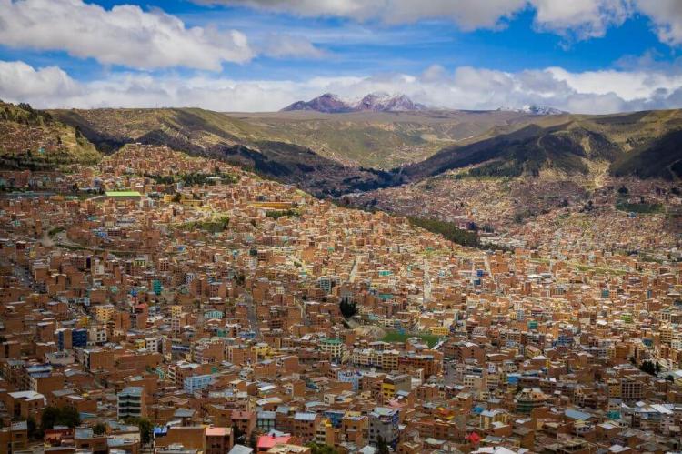
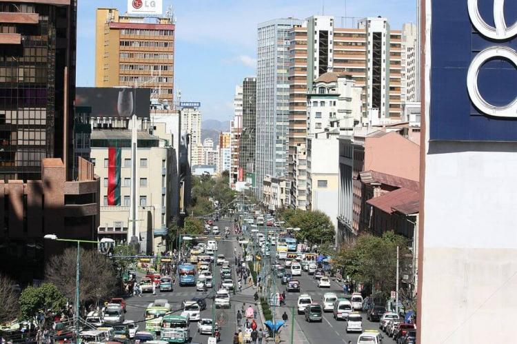
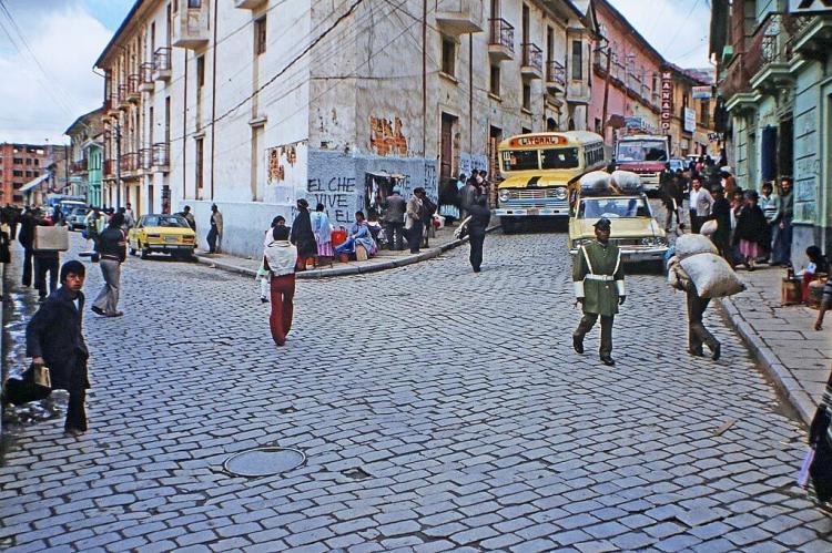
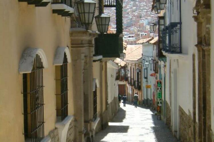
La Paz's unique topography has led to a distinct urban layout. The city sprawls across the canyon walls, with neighborhoods cascading down the slopes. This vertical development creates a striking visual effect and influences everything from transportation to social dynamics within the city.
Climate
Despite its tropical latitude, La Paz experiences a subtropical highland climate due to its extreme elevation. The city enjoys cool temperatures year-round, with average highs rarely exceeding 17°C (63°F) even in the warmest months. The region experiences distinct wet and dry seasons, with the rainy period typically lasting from December to March.
Historical Tapestry
Pre-Columbian Era
Long before the arrival of Spanish conquistadors, the area now known as La Paz was inhabited by the Indigenous Aymara people. The region was part of the Tiwanaku and later the Inca empires, and there is evidence of advanced agricultural and architectural practices dating back centuries.
Colonial Founding
La Paz was officially founded on October 20, 1548, by Spanish conquistador Alonso de Mendoza. Originally named Nuestra Señora de La Paz (Our Lady of Peace), the city was established as a critical stop on the trade route between the silver mines of Potosí and the Pacific coast.
Independence and Capital Status
Bolivia gained independence from Spain in 1825, with La Paz playing a crucial role in the struggle. The city was renamed La Paz de Ayacucho to commemorate a decisive battle in the war for independence. Although Sucre remained the constitutional capital, La Paz gradually assumed the role of administrative capital due to its economic importance and strategic location.
20th Century and Beyond
Throughout the 20th century, La Paz experienced significant growth and modernization. Waves of rural-to-urban migration, particularly from Indigenous communities, led to rapid expansion and the development of satellite cities like El Alto. Political upheavals, including numerous coups and periods of instability, have also shaped the city's recent history.
Political Significance
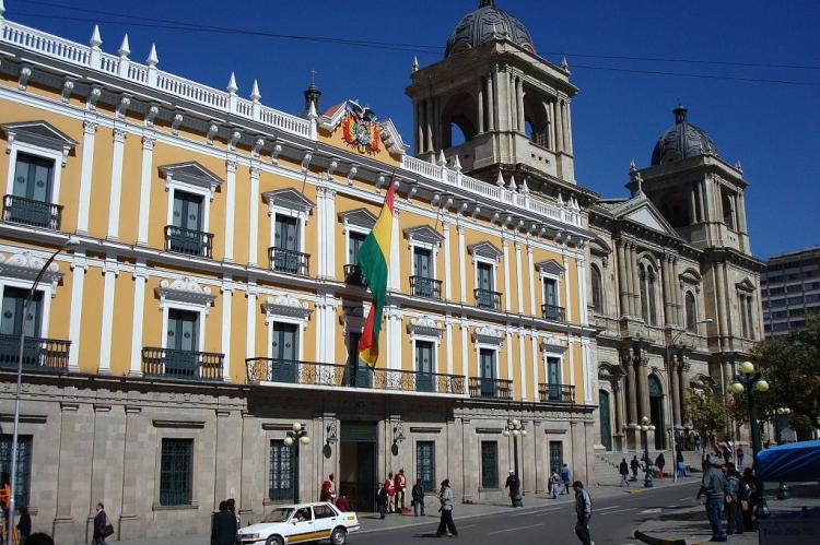
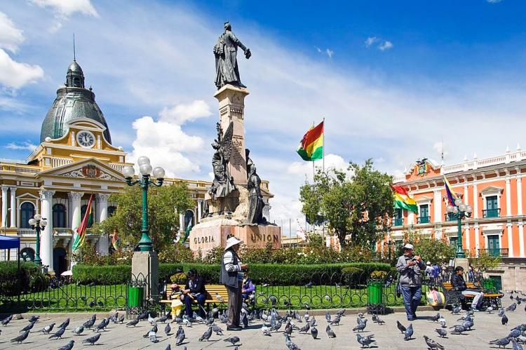
La Paz has been central to many pivotal moments in Bolivia's political history. The city was a hotbed of revolutionary activity during the independence movement and has since witnessed numerous political upheavals. One of the most significant events was the 1952 Bolivian National Revolution, which began in La Paz and led to significant social and economic reforms, including universal suffrage and the nationalization of tin mines.
In more recent history, La Paz was the focal point of the 2003 Bolivian Gas War, a series of protests that led to President Gonzalo Sánchez de Lozada's resignation. This event marked a turning point in Bolivian politics, paving the way for the 2005 election of Evo Morales, the country's first Indigenous president.
Cultural Melting Pot
Ethnic Diversity
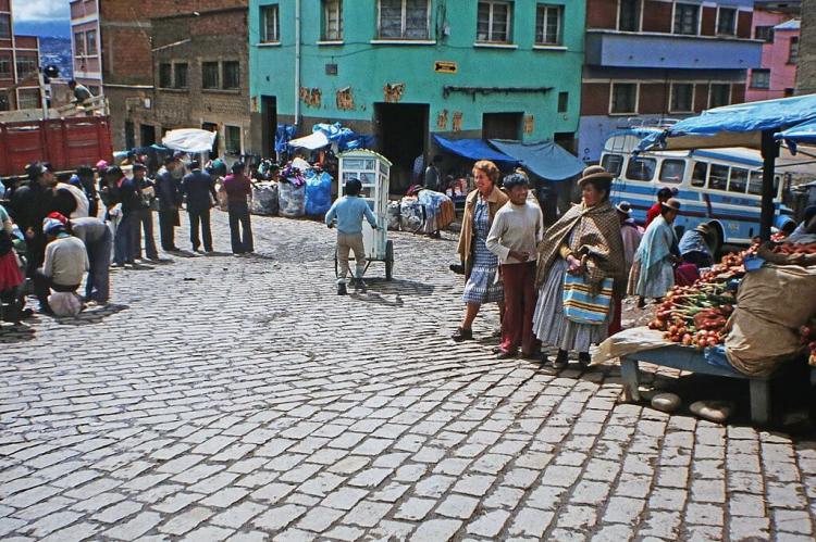
La Paz is a microcosm of Bolivia's ethnic diversity. The city is home to significant populations of Aymara and Quechua people, mestizos, and descendants of European immigrants. This diversity is reflected in the city's languages, with Spanish, Aymara, and Quechua commonly heard on the streets.
Traditional Markets
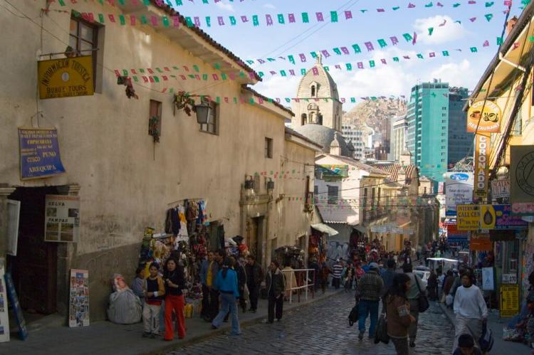
The city's markets are vibrant centers of cultural exchange. The Witches Market (Mercado de las Brujas) offers a fascinating glimpse into traditional Aymara spiritual practices, selling herbs, amulets, and other mystical items. The sprawling Mercado Rodriguez is a food lover's paradise, showcasing the rich variety of Andean produce and cuisine.
Festivals and Celebrations
La Paz's calendar is punctuated by colorful festivals that blend Indigenous, colonial, and modern influences. The Feast of Jesus del Gran Poder, held annually in May or June, features elaborate parades with thousands of dancers in traditional costumes. Alasitas, a month-long fair dedicated to Ekeko, the Aymara god of abundance, is another unique celebration where miniature items are bought and sold for good luck.
Architectural Heritage
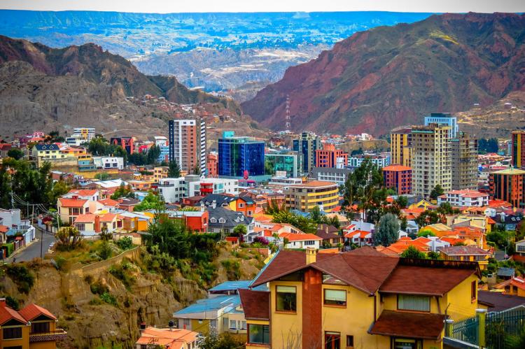
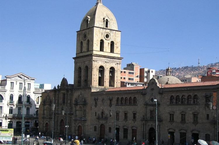
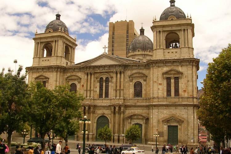
The city's architecture tells the story of its diverse influences. Colonial-era churches like San Francisco Basilica stand alongside modern skyscrapers. The colorful buildings of the Chualluma neighborhood, with their distinctive Andean-inspired murals, showcase a more contemporary artistic expression.
Museums and Cultural Institutions
La Paz boasts numerous museums that preserve and showcase its rich heritage. The National Museum of Ethnography and Folklore offers insights into Bolivia's Indigenous cultures, while the Museum of Contemporary Art highlights modern Bolivian artists.
Cuisine
La Paz's culinary scene is a reflection of its diverse cultural influences. Traditional Andean ingredients like quinoa, potatoes (with over 200 varieties), and chuño (freeze-dried potatoes) form the basis of many dishes. Popular local specialties include:
- Salteñas: savory pastries filled with meat, vegetables, and a slightly sweet sauce.
- Anticuchos: skewered and grilled beef heart, a popular street food.
- Silpancho: a breaded meat dish served with rice, eggs, and vegetables.
- Api con pastel: a thick, hot purple corn drink served with a cheese pastry, often for breakfast.
The city is also known for its innovative fine dining scene. Restaurants like Gustu, founded by Noma co-founder Claus Meyer, showcase modern interpretations of Bolivian cuisine.
Art and Literature
La Paz has a thriving arts scene, with numerous galleries showcasing traditional and contemporary Bolivian art. The city has been home to renowned artists like María Luisa Pacheco and Roberto Mamani Mamani, whose vibrant, neo-Andean-style murals can be seen throughout the city.
In literature, La Paz has produced notable authors such as Edmundo Paz Soldán and Adolfo Costa du Rels. The city hosts the annual International Book Fair of La Paz, one of the largest literary events in Bolivia.
Education and Research
La Paz is an important center for education and research in Bolivia. The city is home to several prestigious institutions of higher learning:
- Universidad Mayor de San Andrés (UMSA): Founded in 1830, it is one of Bolivia's oldest and largest universities. UMSA is known for its social sciences, engineering, and medicine programs.
- Universidad Católica Boliviana San Pablo: A private university known for its business and economics programs.
- Universidad Andina Simón Bolívar: A postgraduate institution focused on Andean studies and integration.
These institutions play a crucial role in research, particularly in fields related to high-altitude biology, Andean geology, and Indigenous studies. The city also hosts several research centers, including:
- Instituto Boliviano de Biología de Altura: Specializing in high-altitude medicine and physiology.
- Instituto de Investigaciones Físicas: Conducting research in physics and astronomy, taking advantage of La Paz's high altitude for astronomical observations.
Economic Hub
Industrial Base
La Paz is Bolivia's major economic center. The city's industrial sector includes food processing, textiles, chemicals, and handicrafts. El Alto, a neighboring city that was once a suburb but is now a major urban center, hosts numerous factories and industrial parks.
Financial Services
As the administrative capital, La Paz is home to many of Bolivia's major financial institutions and the headquarters of multinational corporations operating in the country. The banking sector is particularly prominent, with domestic and international banks maintaining a strong presence.
Tourism
Tourism plays an increasingly important role in La Paz's economy. The city's unique cultural offerings, stunning natural surroundings, and proximity to attractions like Lake Titicaca and the Salar de Uyuni draw visitors worldwide. The development of eco-tourism and adventure tourism has opened new economic opportunities for the region.
Transportation Hub
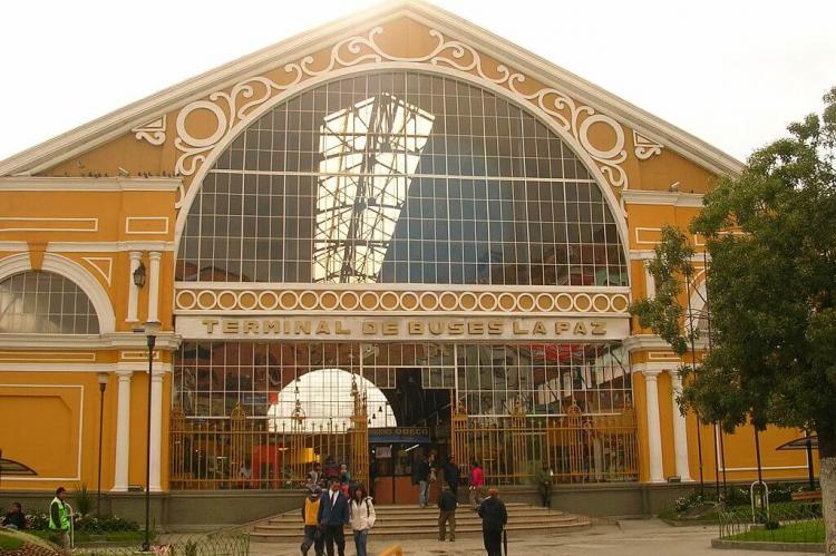
La Paz's strategic location makes it a crucial transportation hub. The El Alto International Airport, one of the world's highest-altitude commercial airports, connects the city to international destinations. The city's unique topography led to the development of an innovative urban cable car system, Mi Teleférico, which not only eases transportation but has also become a tourist attraction.
Informal Economy
A significant portion of La Paz's economy operates in the informal sector. This sector includes street vendors, small-scale manufacturers, and service providers who operate outside the formal regulatory framework. While this presents challenges for tax collection and labor regulations, it also provides a source of livelihood for many residents and contributes to the city's vibrant street life.
Mining and Natural Resources
Although not directly engaged in mining activities, La Paz is a crucial administrative and financial center in Bolivia's mining sector. The city hosts the headquarters of COMIBOL (Corporación Minera de Bolivia), the state mining company, and serves as a hub for mining-related services and logistics.
Technology and Innovation
In recent years, La Paz has seen growth in its technology sector. Initiatives like the government-sponsored "Digital Agenda 2025" aim to boost digital innovation and entrepreneurship. Co-working spaces and tech incubators have emerged, fostering a small but growing startup ecosystem.
Urban Development and Infrastructure
Mi Teleférico
La Paz's iconic cable car system, Mi Teleférico, deserves special mention. Inaugurated in 2014, it is the world's largest urban cable car network, with ten lines spanning over 30 kilometers. The system provides efficient transportation in the city's challenging topography and stunning views of the urban landscape and surrounding mountains.
Water Supply Challenges
Given its high altitude and growing population, water supply is a critical issue for La Paz. The city primarily relies on glacial meltwater from the surrounding mountains. However, climate change has led to significant glacier retreat, threatening long-term water security. The city has implemented water conservation measures and is exploring alternative water sources.
Urban Expansion and El Alto
The rapid growth of El Alto, La Paz's neighboring city on the Altiplano above the canyon, has significantly impacted La Paz's urban dynamics. Once considered a suburb, El Alto has grown into Bolivia's second-largest city, with a population exceeding 1 million. This growth has led to increased economic integration between the two cities, but also presents challenges in urban planning and service provision.
Environmental Challenges and Initiatives
Air Quality
La Paz's high altitude and topography can trap air pollution in the canyon, especially during the dry season. To improve air quality, the city has implemented measures, including restricting vehicle use and promoting cleaner public transportation options, such as the electric bus system PumaKatari.
Waste Management
Managing waste in La Paz's challenging terrain is an ongoing issue. The city has implemented recycling programs and is working on improving waste collection in hard-to-reach areas. Initiatives to promote composting and reduce plastic use are also underway.
Green Spaces
Despite its urban density, La Paz has several notable green spaces. The Parque Urbano Central, completed in 2021, is a major urban renewal project that has transformed a former railway yard into a public park. While small, the Jardín Botánico de La Paz plays an important role in the conservation and education of Andean flora.
Challenges and Opportunities
Urban Growth and Infrastructure
Rapid urbanization has presented challenges for La Paz, particularly in terms of housing and infrastructure development. The city has had to adapt to its unique geography, developing innovative transportation and urban planning solutions.
Environmental Concerns
The city faces environmental challenges, including air pollution and water scarcity. Efforts are underway to address these issues through sustainable urban development practices and conservation initiatives.
Social Inequality
Like many large urban centers, La Paz grapples with issues of social inequality. The contrast between affluent neighborhoods and impoverished areas reflects broader socioeconomic disparities in Bolivia.
Cultural Preservation
Balancing modernization with the preservation of cultural heritage remains an ongoing challenge. Maintaining Indigenous languages and traditions while embracing economic development is critical to La Paz's future.
Conclusion
La Paz is a city of contrasts and resilience, where ancient traditions and modern aspirations coexist alongside breathtaking natural beauty. From its dizzying heights to its deep cultural roots, La Paz offers a unique window into the complexities of urban life in the Andes. The city's rich tapestry of history, culture, and innovation continues to evolve, as it faces challenges head-on while seizing new opportunities.
As La Paz moves forward, it must balance preserving its unique heritage and embracing progress. The city's innovative solutions to urban challenges, such as the Mi Teleférico system, demonstrate its capacity for creative problem-solving. Meanwhile, its vibrant cultural scene and diverse population ensure that La Paz remains a dynamic and exciting place to live and visit.
La Paz offers an unparalleled experience for residents and visitors—a place where the thin air carries centuries of history and promises new horizons. As it continues to adapt and grow, La Paz will remain a fascinating subject of study and a testament to the enduring spirit of Bolivia and its people.
