
The Venezuelan Andes: A Jewel of the Tropical Andes
The Venezuelan Andes form the northernmost portion of the Andes system. The Cordillera de Mérida and Serranía del Perijá comprise the Andean natural region, a landscape of páramo, cloud forest, and cultural heritage now marked by the loss of the country's last glacier.

The Venezuelan Andes: Where the Cordillera Begins, and Its Glaciers Have Ended
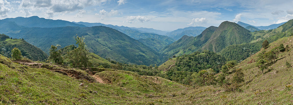
The Venezuelan Andes, also known as the Venezuelan Andean Cordillera, represent the northernmost extension of the Andes Mountain range, the point where South America's great mountain system first rises from the Caribbean coastal lowlands. This region is vital to Venezuela's natural and geographic landscape, offering a rich tapestry of ecological diversity, geological significance, and cultural heritage. The Andean natural region, encompassing the Cordillera de Mérida and the Serranía del Perijá, is one of Venezuela's eight distinct natural regions. In recent years, it has also become a stark marker of climate change: in 2024, scientists confirmed that Venezuela had become the first country in modern history to lose every one of its glaciers.
Geological Origins and Tectonic Activity
The geological history of the Venezuelan Andes is a testament to the dynamic processes that have shaped the planet over millions of years. Their formation dates back to the Eocene epoch of the early Tertiary period, approximately 40 to 50 million years ago, when significant tectonic activity began involving the interaction of three major tectonic plates: the Nazca Plate, the Caribbean Plate, and the South American Plate. The collision and subsequent interactions among these plates initiated the orogenic processes that ultimately built the Andes. This geological evolution not only sculpted the region's dramatic landscapes but also endowed it with rich mineral resources.
Regional Divisions of the Venezuelan Andes
The Venezuelan Andes divide into two main sections, each with distinct characteristics and geographical significance.
The Cordillera de Mérida is often regarded as the true heart of the Venezuelan Andes. This massif extends from southwest to northeast across a considerable portion of northwestern Venezuela, encompassing almost all of the states of Táchira, Mérida, and Trujillo, significant parts of southern Lara, and the higher elevations of western Barinas, Apure, and Portuguesa. It subdivides further into three subregions. The Western Venezuelan Andes include the Macizo del Tamá, on the border with Colombia and known for its lush forests and diverse wildlife, and the Páramos Batallón and La Negra, high-altitude grasslands supporting plant and animal life adapted to harsh climatic conditions. The Central Venezuelan Andes contain the Macizo del Sur, the Sierra Nevada de Mérida, the Sierra de la Culata, and the Sierra de Santo Domingo; the Sierra Nevada de Mérida is the most significant of these, home to Pico Bolívar, Venezuela's highest peak at 4,978 m (16,332 ft), named for Simón Bolívar, and to the site of the former Humboldt Glacier. The Northeastern Venezuelan Andes comprise the Sierra de Trujillo, known for rolling hills and fertile valleys well suited to agriculture, the forested and grassland mix of the Sierra de Portuguesa, and the arid, geologically distinctive Lara Andes.
The Serranía del Perijá, also known as the Sierra de Perijá, is a smaller but significant part of the Venezuelan Andes, running along the border with Colombia in the state of Zulia. It includes notable peaks such as Cerro de Las Tetas, at 3,630 m (11,909 ft), and Cerro Irapa, at 3,540 m (11,614 ft). The range separates the Maracaibo Basin from the Cesar-Ranchería Basin and extends into the Guajira Desert, its diverse topography spanning cloud forest, high-altitude grassland, and arid zones as elevation and rainfall shift across the range. The Serranía del Perijá is also home to the Yukpa and Barí Indigenous peoples, who have lived in the region for centuries and maintain a deep, sustainable relationship with its natural resources, preserving cultural traditions distinct from those of the Cordillera de Mérida further south.
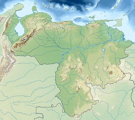
Relief map of Venezuela, showing the Cordillera de Mérida and Serranía del Perijá in the upper left.
Ecological and Climatic Characteristics
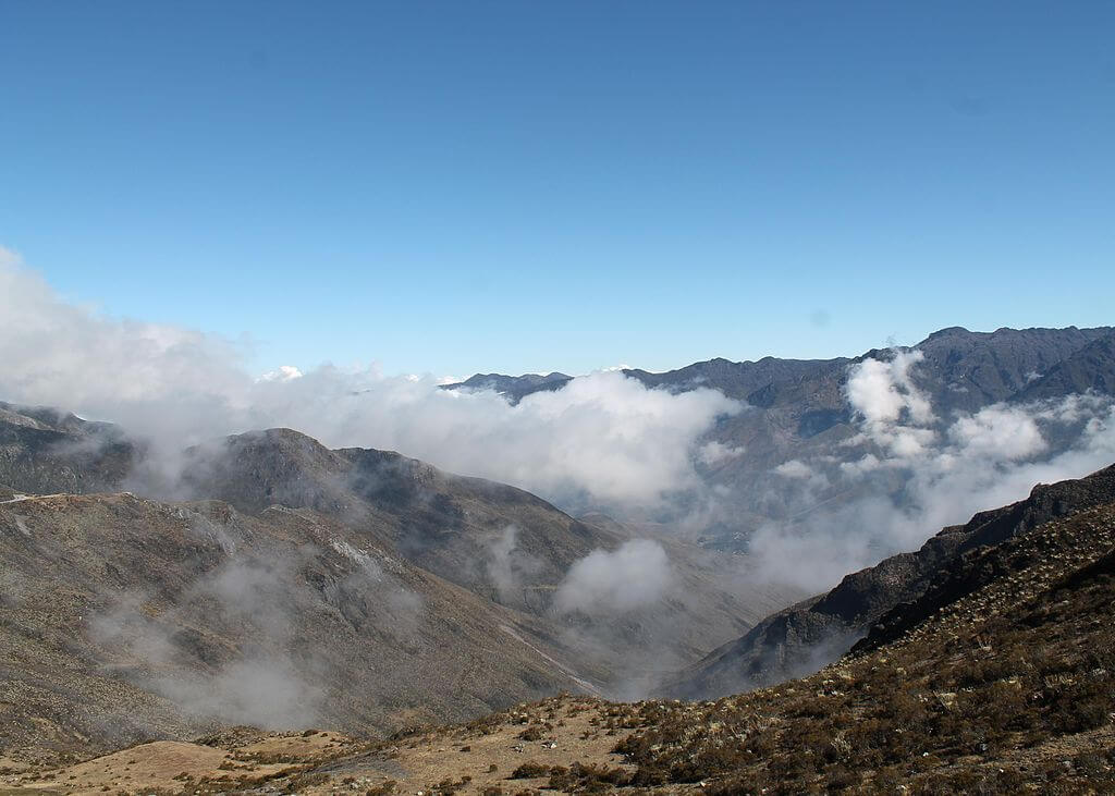
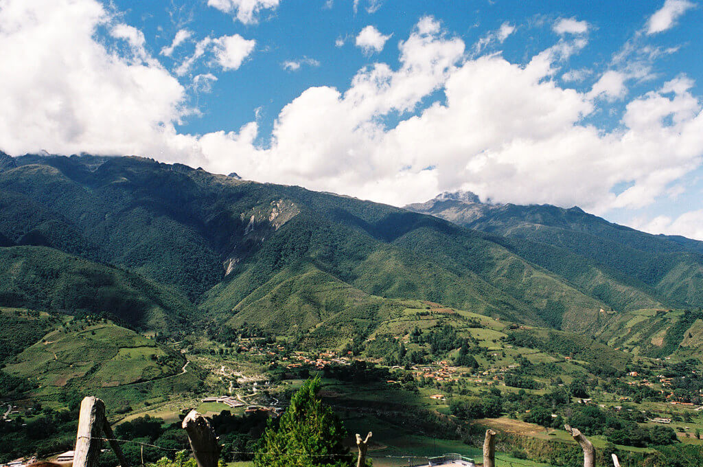
The Venezuelan Andes form part of the larger Tropical Andes, one of the most biodiverse regions on Earth, and are characterized by a wide range of ecological zones stretching from lowland forest to high-altitude tundra. The region's montane forests occupy its middle elevations, forming lush, moist cloud forest that serves as an ecological barrier separating the basins of Lake Maracaibo and Venezuela's expansive Llanos plains. These forests support a rich array of flora and fauna, including the spectacled bear (Tremarctos ornatus), South America's only native bear species, and the Andean condor (Vultur gryphus), which patrols the highest ridgelines of the Sierra Nevada de Mérida.
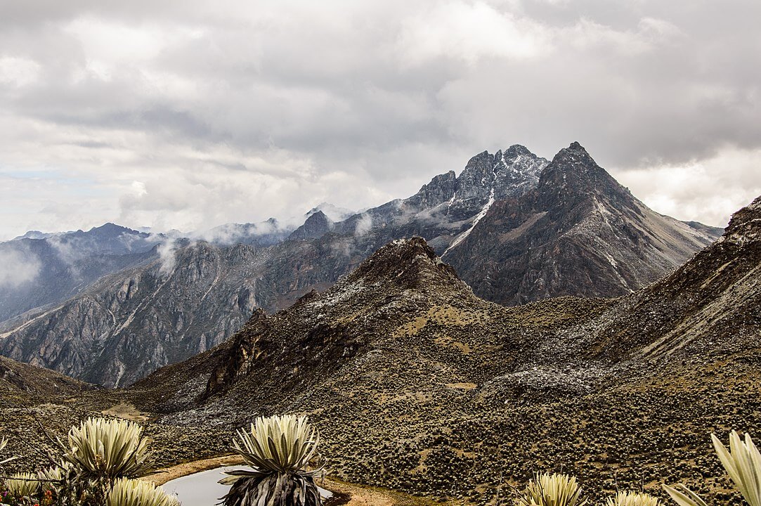
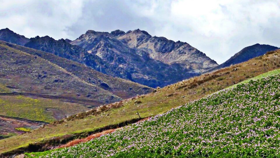
At elevations above roughly 3,100 m (10,170 ft), the tree line gives way to the páramo, a tropical alpine grassland ecosystem found only in the northern Andes and a small number of similarly isolated high-altitude enclaves worldwide. The Cordillera de Mérida's páramo is one of the most significant enclaves of this ecosystem anywhere in the world. Its defining plant is the frailejón (Espeletia spp.), a genus of giant rosette shrubs whose thick, felted leaves and slow, centuries-long growth have made it both an ecological marvel—adapted to survive nightly freezes and intense daytime UV radiation within a matter of hours—and an emblem of the páramo landscape itself, giving the Cordillera de Mérida's highest valleys their distinctive silvery-green appearance.
The Sierra Nevada de Mérida was, until recently, also home to the Humboldt Glacier, or La Corona, Venezuela's last remaining glacier and the final survivor of six glaciers that crowned the range as recently as 1910, together covering roughly 1,000 sq km (386 sq mi). By 2011, five of those glaciers had disappeared entirely. The Humboldt persisted until 2024, when researchers at the Universidad de los Andes in Mérida confirmed it had shrunk to approximately 2 hectares—well under the roughly 10-hectare threshold glaciologists generally use to define a glacier—leading the International Climate and Cryosphere Initiative to formally reclassify it as an ice field. The reclassification made Venezuela, by most glaciologists' assessment, the first country in modern history to lose all of its glaciers, a milestone described by University of Los Andes astrophysicist Alejandra Melfo, who has studied the region's tropical glaciers for years, as "a great sadness," with the glacier's remaining legacy now used chiefly to teach children what the Sierra Nevada once looked like.
National Parks and Conservation
The Venezuelan Andes are home to several protected areas that preserve their unique ecosystems and dramatic landscapes, among them Sierra Nevada National Park, which contains Pico Bolívar and the site of the former Humboldt Glacier, and Sierra La Culata National Park. These parks conserve the region's biodiversity, protect the páramo watersheds that supply water to Mérida and the surrounding valleys, and support both scientific research and ecotourism.
The city of Mérida itself, the region's cultural and academic center, sits at approximately 1,600 m (5,250 ft) and is home to the Universidad de los Andes, one of Venezuela's oldest and most prestigious universities and the institutional home of much of the glacial and páramo research referenced above. Mérida is also known for its cable car, the Teleférico de Mérida, which at its peak once held the distinction of being the world's highest and longest aerial tramway, rising from the city toward Pico Espejo near the base of the Sierra Nevada, though extended closures for renovation have periodically interrupted its operation in recent years.
The Andean Natural Region
The Andean natural region of Venezuela, encompassing the Cordillera de Mérida and the Serranía del Perijá, constitutes just over 5% of Venezuela's territory. It is the fourth-largest of the country's eight natural regions and includes its highest point, Pico Bolívar. This region is crucial for its ecological significance, providing essential ecosystem services such as water regulation and carbon sequestration for the densely populated valleys and plains that surround it, and it remains culturally significant as well, its history and traditions deeply intertwined with the mountain landscape from which it takes its name.
Conclusion
The Venezuelan Andes are a remarkable segment of the broader Andean mountain system, distinguished by their geological origins, diverse ecosystems, and significant elevation. From the páramo's frailejón-studded slopes to the lush montane cloud forests below, these ranges offer a wealth of natural beauty and biodiversity, even as the disappearance of the Humboldt Glacier stands as a sobering marker of how quickly that landscape is changing. The region's geological history, ecological complexity, and cultural richness remain vital to Venezuela's natural heritage, and ensuring the conservation and sustainable management of what remains—forests, páramo, and the communities who depend on both—is more urgent now than when this region's glaciers still crowned its highest peaks.
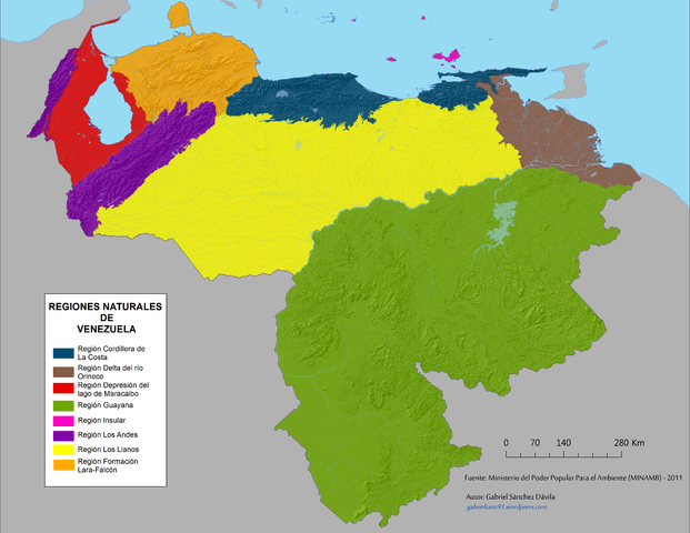
Map showing Venezuela's natural regions.