
The Colombian Andes: A Confluence of Nature and Civilization
The Colombian Andes consist of three parallel north-to-south mountain chains. The Andean Natural Region is Colombia's most populated natural region, encompassing its coffee country, its highest volcanoes, and the ancient homeland of the Muisca civilization.



The Colombian Andes: Three Cordilleras, One Nation's Heartland
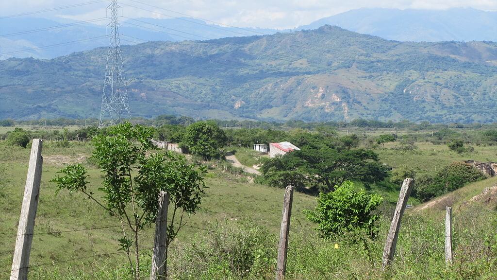
The Colombian Andes are a fascinating and complex part of the Andean mountain system, representing the northern extension of this vast range along South America's western coast. In Colombia, the Andes divide into three parallel mountain chains: the Cordillera Occidental, the Cordillera Central, and the Cordillera Oriental. These ranges form a backbone that is vital to the country's geography, culture, and ecology. The Andean Natural Region encompassing them is Colombia's most populous natural region, hosting the great majority of the country's urban centers and its most significant pre-Columbian settlements.
Geological Origins and Tectonic Activity
The geological formation of the Colombian Andes traces back millions of years to the interaction of tectonic plates. In the south, just north of the border with Ecuador, the Andes bifurcate into three parallel ranges at the Huaca Knot, a cluster of snow-capped volcanoes. Further north, the Pasto mountain knot, an important hydrological source, marks the point where the three cordilleras formally originate. The tectonic activity of the Nazca Plate, the Caribbean Plate, and the South American Plate has shaped the dramatic landscapes of the Colombian Andes, creating a region of exceptional geological diversity and, in its volcanic zones, real and continuing hazard.
The Three Cordilleras
The Cordillera Occidental, the westernmost range of the Colombian Andes, runs parallel to the Pacific coast. It is the least populated of the three ranges, with an average altitude of 2,000 m (6,600 ft) and a highest point at Cerro Tatamá, standing at 4,100 m (13,500 ft). The range extends from south to north before splitting into three smaller ranges that merge into the Caribbean plain and the Sinú River Valley. Its relatively low elevation permits dense tropical vegetation, particularly on its western slopes, and it is separated from the coastal Baudó Mountains by the Atrato River and from the Cordillera Central by the deep rift of the Cauca Valley.
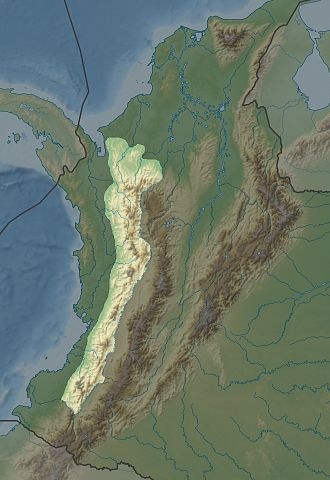
Map depicting the location of the Cordillera Occidental in Colombia.
The Cordillera Central is the highest and most prominent of the three branches of the Colombian Andes, forming a formidable rock wall extending 800 km (500 mi) from north to south and dotted with snow-covered volcanoes. Among its highest peaks are Nevado del Tolima, at 5,215 m (17,105 ft), Nevado del Ruiz, at 5,400 m (17,717 ft), and Nevado del Huila, at 5,750 m (18,865 ft). On November 13, 1985, Nevado del Ruiz produced one of the deadliest volcanic disasters of the 20th century: a relatively modest eruption melted the summit's glacial ice, sending lahars racing down river valleys at speeds up to 60 km/h (37 mph) and burying the town of Armero, roughly 50 km (31 mi) to the east, killing an estimated 23,000 to 25,000 people in a matter of hours. The disaster, now known as the Armero tragedy, remains Colombia's worst natural disaster and reshaped disaster-response policy across Latin America; Nevado del Ruiz remains active and closely monitored today.
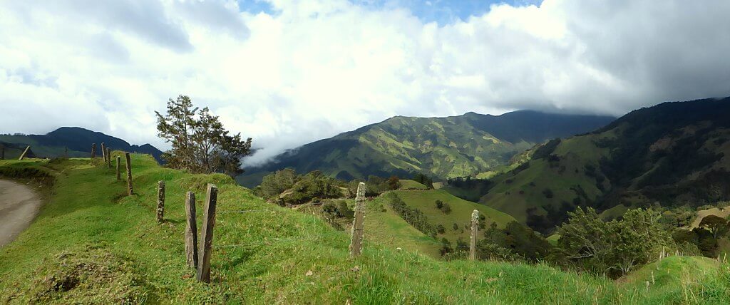
North of the volcano, the range widens into a plateau around 6°N, where the city of Medellín, Colombia's second-largest city, is located. Further south, the Cordillera Central is home to the heart of Colombia's Eje Cafetero, or Coffee Triangle, centered on the cities of Manizales, Pereira, and Armenia; the region's volcanic soils, moderate elevation, and reliable cloud cover make it one of the world's premier coffee-growing zones, and its cultural landscape—the farms, traditional architecture, and generations-old cultivation practices of the area—is recognized collectively by UNESCO as the Coffee Cultural Landscape of Colombia. Near Salento, in the Cocora Valley, the Cordillera Central also shelters extensive stands of the wax palm (Ceroxylon quindiuense), Colombia's national tree and, at heights regularly exceeding 45 m (148 ft), the tallest palm species on Earth; these forests are the principal habitat of the critically endangered yellow-eared parrot (Ognorhynchus icterotis), whose population collapsed to fewer than 100 birds by the late 1990s before a sustained conservation effort helped it recover into the low thousands today. The Cauca River Valley bounds the Cordillera Central to the west and the Magdalena River Valley to the east, and toward its northern end the range splits into several branches that descend toward the Caribbean coast.
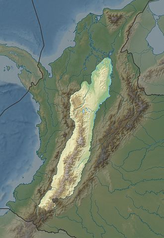
Map depicting the location of the Cordillera Central in Colombia.
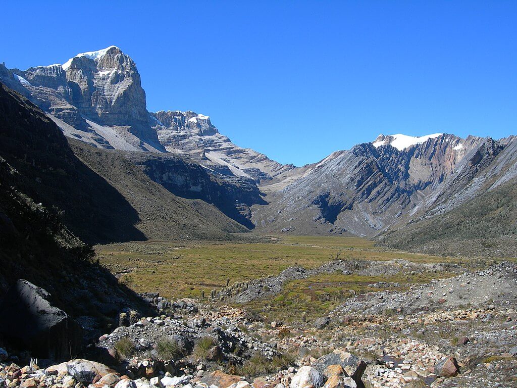
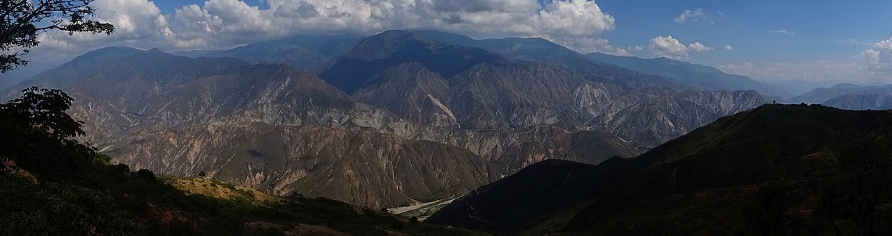
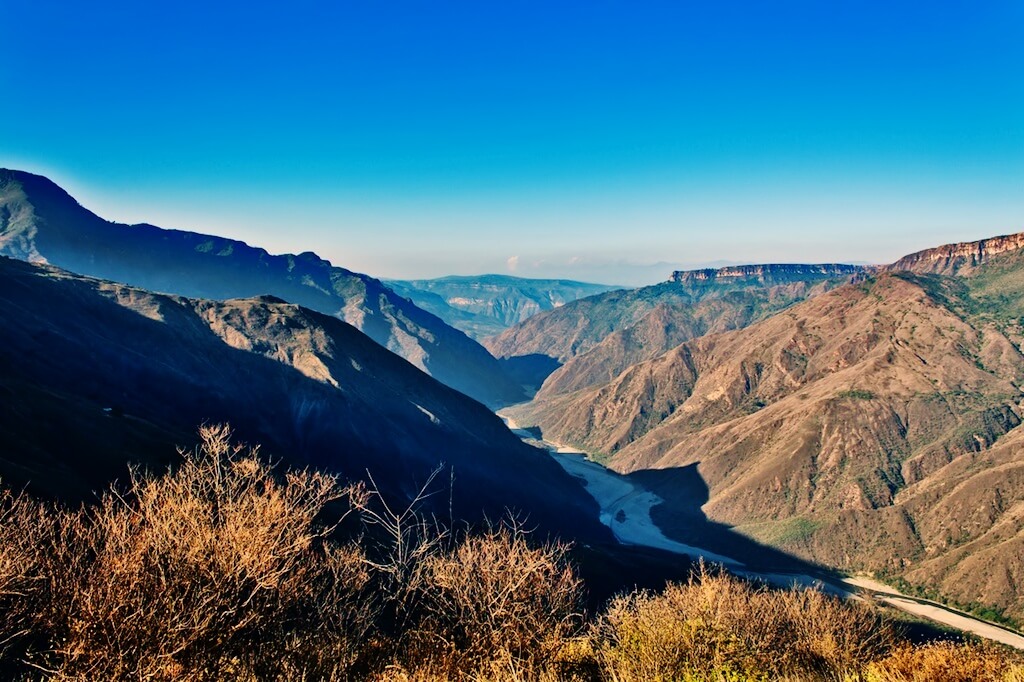
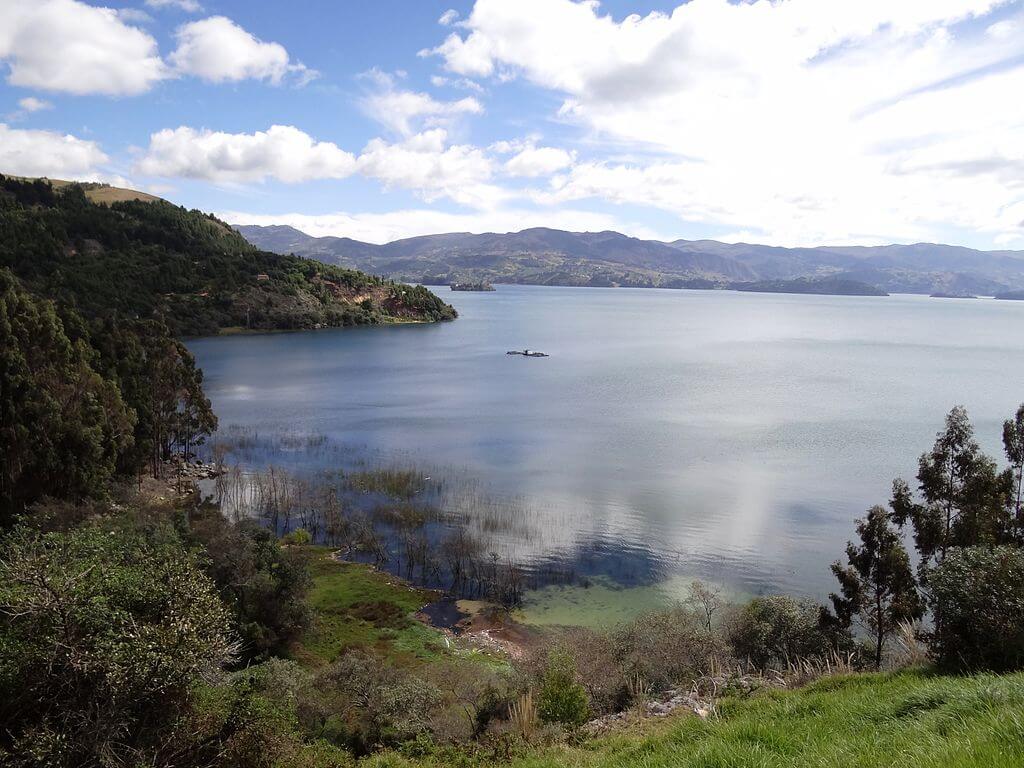
The Cordillera Oriental is the easternmost and broadest of the three Colombian Andes ranges, extending south to north before splitting into the Serranía del Perijá and the Cordillera de Mérida of the Venezuelan Andes. Its highest peak is Ritacuba Blanco, rising to 5,410 m (17,750 ft) in the Sierra Nevada del Cocuy. Further south, the range is cut by the Chicamocha Canyon, one of the largest canyons in the world by volume, its striated red-and-ochre walls dropping more than 2,000 m (6,560 ft) below the surrounding plateau. The Altiplano Cundiboyacense, a high plateau within the Cordillera Oriental covering parts of Cundinamarca and Boyacá, corresponds to the ancient territory of the Muisca civilization, whose ritual offerings of gold at Laguna de Guatavita, a sacred crater lake in the highlands northeast of Bogotá, gave rise to the legend of El Dorado that drew Spanish conquistadors deep into the Andes in the 16th century. The Colombian capital, Bogotá, sits on this same plateau at roughly 2,640 m (8,660 ft). The Magdalena River Basin lies west of the range, while the Amazon, Orinoco, and Catatumbo river basins lie to the east.
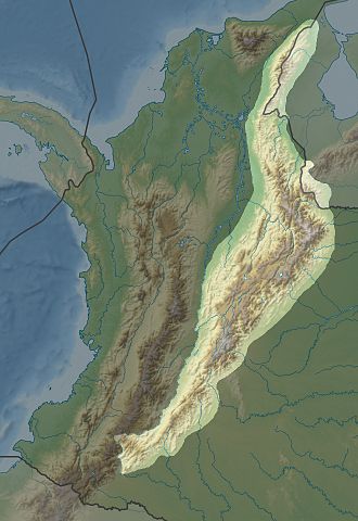
Map depicting the location of the Cordillera Oriental in Colombia.
The Andean Natural Region
The Andean Natural Region is Colombia's most populated natural region and includes most of the country's urban centers. It is a geographical marvel and a hub of historical and cultural significance, home to many of the most important pre-Columbian Indigenous settlements in the country. Beyond the Colombian Massif in the southwestern departments of Cauca and Nariño, the Colombian Andes divide into the three major branches described above: the Cordillera Occidental, home to the city of Cali; the Cordillera Central, encompassing Medellín, Manizales, and Pereira; and the Cordillera Oriental, extending northeast toward the Guajira Peninsula and including Bogotá, Bucaramanga, and Cúcuta.
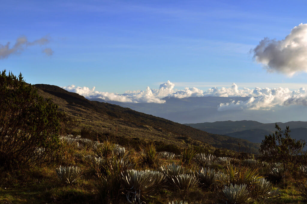
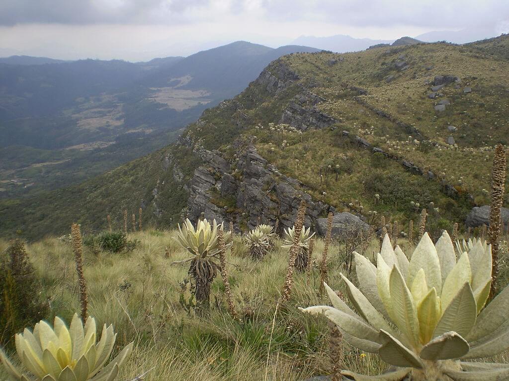
The Andean Natural Region spans a striking range of temperature zones, defined almost entirely by elevation rather than season, which in turn shapes its vegetation and agriculture. Below roughly 1,000 m (3,280 ft), river valleys and basins fall within the tierra caliente, or warm land, characterized by tropical climates and dense vegetation. Between 1,000 and 2,000 m (3,280 and 6,560 ft) lies the tierra templada, or temperate land, whose moderate climate supports a wide range of agricultural activity, including much of the coffee cultivation described above. From 2,000 to 3,200 m (6,560 to 10,500 ft), the tierra fría, or cold land, contains some of the region's most productive agricultural land and, not coincidentally, the great majority of its population, including Bogotá itself. Above 3,200 m (10,500 ft), the landscape transitions first through forested slopes and then into the páramo, a high-altitude moorland found between roughly 3,900 and 4,600 m (12,800 and 15,100 ft) and dominated by frailejones (Espeletia spp.), the giant rosette shrubs characteristic of the northern Andean high country, before giving way above 4,600 m (15,100 ft) to permanently frozen tierra helada.
Numerous national parks across the Andean Natural Region preserve this range of ecosystems and shelter Colombia's exceptional flora and fauna, including the Andean condor (Vultur gryphus) and the spectacled bear (Tremarctos ornatus), South America's only native bear species, both of which range through the region's higher forests and páramo. These protected areas play a crucial role in conservation, scientific research, and sustainable tourism, contributing to the region's ecological and economic sustainability alike.
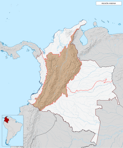
Map depicting the location of the Andean Natural Region of Colombia.
Conclusion
The Colombian Andes, with their three distinct cordilleras, are a remarkable natural feature of South America, characterized by geological complexity, ecological diversity, and profound cultural significance. From the tropical forests of the Cordillera Occidental to the coffee farms and wax palm groves of the Cordillera Central and the extensive high plateaus of the Cordillera Oriental, the region offers an extraordinary range of landscapes and histories—from the Muisca civilization's gold offerings at Guatavita to the enduring lesson of the Armero tragedy in disaster preparedness. The Andean Natural Region, the most populous area of Colombia, underscores the critical interplay between natural environment and human civilization that continues to shape the country's present and future. Preserving the integrity and biodiversity of the Colombian Andes remains essential to maintaining this extraordinary region's ecological balance and cultural heritage.