
The Sierra Madre: Mexico's Magnificent Mountain Kingdom
The Sierra Madre is the principal mountain system of Mexico, consisting of four main ranges plus the southern extension known as the Sierra Madre de Chiapas, together forming a northwest-southeast arc enclosing the Mexican Plateau.
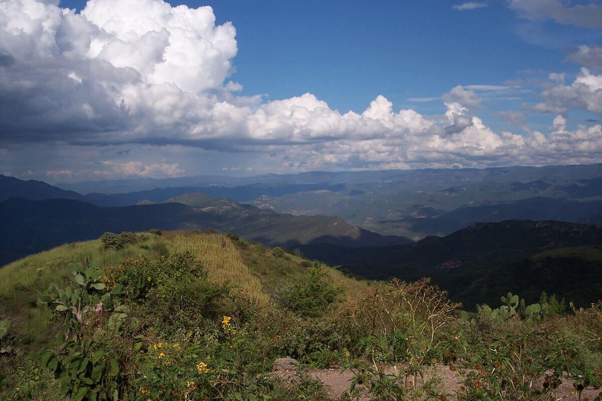
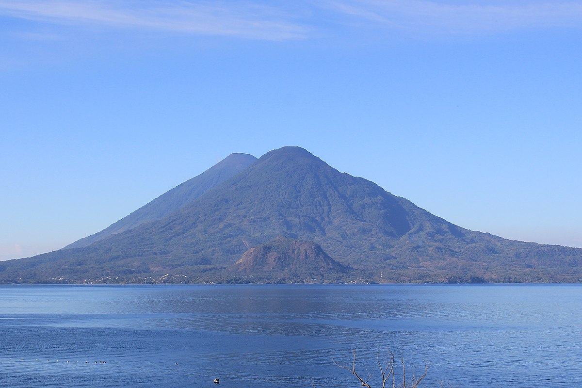
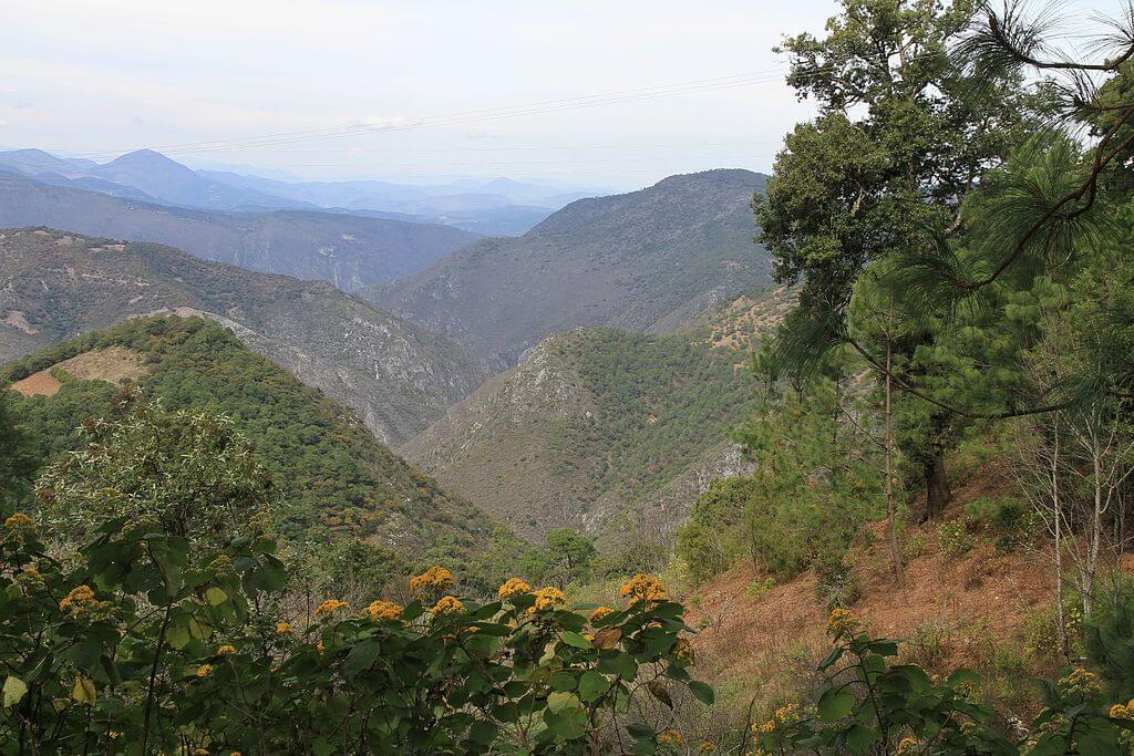
Sierra Madre: Mexico's Mountain Backbone, From Copper Canyon to the Golden Triangle
Stretching majestically across Mexico, the Sierra Madre mountain system forms an awe-inspiring backbone that encloses the central Mexican Plateau. This vast and intricate network of ranges, part of the mighty American Cordillera, extends in a broad northwest-southeast arc, encompassing an extraordinary range of landscapes, ecosystems, and cultural heritage that have shaped the essence of Mexico.
The Sierra Madre proper should not be confused with the Trans-Mexican Volcanic Belt, a separate and geologically distinct chain of volcanoes—including Popocatépetl and Pico de Orizaba—that runs east-west across central Mexico, cutting perpendicular to the Sierra Madre's north-south orientation rather than forming part of the same system.
The Imposing Sierra Madre Ranges
Sierra Madre Occidental
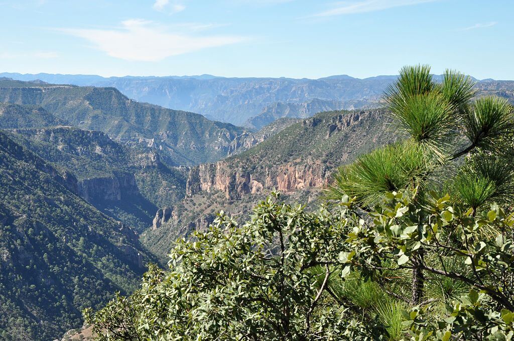
The Sierra Madre Occidental, a primarily volcanic range, runs parallel to Mexico's Pacific coast for a staggering 1,250 km (780 mi). Forming the western rampart of the Mexican Plateau, this formidable range is renowned for its deep, labyrinthine river valleys, or barrancas, the most spectacular of which is the Copper Canyon (Barranca del Cobre) in southwestern Chihuahua, a network of canyons more profound and vaster in combined volume than the Grand Canyon.
The uplift of the Sierra Madre Occidental has profoundly influenced regional weather patterns, creating pockets of increased rainfall that support ecosystems distinct from the surrounding arid lowlands, most notably oak forests that extend as verdant, biodiverse islands into terrain that would otherwise be desert. The range also forms part of the Continental Divide separating Mexico's Pacific and Gulf/Atlantic watersheds: rivers on its western slopes drain toward the Pacific, nourishing the arid regions of western Mexico, while those on its eastern slopes flow toward the Gulf of Mexico and the Caribbean Sea, sustaining the central plateau and eastern states. This divide has shaped ecological communities on either side just as much as it has water supply, with lush riparian forest thriving on the wetter western slopes and hardier desert and semi-arid vegetation dominating the drier east.
The Sierra Madre Occidental's remoteness and rugged terrain, while a boon for biodiversity, have also made the range—spanning the states of Sinaloa, Durango, and Chihuahua in particular—one of Mexico's principal regions for illicit crop cultivation for well over a century, an area long known as the country's "Golden Triangle." This history has shaped land use, security conditions, and the degree of external access across large parts of the range, and it remains a significant factor in the daily lives of many of the rural and Indigenous communities who call these mountains home.
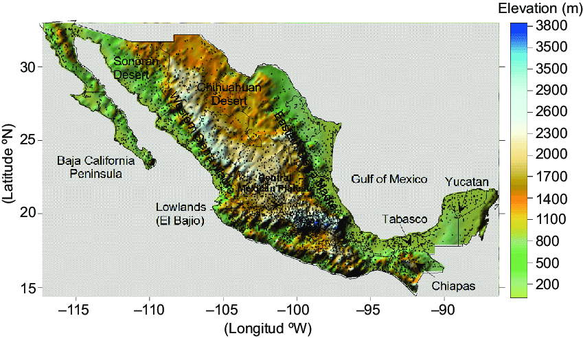
Elevation map of Mexico, including its main topography features.
Sierra Madre Oriental
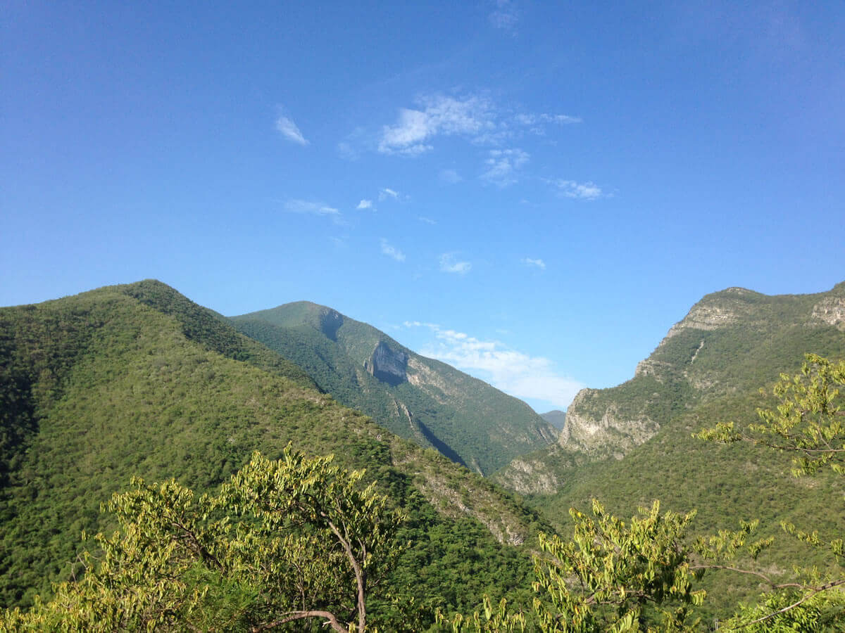
The Sierra Madre Oriental extends an impressive 1,000 km (620 mi) from the Rio Grande on the border with Texas southward through the Mexican states of Nuevo León, Tamaulipas, San Luis Potosí, Querétaro, Hidalgo, and northern Puebla. This range is a true repository of biodiversity, harboring an abundance of endemic plant and wildlife species from the arid northern regions to the lush, moisture-rich southern areas, including black bears (Ursus americanus) in its northern forests. The northernmost reaches of the range, including the Sierra del Burro and the Sierra del Carmen, extend into the United States, where they continue as the Davis and Guadalupe Ranges in Texas, underscoring the interconnectedness of the continent's mountain systems across the modern border.
Sierra Madre de Oaxaca
The Sierra Madre de Oaxaca is a rugged mountain range in southern Mexico, primarily in the state of Oaxaca. Its peaks average an impressive 2,500 m (8,200 ft) in elevation, with some towering giants exceeding 3,000 m (9,800 ft). This range is characterized by its wetter eastern slopes, which intercept moisture-laden winds from the Gulf of Mexico, in sharp contrast to the drier valleys to the west, sheltered in the range's rain shadow. The Sierra Madre de Oaxaca is home to the Sierra Madre pine-oak forests ecoregion, which thrives above 1,600 m (5,200 ft), while the humid Oaxacan montane forests ecoregion flourishes below this altitude on the eastern slopes, cascading toward the Veracruz lowlands.
Sierra Madre del Sur
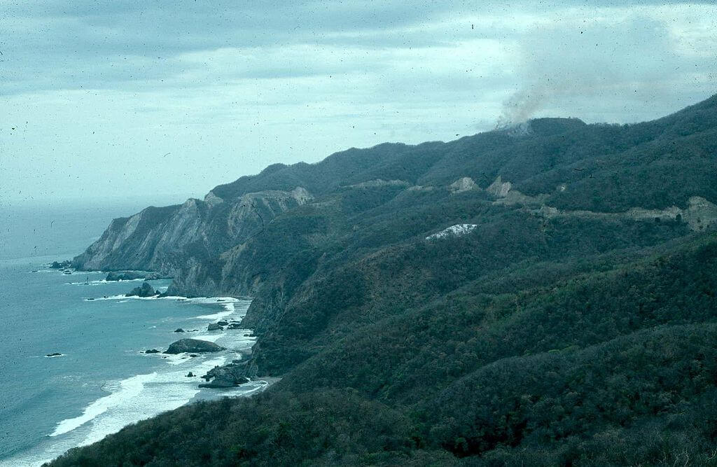
The Sierra Madre del Sur extends for an impressive 1,000 km (620 mi) from southern Michoacán through Guerrero to the Isthmus of Tehuantepec in eastern Oaxaca. It is a renowned biodiversity hotspot, with its highest point reaching 3,703 m (12,149 ft) in central Guerrero. The range is particularly noteworthy for its diversity of ecosystems, from the Sierra Madre del Sur pine-oak forests that cloak its higher reaches to the tropical dry forests and subtropical dry broadleaf forests that blanket its lower elevations.
Sierra Madre de Chiapas
The southernmost extension of the Sierra Madre system, the Sierra Madre de Chiapas, extends beyond Mexico's borders into Guatemala, El Salvador, and Honduras. This range is not only a testament to the region's geological interconnectedness but also a repository of rich cultural heritage, with Indigenous communities including the Maya having called these mountains home for centuries. The Sierra Madre de Chiapas is renowned for its lush cloud forests and tropical rainforests, home to species such as the resplendent quetzal (Pharomachrus mocinno) and jaguar (Panthera onca), as well as an extraordinary array of plant and animal life found nowhere else on Earth.
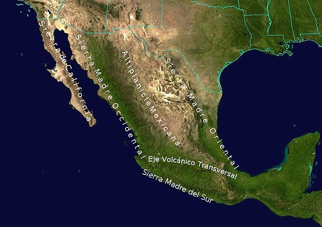
Topographic map of Mexico: Sierra Madre System.
Ecological Treasures
The Sierra Madre mountain system is an ecological marvel, harboring unparalleled biodiversity in North America. From the wetter southern regions, where lush rainforests and cloud forests thrive, to the drier northern reaches, where resilient desert ecosystems cling to life, the Sierra Madre ranges support an astounding array of plant and animal species, many of which are endemic to the region. The Sierra Madre Oriental and Sierra Madre de Oaxaca, in particular, are renowned for their abundant biodiversity and their various ecoregions—pine-oak forests, tropical moist forests, and dry scrublands among them—each supporting distinctive flora and fauna.
Cultural Tapestry
The Sierra Madre mountain system holds immense cultural significance for Mexico. Indigenous communities, such as the Rarámuri (Tarahumara) in the Sierra Madre Occidental and the Zapotec and Mixtec in the Sierra Madre de Oaxaca, have called these mountains home for centuries, preserving their traditions, languages, and ways of life in the rugged landscapes that have sustained them. The ranges have also played a pivotal role in Mexico's history, their remote, rugged terrain having served at various points as refuges for rebel movements and for the preservation of customs and practices that might otherwise have been lost. The Sierra Madre has left an indelible mark on Mexico's arts and literature as well, its towering peaks and plunging canyons inspiring writers, poets, and artists for generations, most famously lending its name to B. Traven's novel and John Huston's 1948 film adaptation, The Treasure of the Sierra Madre.
Adventure and Exploration
The Sierra Madre offers extensive opportunities for outdoor recreation, from hiking and trekking through rugged terrain to rock climbing and canyoning. Copper Canyon in the Sierra Madre Occidental and the Sierra Gorda Biosphere Reserve in the Sierra Madre Oriental are among the most visited destinations, drawing travelers with dramatic scenery, opportunities for cultural immersion with local Indigenous communities, and access to some of Mexico's most significant remaining wilderness.
Conservation and Sustainability
Mexico's National Commission for Protected Natural Areas (CONANP) oversees the national parks, biosphere reserves, and other protected areas established throughout the Sierra Madre ranges, working to safeguard biodiversity while promoting the sustainable use of natural resources through reforestation programs, wildlife monitoring, and sustainable tourism initiatives. The Monarch Butterfly Biosphere Reserve, at the eastern edge of the Trans-Mexican Volcanic Belt near the Sierra Madre Oriental, exemplifies this approach, integrating conservation, sustainable development, and scientific research within a single protected landscape.
A central challenge across the Sierra Madre lies in harmonizing the needs of Indigenous and rural communities, who have depended on these mountains for their livelihoods and cultural practices for generations, with the demands of modern conservation. Involving local stakeholders in decision-making and developing sustainable economic alternatives, such as ecotourism and sustainable forestry, remains central to reconciling these interests. Maintaining ecological connectivity between protected areas is likewise a growing priority as human activity fragments habitat; the Mesoamerican Biological Corridor, spanning from Mexico to Colombia, represents the most ambitious such effort, aiming to link protected areas and sustainable land-use zones into a single network that allows wildlife populations to move and exchange genetic material across what would otherwise be isolated fragments. Despite these efforts, the Sierra Madre continues to face significant threats from deforestation, illegal mining, and climate change, and ongoing collaboration among government agencies, non-governmental organizations, academic institutions, and local communities remains essential to addressing these threats.
Conclusion
As one of the defining geological and cultural features of Mexico, the Sierra Madre mountain system will remain central to the country's ecological resilience, biodiversity, and the well-being of the communities who call these mountains home. Its conservation depends on recognizing the intricate connections between human societies and the natural world that have shaped this landscape for millennia.
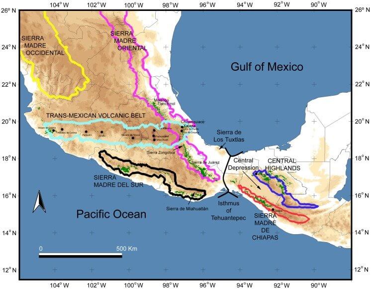
Topographic map of Mexico / Central America.