Copper Canyon and the Sierra Tarahumara: Nature's Grandeur and Indigenous Heritage
Copper Canyon and the Sierra Tarahumara are located in northwestern Mexico. These breathtaking terrains, known for their cultural significance, natural beauty, and diverse ecosystems, lie within the Sierra Madre Occidental. Their rich indigenous heritage fascinates travelers and researchers.
Journey Through the Copper Canyon: Nature and Heritage in the Sierra Tarahumara
Located in the northwestern region of Mexico, within the Sierra Madre Occidental, lies a breathtaking landscape of great cultural significance and beauty - Copper Canyon and the Sierra Tarahumara. This region, encompassing an area of approximately 65,000 square kilometers (25,000 square miles), fascinates travelers and researchers with its remarkable geographical features, diverse ecosystems, and rich indigenous heritage. This combination of natural beauty and cultural richness offers a glimpse into northern Mexico's ecological wonders and the enduring traditions of northern Mexico.
Copper Canyon: A Geological Wonder
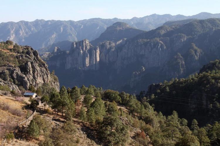
Copper Canyon is more than just a single canyon; it is a complex network of interconnected gorges that carve their way through the rugged terrain of the Sierra Tarahumara. Named for the distinctive copper hues that adorn its canyon walls, this awe-inspiring landscape is a testament to the forces of nature that have shaped it over millions of years.
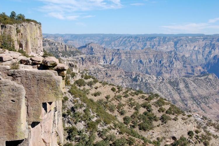
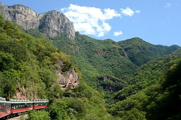
The canyon system comprises over 20 individual canyons, with six main canyons dominating the landscape. These canyons, including Urique, Sinforosa, Copper, Tararecua, Batopilas, and Oteros, showcase staggering depths ranging from 975 to 1,860 meters (3,200 to 6,100 feet). The geological composition of the region, characterized by alternating layers of soft and hard rock, has given rise to the dramatic stair-step formations that define the canyon walls.
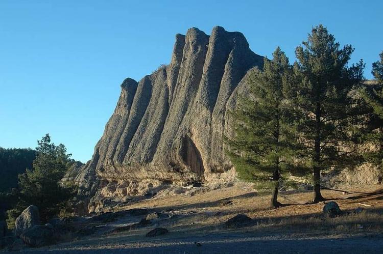
The canyon's geology also tells a story of ancient volcanic activity, with rocks primarily consisting of explosive volcanic ash flows, ash falls, and mudflow breccias deposited millions of years ago. Over time, erosion sculpted the landscape, creating a mosaic of cliffs, valleys, and mesas that stretch as far as the eye can see.
Ecological Diversity: From Ponderosa Pines to Tropical Oasis
One of the most remarkable aspects of Copper Canyon is its unusual ecological diversity, shaped by its dramatic variations in altitude and climate. As elevation changes from the cooler highlands to the warmer lowlands, so does the vegetation that thrives within its confines.
In the cooler highlands, forests of Ponderosa pines and oak trees dominate the landscape, their verdant canopy providing habitat for diverse wildlife species. As one descends into the warmer lower zones, the landscape transforms into a subtropical oasis, with lush vegetation and vibrant flora flourishing in the abundant water supply.
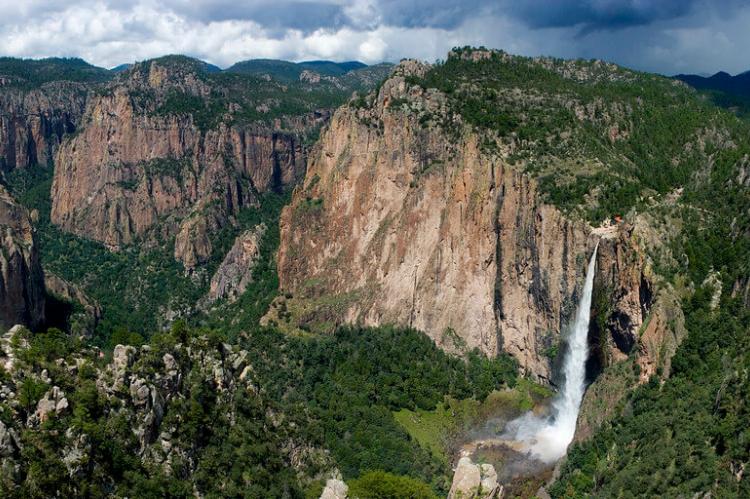
Piedra Volada Falls and Basaseachi Falls, two of the region's iconic waterfalls, punctuate the landscape with their thundering cascades. They add to the area's natural allure and serve as vital water sources for the surrounding ecosystems.
El Chepe: A Journey Through Spectacular Scenery
Central to exploring Copper Canyon is the Chihuahua-Pacific Railway, affectionately known as El Chepe. This iconic railway journey, spanning 673 kilometers (418 miles), links the city of Chihuahua to the coastal town of Los Mochis, traversing the heart of Copper Canyon.
Widely hailed as one of the most scenic railway journeys on the continent, El Chepe offers passengers a front-row seat to the breathtaking beauty of the canyon landscape. The train's route takes passengers over 37 bridges and through 86 tunnels, including a mile-long tunnel that traverses the rugged terrain to gain elevation.
Divisadero, an essential stop along the route, offers panoramic canyon views from its scenic lookout points. Perched high above the canyon floor, visitors can marvel at the sheer scale and grandeur of Copper Canyon, a testament to the awe-inspiring power of nature.
Exploring the Villages of Copper Canyon
Dotting the landscape of Copper Canyon is a series of charming villages, each offering its unique glimpse into the region's cultural heritage and way of life. From the bustling town of Creel, a hub of commerce and tourism, to the remote village of Batopilas, steeped in history and tradition, these communities are integral to the fabric of Copper Canyon's identity.
Whether exploring the historic streets of Batopilas, founded by Spanish settlers in the 17th century or immersing oneself in the vibrant atmosphere of Divisadero, where local artisans showcase their traditional crafts, each village offers travelers a chance to connect with the rich tapestry of life in Copper Canyon.
The Sierra Tarahumara: Canyon Country and Cultural Heartland
Beyond its geological splendor, the Sierra Tarahumara is also home to the indigenous Tarahumara people, who have inhabited this remote corner of Mexico for centuries. Known for their deep connection to the land and rich cultural traditions, the Tarahumara have long been stewards of this rugged landscape, living in harmony with its natural rhythms and cycles.
The region's numerous deep canyons, or barrancas, are geological marvels and serve as vital lifelines for the communities that call them home. Here, amid the towering cliffs and winding rivers, the Tarahumara have carved out a way of life uniquely attuned to the rhythms of the land.
From the high plateaus cloaked in Mexican Douglas-fir trees to the lush canyon bottoms teeming with giant fig and palm trees, the Sierra Tarahumara boasts a remarkable diversity of flora and fauna. However, this biodiversity is increasingly threatened by deforestation and habitat loss, underscoring the need for sustainable conservation efforts to protect this fragile ecosystem.
Conclusion
The Copper Canyon and the Sierra Tarahumara are a remarkable testament to the enduring power of nature and the rich tapestry of human culture that thrives within it. From the breathtaking vistas of Copper Canyon to the cultural heritage of the Tarahumara people, this region provides travelers with a glimpse into an ancient and timeless world. Here, the forces of nature and human ingenuity converge in perfect harmony. This region is a must-visit for those wishing to experience nature and culture's beauty and diversity.
