
The Marañón River: Peru’s Andean Headwater of the Amazon
The Marañón rises in the Peruvian Andes and runs about 1,700 km (1,060 mi) through deep gorges before joining the Ucayali near Nauta to form the Amazon. This article covers its canyons, floodplain life, the stalled dam plans, and the 2024 court ruling recognizing the river's rights.



The Marañón River: Canyons, Dams and Legal Rights on the Upper Amazon
The Marañón is the great Andean river of northern Peru. It rises more than 4,500 m (14,800 ft) above sea level, runs about 1,700 km (1,060 mi) through deep canyons and narrow gorges, and meets the Ucayali near the town of Nauta to form the main stem of the Amazon River. Its basin covers about 363,000 km² (140,000 sq mi), about 82 percent of it in Peru and the rest in Ecuador, and it carries the sediment and nutrients that feed the Amazon's floodplains. The Marañón also marks a human frontier: the homeland of the Awajún, Wampís and Kukama peoples, the route of an aging oil pipeline, and the site of long-contested dam plans. In 2024, a Peruvian court recognized the river itself as a rights-bearing entity. This article follows the river from its Andean sources to the Amazon and describes the pressures it faces today.
Sources in the High Andes
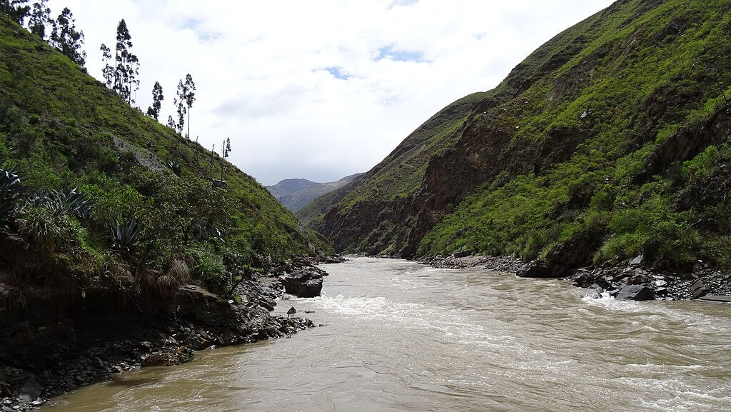
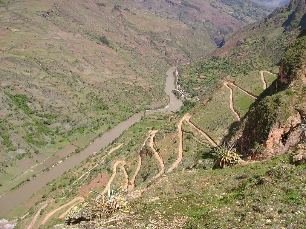
The Marañón's most distant source lies at about 4,600 m (15,100 ft) at the foot of the Yapura snowcap, also known as Cerro Caudalosa, in the Huánuco Raura range. A second major headwater system, the Carhuacocha and Janca streams of the Huayllay range, forms the Nupe River, which joins the outlet of Lake Lauricocha, and the combined river takes the Marañón name. From there, the river runs north-northwest between the Cordillera Blanca and the Cordillera Central, as described in Cordillera Blanca and The Peruvian Andes, crossing the regions of Huánuco, Áncash, La Libertad, Cajamarca, Amazonas, and Loreto. Its deep upper canyon is sometimes called the Grand Canyon of the Amazon.
Gorges and the Descent to the Lowlands
Where the river turns east and breaks through the last Andean ranges, it passes two famous gorges, the pongos. The Pongo de Rentema near Bagua is the first. The Pongo de Manseriche, the last and largest, sits below the mouth of the Santiago River, where the Marañón narrows to roughly 30 to 35 m (100 to 115 ft) between cliffs and rushes through at speeds of up to about 19 km/h (12 mph). Estimates of its length range from about 5 to 12 km (3 to 7.5 mi). The Spanish explorer Juan de Salinas passed through it in 1557. Beyond the Pongo de Manseriche, the river reaches the lowlands at about 200 m (650 ft) elevation and flows another several hundred kilometers across a broad forested floodplain to the Ucayali, where its mouth stands at about 89 m (292 ft).
Basin and Flow
Estimates of the river's length vary because it meanders and its headwaters are measured in different places. This article uses about 1,707 km (1,061 mi) from the Yapura source to the Ucayali confluence, and published figures range from about 1,400 km to 1,800 km (870 to 1,120 mi). The mean discharge at the mouth is about 14,900 m³/s (526,000 cu ft/s). Major tributaries include the Crisnejas, Chamaya, Utcubamba, Chinchipe, Santiago, Morona, Pastaza, and Tigre, and the Huallaga, about 1,000 km (620 mi) long, is the largest right-bank tributary. The Andes supply roughly 90 percent of the sediment and nutrients that feed the floodplains and wetlands of the whole Amazon Basin, and the Marañón carries much of that load.
The river's modern name has an uncertain history. Spanish writers used Marañón for the whole Amazon from the 1530s, and the Jesuit Samuel Fritz's 1707 map popularized Amazonas for the main river, leaving Marañón as the name for the upper stream.
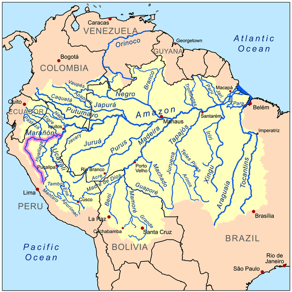
Map of the Amazon River drainage basin with the Marañón River highlighted.
Floodplain Life
Downstream, the Marañón and the Ucayali enclose the Pacaya-Samiria National Reserve, the Amazon's largest protected floodplain. It holds more than 1,025 vertebrate species and 449 bird species, including the Amazonian manatee (Trichechus inunguis), the pink river dolphin (Inia geoffrensis), the gray river dolphin (Sotalia fluviatilis), and the jaguar (Panthera onca). It also has at least 85 lakes that supply fish to the markets of Nauta and Iquitos, and stands of aguaje palms (Mauritia flexuosa) fill the wet forest. The river is also a migration route. The dorado or goliath catfish (Brachyplatystoma rousseauxii) swims between the Amazon estuary and the Andean foothills in what is described as the longest freshwater fish migration in the world, and dams across the Marañón would block it. In the upper canyon, patches of seasonally dry forest harbor plants and animals found nowhere else.
Peoples of the River
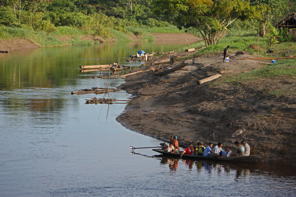
The Awajún and Wampís live along the Santiago, Morona, and middle Marañón, and the Kukama live along the lower river near Nauta. Their communities depend on fishing, small farming, hunting, and forest products. The river was a travel route long before Spanish explorers entered the gorge, and it remains the main transport route for many communities today.
Dams on the Marañón
In 2011, a Peruvian decree declared 20 hydroelectric plants on the Marañón to be of national interest, and the government has since studied more than 20 projects. Two large ones have drawn the most attention. Chadín 2, a planned 600 MW dam in the middle Marañón between Cajamarca and Amazonas, would flood about 32.5 km² (12.5 sq mi) along roughly 22 km (14 mi) of river and displace at least 1,000 people; its concession passed from Odebrecht to AC Energía in 2011 and received a definitive concession in October 2014. The Veracruz project, backed by the Italian utility Enel, was also planned on the middle river. A far larger dam has also been proposed at the Pongo de Manseriche, which would be the biggest in the Peruvian Andes. Neither Chadín 2 nor Veracruz has been built, and Enel has asked the government to end its Veracruz contract. The basin's only relatively large existing dam is Chaglla, over 400 MW, on the Huallaga.
Opponents argue that the dams would trap sediment, cut off fish migrations, interrupt the natural flood pulse, and flood native communities. On September 9, 2021, the IUCN World Conservation Congress in Marseille approved Motion 013, urging Peru to protect the Marañón, Ucayali, Huallaga, and Amazon rivers from large infrastructure projects, to reassess the Amazon waterway, and to cancel the dam concession contracts.
Oil Spills and the Rights of the River
Oil is the river's other long-running conflict. The Northern Peruvian Pipeline, operated by the state company Petroperú, crosses the basin, and ruptures such as a 1999 pipeline break and a 2000 barge spill of about 5,500 barrels have polluted the river and its tributaries. Kukama women's organizations, led by the federation Huaynakana Kamatahuara Kana, spent more than a decade campaigning against the spills. On March 18, 2024, the Mixed Court of Nauta, in Loreto, ruled in their favor, recognizing the Marañón and its tributaries as rights-holders, including the rights to flow, to be free from contamination, and to regenerate. It named the federation's members, Indigenous communities, and the Peruvian state as guardians of the river and ordered Petroperú to update its environmental management plan and the regional government to create a basin council with Indigenous participation. The Civil Court of Loreto upheld the ruling on appeal in late 2024.
Other Pressures
Deforestation is most intense in the Huallaga basin, near Iquitos and in the Ecuadorian headwaters, and mining and oil concessions overlap protected areas, including oil wells inside Pacaya-Samiria. Climate change is also altering river flows and flood timing, although its effects on the Marañón have not been well measured.
Conclusion
The Marañón links the high Andes to the lowland Amazon, carrying water, sediment, fish and people between them. It is one of the last large Andean rivers without major dams on its main stem, and its future depends on decisions about hydropower, oil, and the rights of the Indigenous peoples who live along it. Where it ends, joining the Ucayali River near Nauta, it becomes the Amazon.
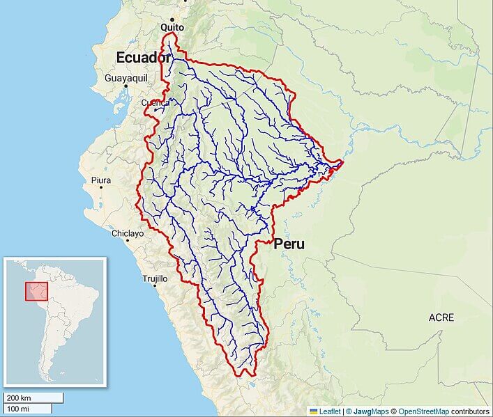
Map of the Marañón River watershed.