
The Putumayo River: A Shared Amazon Boundary from the Andes to the Içá
The Putumayo River runs about 1,800 kilometers from the Colombian Andes to the Solimões in Brazil, where it becomes the Içá. Forming much of the boundary between Colombia, Ecuador, and Peru, it flows past Yaguas National Park and Indigenous homelands and bears the legacy of the rubber era amid rising gold-mining pressure.
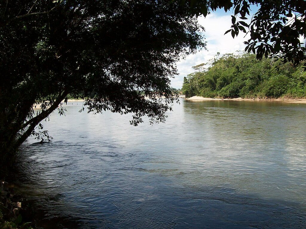
The Putumayo River: Border, Rubber Frontier and Amazon Tributary
The Putumayo River runs about 1,800 kilometers (1,100 miles) from the Andean highlands of southern Colombia to the Solimões, the middle course of the Amazon, in Brazil. For much of its length, it is a boundary, first between Colombia and Ecuador and then between Colombia and Peru, and in its final stretch it crosses into Brazil under the name Içá. Its basin holds one of the richest freshwater fish communities in South America, the homelands of many Indigenous peoples, and a history that includes some of the worst abuses of the Amazon rubber era.
Course and Basin
The river rises in the Andean uplands east of Pasto, in the Nudo de los Pastos region of Nariño, Colombia. Lake La Cocha drains through the Guamuez River, which some sources treat as the upper Putumayo, and the river takes its more familiar name around Puerto Asís, where it leaves the foothills for the lowland plain. From there it flows southeast through a lowland landscape, with the Colombian-Ecuadorian boundary along one stretch and the Colombian-Peruvian boundary along a much longer one.
Near the Brazilian frontier, the river becomes the Içá, which runs roughly 320 kilometers (200 miles) through the Brazilian state of Amazonas before joining the Solimões near Santo Antônio do Içá. The mouth is wide and slow, and the river carries a mean discharge of about 8,760 cubic meters per second (309,000 cubic feet per second). Published figures for the basin vary with how its limits are drawn, from about 121,000 square kilometers (47,000 square miles), the figure used by the binational conservation project, to about 148,000 square kilometers (57,000 square miles). Either way, the basin makes up roughly 2 percent of the Amazon watershed.
The main tributaries include the Guamuez, San Miguel, Güepí, Cara Paraná, Algodón, Igara Paraná, and Yaguas. The Igara Paraná, about 440 kilometers (270 miles) long, is the longest. These rivers arrive from the north and south through forests that are flooded for part of every year, and together they give the basin an extensive network of channels, oxbow lakes and swamps. The Amazon River system as a whole depends on tributaries of this kind to supply the sediment, nutrients and fish that move through the main channel.

Map of the Amazon River drainage basin with the Putumayo River highlighted.
Flow, Floods and Navigation
The Putumayo is a lowland river with moderate current, moving at roughly 0.5 to 1.5 meters per second (1 to 3 miles per hour), depending on the season and reach. Rainfall across the basin generally exceeds 2,500 millimeters (98 inches) a year, and the river rises and falls with the wet and dry seasons. High water spreads across the floodplain, erodes the banks, and sends large floating trees downstream, which are a hazard for boats. Sandbars shift and often turn into islands.
The river is navigable for about 1,800 kilometers (1,100 miles) from Puerto Asís to its mouth. Upstream of the Peruvian settlements of San Antônio del Estrecho and Flor de Agosto, depth is limited in the dry season, but from those points to the Solimões, boats with a draft of about 1.2 meters (4 feet) can travel year-round. In the 19th century, the French explorer Jules Crevaux sailed far upriver, to Cuembí, about 1,300 kilometers (800 miles) from the mouth, and reported no rapids along the way. For communities without roads, the river remains the main route for people, fuel, food, and trade.
Forests and Wildlife
Most of the basin is humid lowland forest, with seasonally flooded várzea forests along the sediment-rich rivers and terra firme forest on the higher ground between them. This is part of the Amazon rainforest, and the basin ranks among its most species-rich areas. The binational conservation project counts more than 380 fish, 210 amphibian, 230 reptile, 1,050 bird, and 270 mammal species.
Large animals include the jaguar (Panthera onca), the giant otter (Pteronura brasiliensis), the harpy eagle (Harpia harpyja), and the Amazon river dolphin or pink river dolphin (Inia geoffrensis). The rivers support heavily harvested fish such as the tambaqui (Colossoma macropomum), along with piranhas and many catfish, which feed both wildlife and people living along the banks. The fish fauna is especially varied in the small blackwater and clearwater streams that drain the forest, where many species are found in only a few catchments.
Yaguas National Park
The most important protected area in the basin is Yaguas National Park, created in Peru in 2018, which covers more than 800,000 hectares (about 2 million acres) of the department of Loreto between the Putumayo and the Amazon. Surveys there have recorded about 337 fish, 393 bird, 948 plant and 71 mammal species, and conservationists describe it as having the greatest freshwater fish diversity in Peru and possibly in South America. Its intact forests also store large amounts of carbon.
The park was created after a long process involving Indigenous communities, scientists, and conservation groups. Six Indigenous peoples live in the surrounding landscape and depend on its fishing, hunting, and forest products. Because the park lies along the Peruvian bank of the river, it also acts as a buffer for the wider region, and it connects with other protected lands on the Colombian side. This part of Loreto is part of the Peruvian Amazon, which is described in more detail elsewhere on this site.
Peoples of the Putumayo
Indigenous peoples hold roughly 45 percent of the basin as legally recognized territory. In the upper river, the Kofán, Siona and Secoya live in Colombia and Ecuador, and communities of the Kichwa and other groups are found along the Andean margin. Farther downstream, the Murui (also called Witoto) and the Bora live on the middle river and its tributaries, and the Ticuna and other peoples live toward the Brazilian border. Many of these groups hold detailed knowledge of seasonal fishing, forest gardens and medicinal plants, and their federations have become influential in debates over mining and conservation.
Traditional agriculture relies on small clearings, or chagras, where families grow cassava, plantains and maize alongside fruit trees, and fishing and hunting provide most of the protein. Settlers from the Andes arrived in the upper Putumayo in the 20th century and brought cattle ranching, oil exploration and, later, coca cultivation, which changed land use across the Colombian side.
The Rubber Era
The river is also known for the abuses of the early 1900s, when a rubber company, the Peruvian Amazon Company, controlled a huge area between the Putumayo and the Caquetá. The company was founded by Julio César Arana, a Peruvian trader, and registered in London. Its agents forced Indigenous people to collect wild rubber under a system of debt, threats, and violence, and used overseers recruited in Barbados. Torture, mutilation and killings were widespread, and the population of the region fell sharply.
In 1910, the British consul Roger Casement traveled to the area as part of an official commission, and his report, published in 1912, caused international outrage. Estimates of the number of Indigenous people killed run to tens of thousands, and a figure of about 40,000 is often cited. Most of those responsible were never punished, and the company was eventually liquidated. The episode helped shape early international human rights campaigning and is still remembered by the Murui, Bora and other peoples of the river.
A River Boundary and the 1932 War
The rubber boom left the Putumayo as a disputed frontier. The Salomón-Lozano Treaty of 1922 recognized Colombian sovereignty over the land between the Putumayo and Caquetá rivers and gave Colombia the Amazon trapezoid that includes Leticia. The treaty was kept quiet for years and was approved by Peru's Congress in 1927, and many Peruvians opposed it.
On September 1, 1932, a group of about 48 Peruvian civilians seized Leticia and expelled Colombian officials. The Peruvian government first treated the act as a political plot and then supported it under public pressure, and fighting followed along the Putumayo near Puerto Leguízamo and Leticia. Both sides reported roughly 100 deaths, counting combat and tropical disease, though the figures are disputed. The conflict ended with the Rio de Janeiro Protocol of 1934, which confirmed the earlier treaty, and Colombia kept the Leticia trapezoid. The Putumayo has served as a recognized boundary since then.
Towns and Economy
Puerto Asís, the head of navigation, is the largest town on the river. Farther downstream are Puerto Leguízamo, Puerto Arica and Tarapacá in Colombia and, in Brazil, Santo Antônio do Içá near the mouth. Most settlements are small, and the economy combines subsistence farming, fishing, timber, trade and, in places, oil production in the upper basin. Along the river, small boats carry produce and passengers between communities.
In March 2008, the river drew international attention when a Colombian military operation in Ecuadorian territory near the Putumayo killed the FARC commander Raúl Reyes, which led to a diplomatic dispute between Colombia, Ecuador, and Venezuela. The armed groups and illicit economies that persisted on the Colombian side after that, including coca and trafficking, continue to affect communities in the basin.
Mining, Mercury and Other Pressures
The most serious recent threat is illegal gold mining. Dredges and heavy machinery work in the river channels, and the miners use mercury to separate gold from sediment. Mercury enters the water and accumulates in fish, which are a staple food, and it can cause lasting neurological damage, especially to pregnant women and young children. Reports link mining in the region to armed groups, extortion, and the displacement of Indigenous communities. Oil spills and agricultural chemicals add to the pollution load, and forest clearing for pasture and coca continues on the Colombian side of the basin.
Cooperation and Outlook
Because the Putumayo is shared by four countries, effective protection requires coordination. A five-year project led by the environment ministries of Brazil, Colombia, Ecuador, and Peru, funded with a US$12.84 million grant from the Global Environment Facility, is implemented by the World Bank and executed regionally by the Wildlife Conservation Society. It aims to build a shared system for managing the basin's water and fisheries, to monitor mercury in water and people, and to support sustainable alternatives for local communities. Its approach follows the Minamata Convention on Mercury.
The long-term outlook depends on whether mining and deforestation can be controlled while Indigenous territories and protected areas such as Yaguas remain secure. The Putumayo links the Andes to the Amazon and connects the Colombian Andes to the vast lowlands of the Amazon basin. Its future will be decided by the countries and communities that share it.