
Puerto Maldonado: Gateway to Peru's Southern Amazon
Puerto Maldonado is the capital of Peru's Madre de Dios region, a river port city where the Tambopata meets the Madre de Dios, 55 km from Bolivia. Founded in 1902 during the rubber boom, it is now the gateway to Tambopata, Manu, and Bahuaja-Sonene, and a hub for Brazil nuts, ecotourism, and gold mining.
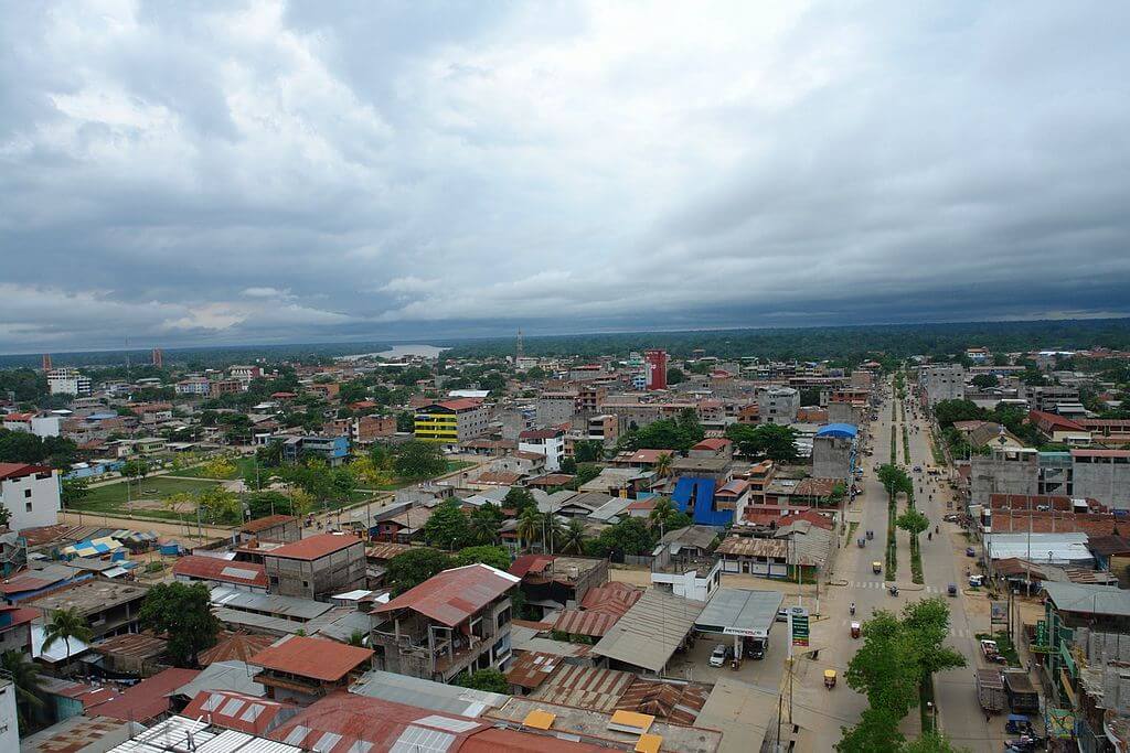
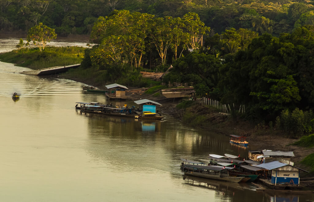


Puerto Maldonado: Peru's Frontier City at the Meeting of Two Amazon Rivers
Puerto Maldonado sits on a bluff at the confluence of the Tambopata and Madre de Dios rivers, in the lowland forest of southeastern Peru, 55 km (34 mi) west of the Bolivian border. It is the capital of the Madre de Dios region and Tambopata Province, and the largest city in Peru's southern Peruvian Amazon. Until the early 2010s, it could be reached only by river, by air, or by a rough road from the Andes. Today, a paved highway, a long bridge, and daily flights make it the main entry point to some of the best-protected rainforest in the Amazon lowlands, and also the center of one of the region's most damaging gold rushes.
History and Founding
Outsiders came late to this corner of the Amazon. The explorer Faustino Maldonado traveled down the Madre de Dios in 1861 and drowned in the rapids of the Mamoré River, and the city later took his name. The rubber baron Carlos Fitzcarrald saw the confluence as a strategic location, and he died in 1897 when his steamship sank in the river near the site. Juan Villalta, who had led an expedition down the Tambopata, officially founded Puerto Maldonado on July 10, 1902, as a station at the confluence. The department of Madre de Dios was created by law on December 26, 1912, with Puerto Maldonado as its capital.
The rubber boom collapsed within a few years of the city's founding, and Puerto Maldonado stayed small and isolated for decades. A rough road from the Andes, built in the mid-1960s, brought landless migrants from the highlands, and paving the Interoceanic Highway in the 2010s brought many more. The city has grown quickly ever since. Much of that history and its human cost is told in the article on the Madre de Dios River.
Setting and Climate
Puerto Maldonado lies at about 183 m (600 ft) above sea level, on flat to gently rolling ground in the Amazon Basin. The climate is hot and humid year-round. The average annual temperature is about 26 °C (79 °F), and August and September are usually the warmest months. Annual rainfall exceeds 2,000 mm (79 in), and the wet season runs roughly from October to April.
One local weather pattern surprises many visitors. A cold air mass called a friaje, or surazo, occasionally sweeps up from the south, and temperatures can drop to as low as 8 °C (46 °F) for several days. Those days are rare, but they are one reason a light jacket belongs in a rainforest packing list.
People and Population
The population has grown fast, and the figures depend on the unit. The 2025 census counted about 209,000 people in the whole Madre de Dios region, up from 161,204 in 2017. Tambopata Province, which contains the capital, grew from 127,511 to 170,763 over the same period. The district of Tambopata, which includes the city, had 92,705 residents in 2017. Most newcomers have come from the Andean departments of Cusco and Puno, drawn by land, work, and gold.
Indigenous peoples have lived along these rivers long before the city existed. The Ese Eja live in communities along the Tambopata and Madre de Dios, the Yine and Matsigenka live farther up the basin, and several lodges near the city are run in partnership with Ese Eja communities.
Economy
The economy runs on four activities: Brazil nuts, gold, tourism, and trade. The Brazil nut tree (Bertholletia excelsa) grows wild in the forest, and the region's harvesters gather the fallen fruits from about January to March. A CIFOR study found that the region's trees produced 3 to 4 million kg (6.6 to 8.8 million lb) of shelled nuts a year and that export earnings reached US$14 million in 2010. Between 15,000 and 20,000 people worked directly or indirectly in the industry. Concessions of about 200 to 1,200 hectares (490 to 2,970 acres) each cover roughly 1 million hectares (2.5 million acres) of standing forest, giving harvesters a financial reason to keep the trees alive, though mining and farming claims increasingly overlap them.
Gold has been the other mainstay, and it is far more destructive. Logging, boat building, and trade in food and supplies for the surrounding communities round out the city's economy, and visitors spend heavily at the lodges and tour agencies.
Roads, Bridge, and Airport
The Interoceanic Highway, which links Brazil's Atlantic side to Peru's Pacific coast, runs through the city. It crosses the Madre de Dios on the Continental Bridge, formerly the Billinghurst Bridge, a 723 m (2,372 ft) suspension span inaugurated on July 15, 2011. Before the bridge, vehicles crossed by ferry. Cusco is now about 463 km (288 mi) away, a trip of about ten hours by road, and Juliaca is 597 km (371 mi) away.
Most visitors arrive by air. Padre Aldamiz International Airport, at about 200 m (659 ft) above sea level, has a runway of roughly 3,500 m (11,480 ft), and its name honors a Basque missionary who served Indigenous communities in the 1950s. Flights from Cusco take under an hour, and flights from Lima take about an hour and 40 minutes. Rivers remain the main roads into the forest, and lodge guests usually transfer straight from the airport to a boat.
Gateway to the Forest
Three major protected areas lie within reach of the city. Tambopata National Reserve begins within a few hours' travel upriver, and it borders Bahuaja-Sonene National Park, which reaches the Bolivian border. Manú National Park lies farther to the northwest and is usually reached from Cusco, though Puerto Maldonado is also a base for trips on the Madre de Dios.
The best-known day trip is Lake Sandoval, an oxbow lake inside Tambopata National Reserve, reached by a short motorboat ride down the Madre de Dios followed by a walk through the forest. It is known for its giant otters (Pteronura brasiliensis), black caimans (Melanosuchus niger), and macaws. Back in town, the viewing tower at the Biodiversity Viewpoint rises about 47 m (154 ft) above the confluence of the two rivers; the Mercado Central sells Amazonian fruit and fish, and the riverfront promenade is a popular place to watch the sunset.
Gold, Protest, and Pressure
Gold mining shapes the city's politics as much as its economy. In March 2012, thousands of small-scale miners protested a government crackdown by blocking streets and the highway and trying to seize the airport and the new Continental Bridge. Three people died in a day of street fighting. The state has since returned many times to the mining zones outside the city, most notably in Operation Mercury in 2019, which cut deforestation in the La Pampa area by more than 90 percent.
The gains have not held everywhere. The Monitoring of the Andean Amazon Project (MAAP) recorded about 500 hectares (1,240 acres) of new mining clearing inside Tambopata National Reserve between mid-2025 and early 2026, more than in the peak years of 2016 and 2017, and Peru's Congress has repeatedly extended the temporary registry that shelters informal miners. For Puerto Maldonado, the question is whether the same highway and river that carry tourists and Brazil nuts to market can be managed so they don't also carry away the forest.
Few cities show so clearly how a single river junction can link a global biodiversity hotspot, a gold frontier, and a young, fast-growing community. The surrounding Amazon Rainforest is what draws travelers to Puerto Maldonado, and it is also what the city's economy depends on and puts at risk.