Anavilhanas Archipelago and National Park: Guardians of the Amazon
The Anavilhanas Archipelago, the world's second-largest riverine archipelago, is a stunning example of the natural forces that shape the Amazon landscape. Anavilhanas National Park is a refuge for a diverse range of plants and animals, making it a pivotal center of biodiversity and ecological importance.
Anavilhanas Archipelago
A Fluvial Wonderland
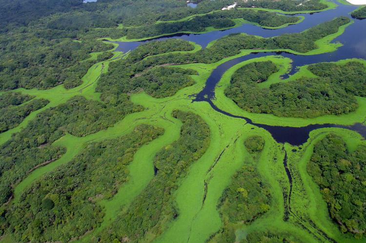
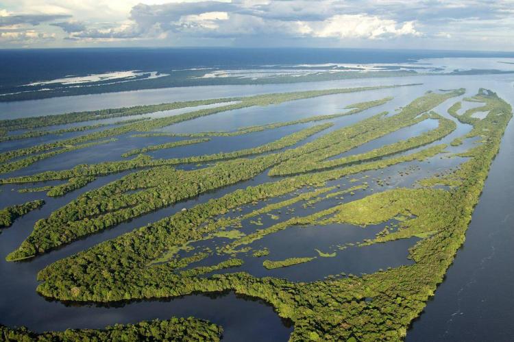
The Anavilhanas Archipelago, located within Anavilhanas National Park, is a testament to the dynamic forces of nature that shape the Amazon landscape. Comprising around 400 islands, 60 lakes, and numerous river channels, the archipelago is the world's second-largest fluvial archipelago, covering approximately 350,000 hectares (866,000 acres). Formed by the deposition of sediments and debris carried downstream from the Guyana Highlands by the Rio Branco, the archipelago is a mosaic of ever-changing habitats and ecosystems.
Geological Formation and Ecological Significance
The Anavilhanas Archipelago owes its existence to the intricate interplay of geological processes and hydrological dynamics. Over millennia, the accumulation of sediments and debris in the dark acidic waters of the Río Negro has given rise to a spectacular delta-like formation characterized by a labyrinth of islands, lakes, and river channels. This unique habitat supports a remarkable diversity of plant and animal life, including rare and endemic species found nowhere else in the world.
Seasonal Variability and Ecosystem Dynamics
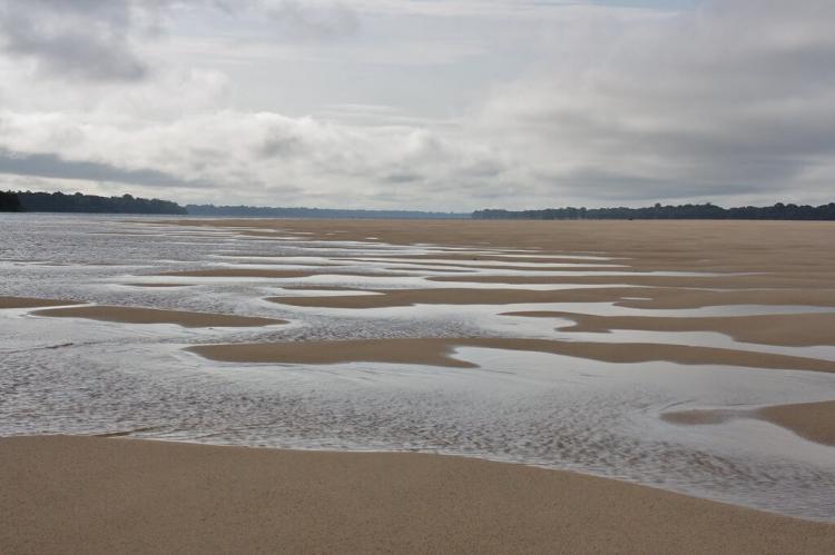
The islands of the Anavilhanas Archipelago undergo a constant transformation in response to the seasonal fluctuations of the Río Negro. With water levels varying by up to 10 meters (33 feet) between ebb and flood periods, the islands are in a continuous state of flux, undergoing sedimentation and erosion processes. This dynamic environment creates a mosaic of habitats that support a wide variety of flora and fauna, from lush rainforests to expansive wetlands.
Conservation Challenges and Management
Despite its ecological importance, the Anavilhanas Archipelago faces threats from deforestation, illegal fishing, and habitat destruction. Invasive species and climate change further exacerbate these challenges, putting pressure on the fragile ecosystems of the archipelago. Collaborative conservation efforts are underway to address these threats, focusing on habitat restoration, wildlife monitoring, and community engagement. By working together to protect and preserve the unique biodiversity of the Anavilhanas Archipelago, stakeholders can ensure that this fluvial wonderland remains a vibrant and resilient ecosystem for generations to come.
Anavilhanas National Park
Protecting the Heart of the Amazon
Anavilhanas National Park, situated in the Amazonas region of Brazil, stands as a bastion of biodiversity and ecological significance within the vast expanse of the Amazon Rainforest. Encompassing the Anavilhanas River archipelago in the Río Negro, the park was established in 1981 as an ecological station and later reclassified as a National Park in 2008. Today, it forms an integral part of the Central Amazon Conservation Complex, a UNESCO World Heritage Site, and serves as a vital sanctuary for the region's unique flora and fauna.
Geographical and Geological Features
Spanning approximately 350,470 hectares (866,000 acres), Anavilhanas National Park boasts diverse landscapes and ecosystems. The park's terrain varies from 50 to 150 meters (160 to 490 feet) above sea level, with forested islands and protected riverside forests interspersed throughout the archipelago. The park is administered by the Chico Mendes Institute for Biodiversity Conservation (ICMBio) and is bounded by the Rio Negro Left Bank Environmental Protection Area to the north and east.
Flora and Fauna
Anavilhanas National Park harbors an astonishing array of plant and animal species, many of which are endemic to the Amazon region. The park's rich biodiversity includes iconic species such as jaguars, giant otters, Amazon river dolphins, and giant armadillos. Endangered species like the margay and the Amazonian manatee find refuge within the park's protected habitats, highlighting its importance for conservation efforts in the Amazon basin.
Hydrological Dynamics and Seasonal Variability
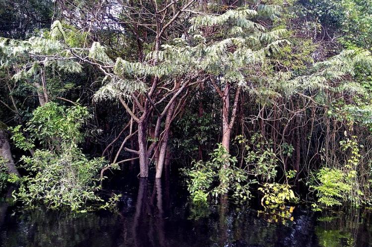
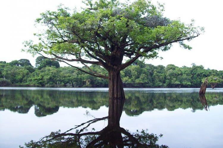
The hydrology of Anavilhanas National Park is characterized by the dynamic flow of the Río Negro and its seasonal fluctuations. During the wet season, typically from October to March, the river swells to nearly 30 kilometers (18 miles) in width, inundating the islands and surrounding forests with water levels fluctuating between 8 and 12 meters (26 and 40 feet). This seasonal flooding creates vital habitats known as igapós, blackwater-flooded forests that support a wide variety of aquatic and terrestrial life.
Conservation Challenges and Efforts
Despite its ecological significance, Anavilhanas National Park faces numerous conservation challenges, including deforestation, illegal logging, and wildlife poaching. Climate change and habitat degradation further exacerbate these threats, putting pressure on the park's fragile ecosystems and biodiversity. To address these challenges, concerted efforts are underway to strengthen park management, enhance law enforcement, and promote sustainable tourism practices. Community engagement and environmental education initiatives play a crucial role in raising awareness about the importance of conservation and fostering a sense of stewardship among local communities.
