
Rio de Janeiro: Urban Splendor Between Mountain and Sea
Rio de Janeiro, Brazil's capital until 1960, sits between granite peaks, the Atlantic Forest, and the Atlantic Ocean around Guanabara Bay, with about 6.2 million residents in the city and nearly 14 million in the metropolitan area. Its UNESCO-listed landscape, Tijuca National Park, Christ the Redeemer, beaches, and Carnival make it Brazil's best-known international destination.

Rio de Janeiro: The Marvelous City Between Mountain and Sea
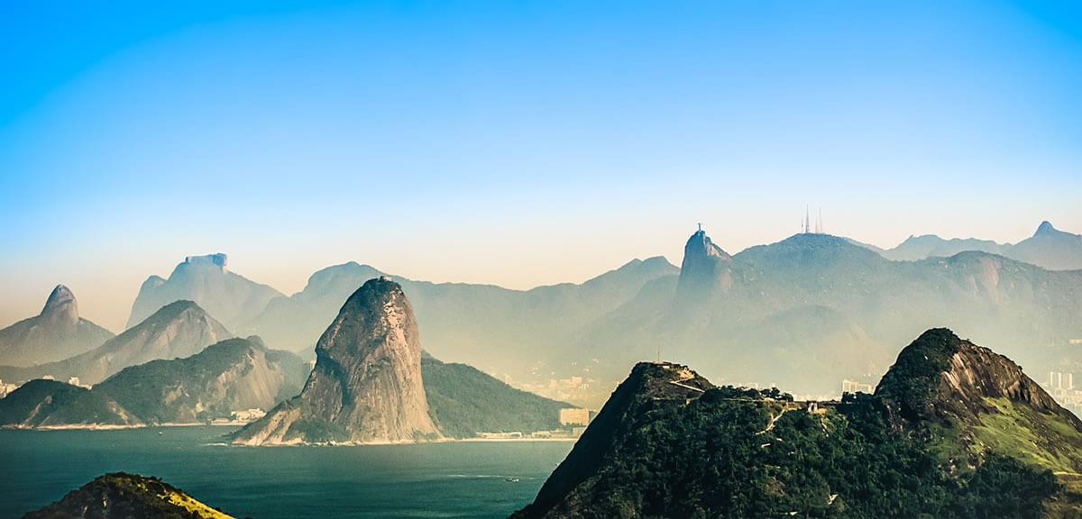
Rio de Janeiro is Brazil's best-known city and the capital of the state that shares its name. It lies on the Atlantic coast at the entrance to Guanabara Bay, where steep granite peaks, tropical forest, and long white beaches meet in a single city of 6.2 million people, with nearly 14 million in its metropolitan area. It was the capital of Portuguese Brazil, the Brazilian Empire, and the Republic until 1960, and it remains the country's second-largest city by population and its leading international destination. Its landscape of mountains, forest, and bay was inscribed by UNESCO in 2012, and symbols such as Christ the Redeemer, Sugarloaf Mountain, and Carnival are known around the world.
Geographic Setting and Climate
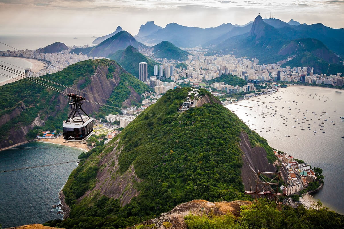
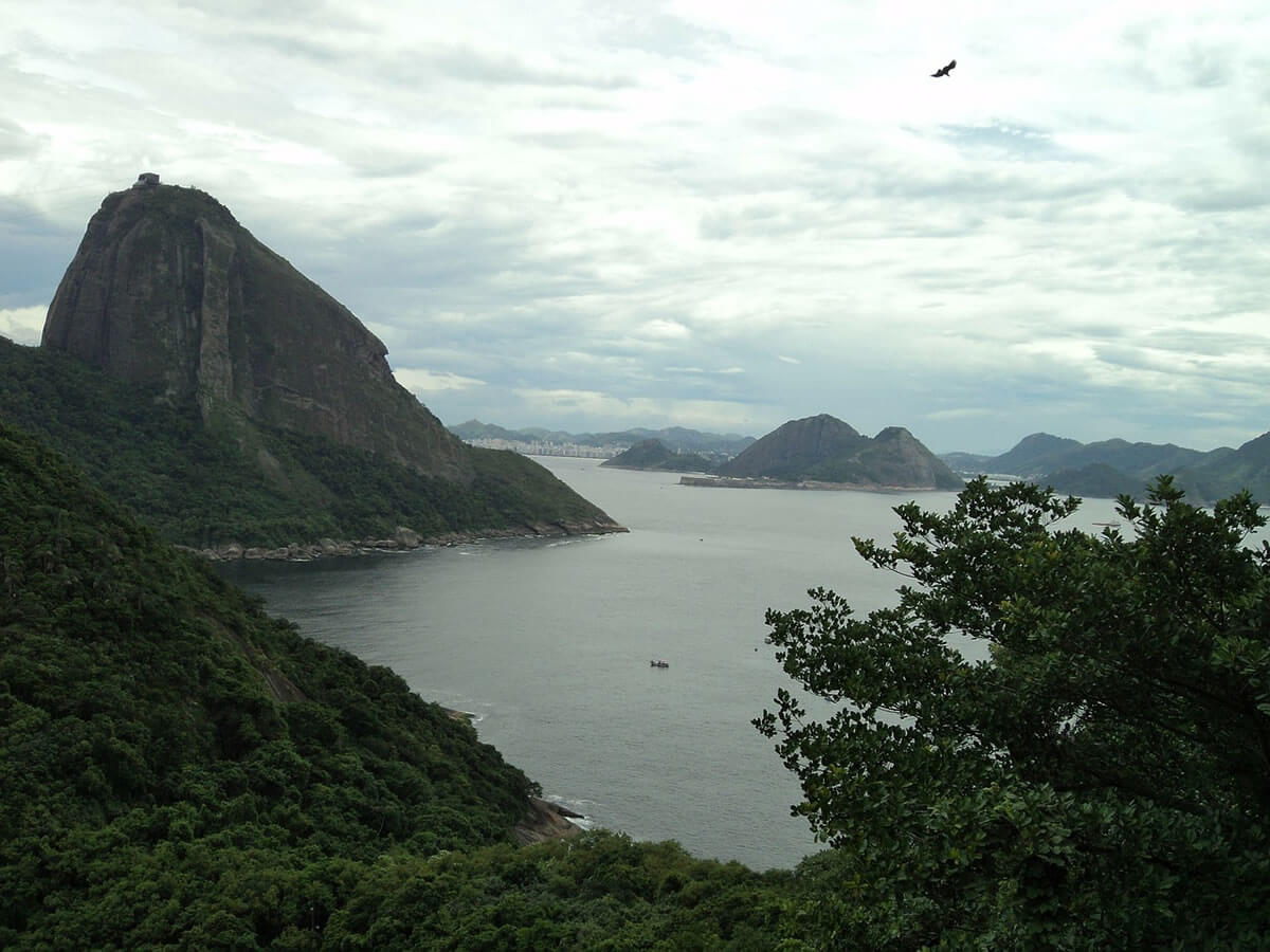
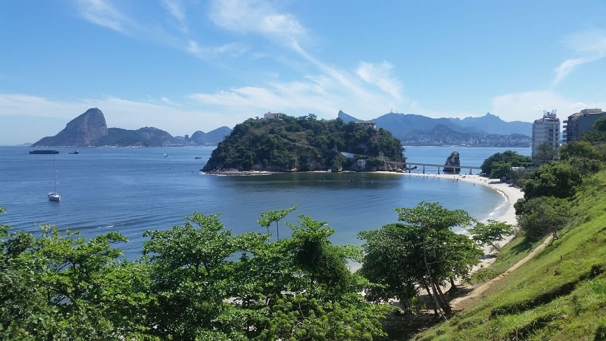
Rio sits on a narrow coastal plain squeezed between the sea and the mountains, and the city is arranged around the hills that divide it. The Centro (historic downtown) lies on Guanabara Bay, the Zona Sul (South Zone) holds the best-known beaches, the Zona Norte spreads inland across the lowlands, and the Zona Oeste (West Zone), including Barra da Tijuca, extends along the coast. Guanabara Bay covers about 412 km² (159 sq mi) and is entered between the headlands of Sugarloaf and Niterói. The municipality covers about 1,200 km² (463 sq mi), and its highest point, Pico da Pedra Branca, is 1,024 m (3,360 ft) in Pedra Branca State Park. Pico da Tijuca, at 1,021 m (3,350 ft), is the highest peak in Tijuca National Park, and the city's lowlands include the Rodrigo de Freitas Lagoon beside Ipanema and Leblon.
The climate is tropical, with wet and dry seasons. At the Saúde weather station, the mean annual temperature is about 25.3 °C (77.5 °F), and rainfall averages about 1,070 mm (42 in) a year, much of it falling in short, heavy storms between December and March. Winters, from June to August, are the driest and mildest months, while summers are hot and humid.
History from Indigenous Lands to Imperial Capital
Before Europeans arrived, Tupi-speaking peoples and other Indigenous groups lived along the shores of Guanabara Bay. In 1555, a French expedition under Nicolas Durand de Villegaignon occupied an island in the bay and founded the colony of France Antarctique, the first of several French attempts to settle Brazil's coast. The Portuguese expelled them and, on 1 March 1565, Estácio de Sá founded the city of São Sebastião do Rio de Janeiro. Rio grew slowly at first, but the discovery of gold and diamonds in Minas Gerais in the early eighteenth century made its port the colony's main outlet for wealth, and on 27 January 1763 the colonial administration moved here from Salvador.
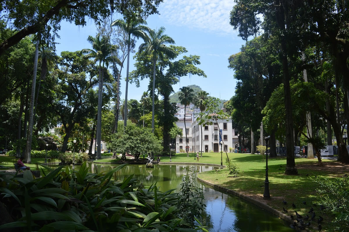
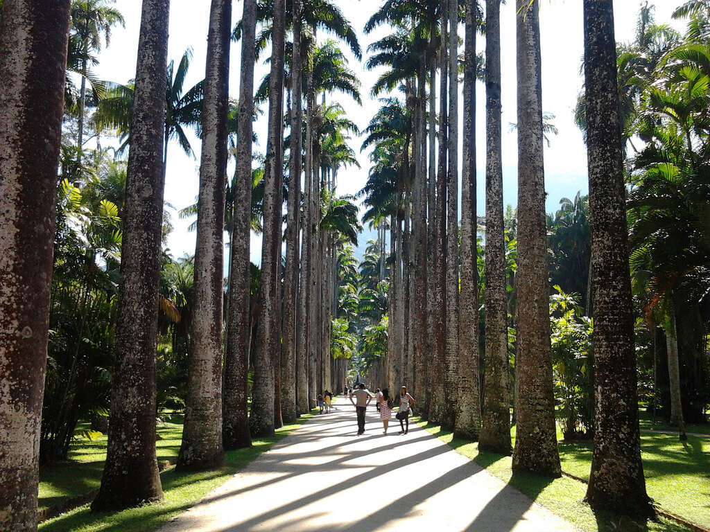
In 1808, the Portuguese royal court fled Napoleon's armies, arrived in Rio, and made it the seat of the Portuguese Empire, transforming the city. The Botanical Garden was founded that year, and ports, schools, libraries, and ministries followed. Rio then served as the capital of the Empire of Brazil from 1822, and of the Republic from 1889, until the government moved inland to Brasília on 21 April 1960.
The Historic Center and Colonial Architecture
The Centro preserves much of the city's colonial and imperial core. Near Cinelândia stand the Theatro Municipal, the opera house and one of the city's finest early twentieth-century buildings, and the National Library, which holds the largest collection in Latin America. Churches, convents and the former royal palaces recall the centuries when Rio governed Brazil, while the nearby port zone has been redeveloped with new museums such as the Museum of Tomorrow.
Christ the Redeemer and Corcovado
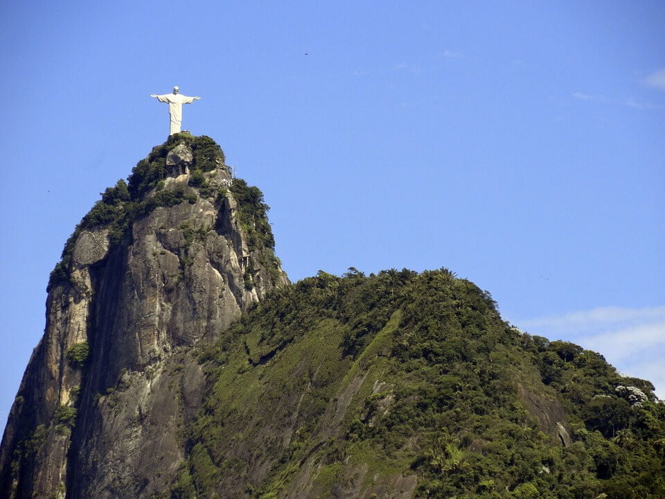
Christ the Redeemer stands on the summit of Corcovado, about 700 m (2,300 ft) above the city inside Tijuca National Park. The statue is 30 m (98 ft) tall, stands on an 8 m (26 ft) pedestal, and has a 28 m (92 ft) arm span. It weighs about 635 metric tons (700 short tons). Brazilian engineer Heitor da Silva Costa designed and directed its construction; French sculptor Paul Landowski created the figure; French engineer Albert Caquot designed the reinforced-concrete structure; and Romanian sculptor Gheorghe Leonida shaped the face. Built between 1922 and 1931 and covered in a soapstone skin, it was dedicated on 12 October 1931. It was named one of the New Seven Wonders of the World in 2007, and lightning strikes in 2008 and 2014 damaged parts of the statue, which has been restored several times.
Sugarloaf Mountain
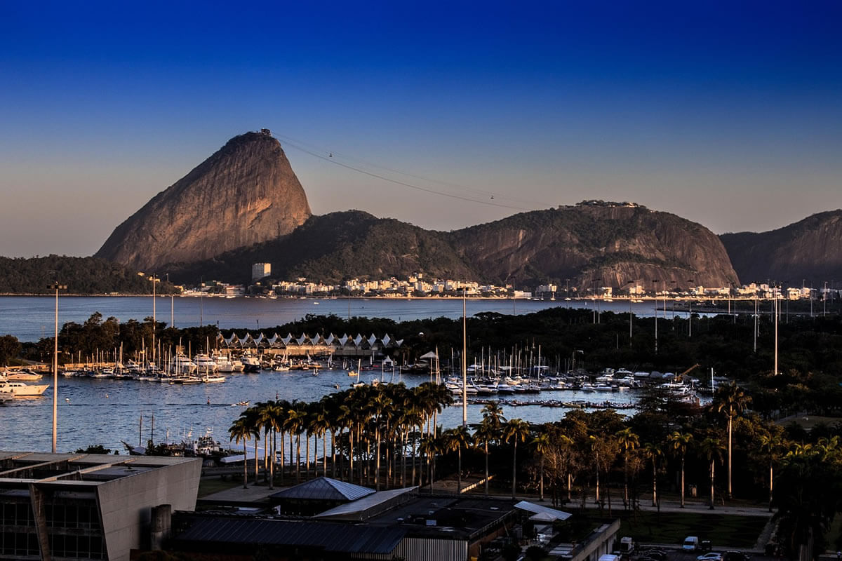
Sugarloaf Mountain, or Pão de Açúcar, a 396 m (1,299 ft) granite dome at the mouth of Guanabara Bay, is the city's other great landmark. It is a monolith of granite and quartz, one of the rounded rock domes called bornhardts, and its name comes from the conical clay molds used to ship refined sugar in colonial times. A cable car, opened in 1912 as Brazil's first, climbs in two stages: first to the 220 m (722 ft) hill of Urca, then to the summit, for a total distance of about 1,400 m (4,600 ft). The mountain is also a rock-climbing destination, with more than 270 routes on Sugarloaf and the neighboring hills.
Tijuca National Park and the Atlantic Forest
Established in 1961, Tijuca National Park protects about 3,950 ha (39.5 km², or 15 sq mi) of rainforest in the middle of the city and is often described as one of the world's largest urban forests. See Tijuca National Park for a fuller account. The forest was largely cleared for coffee plantations in the early nineteenth century, causing erosion and threatening the city's water supply; from the mid-nineteenth century, the government replanted it under Major Manuel Gomes Archer. Today it is part of the Atlantic Forest, and some of its wildlife has been deliberately reintroduced. In 1970, the primatologist Adelmar Coimbra Filho released 46 Ariel toucans (Ramphastos ariel) into the park after the species had disappeared there, and the birds now spread the seeds of native trees such as the jussara palm (Euterpe edulis), while brown howler monkeys (Alouatta guariba) and red-rumped agoutis have also been reintroduced. UNESCO World Heritage: Carioca Landscapes
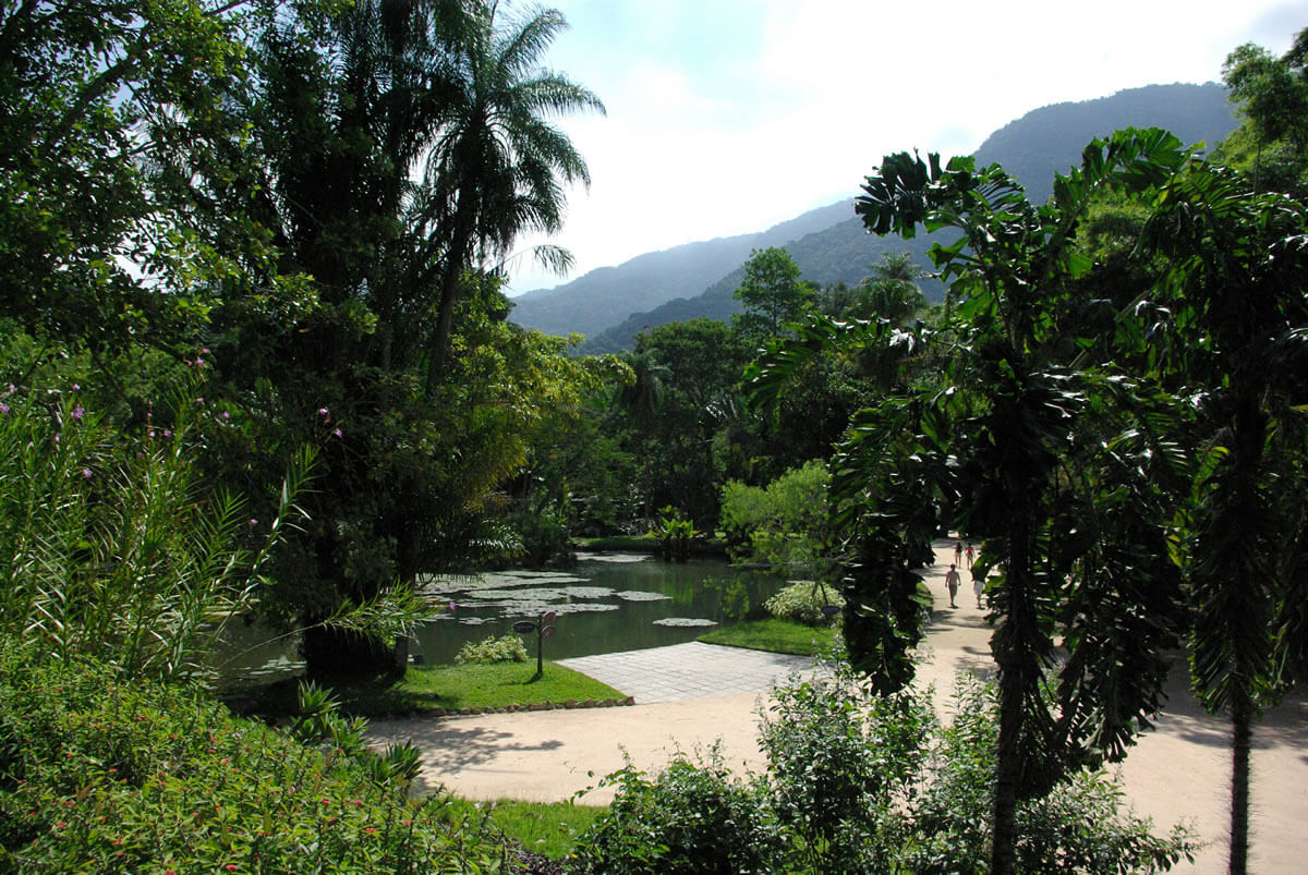
In 2012, UNESCO inscribed "Rio de Janeiro: Carioca Landscapes between the Mountain and the Sea" on the World Heritage List, under criteria (v) and (vi). The property covers 7,248.78 ha (72.5 km², or 28 sq mi) and includes Tijuca National Park, the Botanical Garden, Corcovado, Sugarloaf, Flamengo Park and the Copacabana waterfront, and it recognizes how the city's people have shaped and been shaped by this setting. Landscape architect Roberto Burle Marx designed Flamengo Park and the black-and-white, wave-patterned promenade along Copacabana, about 4 km (2.5 mi) long and completed in 1970. His former home and plant collection at Barra de Guaratiba were added to the World Heritage List in 2021, and the estate holds more than 3,500 plant species on 36.5 ha (90 acres). It is described in Sítio Roberto Burle Marx: Tropical Modernism in Rio de Janeiro.
The Beaches and Beach Culture
Rio's beaches are as much a part of daily life as they are a tourist attraction. Copacabana and Ipanema, along with Leblon, Leme, and Arpoador, line the Zona Sul, while Barra da Tijuca and São Conrado stretch west. Cariocas, as residents are called, use them to play football and volleyball, exercise, meet friends, and watch the sunset from Arpoador; the city's open-air, informal social life is tied to the shoreline.
Carnival, Samba and Culture
Carnival is Rio's greatest festival. The samba schools compete in elaborate parades in the Sambódromo, a purpose-built avenue lined with grandstands, while street parties called blocos fill neighborhoods across the city. For the 2026 Carnival, the city expected about 8 million revelers and R$ 5.9 billion in economic activity, including 459 street parades and about 6 million people in the street blocos, with official programming running from 17 January to 22 February. Samba and bossa nova, which emerged here, remain central to Rio's musical identity, and the city also hosts museums, theaters and libraries of national importance.
Economy and Major Events
Rio has Brazil's second-largest municipal economy. The metropolitan area produced about R$ 831 billion (US$154 billion) in 2023, and the city is home to Petrobras, Vale, and Grupo Globo, Latin America's largest media group. Tourism, oil and gas, services, and media lead the economy. The city has hosted the finals of the 1950 and 2014 FIFA World Cups at the Maracanã Stadium, which once held nearly 200,000 spectators; the 2007 Pan American Games; the 2016 Summer Olympics and Paralympics, the first held in South America; and the 2024 G20 summit.
Transport
Two airports serve the city: Rio de Janeiro/Galeão International (GIG), about 20 km (12 mi) from downtown and the main international gateway, and Santos Dumont (SDU), beside the Centro, for domestic flights. The Metrô Rio system, opened in 1979, has about 58 km (36 mi) of track and 41 stations and carried roughly 498,000 passengers a day in 2024. Line 4, opened in 2016 for the Olympics, extended service to Barra da Tijuca. Bus rapid transit corridors such as TransCarioca and TransOeste connect with the metro, and the Rio-Niterói Bridge links the city with the eastern shore of Guanabara Bay.
Population and Demographics
The 2022 census counted 6,211,223 people in the municipality, and the national statistics institute estimates about 6.7 million in 2026, with roughly 13.9 million in the metropolitan area. The density is about 5,200 people per km² (13,400 per sq mi). In the census, 45.4 percent of residents identified as white, 38.7 percent as pardo (mixed-race), 15.6 percent as Black, and about 0.3 percent as Asian or Indigenous. The city's population also includes large descendant communities of Portuguese, Italian, Spanish, German, Lebanese, and Japanese immigrants. Roman Catholicism is the largest religion, at 51 percent in the 2010 census, followed by Protestant churches at 23 percent and Spiritism at about 6 percent. Candomblé and Umbanda are also present.
Favelas, Safety and Pollution
Rio faces some of Brazil's sharpest urban inequality. About 813 favelas, informal hillside neighborhoods, house more than 1.3 million people, roughly a fifth of the population, and many lack full public services. Violence linked to organized crime and to police operations remains one of the city's most serious problems, even though murder rates have fallen from their peaks.
Untreated sewage and industrial waste have polluted Guanabara Bay for decades, and the extensive mangrove forests that once ringed it have been largely destroyed. The concessionaire Águas do Rio reported in 2026 that its work prevents about 134 million liters (35 million gallons) of untreated sewage a day from reaching the bay. However, that figure is company-reported, and a large historical backlog of sewer repair remains. The Rodrigo de Freitas Lagoon has had its own decontamination program since 2008.
Visiting Rio de Janeiro
Rio received more than 1.7 million international visitors in the first ten months of 2025, a record according to Embratur. The best time to visit for hiking and sightseeing is the cooler, drier winter, from May to September, while the summer months bring the liveliest beaches and, in February or March, Carnival, along with heat and heavy rain. Most travelers allow at least four to five days to see the main sights, and a visit to Christ the Redeemer or Sugarloaf is best planned for a clear morning.
Conclusion
Rio de Janeiro combines extraordinary scenery with the strengths and strains of a great Latin American metropolis. Its forests, bay, and beaches earned it World Heritage status, but its future depends on how well it manages inequality, safety, and pollution in Guanabara Bay.