The Amapá Biodiversity Corridor: Safeguarding the Amazon's Ecological Treasures
Nestled in northern Brazil, the Amapá Biodiversity Corridor is a testament to the country's commitment to protecting its invaluable natural heritage. This expansive ecological corridor integrates a network of protected areas and indigenous lands to safeguard the region's exceptional biodiversity.
 via Wikimedia Commons")
 - via Wikimedia Commons")
 https://www.flickr.com/photos/137698907@N06/31680527043")
 - via Wikimedia Commons")


The Amapá Biodiversity Corridor: Safeguarding the Amazon's Ecological Treasures
Nestled in northern Brazil, the Amapá Biodiversity Corridor is a testament to the country's commitment to protecting its invaluable natural heritage. This expansive ecological corridor, spanning over 10 million hectares (24 million acres) and encompassing 72% of the state of Amapá, is a true conservation success story. It integrates a network of protected areas and indigenous lands to safeguard the region's exceptional biodiversity.
Geographical Scope and Ecological Significance
The Amapá Biodiversity Corridor extends across the state of Amapá, linking a diverse array of protected areas, including national forests, state forests, national parks, and indigenous territories. This vast and interconnected landscape is critical to the Guiana Shield, one of the world's most biodiverse regions and a globally significant hotspot for plant and animal life.
Biodiversity and Endemic Species
The protected areas within the Amapá Biodiversity Corridor are home to an extraordinary array of plant and animal species, with over 180 mammal species documented, including iconic Amazon residents such as the jaguar, giant otter, red-handed howler monkey, giant anteater, and Amazonian manatee. The region's exceptional levels of endemism, particularly among its plant life, underscore the global significance of this ecological treasure trove.
Protected Areas and Indigenous Territories
The Amapá Biodiversity Corridor encompasses a diverse mosaic of protected areas, including the Amapá National Forest, the Amapá State Forest, the Cabo Orange National Park, and the Tumucumaque Mountains National Park, the world's largest tropical forest national park. Additionally, the corridor includes several indigenous territories, further highlighting the integral role that local communities play in the stewardship of this remarkable landscape.
Ecosystem Dynamics and Services
The Amapá Biodiversity Corridor is a vital component of the Amazon basin's intricate network of ecosystems, providing critical ecosystem services such as carbon sequestration, water regulation, and biodiversity maintenance. The region's diverse habitats, ranging from tropical rainforests and mangroves to savannas and floodplains, work in concert to sustain the delicate balance of this ecological treasure trove.
Threats and Conservation Challenges
Despite its protected status, the Amapá Biodiversity Corridor faces various threats, including illegal logging, mining, and the encroachment of agricultural activities. Climate change impacts, such as altered precipitation patterns and rising temperatures, also pose significant challenges to the long-term viability of the region's ecosystems.
Conservation Initiatives and Collaborative Efforts
In response to these threats, the Brazilian government, conservation organizations, and local communities have implemented a range of initiatives to safeguard the Amapá Biodiversity Corridor. These efforts include strengthening law enforcement, promoting sustainable land use practices, and fostering collaborative management approaches that engage stakeholders at all levels.
Ecotourism and Environmental Education
The Amapá Biodiversity Corridor offers immense potential for ecotourism and environmental education, allowing visitors to immerse themselves in the region's extraordinary natural and cultural heritage. From guided treks through the tropical forests to educational programs highlighting the importance of biodiversity conservation, these initiatives can play a vital role in garnering greater support for protecting this remarkable ecological treasure.
Conclusion
The Amapá Biodiversity Corridor is a shining example of Brazil's commitment to preserving its natural wealth. It is a vast and interconnected landscape that safeguards the invaluable biodiversity of the Amazon basin. As we protect this remarkable ecoregion, we must recognize its global significance and support the collaborative efforts that will ensure its long-term sustainability for the benefit of all who cherish the wonders of the Amazon.
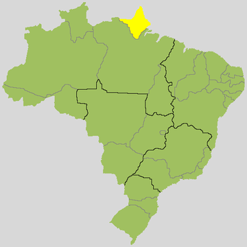
Location map for Amapá state, Brazil.