The Majestic Cumbres de Monterrey National Park and Biosphere Reserve
Cumbres de Monterrey National Park in northeastern Mexico is a UNESCO Biosphere Reserve, preserving native flora and fauna from urbanization. It has diverse ecosystems, including mountain peaks, canyons, waterfalls, and forests, and is part of the American Cordillera range.
The Majestic Cumbres de Monterrey National Park and Biosphere Reserve
Nestled within the rugged Sierra Madre Oriental mountain range in northeastern Mexico, the Cumbres de Monterrey National Park and Biosphere Reserve stands as a testament to the natural wonders of this remarkable region. Established in 1939 to safeguard the native flora and fauna from the encroaching urbanization of the city of Monterrey, this expansive protected area has since been recognized as a UNESCO Biosphere Reserve, highlighting its global significance as a biodiversity hotspot.
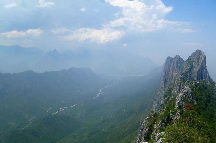
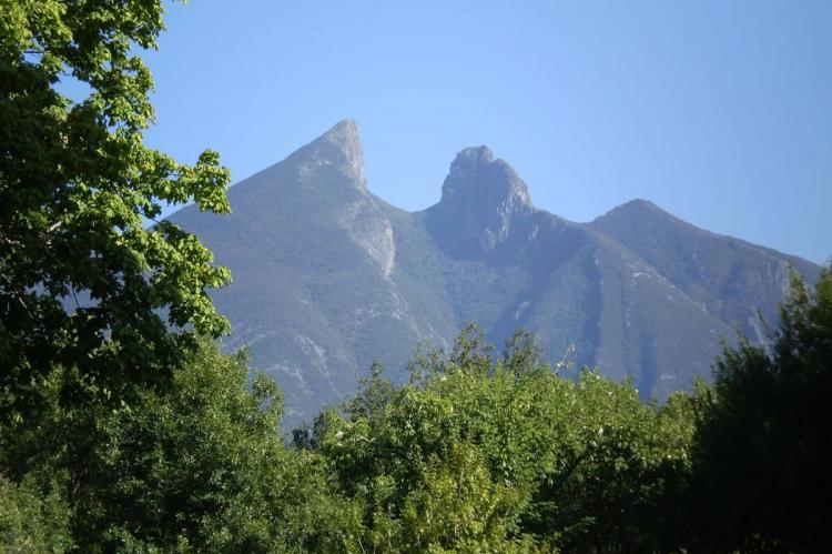
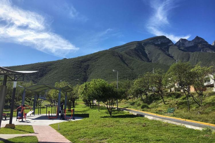
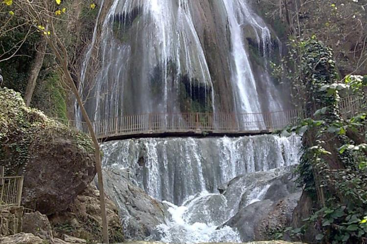
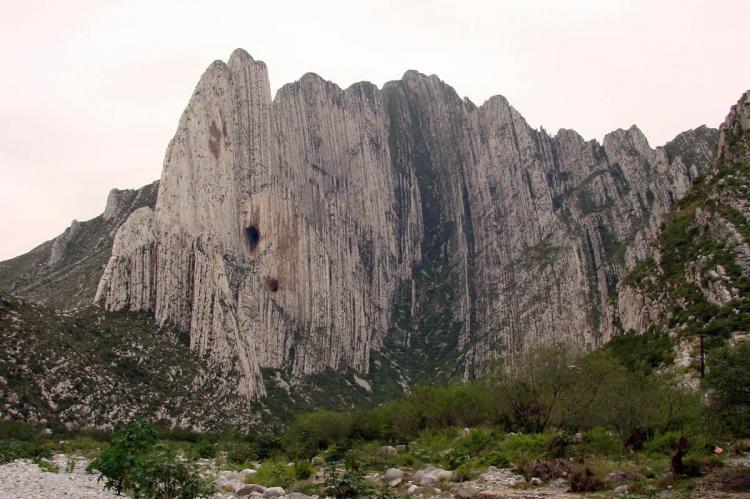
Spanning over 1,770 square kilometers (680 square miles), the Cumbres de Monterrey National Park and Biosphere Reserve is a mosaic of diverse ecosystems, ranging from towering mountain peaks and deep canyons to cascading waterfalls and lush, temperate forests. This rugged landscape is part of the larger American Cordillera, a continuous chain of mountain ranges that forms the western backbone of the Americas, stretching from North America to Antarctica.
Geological Wonders and Biodiversity
The Cumbres de Monterrey National Park and Biosphere Reserve is a geological masterpiece, with steep mountain peaks reaching up to 2,260 meters (7,410 feet) above sea level. These towering summits, such as Pinar, La Ventana, La Antena, M Este, and Copete de las Águilas, are a testament to the region's dynamic tectonic history and the relentless forces of erosion that have shaped the landscape over millions of years.
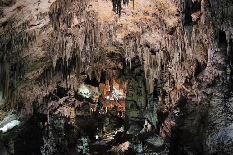
Beneath the surface, the park's intricate network of underground caves, including the renowned Grutas de García, offer a glimpse into the area's marine past, with the cave walls adorned with fossilized remnants of ancient oceanic life. These subterranean wonders, hidden for millions of years, were first discovered in 1843, sparking a sense of wonder and exploration that continues to captivate visitors today.
The diverse ecosystems found within the Cumbres de Monterrey National Park and Biosphere Reserve support a remarkable array of flora and fauna. The park's coniferous forests, dominated by oak and pine species, provide a vital habitat for a wide range of endemic and threatened species, including the endangered Maroon-fronted Parrot, a nearby El Taray reserve resident.
The park's varied terrain and microclimates have also given rise to a rich tapestry of plant life, with numerous species of Agave, Dasylirion, and Rhus thriving in the rugged landscape. The towering spruce, fir, Douglas fir, and oak trees that comprise the park's forests are a testament to the region's ecological resilience and adaptability.
Preserving the Past and the Future
The Cumbres de Monterrey National Park and Biosphere Reserve is not only a haven for a diverse array of plant and animal life but also holds a deep cultural significance. The park's Cañón de la Huasteca, the most famous canyon in the protected area, is marked by many prehistoric glyphs and rock art created thousands of years ago by the region's ancient inhabitants.
As a UNESCO Biosphere Reserve, the Cumbres de Monterrey National Park has been recognized for its exceptional biodiversity and its role in supporting the traditional livelihoods and land-use practices of the local communities that reside within its boundaries. Through careful zoning and management, the park aims to balance the needs of conservation with the region's sustainable development, ensuring that the natural and cultural heritage of the Cumbres de Monterrey is preserved for generations to come.
The Significance of Cumbres de Monterrey
The Cumbres de Monterrey National Park and Biosphere Reserve is a true gem of northeastern Mexico, a testament to the region's geological, ecological, and cultural richness. From its towering mountain peaks and cascading waterfalls to its diverse array of flora and fauna, this protected area offers a glimpse into the remarkable natural heritage of the Sierra Madre Oriental.
As a UNESCO Biosphere Reserve, the Cumbres de Monterrey National Park is crucial in conserving the region's biodiversity, serving as a vital refuge for numerous threatened and endangered species. Moreover, the park's cultural significance, as evidenced by the ancient rock art and the traditional land-use practices of its local inhabitants, underscores the deep connection between the people and the land that has endured for millennia.
In an era of rapid environmental change and growing threats to the world's natural wonders, the Cumbres de Monterrey National Park and Biosphere Reserve stands as a shining example of what can be achieved through dedicated conservation efforts and careful stewardship of our planet's most precious resources. As we look to the future, the preservation and continued study of this remarkable protected area will be crucial in ensuring that the natural and cultural legacy of the Sierra Madre Oriental is safeguarded for generations to come.
