
Río Bravo del Norte: The Great River That Unites and Divides Two Nations
Known as the Rio Grande in the United States, the Río Bravo del Norte carves a 3,051-kilometer (1,896-mile) path from Colorado's San Juan Mountains to the Gulf of Mexico. This article follows its Mexican course and watershed, from the Río Conchos to the maquiladora cities of the border, as a river that has shaped Mexico's northern frontier for centuries.
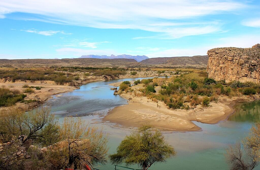
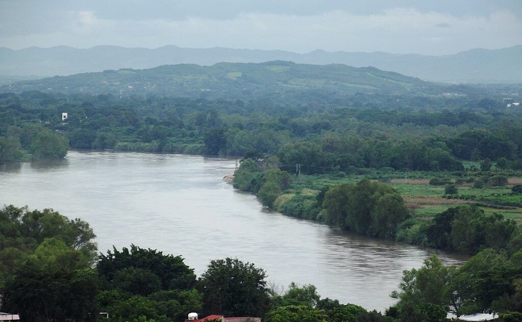
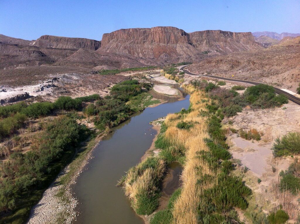
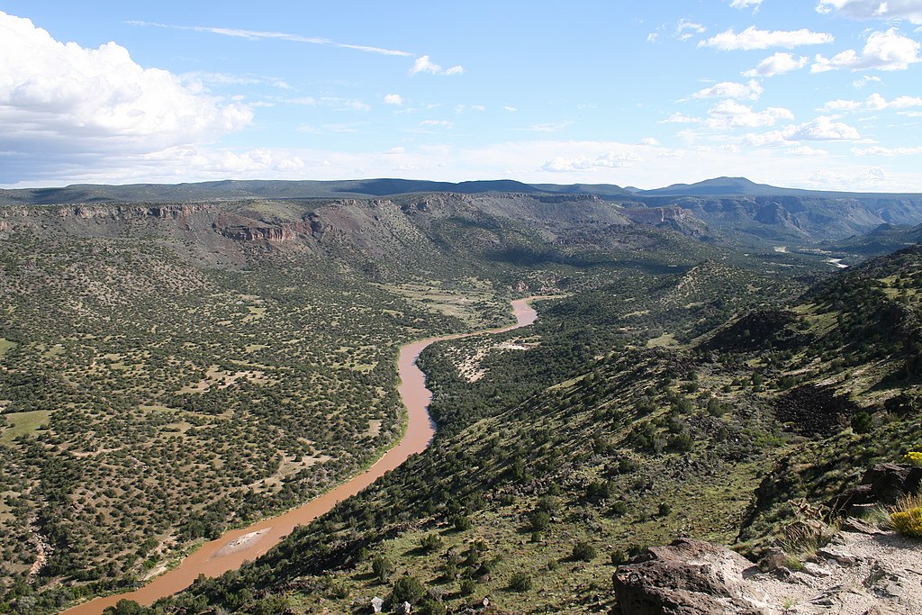

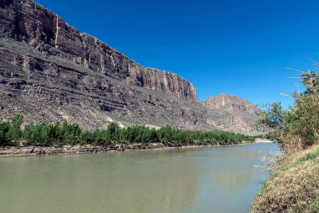
Río Bravo del Norte: Mexico's Great Northern River
In the high peaks of Colorado's San Juan Mountains, where crystalline streams gather force from melting snowfields, one of North America's most culturally and politically significant waterways begins. Known as the Rio Grande in the United States and Río Bravo del Norte in Mexico, this continental river spans 3,051 km (1,896 mi) as it carves its path from alpine tundra to tropical delta, ultimately serving as the international boundary between the two nations for over 2,000 km (1,254 mi) of its journey.
For Mexico, the Río Bravo represents far more than a geographic boundary—it embodies centuries of cultural identity, economic development, and environmental adaptation in some of North America's most challenging landscapes. This article follows the river's course and watershed on the Mexican side, from the sprawling industrial metropolis of Ciudad Juárez to the fertile agricultural valleys of Tamaulipas, a story of resilience, innovation, and the complex relationship between human ambition and natural limits in the arid borderlands.
The Mexican Watershed: Río Bravo's Southern Domain
While the Río Bravo originates in United States territory, its character and ultimate destiny are profoundly shaped by Mexican landscapes and tributaries. The river's most significant tributary, the Río Conchos, flows entirely within Mexico, originating in the Sierra Madre Occidental of Chihuahua and contributing more water to the main stem than any tributary from the north. This 560-km (350-mi) Mexican river drains over 67,000 sq km (26,000 sq mi) of the Chihuahuan Desert, making it the hydrological lifeline that sustains the Río Bravo through its most arid reaches.
The Conchos River system illustrates the remarkable adaptation of Mexican communities to desert hydrology. Towns like Ojinaga, Chihuahua, have thrived for centuries at the confluence of these rivers, developing sophisticated irrigation systems that support agriculture in regions receiving less than 250 mm (10 in) of annual rainfall. These settlements represent continuities in Indigenous technological knowledge, Spanish colonial engineering, and modern hydraulic management spanning over 400 years of continuous occupation.
Beyond the Conchos, numerous smaller Mexican tributaries contribute to the Río Bravo's flow, including the Río San Rodrigo, Río Escondido, and Río Salado. These waterways drain the complex geography of northern Mexico, from the pine-oak forests of the Sierra Madre Oriental to the creosote flats of the Chihuahuan Desert. Each contributes not merely water, but sediments, nutrients, and biological diversity that shape the river's ecological character throughout its international reach.
The Chihuahuan Desert: Mexico's Vast Northern Frontier
The Río Bravo's journey through Mexico traverses the heart of the Chihuahuan Desert, North America's largest hot desert, which spans more than 500,000 sq km (193,000 sq mi) of northern Mexico and the southwestern United States. This vast ecoregion, characterized by dramatic mountain ranges separated by broad basins, creates the environmental context within which Mexican communities along the Río Bravo have developed their distinctive cultures and economies.
The desert's remarkable biodiversity includes over 3,000 plant species, many of which are endemic to the region, resulting in landscapes of extraordinary beauty and ecological complexity. Iconic species such as the lechuguilla agave (Agave lechuguilla), ocotillo (Fouquieria splendens), and various barrel cacti (Ferocactus spp.) dominate vast areas, while riparian corridors along the Río Bravo support islands of mesquite (Prosopis spp.) and Mexican buckeye (Ungnadia speciosa) that provide critical habitat for wildlife. Among the animals sustained by these riparian corridors, the collared peccary or javelina (Pecari tajacu) and the American beaver (Castor canadensis), whose dam-building activity shapes small stretches of tributary habitat, are among the most characteristic; the river also once supported far larger populations of the Rio Grande silvery minnow (Hybognathus amarus), a species whose range has collapsed by over 95% across the entire river system and which now survives mainly in isolated stretches upstream, a stark illustration of how thoroughly damming and water diversion have altered the river throughout its length.
Mexican settlements throughout the Chihuahuan Desert have developed remarkable strategies for thriving in this water-limited environment. Traditional architecture featuring thick adobe walls, courtyards designed to capture and channel scarce rainfall, and underground storage systems reflects centuries of accumulated knowledge about living sustainably in arid lands.
Mexican Cities of the Río Bravo: Urban Oases and Industrial Powerhouses
The Mexican side of the Río Bravo corridor supports some of the country's most dynamic urban centers, each representing different aspects of Mexico's economic and cultural evolution. Ciudad Juárez, Chihuahua, is the largest Mexican city along the river, with a metropolitan population of more than 1.5 million. This sprawling industrial center has emerged as one of North America's most significant manufacturing hubs, hosting hundreds of maquiladora factories that produce a wide range of products, including automotive components and consumer electronics, for global markets.
Ciudad Juárez's relationship with the Río Bravo illustrates both the opportunities and challenges of rapid urban growth in water-scarce environments. The city's location at the confluence of the Río Bravo and Río Conchos provided the hydrological foundation for settlement, but modern industrial and residential demands far exceed natural water supplies. Sophisticated groundwater management systems, water recycling facilities, and cross-border cooperation with El Paso, Texas, represent innovative approaches to urban sustainability in desert environments.
Nuevo Laredo, Tamaulipas, serves as Mexico's busiest inland port and a crucial link in North American trade networks. Located along the Río Bravo opposite Laredo, Texas, this city of over 400,000 inhabitants processes billions of dollars' worth of commercial goods annually, making it a cornerstone of Mexico's export economy. The city's growth reflects the Río Bravo's role not as a barrier, but as an axis of economic integration between Mexico and its northern neighbors.
Reynosa and Matamoros, both in Tamaulipas, represent the Río Bravo's lower reach, where the river transitions from a desert waterway to a subtropical delta. These cities, with combined populations exceeding 1.2 million, anchor Mexico's Gulf Coast economy while maintaining deep cultural connections to the river's ecological rhythms. Traditional festivals, cuisine, and agricultural practices in these communities reflect centuries of adaptation to the river's seasonal flooding patterns and the rich biodiversity of its lower watershed.
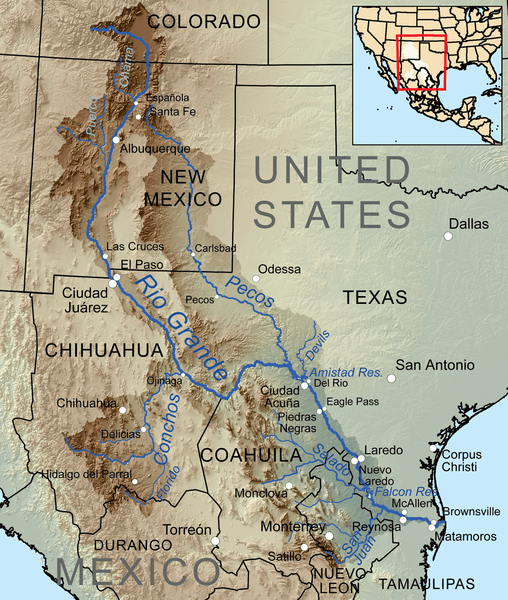
Map depicting the Rio Grande/Río Bravo del Norte and its tributaries within its drainage basin.
Agricultural Landscapes: Mexico's Río Bravo Valleys
The fertile valleys of the Mexican Río Bravo support some of Mexico's most productive agricultural regions, creating green corridors through otherwise arid landscapes. The Juárez Valley in Chihuahua, irrigated by waters from both the Río Bravo and Río Conchos, produces cotton, alfalfa, pecans, and chilies that supply both domestic and international markets. This 50,000-hectare (123,000-acre) agricultural zone demonstrates the transformation possible when desert soils receive reliable water supplies.
Mexican agricultural communities along the Río Bravo have developed distinctive crop varieties adapted to local conditions, and genetic material has long flowed freely across the border in both directions; many chile varieties now closely associated with the American Southwest originate from Mexican seed stocks developed over centuries of selection. Similarly, southwestern cotton varieties, pecans, and other crops reflect the binational agricultural heritage of the Río Bravo watershed.
The Tamaulipas portion of the Río Bravo valley supports Mexico's northeasternmost agricultural region, where irrigation systems dating to the colonial period continue to channel river water across thousands of hectares. This region produces citrus fruits, sugarcane, corn, and sorghum, benefiting from its subtropical climate and fertile alluvial soils deposited over centuries by river flooding. However, like agricultural systems throughout the watershed, these operations face mounting challenges from water scarcity, climate variability, and competition from urban and industrial users.
Indigenous Heritage and Colonial Legacies
Long before European contact, numerous Indigenous groups inhabited the landscapes along the Río Bravo, developing sophisticated knowledge systems to survive and thrive in the region's challenging environments. The Jumano people, who occupied much of the Río Conchos and middle Río Bravo region, maintained extensive trade networks that connected the Gulf of Mexico with the American Southwest, using the river system as a transportation corridor and source of resources.
The Coahuiltecan peoples of the lower Río Bravo developed remarkable adaptations to the river's variable flows and seasonal resources. Their detailed knowledge of edible plants, seasonal hunting patterns, and water sources enabled them to sustain their populations in landscapes that later proved challenging for European settlers. Archaeological evidence suggests that these communities managed controlled burning regimes that maintained grasslands and supported wildlife populations along river corridors.
Spanish colonization, beginning in the 16th century, introduced new technologies, crops, and land use patterns that fundamentally transformed the Río Bravo watershed. The establishment of missions, presidios, and civilian settlements created nodes of intensive agriculture and European-style animal husbandry that required substantial water resources. The acequia irrigation systems introduced during this period, based on Moorish engineering principles refined over centuries in Iberia, enabled agricultural expansion into previously uncultivated areas.
Mexican independence in 1821 and the subsequent Texas Revolution, Mexican-American War, and Treaty of Guadalupe Hidalgo (1848) established the Río Bravo as an international boundary, fundamentally altering its political and economic significance. For Mexico, the loss of vast territories north of the river represented a profound geographical and cultural trauma, while the establishment of the river boundary created new challenges and opportunities for border communities.
The Maquiladora Revolution and Industrial Transformation
Beginning in the 1960s, Mexico's Border Industrialization Program transformed the Río Bravo corridor into one of North America's most important manufacturing regions. The maquiladora system, which allows foreign companies to import materials duty-free for assembly in Mexico before export, has created hundreds of thousands of jobs in cities such as Ciudad Juárez, Nuevo Laredo, Reynosa, and Matamoros.
This industrial transformation dramatically altered water demand patterns along the Mexican side of the Río Bravo. Manufacturing processes requiring substantial water inputs, combined with rapidly growing urban populations attracted by employment opportunities, have strained water supplies throughout the region. Mexican authorities developed innovative water management strategies, including groundwater mining, water recycling systems, and negotiations for increased allocations from the Río Bravo's flow. The environmental consequences of rapid industrialization have created complex challenges as well: air and water quality concerns, hazardous waste management issues, and pressure on natural ecosystems represent real costs of economic development in a water-scarce environment, though newer generations of maquiladora operations increasingly emphasize environmental stewardship and resource efficiency.
Binational Water Management: The Mexican Perspective
Mexico's relationship with Río Bravo waters operates within complex legal and diplomatic frameworks established by treaties with the United States. The 1944 Water Treaty, which governs the allocation of water from the Río Bravo and the Colorado River, reflects negotiations conducted during a period of above-average rainfall and with more modest development pressures than exist today. From the Mexican perspective, the treaty's provisions create both opportunities and constraints for national development: Mexico receives guaranteed allocations of Río Bravo waters but must also deliver specific quantities of water to the United States from Mexican tributaries, particularly the Río Conchos, and during drought periods these obligations can strain Mexican water supplies and create tensions between international commitments and domestic needs.
The Comisión Internacional de Límites y Aguas (CILA), Mexico's counterpart to the U.S. International Boundary and Water Commission, manages Mexican participation in binational water administration, overseeing reservoir operations, water quality monitoring, flood control measures, and boundary demarcation along the Río Bravo in constant coordination with U.S. counterparts. Recent drought periods have highlighted the challenges of managing shared water resources under increasingly stressed conditions, with Mexican reservoir levels in the Río Conchos basin falling to critical lows at times, forcing difficult decisions about water allocation among agricultural users, urban supplies, and international treaty obligations.
Mexican Environmental Conservation Efforts
Despite facing enormous development pressures, Mexico has established significant protected areas and conservation programs along the Río Bravo watershed. The Área de Protección de Flora y Fauna Maderas del Carmen in Coahuila protects over 208,000 hectares (514,000 acres) of Chihuahuan Desert ecosystems, including critical watershed areas that contribute to Río Bravo tributaries.
Mexican conservation efforts often emphasize community-based approaches that integrate environmental protection with local economic development. Ejidos (communal land holdings) throughout the Río Bravo watershed participate in payment-for-ecosystem-services programs, sustainable forestry initiatives, and ecotourism projects that provide income while protecting natural resources. Binational conservation partnerships between Mexican and U.S. agencies have achieved significant successes as well, particularly around Big Bend, where the river creates dramatic canyons between Texas and Chihuahua; coordinated management between Big Bend National Park and Mexican protected areas addresses challenges such as wildlife migration, fire management, and invasive species control that transcend national boundaries.
Cultural Identity and the Río Bravo
For Mexican communities along the Río Bravo, the river represents far more than a water source or political boundary—it embodies cultural identity and historical continuity that spans centuries. Traditional festivals, cuisine, music, and artistic expressions throughout the region reflect deep connections to the river's seasonal rhythms and ecological abundance. The norteño musical tradition, which originated in the borderlands of northeastern Mexico, draws inspiration from the landscapes and experiences of Río Bravo communities; its songs celebrate the river, the desert, and the resilience of border peoples, and it has become emblematic of Mexican regional culture, spreading throughout Mexico and Mexican-American communities in the United States.
Culinary traditions along the Mexican Río Bravo showcase the creative adaptation of Indigenous ingredients and techniques to the opportunities afforded by river-valley agriculture. Dishes featuring river fish, desert plants, and agricultural products from irrigated valleys represent unique regional cuisines that differ significantly from Mexico's better-known culinary traditions, with native chiles, quelites (wild greens), and other local ingredients creating flavors found nowhere else in the country.
Challenges and Opportunities in the 21st Century
Climate change poses unprecedented challenges for Mexican communities along the Río Bravo, with projections indicating continued warming, increased evaporation rates, and potentially reduced precipitation in critical watershed areas. These changes threaten not only water supplies but also the cultural and economic systems that have evolved around the river's historical patterns. Mexico's experience managing water resources in arid environments, however, provides valuable knowledge for adaptation: traditional water harvesting techniques, drought-resistant crop varieties, and community-based resource management systems, developed over centuries, offer potential solutions to contemporary challenges, and Mexico's growing renewable energy sector, particularly solar power development in the northern desert regions, could reduce pressure on water resources currently used for energy production.
Conclusion: The Río Bravo as Mexico's Northern Lifeline
The Río Bravo del Norte stands as one of Mexico's most significant geographical features, shaping the nation's northern frontier and connecting it to broader continental systems. From its role in pre-Columbian trade networks to its function as a modern industrial corridor, the river has continuously adapted to serve the changing needs of Mexican society while maintaining its fundamental importance as a source of life in the desert. For contemporary Mexico, the Río Bravo represents both heritage and future—a connection to Indigenous and colonial pasts as well as a foundation for 21st-century development, with management requiring a balance between respect for cultural tradition and adaptation to new environmental and economic realities, a balance that has characterized successful desert civilizations throughout history.