
The São Francisco River: Velho Chico from the Canastra to the Atlantic
The São Francisco River rises in the Serra da Canastra in Minas Gerais and flows about 2,800 kilometers (1,740 miles) north and east to the Atlantic, crossing the semiarid Northeast. Known as Velho Chico, it powers major hydroelectric plants, supplies irrigation and drinking water, and feeds a canal system serving drier states.

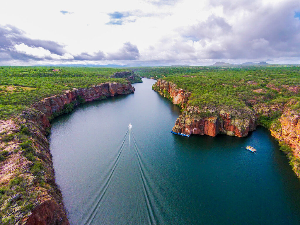

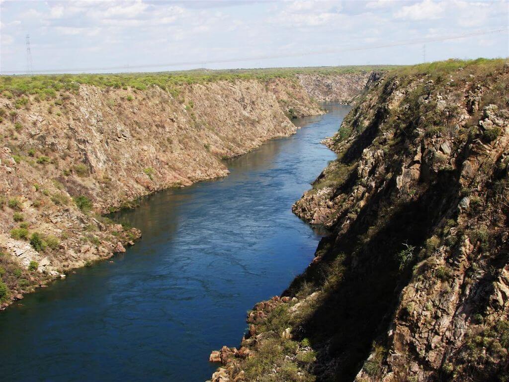
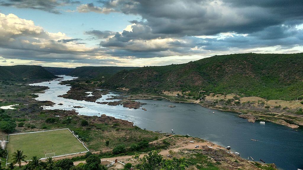

The São Francisco River: Water, Power and People in Brazil's Semiarid Heart
The São Francisco is the largest river that lies entirely within Brazil, running about 2,800 kilometers (1,740 miles) from the highlands of Minas Gerais to the Atlantic Ocean. It drains roughly 7.5 percent of the country and crosses the semiarid interior of the Northeast, where few other permanent rivers exist. Brazilians call it Velho Chico, "Old Chico," and have long described it as a river of national unity because it links the Southeast with the Northeast. Today it supplies hydroelectric power, irrigation, drinking water, and fish, and it feeds one of the largest water transfer projects in the Southern Hemisphere.
Source and Course
The river rises in the Serra da Canastra in southwestern Minas Gerais, near São Roque de Minas, at the edge of the Cerrado. The Serra da Canastra is a plateau of quartzite ridges where small streams gather into a river that flows north for more than 1,600 kilometers (1,000 miles) through Minas Gerais and Bahia. Published measurements of the total length range from about 2,700 to 2,914 kilometers (1,680 to 1,810 miles), depending on where the source and mouth are placed. This article uses about 2,800 kilometers (1,740 miles).
Geographers divide the river into four regions. The upper river runs from the source to Pirapora in Minas Gerais; the middle river continues north to Remanso in Bahia; the sub-middle river crosses the driest country to Paulo Afonso; and the lower river runs from there to the sea. Along the way, it turns east at the Bahia-Pernambuco boundary, then forms the border between Pernambuco and Alagoas and, finally, between Alagoas and Sergipe. It enters the Atlantic near Piaçabuçu, Alagoas, and Brejo Grande, Sergipe.
The principal left-bank tributaries are the Paracatu, Urucuia, Corrente and Grande rivers, and the right bank receives the Rio das Velhas, Verde Grande, Paramirim and Jacaré. Lower down, the Pajeú and Moxotó join from Pernambuco. Many sertão tributaries run dry for part of the year, making the permanent flow of the upper basin especially important.
Basin and Flow
The basin covers about 640,000 square kilometers (247,000 square miles) and includes 521 municipalities in Minas Gerais, Goiás, Bahia, Pernambuco, Alagoas, Sergipe and the Federal District. The headwaters of some tributaries lie near the Federal District, which sits on the divide between this basin and others. About 14 million people live in the basin, according to estimates cited by the basin committee.
The mean flow at the mouth is about 2,850 cubic meters per second (100,600 cubic feet per second). The distribution is very uneven: the upper basin supplies about 42 percent of this flow and the middle basin about 53 percent, so the wetter south and center produce roughly 95 percent of the water that reaches the sea. By contrast, the sub-middle and lower basins add only a few percent while crossing some of Brazil's driest land. Rain in the middle basin generally totals 500 to 1,000 millimeters (20 to 40 inches) a year, falls mostly from December to March, and river levels can change by as much as 9 meters (30 feet) between seasons.
The river ranks among the largest in South America, after the Amazon and the Paraná, and it is the longest in Brazil that does not leave the country. The Madeira is longer overall, but it flows through Bolivia and Peru before it reaches Brazil, as described in the article on the Madeira River.
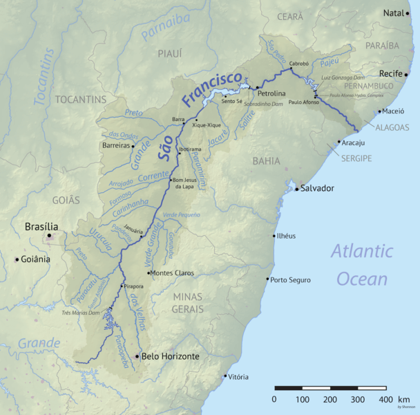
Map depicting the São Francisco River drainage basin in Brazil.
Name and Early History
Before colonization, Indigenous peoples called the river Opará. The Portuguese name honors Saint Francis. Many accounts link it to an expedition that reached the mouth in 1501 on the feast day of Francis of Assisi, although some references credit Saint Francis Borgia instead. In the colonial period, the river became a corridor for cattle drovers moving between Bahia, Pernambuco and the mining districts of Minas Gerais, and it remained one of the few dependable routes through the interior. Most of the original riverside forest has since been cleared for farms and pasture.
Peoples of the River
The basin is home to Indigenous peoples such as the Tuxá, Pankararu, Pankará, Atikum, Truká and Kariri-Xocó, along with quilombola communities, artisanal fishers, ribeirinhos, vazanteiros who plant on the exposed riverbanks, geraizeiros, caatingueiros and fundo de pasto communities. Many hold knowledge of the river's seasons that predates the dams, and several Indigenous territories along the river are still awaiting full legal recognition. Construction of the Itaparica dam in the 1980s flooded riverside towns and forced the relocation of communities, including Indigenous families, and the effects of that displacement are still felt.
The basin committee, created in 2001, represents users, public agencies, civil society, and Indigenous peoples in decisions about the river's water.
Dams and Hydroelectric Power
The river is one of the most heavily developed in Brazil. The Três Marias dam, finished in 1961, is the only dam on the main channel in the first 2,064 kilometers (1,282 miles) of the river. The remaining large dams lie in the final 750 kilometers (466 miles), where the river drops from the plateau toward the sea. They are Sobradinho, Itaparica (also called Luiz Gonzaga), Moxotó, the Paulo Afonso complex, and Xingó; together, they have dammed more than 550 kilometers (340 miles) of the sub-middle and lower river.
Sobradinho, completed in the late 1970s, is one of the world's largest artificial lakes, holding about 34 billion cubic meters (about 9 trillion US gallons) at full level. Its surface area can shrink from about 4,216 square kilometers (1,628 square miles) to about 1,177 square kilometers (454 square miles) as water levels fall. Itaparica has an installed capacity of 1,500 megawatts, the Paulo Afonso complex has nearly 4,000 megawatts across its four stations, and Xingó, finished in 1994, has 3,000 megawatts. Paulo Afonso is named for the falls where the river once dropped about 84 meters (275 feet) through granite. The basin's hydroelectric potential is estimated at more than 10,000 megawatts, and these plants supply a large share of the Northeast's electricity.
Navigation
The river is naturally navigable year-round for 1,371 kilometers (852 miles) between Pirapora and the twin cities of Petrolina, Pernambuco, and Juazeiro, Bahia. That stretch has carried cargo, passengers, and cattle for generations, and the restored riverboat Benjamim Guimarães is still based at Pirapora. Below Sobradinho, dams interrupt the river, and the falls and canyons of the lower river mean most cargo that once moved by water now travels by road.
Fish and Fisheries
The São Francisco's fish fauna includes many species found nowhere else. The pirá (Conorhynchos conirostris) is a large catfish endemic to the basin and is listed as threatened; the surubim (Pseudoplatystoma corruscans), the dourado (Salminus franciscanus), and the curimatá (Prochilodus argenteus) are important migratory species. Migratory fish need free-flowing stretches and seasonal floods to spawn, and studies near Três Marias have shown that surubim and curimatá spawn in the stretch just downstream of the dam, around the Abaeté River mouth and the Pirapora rapids.
Dams have blocked migration routes, changed temperatures and flows, and reduced the floods that fill the marginal lagoons. Fishers on the lower river report that surubim and dourado have been absent from catches for decades, while introduced fish such as the Nile tilapia (Oreochromis niloticus), the peacock bass (Cichla monoculus) and a small piranha relative (Metynnis lippincottianus) have spread. Fisheries remain a critical income and food source for riverside communities, but catches are far lower than in the past.
The Integration Project
The idea of carrying São Francisco water to the drier states dates to engineering studies in the 1840s under Emperor Pedro II. The modern Projeto de Integração do Rio São Francisco, often called the transposição, began construction in 2007 and consists of two main canal systems. The North Axis starts at Cabrobó, Pernambuco, and the East Axis begins at the Itaparica reservoir near Floresta, Pernambuco. Together, they total about 477 kilometers (296 miles) of canals, tunnels, aqueducts, and pumping stations and are meant to supply about 12 million people in 390 municipalities in Pernambuco, Ceará, Paraíba, and Rio Grande do Norte.
The government's May 2026 summary listed the project as about 99 percent complete, with a budget of about R$13.68 billion. Water from the North Axis began reaching Rio Grande do Norte in August 2025, and pumping capacity on that axis is being expanded. The federal government is also preparing to offer the system's operation to a private partner under a 30-year concession. Critics have questioned whether the river can supply enough water for the project and for its other uses, and whether the canals will be used as heavily as planned. Some stretches in Ceará have run dry because local demand was low.
Drought, Pollution and the Lower River
Severe droughts between 2012 and 2017 pushed Sobradinho close to its minimum operating level, and authorities cut the minimum outflow below the long-standing standard of 1,300 cubic meters per second. Municipalities in Alagoas and Sergipe, including the Sergipe capital Aracaju, had to deepen their intakes to keep drawing water. Storage later recovered. By early August 2026, national grid operator data showed the Três Marias reservoir at about 92 percent of its capacity and Sobradinho at about 80 percent, though conditions can change quickly.
Reduced flow at the mouth has let seawater move farther upriver, now about 10 to 16 kilometers (6 to 10 miles) up the lower channel, changing the fish community and affecting fishers and farmers near Piaçabuçu and Penedo. The river also carries sewage, mining waste, agricultural runoff, and sediment, much of it from the more densely populated upper basin. Basin planners have argued for years that the crisis is more a management problem than one of absolute scarcity, and they have called for revitalization programs, better sanitation, and limits on groundwater and surface withdrawals.
Outlook
The São Francisco connects the Cerrado of the highlands with the Caatinga of the interior and the estuary at the coast, and almost every part of that path now depends on decisions made upstream. Its future will turn on how reservoirs are operated in dry years, whether fish habitats and floods can be restored, how the transfer project is managed, and how much voice Indigenous and traditional communities have in those decisions.