Caracol and Chiquibul: Uncovering Belize's Maya Legacy and Natural Riches
Belize boasts rich historical significance and remarkable biodiversity. Notable treasures are the ancient Maya city of Caracol and the expansive Chiquibul National Park. These two interconnected sites provide an invaluable glimpse into the region's ancient past while showcasing its ecological richness.
Exploring Caracol and Chiquibul National Park: A Journey Through Belize's Ancient and Natural Wonders
Belize is a land of rich historical significance and remarkable biodiversity. Among its most renowned treasures are the ancient Maya city of Caracol and the expansive Chiquibul National Park. These two interconnected sites provide an invaluable glimpse into the region's ancient past while showcasing its ecological richness. Together, they offer a compelling narrative of human ingenuity, environmental preservation, and cultural heritage.
Caracol: A Majestic Maya City
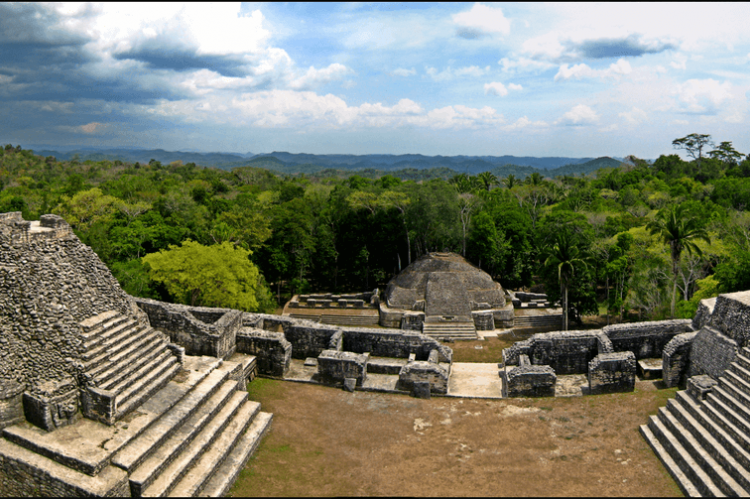
Caracol stands as one of the most important archaeological sites in Belize, reflecting the grandeur of the ancient Maya civilization. Located in the foothills of the Maya Mountains, the site rests on the Vaca Plateau at an elevation of 500 meters (1,640 feet) above sea level. Positioned southeast of the famous Maya city of Tikal, Caracol emerged as a dominant regional power during the Classic Period.
Spanning an impressive 200 square kilometers (77 square miles), Caracol is larger than present-day Belize City and once supported a population far more significant than any modern settlement in the country. Initially considered a minor center, research has revealed its importance as a political, cultural, and economic hub in the Maya Lowlands.
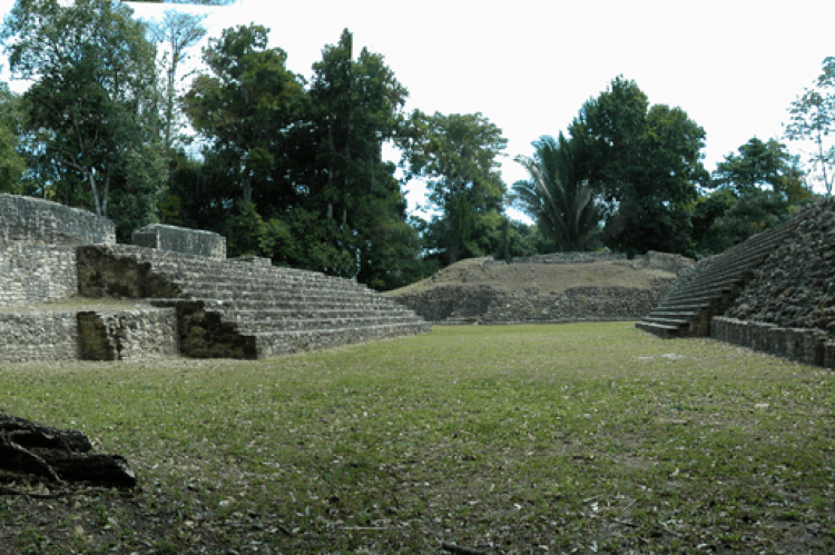
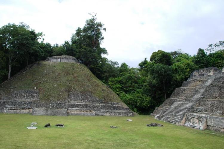
The site was first reported in 1937 by a native logger named Rosa Mai, though significant archaeological investigations began in the 1950s. Extensive excavations, led by teams from the University of Pennsylvania and later from Trent University and the University of Central Florida, uncovered a vast array of structures, including pyramids, tombs, ball courts, and residential complexes. These findings, along with Mayan glyphs and other artifacts, indicate that Caracol was a powerful political center and a city that underwent periods of revival and decline, with its zenith around AD 800.
Caracol's strategic location and extensive agricultural terraces allowed it to thrive, even in a competitive landscape dominated by other Maya city-states. The city's infrastructure reveals advanced urban planning, with evidence of complex water management systems and wide-reaching trade networks.
Chiquibul National Park: A Haven of Biodiversity
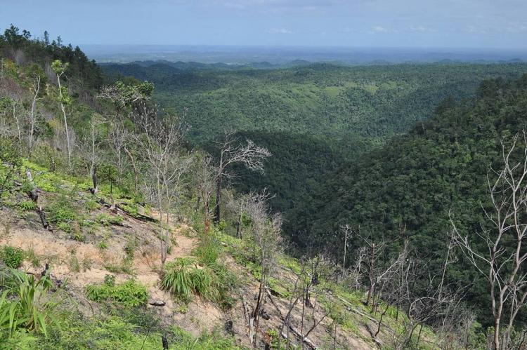
Surrounding the archaeological site of Caracol is Chiquibul National Park, the largest national park in Belize, covering 107,300 hectares (265,144 acres). The park, located in the Cayo District, is part of the greater Chiquibul Forest and represents one of the most biologically diverse regions in Central America.
Chiquibul National Park plays a vital role in protecting Belize's natural heritage. The park's borders, established in 1991, were drawn to protect the rainforest and the ancient city. This vast expanse includes the southern Vaca Plateau and the eastern slopes of the Maya Mountains, incorporating dramatic karst landscapes formed by limestone strata. Doyle's Delight, Belize's highest mountain, is also within the park's boundaries.
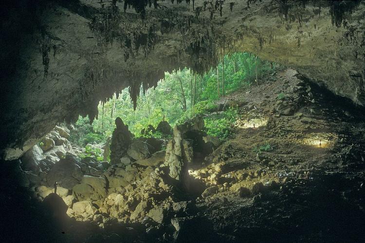
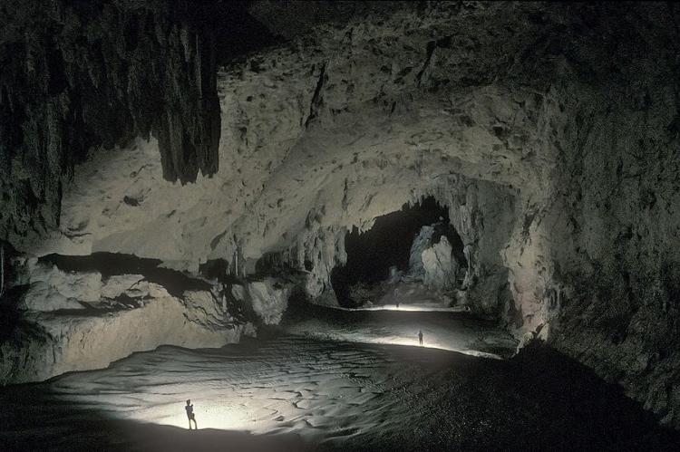
One of Chiquibul's most fascinating features is its most extensive cave system in Central America. The Chiquibul Cave System includes the longest-known underground passages and chambers in the Western Hemisphere. The Chiquibul River flows through the caves, disappearing underground and re-emerging in Guatemala. This hydrological connection forms a critical part of the region's ecosystem, contributing to the area's rich biodiversity.
The park's wildlife includes a remarkable array of species, many of which are endangered. Among the notable inhabitants are jaguars, ocelots, Yucatan spider monkeys, and Baird's tapirs. Chiquibul is also home to Belize's largest breeding population of scarlet macaws. Additionally, the park has yielded new discoveries, with researchers uncovering previously undocumented insect and crustacean species and plant species never before recorded in Central America.
Chiquibul Forest Reserve: Conservation and Challenges
Adjacent to Chiquibul National Park is the Chiquibul Forest Reserve, part of the greater Chiquibul Forest. First designated in 1956, the reserve covers 59,822 hectares (147,823 acres) and plays a crucial role in Belize's conservation efforts. Along with the national park, the reserve forms a continuous stretch of forest that provides a sanctuary for numerous species and is a key area for ecological research.
Despite its protected status, the reserve faces ongoing challenges, particularly from illegal activities such as poaching and unauthorized harvesting of natural resources. Xate palm leaves, valued for ornamental purposes, have been a target of the illicit extraction by Guatemalan Xateros. These activities threaten the ecosystem's delicate balance, requiring vigilant conservation efforts to preserve the forest's biodiversity.
The Chiquibul Forest region supports 17 distinct ecosystems, predominantly variants of lowland and submontane tropical evergreen broadleaf forests. These ecosystems and the park's varied topography make Chiquibul a hotspot for biological diversity. The forest reserve also plays an essential role in maintaining water flow for the Belize River watershed, underscoring its importance for both ecological and human communities.
Conclusion
Caracol and Chiquibul National Park offer a unique window into Belize's rich cultural and natural heritage. Once a thriving Maya city, Caracol is a testament to the ingenuity and resilience of one of the Americas' most remarkable civilizations. Meanwhile, Chiquibul National Park and its surrounding forest reserves protect some of the most biodiverse landscapes in Central America. These sites preserve the Maya's legacy and contribute to the ongoing efforts to safeguard Belize's natural environment. Through continued research and conservation, Caracol and Chiquibul will remain essential destinations for understanding the ancient and natural worlds through continued research and conservation.
