Nevado de Toluca National Park: Mexico's High-Altitude Volcanic Wonderland
Nestled in the heart of Mexico, the Nevado de Toluca volcano and its surrounding national park are a testament to the country's natural wonders. Formerly known by its Aztec name "Xinantécatl," this stratovolcano offers a glimpse into Mexico's rich geological and cultural heritage.
Xinantécatl: Exploring Mexico's Sacred Volcanic Peak and Crater Lakes
Towering majestically in central Mexico, Nevado de Toluca stands as one of the country's most spectacular volcanic peaks and protected wilderness areas. This ancient stratovolcano, known to the Aztecs as "Xinantécatl" (meaning "naked lord"), rises 4,680 meters (15,354 feet) above sea level, making it Mexico's fourth-highest mountain. The surrounding Nevado de Toluca National Park encompasses 51,000 hectares (126,000 acres) of diverse ecosystems, from temperate forests to alpine meadows, creating a unique sanctuary for both wildlife and outdoor enthusiasts.
Location and Accessibility
Nevado de Toluca is strategically positioned in the heart of the Trans-Mexican Volcanic Belt, approximately 22 kilometers (14 miles) southwest of Toluca city and 80 kilometers (50 miles) west of Mexico City. The park extends across twelve municipalities in the State of Mexico, nestled between the valleys of Toluca and Tenango. This prime location makes it one of the most accessible high-altitude wilderness areas for Mexico's urban population.
Geological Formation and Volcanic History
As a classic stratovolcano, Nevado de Toluca showcases millions of years of geological evolution. The mountain's current profile tells a dramatic story of volcanic activity spanning millennia. Geological evidence suggests that approximately 25,000 years ago, a catastrophic eruption may have reduced the volcano's height by as much as 900 meters (3,000 feet), fundamentally reshaping its summit.
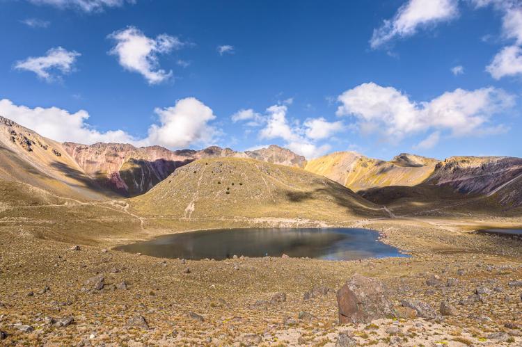
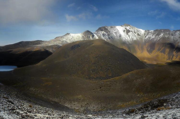
The volcano's most distinctive feature is its large caldera, which opens dramatically to the east. This horseshoe-shaped crater, formed by ancient volcanic collapse, creates a natural amphitheater that houses the mountain's famous crater lakes. The caldera walls rise steeply from the lake basins, creating a spectacular alpine cirque environment rarely found at such elevations in Mexico.
The Enchanting Crater Lakes
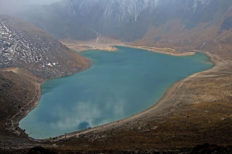
Within the caldera lie two pristine crater lakes that serve as the park's crown jewels. Lago del Sol (Sun Lake), the larger of the two, and Lago de la Luna (Moon Lake), smaller but significantly deeper, rest at approximately 4,200 meters (13,800 feet) elevation. These high-altitude lakes represent some of the highest natural water bodies in North America.
The lakes' crystal-clear waters reflect the surrounding volcanic walls, creating mirror-like surfaces that change color throughout the day as light conditions shift. During winter months, the lakes often freeze partially, adding another dimension to their already otherworldly beauty. The extreme altitude and unique chemistry of these waters create specialized aquatic ecosystems that support endemic microorganisms adapted to the harsh high-altitude environment.
Biodiversity and Ecological Zones
Nevado de Toluca National Park encompasses remarkable ecological diversity across distinct altitudinal zones. The lower slopes, ranging from 2,400 to 3,200 meters (7,900 to 10,500 feet), support dense mixed forests dominated by sacred fir (Abies religiosa), Hartweg's pine (Pinus hartwegii), and various oak species (Quercus spp.). These temperate forests provide critical habitat for numerous wildlife species.
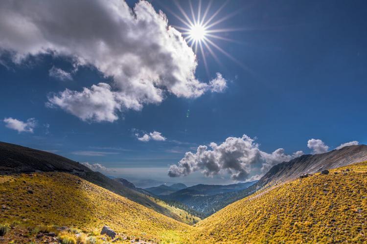
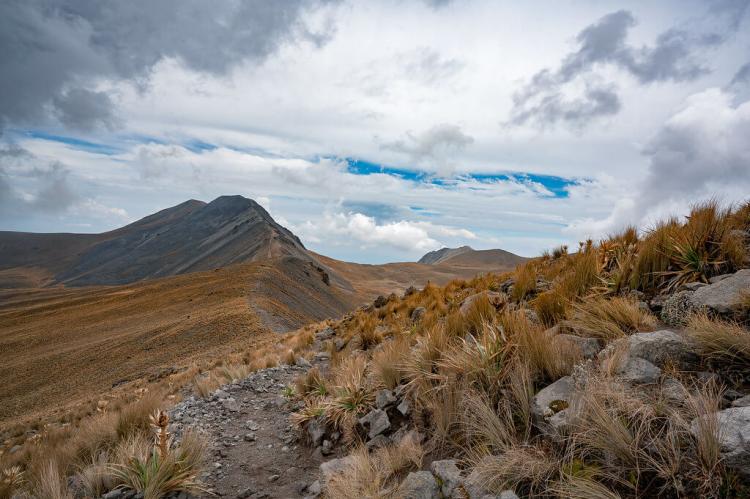
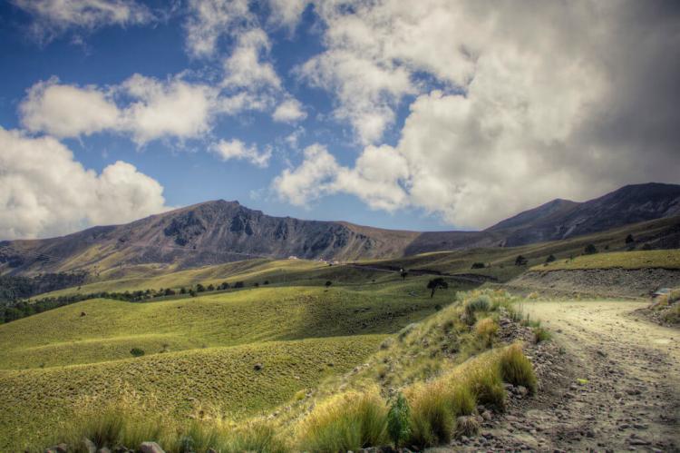
As elevation increases from 3,200 to 4,000 meters (10,500 to 13,100 feet), the forest transitions to subalpine communities characterized by hardy Pinus hartwegii stands that can withstand extreme weather conditions. Above 4,000 meters (13,100 feet), alpine grasslands and cushion plant communities dominate, featuring specialized high-altitude species adapted to intense UV radiation, temperature fluctuations, and thin air.
The park supports diverse fauna, including white-tailed deer (Odocoileus virginianus), coyotes (Canis latrans), gray foxes (Urocyon cinereoargenteus), and various small mammals. Bird species include Mexican chickadees (Poecile sclateri), mountain trogons (Trogon mexicanus), and various hummingbird species. The high-altitude environments also harbor endemic reptile and amphibian species specially adapted to the extreme conditions.
Cultural Heritage and Archaeological Significance
The Indigenous peoples of central Mexico have revered Nevado de Toluca for millennia. The Aztec name "Xinantécatl" reflects the mountain's sacred status in pre-Columbian cosmology. Archaeological investigations have revealed extensive evidence of ritualistic activities around the crater lakes, where Indigenous peoples made offerings to mountain deities.
Underwater archaeological surveys of the crater lakes have uncovered numerous ceremonial objects, including copal incense, obsidian knives, ceramic vessels, and precious metal artifacts. These discoveries provide invaluable insights into the spiritual practices and beliefs of ancient Mesoamerican civilizations. The lakes likely served as portals to the underworld in Indigenous cosmology, making them sites of profound religious significance.
Recreation and Tourism Opportunities
Nevado de Toluca National Park offers exceptional outdoor recreation opportunities for visitors of all skill levels. The park's extensive trail network provides options ranging from moderate forest walks to challenging summit ascents. Popular activities include:
Hiking and Trekking: Multiple trails lead through diverse ecosystems, with the summit trail offering spectacular panoramic views of central Mexico. The crater rim hike provides access to both lakes and represents one of Mexico's premier high-altitude trekking experiences.
Mountaineering: The volcano serves as an excellent training ground for higher peaks, with technical routes available for experienced climbers seeking greater challenges.
Photography: The dramatic landscapes, unique flora, and stunning vistas make the park a photographer's paradise, particularly during sunrise and sunset when the volcanic terrain takes on ethereal qualities.
Winter Sports: During the winter months, limited skiing and snowboarding opportunities exist, though facilities are minimal and weather-dependent.
Scientific Tourism: The park attracts researchers and educational groups interested in vulcanology, ecology, and archaeology.
Environmental Challenges and Conservation
Despite its protected status, Nevado de Toluca National Park faces significant environmental pressures. Rapid urban expansion from the Toluca metropolitan area threatens the park's lower elevations through habitat fragmentation and encroachment. Illegal logging activities have degraded forest ecosystems, while unregulated tourism has created erosion problems along popular trails.
Climate change poses additional long-term threats, with rising temperatures potentially shifting vegetation zones upward and affecting the delicate alpine ecosystems. Changes in precipitation patterns could also impact the crater lakes' water levels and chemistry.
Conservation Initiatives and Management
Park authorities have implemented comprehensive conservation strategies to address these challenges. Current initiatives include:
Reforestation Programs: Large-scale tree planting efforts focus on restoring degraded forest areas using native species appropriate to specific elevation zones.
Sustainable Tourism Development: New visitor management systems aim to balance recreational access with ecosystem protection through designated trails, carrying capacity limits, and environmental education programs.
Community Engagement: Local communities participate in conservation activities through employment opportunities in park management, guiding services, and sustainable enterprise development.
Scientific Research: Ongoing research programs monitor ecosystem health, species populations, and climate change impacts to inform adaptive management strategies.
International Cooperation: Partnerships with international conservation organizations provide technical expertise and funding for critical conservation projects.
Conclusion
Nevado de Toluca National Park represents one of Mexico's most extraordinary natural treasures, combining spectacular volcanic landscapes with exceptional biodiversity and profound cultural significance. As Mexico's premier high-altitude protected area, the park offers unparalleled opportunities for recreation, education, and scientific research while preserving critical ecosystems and archaeological heritage.
The park's future depends on continued commitment to conservation, sustainable tourism development, and community engagement. By balancing recreational access with environmental protection, Nevado de Toluca can continue inspiring future generations while maintaining its ecological integrity and cultural significance. This remarkable volcanic sanctuary stands as a testament to Mexico's natural heritage and the enduring importance of protecting our planet's most precious landscapes.
