Tatacoa Desert: A Journey into Colombia's Arid Wonderland
Nestled within the heart of central Colombia lies the Tatacoa Desert, an expanse of dry tropical forest known for its otherworldly landscapes and rich paleontological heritage. Despite its name, Tatacoa is not a true desert but a unique ecosystem characterized by rocky canyons and labyrinthine gullies.
Tatacoa Desert: A Journey into Colombia's Arid Wonderland
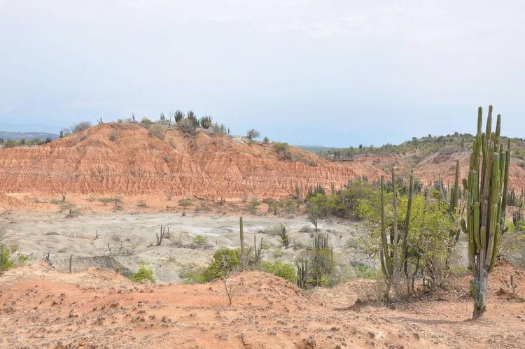
Nestled within the heart of central Colombia lies the Tatacoa Desert, a captivating expanse of dry tropical forest known for its otherworldly landscapes and rich paleontological heritage. Despite its name, Tatacoa is not a true desert but a unique ecosystem characterized by rocky canyons, labyrinthine gullies, and vibrant hues of red and grey. Spanning approximately 340 square kilometers (130 square miles) in the northern part of the Huila Department, this arid region harbors a wealth of natural wonders and cultural significance.
Geological Marvels
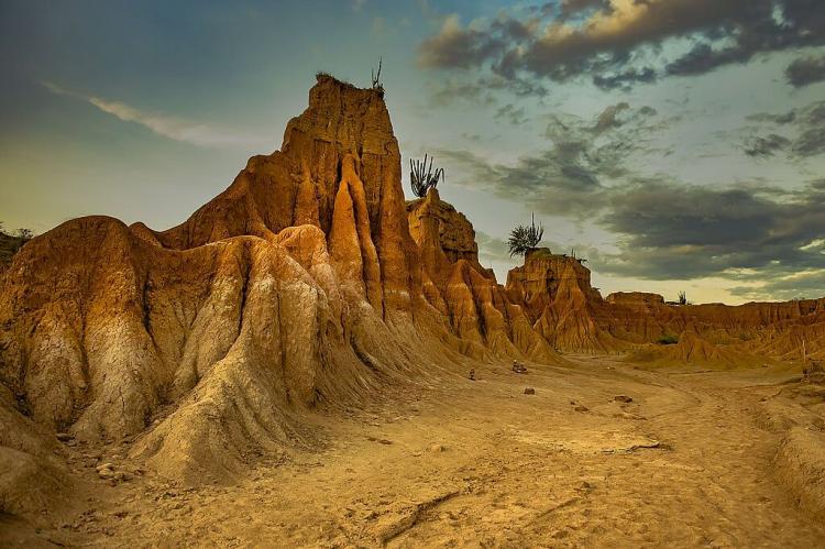
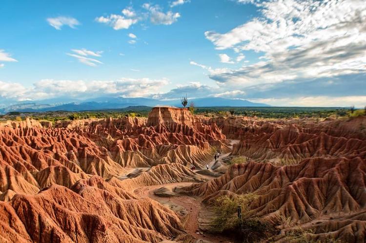
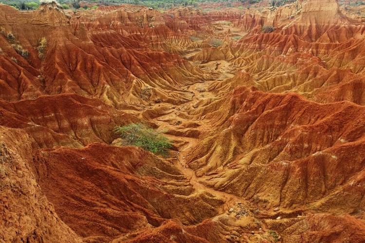
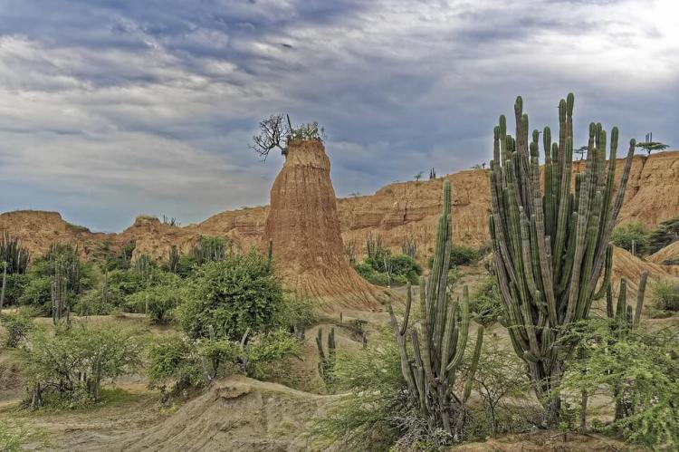
Tatacoa Desert's landscape is a product of millions of years of geological processes shaped by the erosive forces of wind and water. The region's rocky canyons and gullies, carved into clay surfaces, create a mesmerizing labyrinth that stretches across the horizon. The desert's unique geological formations, including the Cuzco and Los Hoyos areas, showcase a kaleidoscope of colors, with deep ochre and ashy grey tones contrasting against the backdrop of the distant Andes Mountains of Colombia.
Paleontological Heritage
One of Tatacoa's most notable attributes is its status as one of the largest vertebrate fossil sites in the Americas. Over millennia, the region's unique geology and climatic fluctuations have fostered the preservation of fossils dating back to the Miocene and Pleistocene periods. These fossil deposits offer invaluable insights into the continent's ancient ecosystems and geological evolution of the continent, providing a window into the distant past.
The Tatacoa Desert presents the most varied paleontological record for the Miocene and Pleistocene periods in Colombia and the continent, making it a treasure trove for scientists and researchers seeking to unravel the mysteries of prehistoric life.
Flora and Fauna
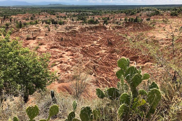
Despite its arid climate, Tatacoa is not devoid of life. The desert's flora and fauna, adapted to the harsh conditions, exhibit remarkable resilience and ingenuity. Plant life, including towering cacti and hardy shrubs, have evolved specialized root systems to access water deep beneath the surface. At the same time, animal species such as eagles, alligators, and wildcats thrive amidst the rocky terrain.
The flora in Tatacoa is adapted to climatic conditions by developing horizontal roots of up to 30 meters (100 feet) and vertical roots of up to 15 meters (50 feet) deep, facilitating access to water in the arid environment.
Cultural Significance
Tatacoa Desert holds a storied history dating back to the arrival of Spanish conquistadors in the 16th century. Its rugged terrain and extreme climatic conditions earned it a reputation as a harsh and unforgiving landscape, yet beneath its arid exterior lies a treasure trove of scientific discovery.
Human presence in Tatacoa is sparse, with the region primarily inhabited by shepherd families who tend to their livestock amidst the harsh desert environment. Yet, despite its remote location and challenging conditions, Tatacoa has garnered attention as a burgeoning tourist destination, drawing visitors from far and wide to marvel at its rugged beauty and scientific wonders.
Astronomy
In addition to its paleontological significance, Tatacoa's clear skies and low light pollution make it an ideal destination for astronomy enthusiasts. The desert's remote location and high elevation provide unparalleled night sky views, offering a glimpse into the cosmos unrivaled by urban environments.
The Tatacoa Desert's atmospheric conditions make it an ideal location for stargazing, attracting astronomers and astrophotographers worldwide. Its vast expanse and minimal light pollution create a perfect setting for observing celestial phenomena, including meteor showers, eclipses, and the Milky Way.
Conclusion
As evidence of life's resilience in extreme environments, the Tatacoa Desert exemplifies nature's enduring power and the limitless potential for exploration for those who venture into its arid expanse. With its diverse ecosystems, geological wonders, and cultural significance, Tatacoa intrigues and motivates exploration, highlighting the remarkable wonders in Earth's most unexpected places.
