Iruya: Journey to Argentina’s Hidden Highland Town
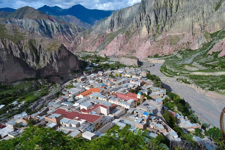
Located within the dramatic mountainous landscape of the Altiplano in northwestern Argentina, the Iruya is known for its stunning geographical beauty and rich cultural heritage. Situated along the Iruya River, this picturesque town is part of the Salta province, near the border with Bolivia.
Exploring Iruya: A Blend of Culture and Nature in Salta
Nestled within the dramatic mountainous landscape of the Altiplano in northwestern Argentina, the town of Iruya captivates visitors with its stunning geographical beauty and rich cultural heritage. Situated at an elevation of 2,780 meters (9,120 feet) along the Iruya River, this picturesque town is part of the Salta province, near the border with Bolivia. Known for its blend of aboriginal and Hispanic cultures, Iruya offers a unique glimpse into the region's history and traditions. Its remoteness and the journey to reach it only add to its charm and allure.
Historical Background
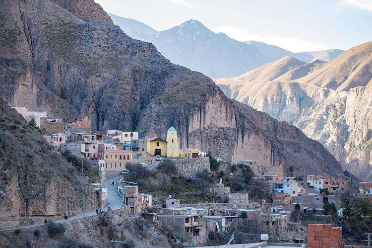
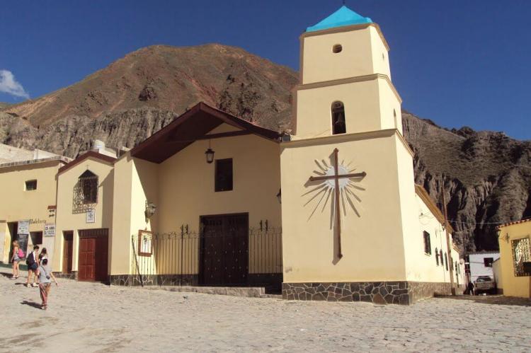
Iruya's history dates back to the mid-1600s when descendants of the Incas first settled in the area. The town was officially founded in 1753, and its historical significance is evident in landmarks such as the Iglesia Nuestra Señora del Rosario y San Roque, built in 1690. This church stands as a symbol of the town's long-standing religious and cultural traditions. In recognition of its historical and architectural value, Iruya was declared a National Historic Site in 1995.
Geographical Setting
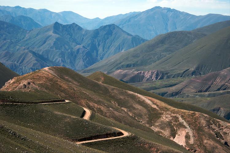
The town is accessible via a primarily unpaved road called the Caretta de Iruya, which leads from Humahuaca in Jujuy Province. This route traverses breathtaking mountainous terrain, including the high mountain pass of Abra del Cóndor, at an elevation of 3,942 meters (12,933 feet). The journey to Iruya is an adventure, with the road winding through steep switchbacks and crossing several rivers. Despite the challenging access, the spectacular views and the sense of seclusion add to the town's allure.
Cultural Heritage
Iruya is a vibrant center where Aboriginal culture intersects with Hispanic influences. As of the 2010 census, the town's population stood at 1,523, many of whom maintain traditional ways of life. The local culture is reflected in the town's festivals, crafts, and daily activities, offering visitors an immersive experience. The surrounding villages of San Isidro, San Juan, and Pueblo Viejo also contribute to the region's cultural mosaic, each with its unique customs and landscapes.
The town is particularly known for its lively festivals. One of the most significant is the celebration of the Virgin of the Rosary, held annually in October. This event draws visitors from all over the region and features traditional music, dance, and religious processions that highlight the town's cultural vibrancy and community spirit.
Architectural Highlights
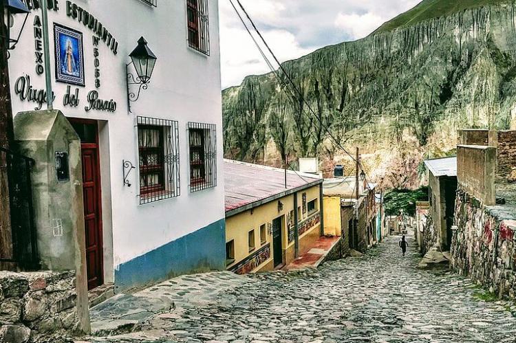
The architectural charm of Iruya is most evident in its colonial buildings and narrow cobblestone streets. The Iglesia Nuestra Señora del Rosario y San Roque, with its whitewashed walls and simple yet elegant design, is a focal point of the town. The church's bell tower provides panoramic views of the surrounding mountains and valleys, offering visitors a glimpse of the breathtaking landscape that defines Iruya.
In addition to the church, the town's architecture includes several well-preserved colonial-era buildings that showcase traditional construction techniques and materials. The use of adobe and stone in building construction reflects the adaptation of indigenous methods to the colonial architectural style, creating a unique blend that characterizes Iruya's built environment.
Natural Attractions
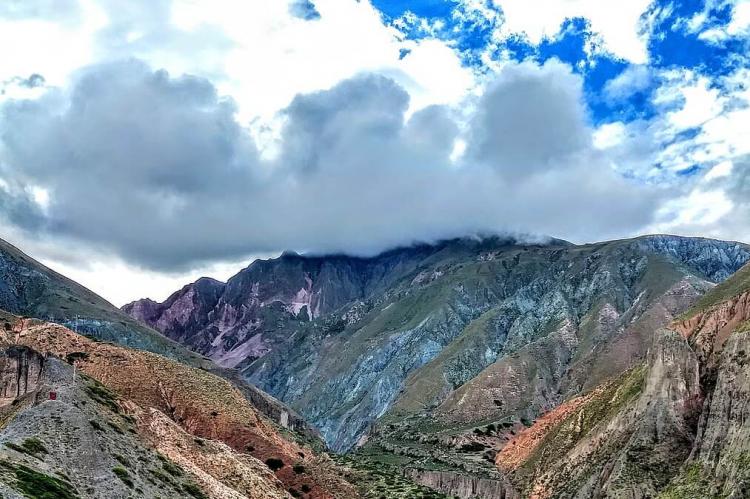
The natural beauty surrounding Iruya is a major draw for visitors. The town is located within the Altiplano natural region, with its rugged mountains, deep valleys, and pristine rivers. Hiking and trekking are popular, with trails leading to panoramic viewpoints and remote villages. The area's biodiversity includes a variety of flora and fauna, making it a haven for nature enthusiasts.
Popular trails include the path to the nearby village of San Isidro, which takes hikers through stunning mountain scenery and across the Iruya River. Another notable trek is the route to the village of San Juan, offering equally breathtaking views and the opportunity to experience the tranquility of the region's natural environment.
Access and Transportation
Although Iruya is part of Salta Province, direct access from Salta is not available year-round. The primary access route is through Jujuy Province, with the road from Humahuaca being the most commonly used. This route, while scenic, can be challenging, especially during the rainy season when the road may become impassable. The isolation of Iruya has helped preserve its unique character and charm, but it also requires careful planning for visitors wishing to explore this hidden gem.
Visitors must be prepared for a rugged journey, typically a bus ride from Humahuaca. Despite the challenging access, the adventure of reaching Iruya is part of its appeal, offering travelers a sense of achievement upon arrival and a deeper appreciation for the town's remote beauty.
Conclusion
Iruya stands as a testament to its people's resilience and cultural richness. Its dramatic landscape, historical significance, and vibrant cultural heritage make it a unique destination in Argentina. Visitors to Iruya are rewarded with an authentic experience that combines natural beauty with a deep sense of history and tradition. As more people discover this secluded town, efforts to preserve its heritage and natural environment will be crucial in maintaining its charm for future generations. The town's blend of aboriginal and Hispanic cultures, historical architecture, and stunning natural surroundings make Iruya a must-visit destination for those seeking an off-the-beaten-path adventure in Argentina.
