Montserrat: The Emerald Isle's Volcanic Legacy
Montserrat is known as "The Emerald Isle of the Caribbean" due to its stunning landscapes and Irish heritage. Its lush mountains and rugged coastline offer a captivating blend of nature and culture. However, the island's turbulent history is shaped by the Soufrière Hills Volcano, which has left scars on the terrain.
Montserrat: The Emerald Isle's Volcanic Legacy
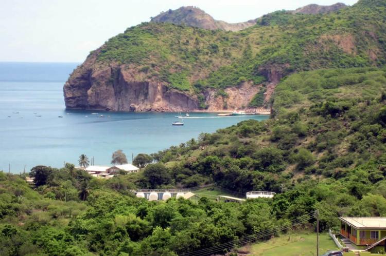
Nestled in the azure waters of the West Indies, Montserrat is a captivating blend of natural beauty and cultural heritage, earning its nickname, "The Emerald Isle of the Caribbean." Known for its stunning landscapes and the rich Irish ancestry of many of its inhabitants, Montserrat beckons with verdant peaks and rugged coastlines. However, beneath its idyllic surface lies a turbulent history shaped by the fiery temperament of the Soufrière Hills Volcano. The island's landscape bears the scars of volcanic upheaval, a testament to Montserrat's resilience in adversity.
Geography and Demographics
Montserrat is nestled in the Leeward Islands, a picturesque part of the Lesser Antilles, located southwest of Antigua and northwest of Guadeloupe. This small yet remarkable island, spanning approximately 103 square kilometers (40 square miles), encompasses diverse geographical features, from its rugged coastlines to its verdant peaks.
The population of Montserrat is as varied as its landscape, reflecting a rich tapestry of cultural influences. Descendants of enslaved Africans, North American settlers, and European colonizers coexist on the island, each contributing to its unique heritage. English serves as the official language, facilitating communication across the diverse community. However, the colorful nuances of Montserratian culture are often expressed through Creole, a vibrant and expressive language spoken by most residents. This linguistic diversity adds depth and character to the island's cultural identity, fostering a sense of unity amidst its multicultural population.
Volcanic Landscape
Montserrat's dramatic topography is characterized by three distinct mountainous regions: the Silver Hills, the Centre Hills, and the Soufrière Hills. These rugged terrains define the island's skyline, offering adventurers and explorers breathtaking vistas and challenging terrain for adventurers and explorers.
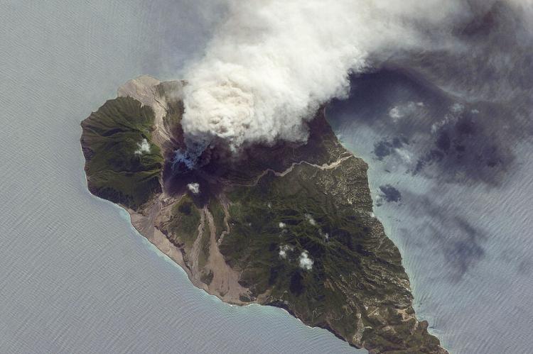
Before the mid-1990s, Chances Peak in the Soufrière Hills reigned as Montserrat's loftiest summit, towering majestically at 915 meters above sea level. However, the tranquility of this volcanic landscape was shattered by the awakening of the Soufrière Hills Volcano, marking the onset of a period of intense volcanic activity that would reshape the island's geography and alter its destiny forever.
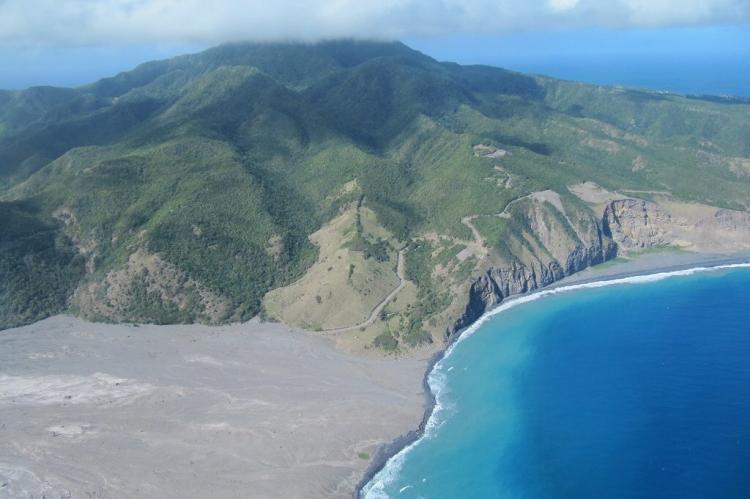
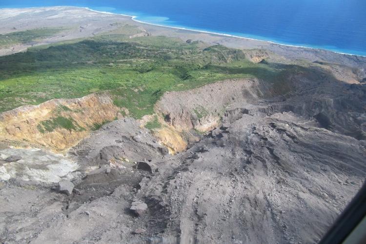
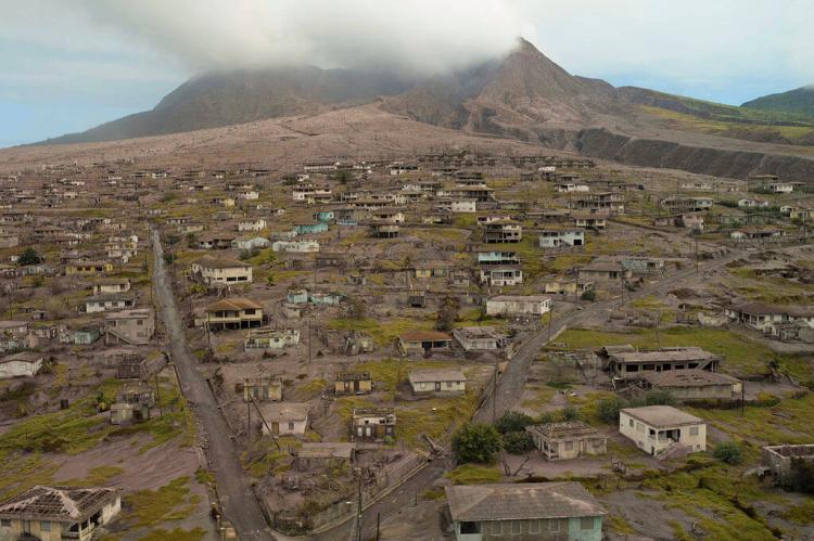
The eruption of the Soufrière Hills Volcano unleashed a series of cataclysmic events that dramatically transformed Montserrat's landscape. Lava flows cascaded down the mountainside, engulfing verdant forests and fertile farmland in their path. Pyroclastic flows, comprised of superheated gas and volcanic debris, swept across the island, leaving destruction in their wake. The once-thriving capital city of Plymouth was buried beneath layers of ash and volcanic debris, transforming it into a modern-day Pompeii.
In the wake of this devastating eruption, two-thirds of Montserrat's population were forced to flee their homes, seeking refuge in neighboring islands and distant shores. The eruption's aftermath left a scarred and desolate landscape as communities grappled with losing their homes, livelihoods, and sense of security. Yet, amidst the chaos and destruction, Montserratians demonstrated remarkable resilience and courage, banding together to rebuild their lives and island. Today, the volcanic landscape of Montserrat serves as a poignant reminder of nature's incredible power and humanity's indomitable spirit in the face of adversity.
Flora and Fauna
Despite the volcanic activity that has left scars on Montserrat's landscape, pockets of biodiversity continue to thrive, a testament to nature's resilience. While the once-lush forests of the southern highlands fell victim to the devastating eruptions, the Centre Hills emerged as a refuge for numerous plant and animal species. Here, amidst the verdant valleys and mist-shrouded peaks, Montserrat's unique flora and fauna find sanctuary.
The Montserrat oriole (Icterus oberi) is perhaps the island's most iconic avian resident, with its vibrant plumage and melodious song echoing through the forest canopy. Endemic to Montserrat, this colorful bird has become a symbol of hope and resilience for the island's inhabitants, its presence serving as a poignant reminder of nature's ability to endure. Among the reptiles, the Montserrat galliwasps (Diploglossus montisserrati) stand out as one of the island's rarest and most enigmatic inhabitants. With their iridescent scales and secretive habits, these elusive lizards play a crucial role in Montserrat's ecosystem, preying on insects and other small invertebrates that inhabit the island's forests and rocky outcrops.
Another notable resident of Montserrat is the "mountain chicken" (Leptodactylus fallax), a large frog that was once a staple of the island's cuisine. These robust amphibians, with their deep, resonant calls and distinctive markings, were traditionally hunted for their succulent meat, considered a delicacy by locals. However, habitat loss, overexploitation, and the introduction of a deadly fungal disease have pushed mountain chickens to the brink of extinction, highlighting the fragile balance between human activity and ecological sustainability.
Climate
Montserrat enjoys a tropical and mild climate with balmy temperatures and ample yearly rainfall. Average temperatures typically range from 21–30°C (70–86°F), offering residents and visitors a comfortable and inviting environment to live and explore. The island experiences distinct wet and dry seasons, with the warmest and wettest periods occurring from June to November, coinciding with the Atlantic hurricane season. During this time, Montserrat may be affected by tropical storms and hurricanes, bringing heavy rainfall, strong winds, and the occasional disruption to daily life.
Despite the potential for inclement weather, Montserratians have learned to adapt to the island's climatic nuances, drawing on centuries of experience to mitigate the impact of extreme weather events and safeguard their communities. With average annual precipitation exceeding 1500 millimeters (59 inches), Montserrat's lush landscapes owe much of their verdant beauty to the generous rains that nourish the island's flora and fauna, sustaining life and livelihoods.
The Soufrière Hills Volcano: A Living Giant
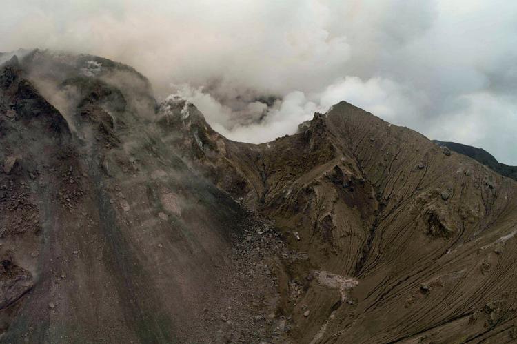
The Soufrière Hills Volcano stands as a towering sentinel in the southern reaches of Montserrat, its brooding presence a constant reminder of the island's turbulent geological history. Named after the French term for "sulfur outlet," this active stratovolcano has left an indelible mark on the landscape and psyche of Montserratians since awakening from centuries of dormancy in 1995.
Geological Significance
Andesitic in nature, the Soufrière Hills Volcano is renowned for its complex and dynamic behavior, characterized by dramatic eruptions and lava dome collapses. These cataclysmic events have reshaped the island's terrain, rendering more than half of Montserrat uninhabitable and forever altering the lives of its inhabitants.
The volcano's eruptions have unleashed pyroclastic flows—fast-moving currents of superheated gas, ash, and rock—that cascade down its slopes with terrifying speed and force, engulfing everything in their path. The once-thriving capital city of Plymouth, nestled in the volcano's shadow, bore the brunt of these devastating flows, becoming a ghost town overnight as residents fled for their lives.
Ongoing Monitoring
In response to the ongoing threat posed by the Soufrière Hills Volcano, the Montserrat Volcano Observatory (MVO) was established to monitor its activity and provide early warning of impending eruptions. Equipped with state-of-the-art instruments and staffed by a team of dedicated scientists and technicians, the MVO plays a crucial role in safeguarding the lives and livelihoods of those living in the volcano's shadow. The MVO tracks changes in volcanic activity using a combination of seismological, gas monitoring, and satellite imagery techniques and issues timely alerts to residents and authorities. While the volcano has remained relatively quiet since 2010, occasional periods of unrest are a stark reminder of the ever-present danger lurking beneath Montserrat's serene exterior.
Conclusion
In conclusion, the Soufrière Hills Volcano is both a testament to the raw power of nature and a sobering reminder of the fragility of human existence. As Montserratians continue to rebuild and reclaim their island paradise, they do so with a profound respect for the forces that shape their world, drawing strength from their resilience and determination to forge a brighter future amidst the ashes of the past.
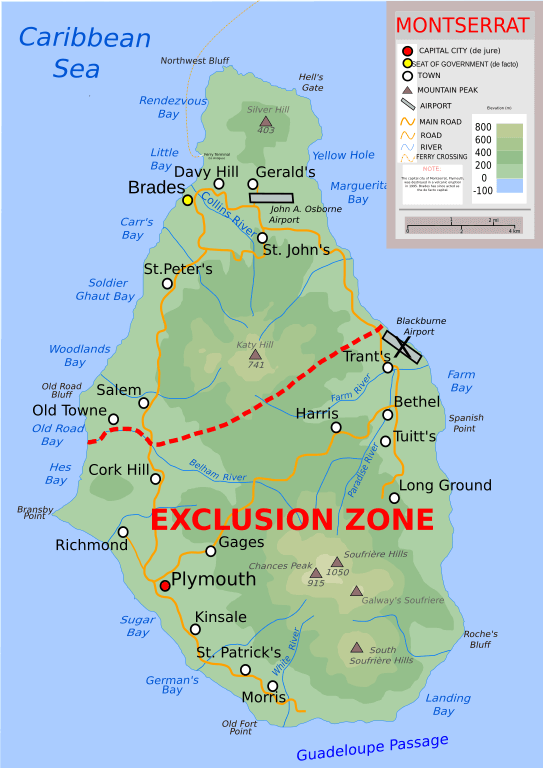
Topographic map of Montserrat.
