Lake Atitlán and Volcán Atitlán: Guatemala's Volcanic Treasures
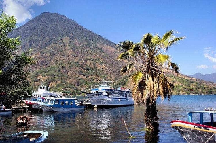
Nestled in the Guatemalan Highlands, Lake Atitlán and Volcán Atitlán are two of Guatemala's most iconic natural landmarks. Lake Atitlán is renowned for its stunning beauty, dramatic volcanic backdrop, and cultural heritage, while Volcán Atitlán is one of the region's most prominent and active volcanoes.
The Majesty of Lake Atitlán and Volcán Atitlán: Nature and Culture in Harmony
Nestled in the Guatemalan Highlands of the Sierra Madre Mountain Range, Lake Atitlán and the towering Volcán Atitlán represent two of Guatemala's most iconic natural landmarks. Lake Atitlán is renowned for its stunning beauty, dramatic volcanic backdrop, and deep cultural heritage, while Volcán Atitlán stands as one of the region's most prominent and active stratovolcanoes. Together, they form a unique landscape that draws tourists and researchers alike, offering a glimpse into Guatemala's rich biodiversity and the enduring legacy of Maya culture.
Lake Atitlán: Geography and Formation
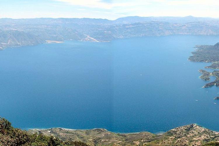
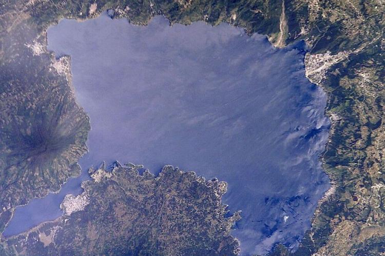
Lake Atitlán is located in the Sololá Department of southwestern Guatemala, at an elevation of approximately 1,563 meters (5,128 feet) above sea level. It is the deepest lake in Central America, reaching a maximum depth of 320 meters (1,049 feet). The lake has an area of 127.7 square kilometers (49.3 square miles) and stretches 19 kilometers (12 miles) in length and 10 kilometers (6 miles) in width. It occupies a valley formed by volcanic activity around 84,000 years ago.
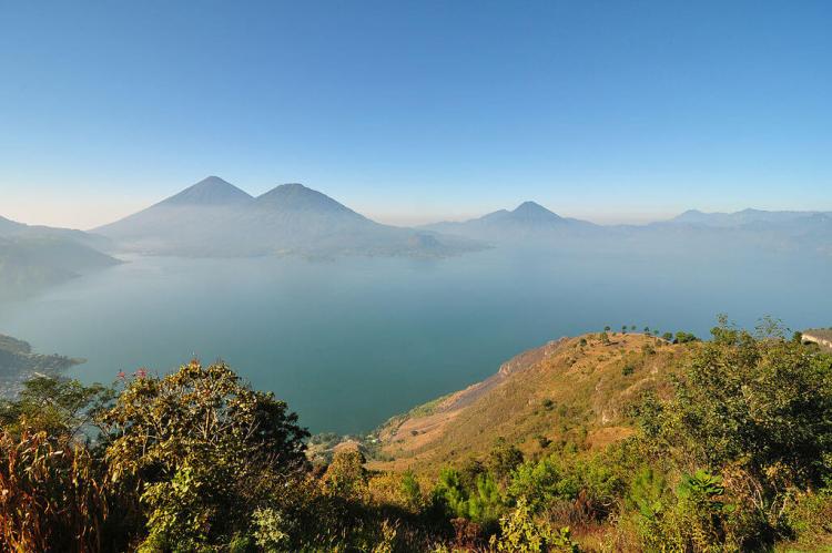
The lake lies within a massive volcanic caldera created by a cataclysmic eruption that left behind the large depression now filled by its waters. Over time, volcanic ash and subsequent eruptions shaped the region, damming the valley and allowing the lake to form. Three striking volcanoes—Atitlán, Tolimán, and San Pedro—surround the lake, further defining its spectacular landscape.
Interestingly, Lake Atitlán is an endorheic lake, meaning it does not drain into the ocean. Instead, it feeds into nearby rivers, making it a unique hydrological feature in the region. Its clear blue waters, dramatic escarpments, and volcanic peaks have earned it a reputation as one of the most beautiful lakes in the world, drawing both domestic and international tourists.
Maya Culture Around Lake Atitlán
The towns and villages surrounding Lake Atitlán are deeply influenced by the Indigenous Maya, particularly the Tz'utujil and Kaqchikel (Cakchiquel) communities, which comprise about 90% of the local population. The cultural traditions of these communities are still alive today, with many villagers wearing traditional dress and engaging in agricultural practices passed down through generations.
The area around the lake is mainly agricultural, with coffee and avocado orchards dominating the landscape, alongside the cultivation of crops like corn and onions. The lake is a significant food source for the local Indigenous populations, providing fish and other aquatic resources.
The presence of the Maya is also reflected in the region's archeological significance. Several Maya archeological sites have been discovered in the lake, including Sambaj, located approximately 17 meters (55 feet) below the current lake level. This site appears to date back to the Preclassic Era, providing insights into the ancient civilizations that once flourished in the area.
Volcán Atitlán: A Dynamic Stratovolcano
Standing at approximately 3,537 meters (11,604 feet), Volcán Atitlán is a large, conical stratovolcano that forms part of the Atitlán volcanic complex, which also includes nearby Volcán Tolimán and Volcán San Pedro. Volcán Atitlán is an active volcano, having recorded more than a dozen eruptions between 1469 and 1853, with the most recent eruption occurring in the 19th century.
The volcano is part of the Central America Volcanic Arc, a chain of volcanoes stretching across Central America formed by the subduction of the Cocos Plate beneath the Caribbean Plate. This subduction process is responsible for the region's significant volcanic activity and is part of the broader Ring of Fire encircling the Pacific Ocean.
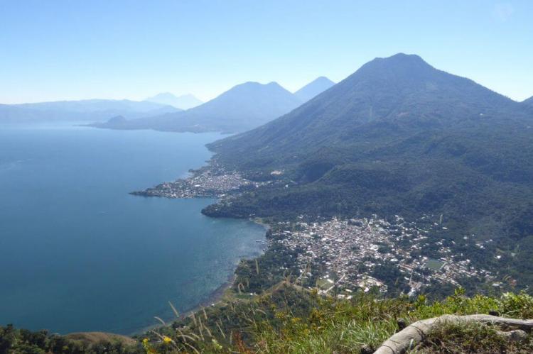
Volcán Atitlán's slopes are steep and covered with lush vegetation, including cloud forests and agricultural fields. It is situated a few kilometers south of Volcán Tolimán, with the two volcanoes separated by a long, narrow bay that extends into Lake Atitlán. Together with Volcán San Pedro, these three volcanoes create an awe-inspiring backdrop for the lake and its surrounding communities.
Flora and Fauna of Volcán Atitlán
Volcán Atitlán is home to a remarkable diversity of plant and animal life owing to its varied habitats, which range from cloud forests to agricultural lands. The volcano's higher elevations are covered by thick forests, home to several rare and endemic species.
One of the most notable species is the horned guan (Oreophasis derbianus), a large, turkey-like bird considered a relic of the Pleistocene epoch. This bird is now restricted to small patches of cloud forest at altitudes above 1,650 meters (5,410 feet). The adult male horned guan is characterized by a unique scarlet-colored "horn" on top of its head, making it one of the most visually striking birds in the region. The species is highly endangered due to habitat loss.
Another important bird species endemic to the region is the Cabanis or azure-rumped tanager (Tangara cabanisi). This small bird has one of the most restricted ranges of any species in the region, occurring only at mid-elevations within the Sierra Madre del Sur of Chiapas, Mexico, and western Guatemala. The tanager's vibrant azure plumage makes it a prized sighting for birdwatchers visiting the area.
Tourism and Significance of Lake Atitlán and Volcán Atitlán
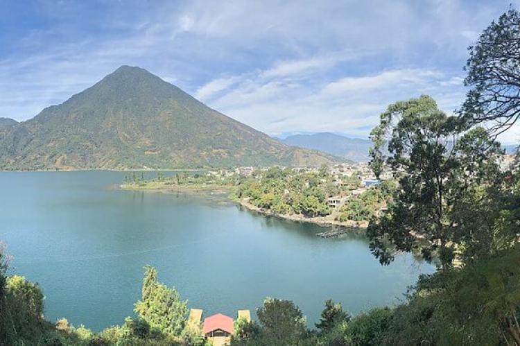
Lake Atitlán is one of Guatemala's most important tourist destinations, drawing visitors with its breathtaking views, serene waters, and the cultural richness of the Maya communities. The main towns along the lake, including Panajachel, San Lucas, and Santiago Atitlán, have become centers for tourism and anthropology, offering a mix of traditional culture and modern amenities.
Hiking around Lake Atitlán and climbing Volcán Atitlán is popular with tourists seeking adventure and natural beauty. Climbing the volcano offers unparalleled views of the lake, surrounding volcanoes, and rugged highland landscape. The region's diverse ecosystems and unique wildlife add to its appeal, especially for nature enthusiasts and birdwatchers.
In addition to its ecological and cultural significance, Lake Atitlán also plays a crucial role in sustaining the local economy. Agricultural products grown in the area, particularly coffee and avocados, are important exports, while the lake's fish provide sustenance for many Indigenous communities living along its shores.
Conclusion
Lake Atitlán and Volcán Atitlán are two of Guatemala's most treasured natural wonders. They offer a rare combination of dramatic volcanic landscapes, rich biodiversity, and vibrant Indigenous culture. The lake's deep waters and towering volcanic peaks have shaped the physical environment and the lives of the people who call the region home. For travelers, scientists, and adventurers, Lake Atitlán and Volcán Atitlán offer an unparalleled opportunity to explore the intersection of natural beauty and cultural heritage in the heart of Central America.
