The Explosive History and Unique Ecology of La Soufrière Volcano
La Soufrière is an active stratovolcano on the island of Saint Vincent in the southeastern Caribbean. It is the highest point on the island and in the Saint Vincent and the Grenadines archipelago. The volcano is known for its long and dynamic eruptive history, with 23 recorded eruptions in the past 4,000 years.
The Explosive History and Unique Ecology of La Soufrière Volcano
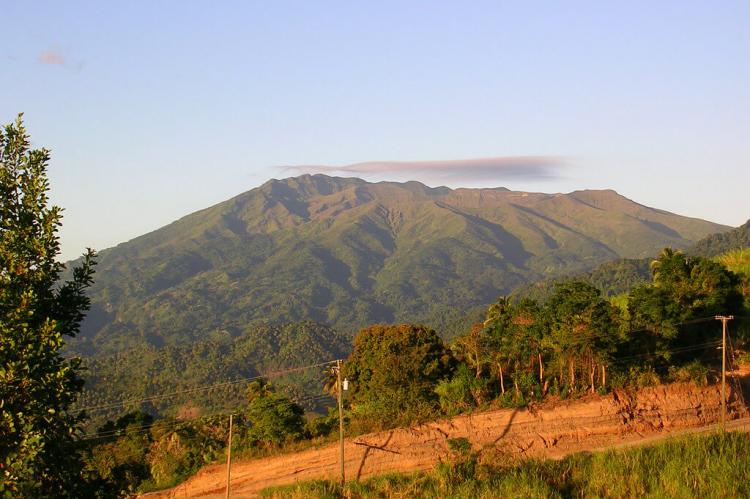
La Soufrière is an active stratovolcano on the island of Saint Vincent, the largest of the Saint Vincent and the Grenadines archipelago in the southeastern Caribbean Sea. Rising to a height of 1,178 meters (3,864 feet) above sea level, La Soufrière is the highest point on the island and the highest in the nation. The volcano is known for its long and dynamic eruptive history, with 23 recorded eruptions in the past 4,000 years.
Geological Setting
La Soufrière volcano is situated within the geologically active Lesser Antilles volcanic arc, resulting from the subduction of the Atlantic Ocean crust beneath the slowly moving Caribbean Plate. This subduction process has fueled the volcanism that has shaped the region's islands over millions of years, creating a chain of predominantly andesitic and dacitic stratovolcanoes.
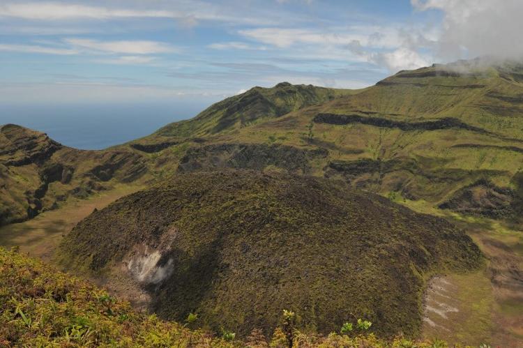
Classified as a stratovolcano, La Soufrière consists of alternating layers of hardened lava, solidified ash, and rocks ejected by explosive eruptions. The volcano's steep, conical profile is characteristic of this type of volcano, known for its potential to produce violent, explosive events.
Eruptive History
La Soufrière has exhibited a pattern of explosive eruptions throughout its history. The volcano has recorded five significant eruptions: 1718, 1812, 1902, 1979, and 2021. In addition, a minor event occurred in 1971, altering the structure of the volcano's crater lake.
The Devastating 1902 Eruption
The 1902 eruption of La Soufrière was particularly catastrophic, killing 1,680 people just hours before the even more deadly eruption of Mount Pelée on the nearby island of Martinique, which claimed 29,000 lives. On Saint Vincent, 600 people were injured or burned, and 4,000 were left homeless. The eruption devastated the habitat of the Island Caribs, an indigenous people who were the region's last significant remnant of Carib culture.
The 1979 Eruption
An eruption on April 13, 1979, caused no casualties, as the warning allowed thousands of residents to evacuate to nearby beaches. However, the eruption did produce a large ash plume that reached as far as the island of Barbados, 160 kilometers (100 miles) to the east.
The 2021 Eruption Sequence
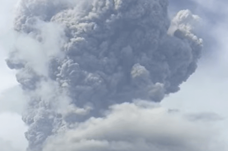
Increased volcanic activity was observed at La Soufrière in December 2020, culminating in an effusive eruption that formed a new lava dome inside the summit crater on December 27. A major explosive eruption followed on April 9, 2021, which sent an ash plume up to 8,000 meters (26,000 feet) in altitude, drifting eastward over the Atlantic Ocean. By this time, approximately 16,000 people had already been evacuated from the areas surrounding the volcano. Explosive eruptions and pyroclastic flows continued for several weeks, depositing ash on nearby islands such as Barbados.
Natural Environment
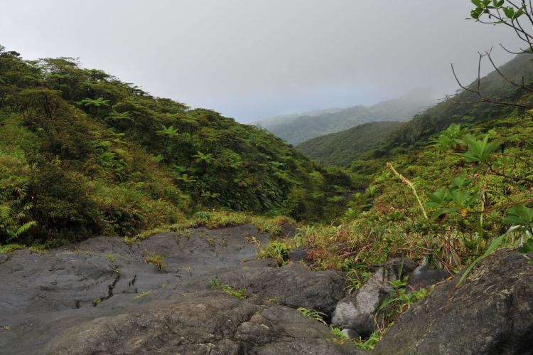
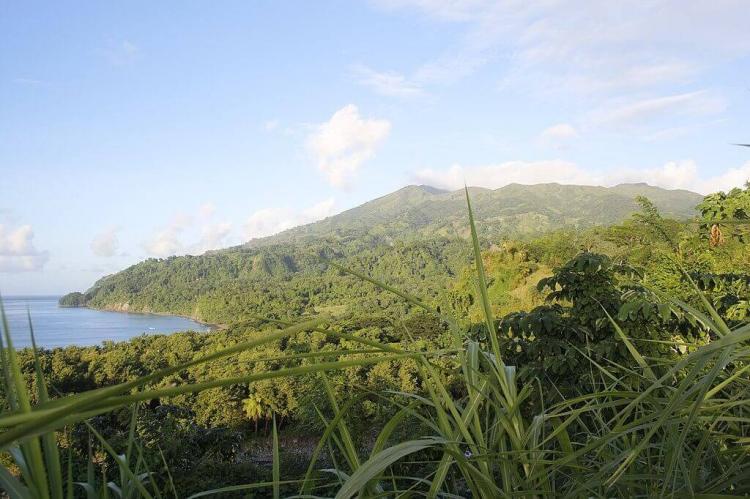
The slopes and flanks of La Soufrière volcano are covered in a diverse and vibrant natural environment. The lower elevations of the volcano are characterized by tropical moist broadleaf forests, which transition to montane cloud forests near the summit. These forests are home to a wide variety of plant and animal species, many of which are endemic to the island of Saint Vincent.
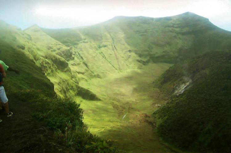
The volcano's crater lake is a unique geological feature that has formed and reformed following various eruptive events. This crater lake supports a specialized aquatic ecosystem adapted to the acidic, sulfur-rich waters. The surrounding areas also have unique geothermal features, such as fumaroles, hot springs, and mud pots.
Hazards and Monitoring
The explosive nature of La Soufrière's eruptions and its location on a densely populated island make it a significant threat to the people and infrastructure of Saint Vincent and the surrounding areas. Monitoring and preparedness are crucial to mitigating the risks posed by this active and dangerous volcano.
Geologists and volcanologists closely monitor the volcano's seismic activity, gas emissions, and other indicators of potential unrest. This information is used to develop early warning systems and evacuation plans to protect the local population in the event of future eruptions.
Conclusion
La Soufrière volcano is a dynamic and potentially catastrophic geological feature that has played a pivotal role in the history and development of the island of Saint Vincent. Its explosive eruptions, including the devastating events of 1902 and 2021, are a stark reminder of the power and danger of volcanic activity in the Caribbean region. Ongoing monitoring and effective disaster planning will be essential for safeguarding the local population in the face of future eruptive episodes while preserving the unique natural environment surrounding this iconic stratovolcano.
