Araguaia National Park: A Haven of Biodiversity and Indigenous Culture
Bananal Island in Tocantins, Brazil, is the world's largest fluvial island, formed by the Araguaia River. A haven for biodiversity and cultural heritage, it shares its environment with Araguaia National Park, a protected area that showcases the region's rich flora and fauna.


 emerge from the water on a riverbank in the Araguaia wetlands of central Brazil - by Rio Cicica at en.wikipedia, CC BY 3.0 <https://creativecommons.org/licenses/by/3.0>, via Wikimedia Commons")
: endemic to the wetlands of the central Araguaia river in Brazil and has one of the smallest ranges of any Amazon bird - by Marco Cruz, CC BY-SA 2.0 via Wikimedia Commons")

Bananal Island and Araguaia National Park: A Natural and Cultural Treasure in Brazil
In the southwestern part of Tocantins, in north-central Brazil, lies Bananal Island, the largest fluvial island in the world. Formed by the bifurcation of the Araguaia River, this unique landscape is a haven for biodiversity and cultural heritage. Sharing this remarkable environment is Araguaia National Park, a protected area that showcases the region's rich flora and fauna. Exploring the natural beauty, ecological significance, and cultural importance of Bananal Island and Araguaia National Park reveals the actual value of these extraordinary areas.
The Formation and Geography of Bananal Island
Discovery and Naming
Bananal Island was discovered on July 26, 1773, by the Sertanista José Pinto Fonseca. Originally named "Sant'Ana Island," it was later renamed "Bananal" due to its extensive banana plantations. Spanning 350 km in length and 55 km in width, Bananal is the second-largest river island in the world and the largest without an ocean coastline.
Access and Transportation
The island's isolation is maintained by its lack of bridges, making boat travel the primary means of access for most of the year. During the dry season, from June to August, vehicles can reach the island when the river levels drop. The island's transportation is limited to horses, bicycles, and walking, preserving its pristine environment.
Natural and Cultural Preserves
Ecological Zones
Bananal Island is divided into two distinct zones: the northern third, which is a National Park, and the southern two-thirds, which serves as a cultural preserve for indigenous peoples. The National Park is home to diverse ecosystems, including babassu palm forests, habitats for tropical birds, and freshwater fish.
Indigenous Inhabitants
The island is populated by the Suyá indigenous people, who encompass at least four tribes: the Javaés, Karajá, Ava-Canoeiro, and Tuxá. These tribes reside in 16 aldeias (villages). In the "Mata do Mamão," a vast forest in the island's north-central part, a small group of Avá-Canoeiros live in voluntary isolation, maintaining their traditional ways of life.
Araguaia National Park: A Biodiversity Hotspot
Establishment and Location
Araguaia National Park, established in 1959 and located on Bananal Island, protects the island's northern third. Covering 557,700 hectares (1,378,100 acres), it is a crucial area for conservation and ecotourism. The park lies at the intersection of the Amazon biome to the north and the Cerrado savanna to the south, creating a unique blend of ecosystems.
Climate and Terrain
The park's terrain is predominantly flat, between 200 and 240 meters (656 to 787 feet) above sea level. It experiences significant rainfall from November to March, leading to periodic flooding that shapes its diverse habitats.
Flora and Fauna of Araguaia National Park
Plant Life
Araguaia National Park features a mix of Pantanal wetlands, Cerrado savanna, and Amazon rainforest. The flora includes savannah grasslands, scrub, and deciduous forests, with notable species like the piassava and buriti palms. The forested areas host trees such as the cow tree, Cabralea, Tabebuia, Qualea parviflora, black sweetwood, and genipap. In contrast, the savannah areas are dotted with souari nut trees and pau-d'alho.
Animal Life
The park is a sanctuary for diverse wildlife, including mammals like marsh deer, peccaries, capybaras, giant anteaters, maned wolves, jaguars, giant otters, and armadillos. Reptiles such as anacondas, spectacled caimans, black caimans, and South American river turtles are also found here. The rivers are home to freshwater fish, Amazon river dolphins, and Tucuxi dolphins.
Avifauna
Bird enthusiasts can observe a wide variety of avifauna, including the common toucan, anhinga, greater rhea, quail, partridge, osprey, Orinoco goose, heron, egret, Spix's macaw, hoatzin, and musician wren. This diversity makes the park a critical area for bird conservation.
Cultural Significance and Preservation
Indigenous Territories
The southern two-thirds of Bananal Island are designated as cultural preserves for Indigenous communities, ensuring the protection of their lands and way of life. These areas are vital for the continuation of traditional practices and the maintenance of cultural heritage.
Ecotourism and Conservation
Araguaia National Park is a popular ecotourism destination, drawing visitors interested in its natural beauty and biodiversity. Conservation efforts within the park and the broader island aim to protect these ecosystems while promoting sustainable tourism practices.
Conclusion
Bananal Island and Araguaia National Park are exceptional examples of Brazil's commitment to preserving its natural and cultural heritage. The island's unique geographical features, diverse ecosystems, and rich cultural traditions offer a compelling narrative of coexistence between nature and indigenous communities. As stewards of these lands, efforts continue to balance conservation with the needs and rights of local populations, ensuring that Bananal Island remains a vibrant and protected sanctuary for future generations.
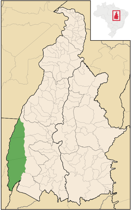
Map depicting the location of Bananal Island (green area) in the Brazilian state of Tocantins.