Alto Loa: A Volcanic Desert Sanctuary in Northern Chile
Alto Loa National Reserve, nestled amidst the towering Andes of northern Chile, showcases life's resilience in extreme environments. The area features the imposing Aucanquilcha volcano and vast salt flats, creating a captivating blend of volcanic grandeur, desert vistas, and a delicate ecology.
Unveiling the Marvels of Alto Loa: A Journey Through Chile's Volcanic Highlands
Nestled amidst the towering Andes of northern Chile, the Alto Loa National Reserve unveils a realm of stark contrasts and awe-inspiring natural wonders. This vast protected area, spanning over 300,000 hectares (740,000 acres) in the Antofagasta Region, is a true testament to the resilience of life in one of the world's most extreme environments. From the imposing Aucanquilcha volcano, a dormant giant that dominates the landscape, to the shimmering salt flats that stretch as far as the eye can see, the Alto Loa Reserve is a captivating tapestry of volcanic grandeur, desert vistas, and a delicate ecology that has adapted to thrive against all odds.
The Sentinel of the Andes: Aucanquilcha Volcano
A Towering Volcanic Edifice
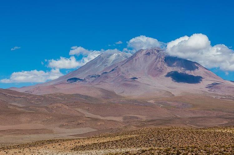
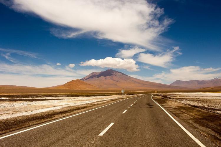
At the heart of the Alto Loa Reserve stands the Aucanquilcha volcano, a towering stratovolcano that rises to an impressive 6,176 meters (20,262 feet) above sea level. One of the most prominent volcanic towers in the region, Aucanquilcha has the distinctive form of a ridge, its imposing silhouette etched against the cerulean skies of the Atacama Desert.
Part of a larger cluster of volcanoes that dot the landscape between the Loa River and the Chile-Bolivia border, Aucanquilcha's formation can be traced back to four distinct eruptive units that occurred between 1.04 and 0.23 million years ago. Despite its dormancy, the summit of this mighty volcano still bears the telltale signs of volcanic activity, with fumarolic vents and sulfur deposits hinting at the forces that once sculpted this natural wonder.
A Legacy of Sulfur Mining
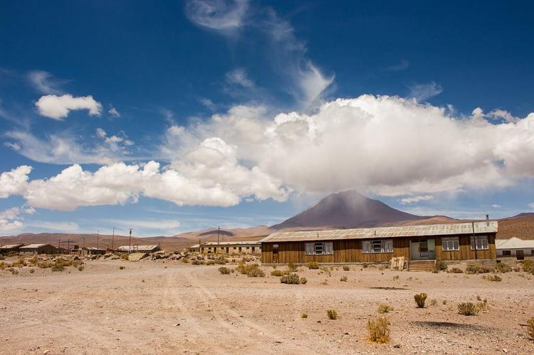
Aucanquilcha's sulfur-rich geology has played a pivotal role in the region's history, as evidenced by the remnants of several sulfur mines scattered across the volcanic complex. At an altitude of 5,950 meters (19,520 feet), one of these mines opened in 1913 and held the distinction of being the world's highest mining operation during its active years, from 1950 to 1992.
In the early days, the sulfur extracted from these lofty peaks was transported down the mountain by hardy llamas, their sure-footed steps navigating the treacherous terrain. Later, an ingenious aerial cable system spanning 22 kilometers (14 miles) was constructed, allowing the precious sulfur to be lowered in buckets from dizzying heights. Eventually, a winding road was carved into the mountainside, enabling 20-ton mining trucks to make the arduous ascent to the summit.
Today, while the mines have fallen silent, their legacy remains etched into the landscape, a testament to the human ingenuity and perseverance that once flourished in this unforgiving environment.
The Salt Flats of Alto Loa
A Shimmering Desert Oasis
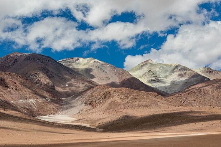
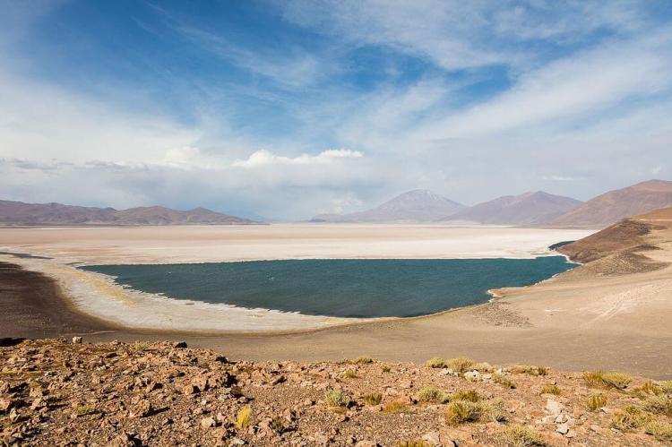
Beyond the towering volcanic peaks, the Alto Loa National Reserve reveals another of its remarkable treasures: the shimmering salt flats that stretch across the desert expanse. Three pristine salt pans – Salar de Carcote (or San Martín), Salar de Ascotán, and Salar de Ollagüe – grace this protected area, their crystalline surfaces reflecting the brilliant hues of the Andean skies.
The Salar de Carcote, a remnant of an ancient lake, covers an area of approximately 108 square kilometers (41.6 square miles), its surface elevation reaching 3,690 meters (12,106 feet) above sea level. The Salar de Ascotán, once filled by a vast 270-square-kilometer (104-square-mile) lake, now spans an impressive 246 square kilometers (95 square miles). The Salar de Ollagüe, straddling the border between Chile and Bolivia, extends across 133 square kilometers (51.3 square miles), most of its expanse within Bolivian territory.
These salt flats are more than mere geological curiosities; they are oases of life in an otherwise inhospitable desert environment. Their hypersaline waters and unique mineral compositions have given rise to a remarkable array of adapted plant and animal species, creating intricate ecosystems that defy the arid conditions surrounding them.
A Fragile Ecosystem
Enduring Life in the Desert
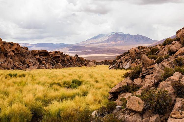
Despite the harsh climate of the Alto Loa Reserve, characterized by scant annual precipitation of approximately 3 millimeters (0.12 inches) and temperatures ranging from 25°C (77°F) to 17°C (63°F), a diverse array of flora and fauna has found a way to thrive within this volcanic desert sanctuary.
Among the resilient residents of the reserve are the iconic guanaco, the majestic Andean condor soaring overhead, the nimble viscacha scampering across rocky outcrops, and the elusive cougar. This stealthy predator stalks the arid landscapes.
The reserve's plant life is equally remarkable. Species like the tabaquillo or queñoa (Polylepis australis) and the yareta or llareta, a hardy cushion plant that can live for thousands of years, adorn the rugged terrain with bursts of verdant hues.
Protecting a Natural and Cultural Legacy
In addition to safeguarding this fragile ecosystem and its remarkable biodiversity, the Alto Loa National Reserve plays a crucial role in supporting the social and economic development of the region's indigenous communities. These communities can share their rich cultural heritage by operating tourist concessions within the reserve while fostering sustainable economic growth.
Moreover, one of the reserve's primary objectives is protecting the source of the Loa River, a vital lifeline that sustains the desert region's ecosystem and the communities that call it home.
Conclusion
The Alto Loa National Reserve is a marvel of nature, where volcanic grandeur, shimmering salt flats, and resilient life converge in a breathtaking display of Earth's diversity. From the towering Aucanquilcha volcano, a silent sentinel that bears witness to the region's geological history, to the shimmering salt pans that mirror the brilliant Andean skies, this protected area presents a captivating tapestry of contrasts and natural wonders.
Exploring the volcanic landscapes, traversing the crystalline salt flats, and observing the adapted flora and fauna that inhabit this desert sanctuary highlights the incredible resilience of life and underscores the importance of preserving these fragile ecosystems for future generations.
The Alto Loa National Reserve stands as a testament to the enduring beauty and fragility of the planet, inviting all to tread lightly, appreciate its wonders, and protect its delicate balance for the future.
