Bridging Civilizations: The Enduring Legacy of Argentina's Quebrada de Humahuaca
Nestled in the heart of Argentina's Jujuy Province, the Quebrada de Humahuaca stands as a testament to the enduring relationship between human civilization and the natural world. This narrow, arid valley has been a crucial passageway for people, goods, and ideas for over 10,000 years.
The Quebrada de Humahuaca: A Timeless Corridor of Culture and Nature
Nestled in the heart of Argentina's Jujuy Province, the Quebrada de Humahuaca stands as a testament to the enduring relationship between human civilization and the natural world. This narrow, arid valley, stretching for 155 kilometers (96 miles) along the Río Grande, has been a crucial passageway for people, goods, and ideas for over 10,000 years. Recognized as a UNESCO World Heritage Site, the Quebrada de Humahuaca offers visitors a unique blend of stunning landscapes, rich cultural heritage, and a living history that continues to shape the region today. Notably, the Quebrada follows the route of the Main Andean Road, a vast network of pre-Columbian and Inca pathways that played a crucial role in developing Andean civilizations.
Geographical Overview
The Quebrada de Humahuaca is a remarkable geological formation characterized by its steep-sided valley walls and the winding course of the Río Grande. Bordered by the Altiplano to the west and north, the Sub-Andean hills to the east, and the warm valleys (Valles Templados) to the south, this quebrada—a term meaning "broken" or deep valley—creates a distinct microclimate within the larger Andean landscape.
The Quebrada's orientation is not coincidental; it follows the line of the Main Andean Road, also known as Qhapaq Ñan or the Inca Trail. This alignment with such a significant cultural route has profoundly influenced the valley's historical development and continues to shape its importance today.
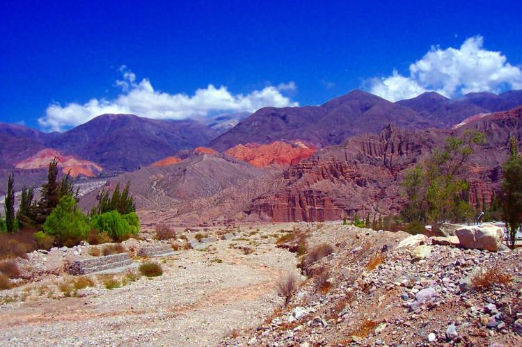
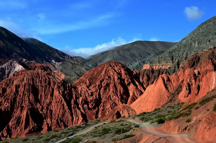
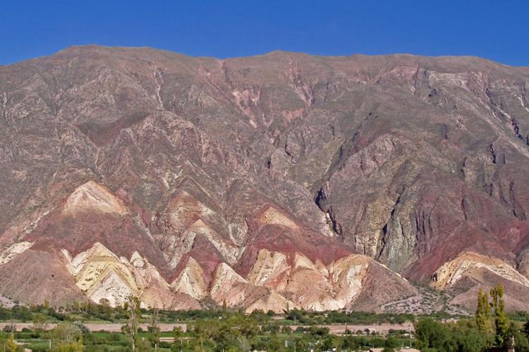
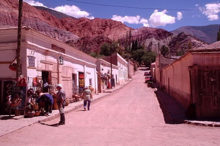
One of the most striking features of the Quebrada is its colorful mountains, composed of various minerals that paint the landscape in vibrant hues. The Cerro de los Siete Colores, or Hill of Seven Colors, stands as the crown jewel of this geological spectacle. This mountain, rising to an elevation of 3,400 meters (11,150 feet), displays a stunning array of colors that seem to shift with the changing light, creating a natural masterpiece that captivates visitors worldwide.
Historical Significance
The historical importance of the Quebrada de Humahuaca cannot be overstated. This valley has been a critical route for trade and communication for millennia, linking diverse cultures and civilizations. Archaeological evidence suggests a human presence in the region dating back at least 10,000 years, with early hunter-gatherer societies leaving behind substantial prehistoric remains.
The Quebrada's role in the Main Andean Road system cannot be overstated. This extensive network of pathways, developed by pre-Inca civilizations and later expanded by the Inca Empire, stretched from Colombia to Chile. The Quebrada was a crucial link in this system, facilitating the movement of people, goods, and ideas across the challenging Andean terrain. This connection to the more extensive road network amplified the valley's importance as a conduit for cultural exchange and economic activity.
During the 15th century, the Quebrada became an integral part of the Inca Empire's extensive road network, facilitating the movement of goods and people across the vast Andean realm. Later, under Spanish colonial rule, the valley served as a vital link between the Viceroyalties of Río de la Plata and Peru, playing a crucial role in the economic and administrative structure of the Spanish American empire.
The Quebrada's strategic importance continued into the 19th century when it became a theater of conflict during the Spanish War of Independence. The valley witnessed numerous battles as the newly emerging nations of South America fought for their sovereignty.
Ecological Importance
The unique geography and climate of the Quebrada de Humahuaca have given rise to a diverse ecosystem adapted to the harsh conditions of the high-altitude environment. The valley's ecological significance is evident in the variety of plant and animal species that have evolved to thrive in this challenging landscape.
Of particular note are the extensive agricultural terraces at Coctaca, believed to have been established around 1,500 years ago. These ancient farming systems, still in use today, demonstrate the ingenuity of early inhabitants in adapting to and cultivating the steep terrain. The terraces showcase sustainable agricultural practices and play a crucial role in preserving soil and water resources in the arid climate.
Socio-Economic Aspects
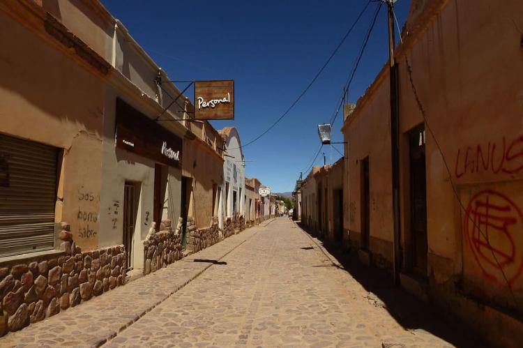
The Quebrada de Humahuaca continues to be a living cultural landscape where ancient traditions blend with modern life. The valley is home to several communities, including the town of Humahuaca, which lends its name to the region. These settlements maintain a rich cultural heritage, evident in their architecture, festivals, and daily practices.
The region's diverse economy encompasses agriculture, tourism, and traditional crafts. The ancient agricultural terraces remain productive, supporting local communities and preserving age-old farming techniques. Tourism has become an important economic driver, with visitors drawn to the area's natural beauty, historical sites, and cultural experiences.
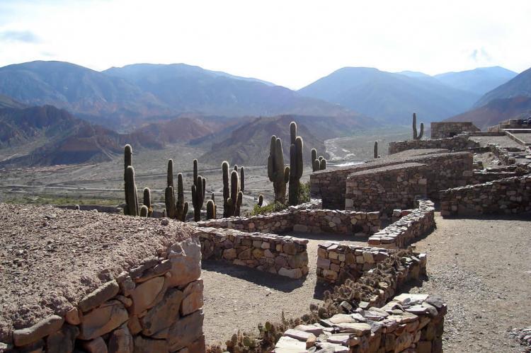
The Quebrada is dotted with significant archaeological and historical sites, including the Pucará de Tilcara, a pre-Inca fortified town dating back to around 1000 BC. Colonial-era churches, such as the 17th-century Iglesia de San Francisco in Humahuaca, remind the region's complex history and the blending of indigenous and European influences.
Conclusion
The Quebrada de Humahuaca is a remarkable testament to the enduring relationship between human civilization and the natural world. Its stunning landscapes, rich cultural heritage, and historical significance make it a unique and invaluable part of Argentina's national identity and world heritage. As a corridor of culture and nature, the Quebrada continues to inspire and educate, offering insights into sustainable living practices and the deep connections between people and their environment. As a vital segment of the Main Andean Road, the Quebrada de Humahuaca stands as a testament to the ingenuity of ancient civilizations in creating vast networks of communication and trade across challenging landscapes. The preservation and study of this extraordinary valley remain crucial for understanding our past and informing our future as we navigate the challenges of the modern world.
