
Radal Siete Tazas National Park: Seven Basalt Pools at the Edge of the Mediterranean Andes
Radal Siete Tazas National Park, in Chile's Maule Region, protects the Claro River's seven basalt pools and waterfalls, carved into old lava flows, and a forest that marks the shift from Mediterranean Chile to the moist forests of the south.
Radal Siete Tazas National Park: Lava, a River, and the Maule Region's First National Park
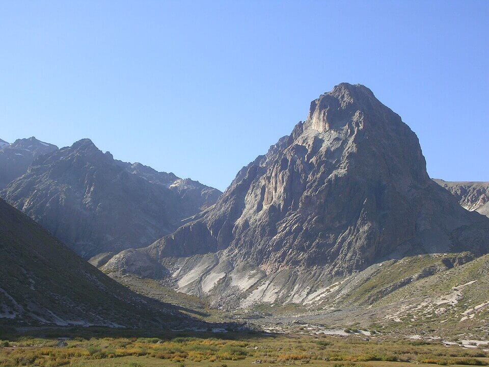
Radal Siete Tazas National Park lies in the Andean foothills of the commune of Molina, in the Curicó Province of the Maule Region. It covers 4,138 hectares (about 10,200 acres) between roughly 650 and 2,600 m (2,130 and 8,530 ft), beside the Descabezado Grande volcano (3,830 m, or 12,570 ft). It is reached from Molina, about 212 km (132 mi) south of Santiago, by Route K-175, a drive of about 55 km (34 mi) that takes an hour or more to the village of Radal. The upper basin of the Claro River marks the start of an ecological transition between the drought-tolerant Mediterranean vegetation to the north and the moist evergreen forests of the south, and that meeting of two biomes shapes both its trees and its wildlife. The park lies in the Andean foothills above the Central Valley described in our Coastal Range and Central Valley article, within the central region covered in our Zona Central article.
A Park Carved from a Reserve
Protection came in stages. CONAF proposed protecting the area in 1980, and in 1981 it became a tourist protection area. On March 20, 1996, Decree 89 created Radal Siete Tazas National Reserve, covering 5,147.58 hectares (about 12,720 acres) in six lots, with the aim of protecting a mix of Andean steppe and forest types and species with conservation problems, including the Andean cypress (Austrocedrus chilensis), the peregrine falcon (Falco peregrinus), the Andean condor (Vultur gryphus), and the tricahue parrot (Cyanoliseus patagonus bloxami), along with the scenery of the seven pools and waterfalls. On March 25, 2008, Decree 15 created the national park, the first in the Maule Region, from most of the reserve's land, and a roughly 1,000-hectare (2,500-acre) remainder continues as a national reserve beside it, a reclassification inaugurated by President Michelle Bachelet. The area received more than 25,000 visits a year at the time.
The Basalt Pools
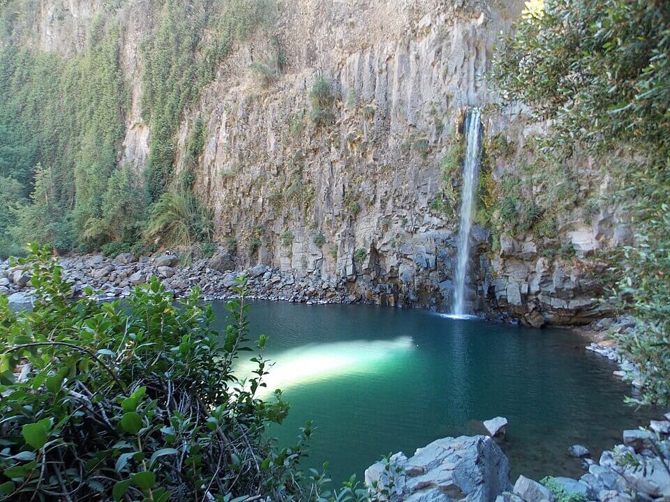
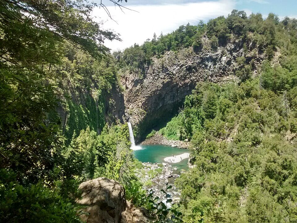
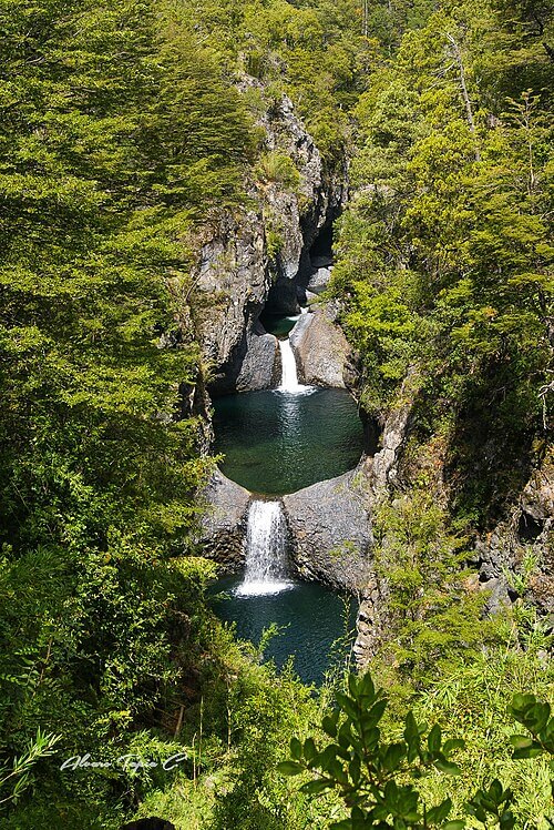
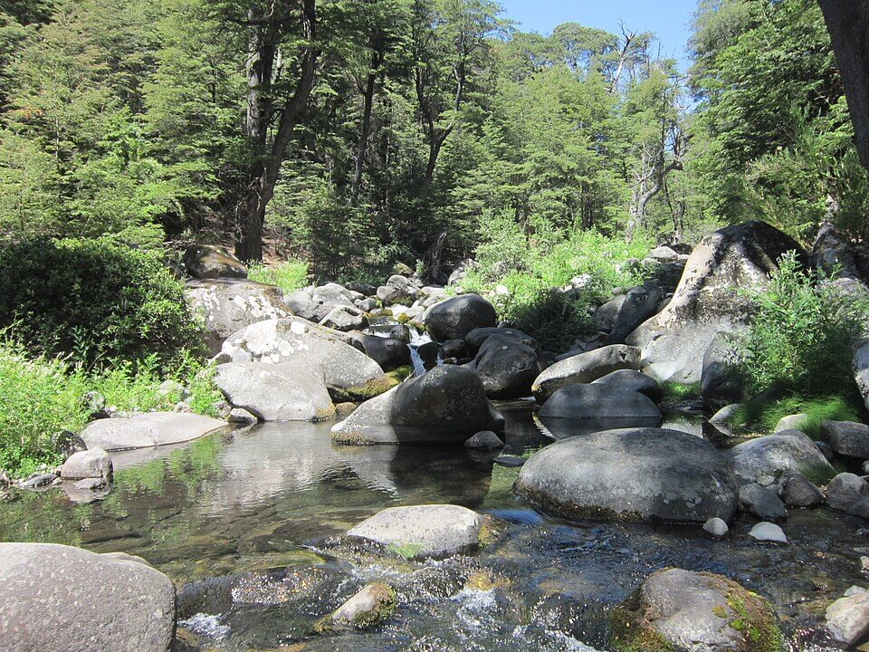
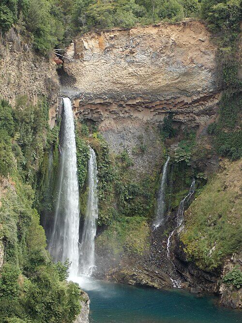
The park is named for the Siete Tazas ("seven cups"), a staircase of seven consecutive pools and waterfalls, 1 to 10.5 m (3 to 34 ft) high, carved by the Claro River into dark basalt. Millions of years ago, intense volcanic activity sent lava flows down the mountains, filling old glacial valleys, and the river has since cut through cracks in that rock, shaping the pools and the narrow gorge below them. Downstream, the river drops over the Salto de la Leona, about 25 m (82 ft) high by most accounts, while the Velo de la Novia ("bridal veil"), 40 to 50 m (130 to 165 ft) high depending on the source, falls beside the road into the park. Farther upriver, in the Parque Inglés sector, the Valle del Indio, where the Claro rises, and the Cordón del Guamparo open views to Descabezado Grande.
Where Two Forests Meet
The park's forests mix northern and southern species. Lower slopes hold the Mediterranean trees of central Chile, such as hualo (Nothofagus glauca) and peumo (Cryptocarya alba), while the higher and moister sites hold southern beeches, including roble (Nothofagus obliqua), raulí (Nothofagus alpina), coigüe (Nothofagus dombeyi), and ñirre (Nothofagus antarctica), along with the Andean cypress on the highest sites. Above the forest, the vegetation gives way to the high Andean steppe of the Maule Andes. The reserve's founding decree listed the Andean cypress, hualo, luma blanca (Legrandia concinna), a small tree found only in the Andean foothills between Curicó and Ñuble and officially listed as Endangered, and the Chubut maitén (Maytenus chubutensis) among the trees with conservation problems. Farther south, the same southern beeches mix with monkey puzzle trees in Nahuelbuta and Tolhuaca national parks.
Wildlife
The park is home to the puma (Puma concolor), the culpeo fox (Lycalopex culpaeus) and the gray fox (Lycalopex griseus), the colocolo cat (Leopardus colocola), the güiña (Leopardus guigna), and the pudú (Pudu puda), and the monito del monte (Dromiciops gliroides), a small marsupial often called a living fossil, has been reported here as well. The Magellanic woodpecker (Campephilus magellanicus), Chile's largest woodpecker, hammers the older trees, and CONAF and the Universidad Católica del Maule have used acoustic monitoring to study its population. Andean condors and peregrine falcons patrol the ridges, along with the giant hummingbird (Patagona gigas).
Concessions, Drought, and Fire
The park has been the site of several disputes. In 2018, the Ministry of National Assets concessioned about 29 hectares (72 acres) of the park, less than 1% of it, in two areas: the El Radal sector (2.75 hectares, or 6.8 acres, for 10 years) and the Siete Tazas, Parque Inglés, and El Bolsón sectors (26.65 hectares, or 66 acres, for 25 years), to a Molina municipal corporation and a private company, which also runs the camping area. In February 2020, CONAF closed the river-access area at Salto de la Leona because the Claro's low flow during a drought no longer replenished the pool, and closed a campground in the neighboring Altos de Lircay reserve. Residents had also protested in 2017 against an Italian energy company's purchase of water rights on the same river for a hydroelectric project. In February 2020, the Agua Fría fire, which started on private land in Molina, burned more than 11,000 hectares (more than 27,000 acres) over three weeks and closed the park because of smoke, though authorities said it did not reach the park itself. CONAF has since closed the park preventively during extreme heat, as in February 2023 and January 2025.
Visiting the Park
The road from Radal passes the Velo de la Novia viewpoint about 2.6 km (1.6 mi) in, then reaches the Siete Tazas ranger post about 4.4 km (2.7 mi) farther, where a 400 m (1,300 ft) trail leads to the pools. A trail of about 1.2 km (0.75 mi) continues to the Salto de la Leona viewpoint, and the 7 km (4.3 mi) Los Chiquillanes trail, named for a nomadic Andean people who are believed to have lived in these forests with the Pehuenche, climbs through oak forest with views of the Claro valley and Descabezado Grande. CONAF's main post is at Parque Inglés, 11 km (6.8 mi) beyond the Radal entrance, and the El Bolsón trail forms part of the multi-day Cóndores circuit, a traverse that links the park with the Altos de Lircay National Reserve. January and February are the busiest months, and CONAF's current conditions page should be checked before a visit.
Conclusion
Radal Siete Tazas is a small park that carries a great deal: a lava-carved gorge that has become one of central Chile's best-known sights, a forest where two biomes meet, and a river whose flow now matters for tourism, hydropower, and wildlife alike. Its future will depend on water, which drought and development are making scarcer, and on keeping wildfire out of the forests that shelter it.