Exploring Vicente Pérez Rosales: Chile's Oldest National Park
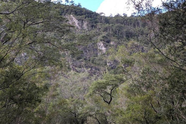
Vicente Pérez Rosales National Park encompasses an expansive area within the Lakes Region of the Chilean Andes and is renowned for its breathtaking and diverse landscapes. It hosts the iconic Lake Todos Los Santos and the Petrohué Waterfalls, surrounded by Valdivian temperate rainforests.
Vicente Pérez Rosales National Park: A Sanctuary of Natural Splendor in Chile
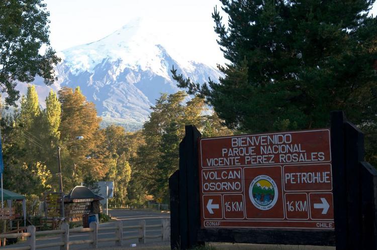
Chile, renowned for its diverse landscapes, is home to some of South America's most spectacular natural wonders. Among these treasures lies the Vicente Pérez Rosales National Park, a testament to Chile's commitment to preserving its pristine wilderness. Chile's first national park, established in 1926, is named in honor of Vicente Pérez Rosales, a revered Chilean politician and diplomat. The park offers a tapestry of breathtaking scenery and ecological diversity, encompassing an expansive area of 253,780 hectares within the Lakes Region of the Chilean Andes.
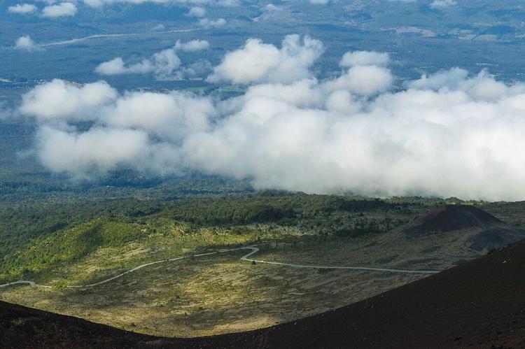
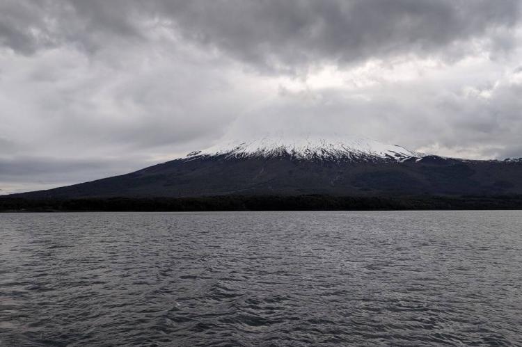
The park has three sectors: Sector Osorno, Sector Petrohué, and Sector Peulla. Each sector boasts unique attractions, ranging from the emerald expanse of Lake Todos Los Santos to the majestic peaks of Osorno, Tronador, and Puntiagudo volcanoes. Visitors to the park are treated to a visual feast of turquoise waters cascading down the Petrohué Waterfalls, set amidst a backdrop of verdant forests and towering mountains.
As part of the Bosques Templados Lluviosos de Los Andes Australes Biosphere Reserve, Vicente Pérez Rosales National Park is vital in conserving the region's rich biodiversity. Together with adjacent Puyehue National Park in Chile, Nahuel Huapi National Park and Lanín National Park in Argentina, it forms a contiguous protected area spanning nearly 15,000 square kilometers (5,800 square miles). This vast expanse of protected wilderness is a sanctuary for numerous plant and animal species, safeguarding their habitats for future generations.
Lake Todos Los Santos
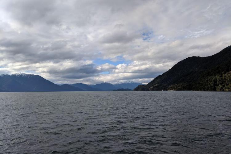
Lake Todos Los Santos, nestled within Vicente Pérez Rosales National Park, covers an area of 178.5 square kilometers (69 square miles) with a maximum depth of 337 meters (1,100 feet). Its formation is attributed to a combination of glacial and volcanic processes. Roughly 20,000 years ago, the basin was occupied by a glacier that receded about 10,000 years ago, leaving behind a large body of water. Osorno and Calbuco volcanoes played a significant role, as lava flows from these volcanoes formed natural dams, further shaping the lake.
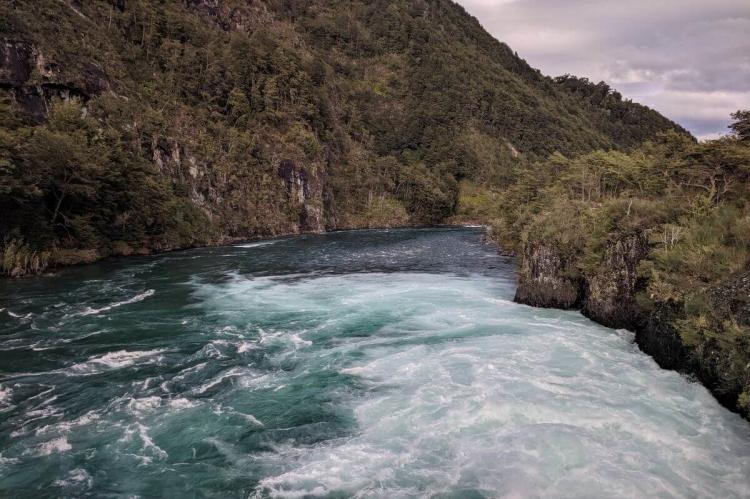
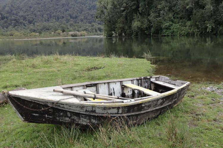
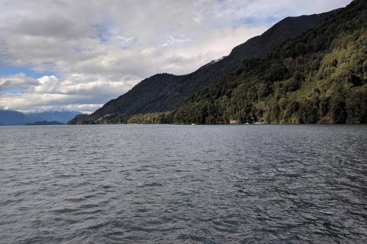
The lake's waters are surrounded by Valdivian temperate rainforests, which reflect its lush greenery. Fed by the Río Peulla/Río Negro, its outflow at Petrohué contributes to the Petrohué Waterfalls. This waterfall system results from the lake's waters carving through the volcanic landscape. The lake's appearance varies depending on weather conditions, often displaying green, blue, or silver hues, primarily influenced by glacial meltwater. Lake Todos Los Santos serves as a vital habitat for various flora and fauna, supporting the ecosystem within the national park. Its tranquil setting offers visitors opportunities for recreation and exploration amidst the natural beauty of the Andean landscape.
Petrohué Waterfalls
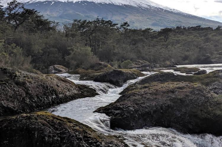
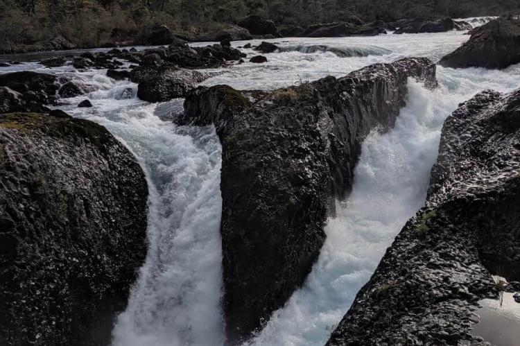
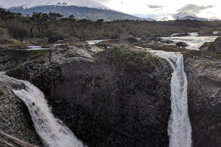
A short distance downstream from Lake Todos Los Santos, the Petrohué Waterfalls stand as a testament to nature's raw power. Carved into the basaltic lava flows of the Osorno Volcano, these cascading falls unleash a torrent of water, their thunderous roar reverberating through the surrounding landscape. With an average flow of 270 cubic meters (9,500 cubic feet) per second, the Petrohué Waterfalls are a mesmerizing spectacle, drawing visitors from far and wide to witness their awe-inspiring beauty.
The Petrohué Waterfalls' rugged terrain provides a dramatic backdrop, with snow-capped peaks and verdant forests framing the cascading waters. Against this picturesque setting, the falls epitomize the untamed splendor of Chile's wilderness, offering a glimpse into the raw and unbridled forces that have shaped the landscape over millennia.
Flora
Vicente Pérez Rosales National Park boasts diverse flora, primarily consisting of Valdivian temperate rainforests and other vegetation adapted to the Andean environment. The composition of the park's flora varies with altitude and substrate, contributing to its rich biodiversity. Some notable plant species found within the park include:
- Coihue (Nothofagus dombeyi): Coihue, also known as southern beech, is one of the park's most common and dominant tree species. It thrives in the Valdivian temperate rainforest and is crucial in shaping the ecosystem.
- Muermo (Eucryphia cordifolia): Muermo, also known as ulmo, is another prominent tree species in the park. Its white flowers and dense foliage contribute to the park's scenic beauty.
- Tineo (Weinmannia trichosperma): Tineo, also known as teñiu, is a deciduous tree species that adds to the diversity of the park's forests. It is often found in association with coihue and other tree species.
- Arrayán (Luma apiculata): Arrayán, or Chilean myrtle, is a small evergreen tree known for its distinctive cinnamon-colored bark and aromatic leaves. It adds to the biodiversity of the park's forests.
- Chusquea Bamboo (Chusquea spp.): Bamboo species belonging to the genus Chusquea are common in the understorey of the park's forests. They provide habitat and food for various wildlife species.
These are just a few examples of the diverse flora found within Vicente Pérez Rosales National Park. The park's vegetation contributes to its ecological significance and supports a wide range of animal species.
Fauna
The park is home to a rich variety of fauna, including mammals, birds, reptiles, amphibians, and insects. Some notable animal species found within Vicente Pérez Rosales National Park include:
- Puma (Puma concolor): The park provides a habitat for pumas, also known as mountain lions or cougars. These elusive predators play a crucial role in maintaining the ecological balance within the park.
- Southern Andean Deer (Huemul, Hippocamelus bisulcus): The huemul is an endangered deer species native to the Andes mountains of Chile and Argentina. Vicente Pérez Rosales National Park is an important refuge for this iconic species.
- Darwin's fox (Lycalopex fulvipes): This small fox species is endemic to Chile and inhabits the park's dense forests and woodlands. It is also known as Darwin's Zorro.
- Andean Condor (Vultur gryphus): The Andean condor is one of the largest flying birds in the world. It can be spotted soaring above the park's mountainous landscapes. The condor is a symbol of the Andean region's natural heritage.
- Southern River Otter (Lontra provocax): This semi-aquatic mammal is found in the park's rivers and lakes, feeding on fish and crustaceans. It is known for its playful behavior and sleek, streamlined body.
Climate
Vicente Pérez Rosales National Park experiences a diverse climate influenced by its location in the Chilean Andes and proximity to the Pacific Ocean. The park's climate can be characterized as temperate with distinct seasonal variations.
Rainfall: The park receives significant precipitation throughout the year, with the rainiest months typically occurring between June and August. During this period, abundant rain contributes to the park's lush vegetation and vibrant ecosystem. Conversely, the least amount of rainfall is recorded during January, February, and March. The rainy season fosters vegetation growth, which extends over approximately six months of the year.
Temperature: The average annual temperature within the park's inhabited levels, which range from 3,000 to 4,000 meters in altitude, is around 11 to 12°C (52 to 54°F). The temperature varies depending on the altitude, with cooler temperatures experienced at higher elevations. Snow persists for most of the year above 1,000 meters in altitude. During the warm summer months, the average daily maximum temperature can reach around 25°C (77°F), providing favorable conditions for outdoor activities and exploration within the park.
Seasonal Variation: The park experiences distinct seasonal changes, with summer and winter being the most pronounced. Summer, typically from December to February, brings warmer temperatures and longer daylight hours, making it an ideal time for hiking, sightseeing, and other outdoor activities. Winter, spanning from June to August, is characterized by cooler temperatures and increased rainfall, which may limit specific outdoor recreational opportunities. However, winter also offers unique experiences, such as snowfall, creating opportunities for winter sports and snow-related activities in the park's higher elevations.
Trekking Trails
Vicente Pérez Rosales National Park offers a variety of trekking trails that cater to different skill levels and interests, allowing visitors to explore the park's diverse landscapes, including lush forests, volcanic peaks, and picturesque waterfalls. Here are some of the trekking trails available within the park:
- Petrohué River Falls Trail: This recreational trail spans approximately 0.6 kilometers and takes about 30 minutes to complete. It offers stunning views of the Petrohué River Falls, allowing visitors to witness the impressive cascades up close.
- Los Enamorados Trail: This recreational trail extends about 0.9 kilometers and takes approximately 45 minutes to hike. It allows visitors to explore the park's scenic beauty and enjoy leisurely walks through the forested terrain.
- Laguna Verde Trail: This short recreational trail covers approximately 0.18 kilometers and can be completed in around 20 minutes. It leads to Laguna Verde, a picturesque green lagoon nestled within the park's pristine surroundings.
- Cascada de Los Novios Trail: This recreational trail measures about 0.4 kilometers and takes around 25 minutes to hike. It leads to the Cascada de Los Novios, or "Waterfall of the Newlyweds," offering a romantic setting and breathtaking views of the cascading waters.
- Los Pilleyos Trail: This recreational trail spans approximately 1.2 kilometers and takes about 45 minutes to complete. It offers a longer trek through the park's forests, providing birdwatching and wildlife spotting opportunities.
- Carilemu Trail: This interpretive trail covers about 1.2 kilometers and takes around 45 minutes to hike. It offers informative signage along the way, allowing visitors to learn about the park's flora, fauna, and geological features.
- Paso Desolación Trail: This longer excursion trail extends approximately 10 kilometers and takes about 6 hours to complete. It offers a challenging trek through diverse landscapes, including forests, alpine meadows, and volcanic terrain, with stunning views of the surrounding mountains and valleys.
- Rincón del Osorno Trail: This excursion trail measures about 5 kilometers and takes around 4 hours to hike. It leads to Rincón del Osorno, a scenic viewpoint offering panoramic vistas of Volcan Osorno and the surrounding area.
- El Solitario Trail: This excursion trail spans approximately 6 kilometers and takes about 2 hours to hike. It offers a moderate trek through forests and meadows, with opportunities to enjoy the solitude and tranquility of the park's remote areas.
- Laguna Margarita Trail: This longer excursion trail covers about 8 kilometers and takes around 8 hours to hike. It leads to Laguna Margarita, a beautiful alpine lake nestled amidst the park's rugged landscapes, offering a rewarding trek for experienced hikers.
- Termas del Callao Trail: This excursion trail extends for approximately 8 kilometers and takes about 5 hours to hike. It leads to the Termas del Callao, natural hot springs where visitors can relax and rejuvenate amidst the park's stunning scenery.
- Los Alerzales Trail: This excursion trail measures about 3.4 kilometers and takes around 4 hours to hike. It leads to Los Alerzales, a forested area dominated by ancient alerces (larch) trees, offering a glimpse into the park's ecological diversity.
- Cayutué Trail: This longer excursion trail covers approximately 25 kilometers and takes about 5 hours to hike. It offers a challenging trek through remote areas of the park, with opportunities to experience the wilderness and solitude of the Andean landscape.
- Cerro Rigi Trail: This excursion trail is about 8 kilometers long and takes about 5 hours to hike. It leads to Cerro Rigi, a scenic viewpoint offering panoramic vistas of the surrounding mountains, lakes, and forests.
- Paso Vuriloche Trail: This extensive excursion trail extends for approximately 40 kilometers and takes about five days to complete. It is typically done on horseback. It offers a multi-day trek through remote areas of the park, crossing mountain passes and valleys, with opportunities to experience the rugged beauty of the Andean landscape.
Conclusion
In conclusion, Vicente Pérez Rosales National Park, Lake Todos Los Santos, and Petrohué Waterfalls are examples of Chile's natural heritage. From the rugged slopes of the Andes Mountains to the tranquil shores of its pristine lakes, this region offers many experiences for nature lovers and adventurers alike. As stewards of these precious ecosystems, society is responsible for preserving and protecting them for future generations.
