Nazca Lines: Lines and Geoglyphs of Nasca and Palpa (Peru)
The Nazca Lines are a group of very large geoglyphs formed by depressions or shallow incisions made in the soil of the Nazca Desert in southern Peru between 500 BC and 500 AD. The site is one of the most impressive-looking archaeological areas in the world.
Nazca Lines
The Nazca Lines (or Nasca* Lines) are a group of enormous geoglyphs formed by depressions or shallow incisions made in the soil of the Nazca Desert in southern Peru. The Nazca Desert is within the larger Sechura Desert of coastal Peru.
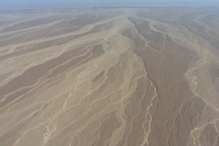
The high, arid plateau stretches more than 80 km (50 mi) between the towns of Nazca and Palpa on the Pampas de Jumana. The Nazca Lines are naturally preserved by the region's dry climate and winds that sweep sand out of their grooves.
Since their discovery in the 1920s, the lines have been variously interpreted, but their significance remains largely shrouded in mystery. They were designated as a UNESCO World Heritage Site in 1994.
Most of the Nazca Lines were constructed more than 2,000 years ago by the people of the Nasca culture (c. 200 BCE–600 CE), though some predate the Nazca and are considered to be the work of the earlier Paracas culture.
Not far from the Nazca lines in the province of Palpa, Peru, archaeologists have newly discovered more than 25 geoglyphs carved into the desert hillsides. The glyphs are commonly known as the Paracas geoglyphs. Experts consider these glyphs hundreds, if not a thousand years older than the Nazca lines.
The glyphs were built by the ancient Peruvian Indian culture of Paracas. This is the same culture that created the well-known geoglyph known as the Paracas Candelabra.
Lines and Geoglyphs of Nasca and Palpa
The Lines and Geoglyphs of Nasca (or Nazca*) and Palpa, a World Heritage Site, are located in the arid Peruvian coastal plain, some 400 km (250 mi) south of Lima. It is one of the most impressive-looking archaeological areas in the world.
Located in the arid Peruvian coastal plain, some 400 km (250 mi) south of Lima, the lines exemplify the traditional magical-religious world of the ancient pre-Hispanic societies. These societies flourished on the Peruvian south coast between the 8th century BC and the 8th century AD.
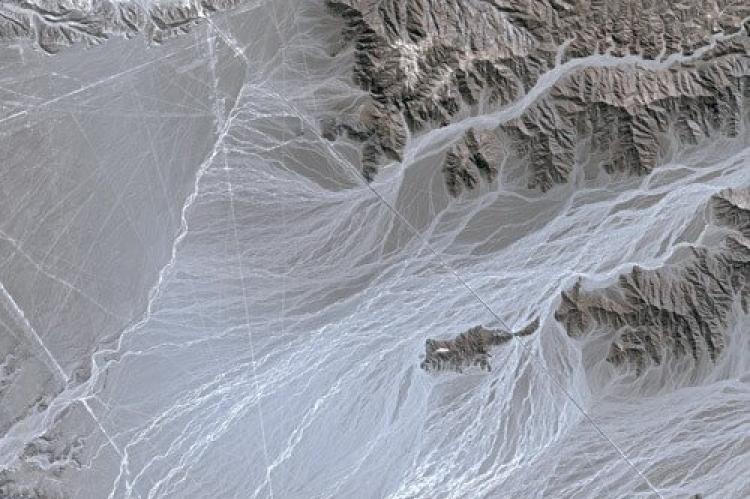
The lines are located in the desert plains of the basin river of Rio Grande de Nazca. The archaeological site covers an area of approximately 75,000 ha (186,000 acres).
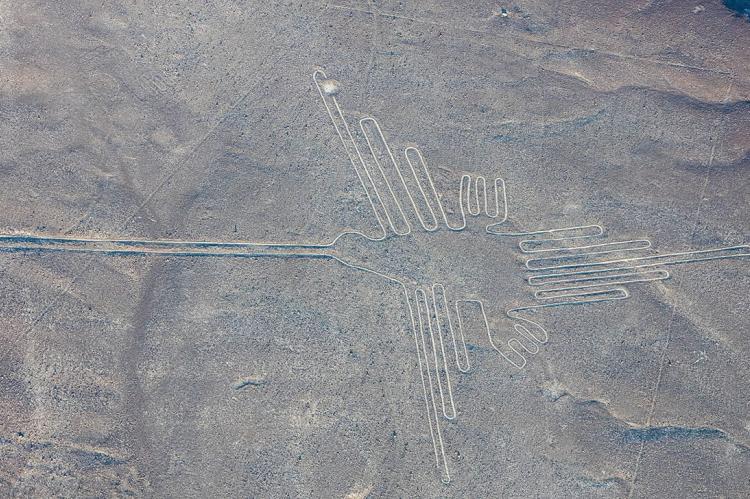
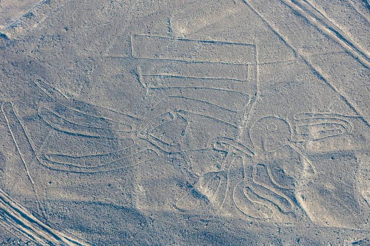
For nearly 2,000 uninterrupted years, the region's ancient inhabitants drew thousands of large-scale zoomorphic and anthropomorphic figures and lines or sweeps on the arid ground with outstanding geometric precision.
The lines transformed the vast land into a highly symbolic, ritual and social-cultural landscape that remains until today. They represent a remarkable manifestation of a common religion and social homogeneity that lasted a considerable time.
They are the most outstanding group of geoglyphs anywhere in the world. They are unmatched in their extent, magnitude, quantity, size, diversity and ancient tradition to any similar work.
The concentration and juxtaposition of the lines, as well as their cultural continuity, demonstrate that this was an important and long-lasting activity, lasting approximately one thousand years.
Intensive study of the geoglyphs and comparison with other manifestations of contemporary art forms suggests that they can be divided chronologically from the Middle and Late Formative (500 BC - 200 AD) to the Regional Development Period (200 - 500 AD), highlighting the Paracas phase (400 - 200 BC) and the Nasca phase (200 BC - 500 AD).
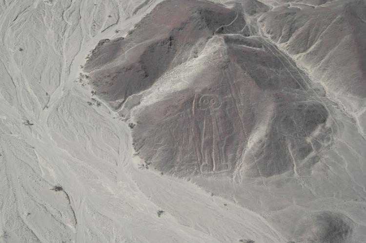
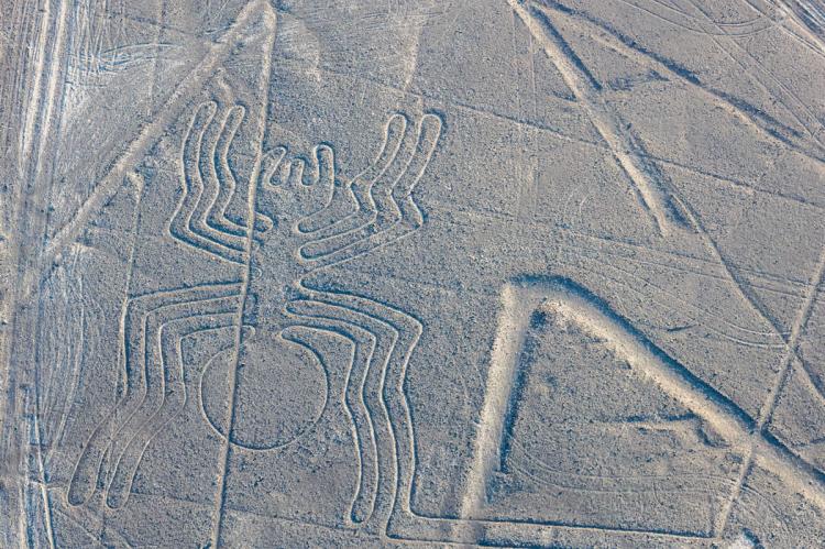
There are two categories of glyphs: the first group is representational, depicting in schematic form various natural forms, including animals, birds, insects, and other living creatures and flowers, plants, and trees, deformed or fantastic figures and objects of everyday life. There are very few anthropomorphic figures.
The second group comprises the lines, which are generally straight lines that crisscross certain parts of the pampas in all directions. Some are several kilometers long and form designs of many geometrical figures: triangles, spirals, rectangles, wavy lines, etc.
Others radiate from a central promontory or encircle it. Yet another group consists of so-called 'tracks,' which appear to have been laid out to accommodate large numbers of people.
* "Nazca" and "Nasca" are commonly used interchangeably, but generally, Nasca is used to refer to the period and culture that inhabited this area, while Nazca is used to describe the elements, such as the region, town and river.
