
The Paraná Plateau: A Continent-Wide Legacy of Gondwana's Fire
The Paraná Plateau is a vast basalt tableland spanning southern Brazil, eastern Paraguay, northeastern Argentina, and northern Uruguay, formed by one of the largest volcanic eruptions in Earth's history. Its fertile soils, dramatic waterfalls, and role as a hydroelectric powerhouse make it one of South America's most economically significant landforms.
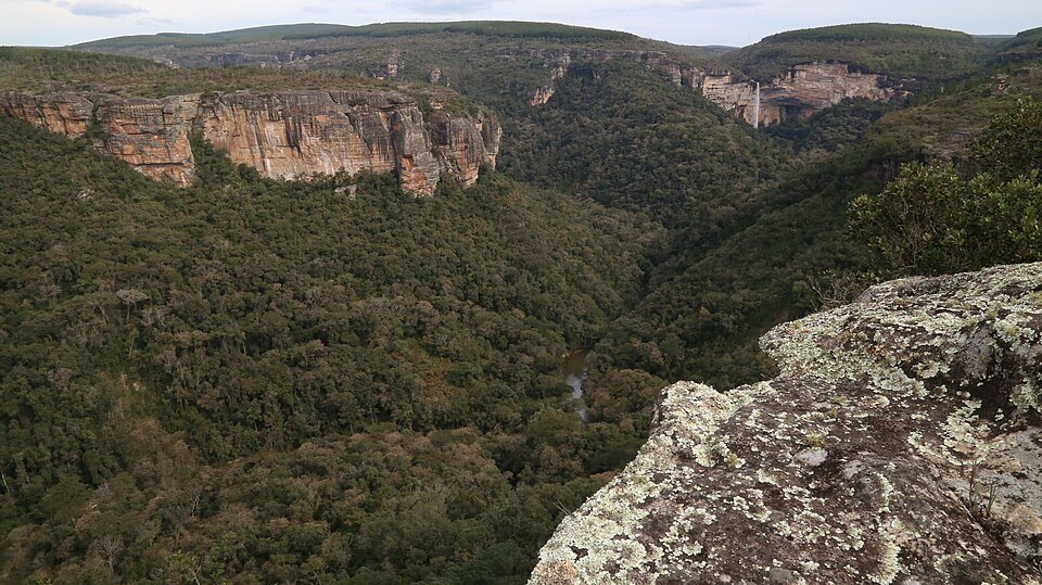
The Paraná Plateau: Fire, Basalt, and the Making of South America's Farmland
Stretching across parts of four countries, the Paraná Plateau (Planalto Paranaense in Portuguese, Meseta Paranaense in Spanish) is a vast tableland of layered volcanic rock that underlies some of South America's most productive farmland and most dramatic waterfalls. Though its Brazilian portion is often folded into discussions of the Brazilian Highlands as a "Southern Plateau" subregion, the Paraná Plateau is better understood as a distinct geological province in its own right: a single, continuous basalt cap laid down in one of the largest volcanic events in the planet's history, which today spans southern Brazil, eastern Paraguay, the Argentine province of Misiones, and the far north of Uruguay. Its story is inseparable from that of Gondwana's breakup, of the terra roxa soils that built Brazil's coffee and soy economies, and of two of the world's most famous waterfalls—one still thundering, one drowned beneath a reservoir.
Geological Origins: A Continent Cast in Basalt
The Paraná Plateau owes its existence to the Paraná-Etendeka large igneous province, one of the most voluminous volcanic events documented in Earth's geological record. Beginning around 135 million years ago and concentrated into a remarkably brief pulse of roughly 132 to 134 million years ago—a geological eyeblink lasting only one to three million years—vast fissure eruptions poured basaltic lava across what was then the interior of southwestern Gondwana. This southern supercontinent had fused South America, Africa, Antarctica, Australia, and India into a single landmass since the late Paleozoic and was, by this point, on the verge of splitting apart. The eruptions are thought to have been triggered by the Tristan da Cunha mantle plume, the same hotspot later responsible for the volcanic island of Tristan da Cunha in the South Atlantic, as it impinged on the base of the Gondwanan lithosphere shortly before the supercontinent began to rift apart.
At the time of eruption, the lava flows covered a single, unbroken landmass. The South Atlantic Ocean had not yet opened, and what is now the Paraná Plateau of South America was directly connected to the Etendeka traps of present-day Namibia and Angola. When the ocean began opening roughly 30 million years later, this once-continuous basalt province was split in two, leaving the larger portion—approximately 1.2 million sq km (463,000 sq mi)—in South America, and a smaller remnant of around 160,000 sq km (62,000 sq mi) stranded on the African side of the widening Atlantic. The basalt itself, known geologically as the Serra Geral Formation, built up through hundreds of individual tabular lava flows, each typically around 25 m (82 ft) thick, stacking in places to a cumulative thickness exceeding 1,700 m (5,580 ft) near the depocenter of the underlying Paraná sedimentary basin.
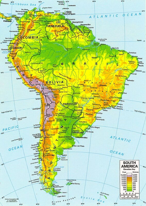
Topographical map of South America.
Physical Extent Across Four Countries
Unlike the Brazilian Highlands, which by definition stop at Brazil's borders, the Paraná Plateau extends well beyond them, following the footprint of the ancient basalt flows rather than any modern political boundary. Its Brazilian portion is by far the largest, underlying most of the states of Paraná, Santa Catarina, and Rio Grande do Sul, along with the western reaches of São Paulo. In Paraguay, the same basalt cap forms the higher ground of the Alto Paraná and Canindeyú departments in the country's east. In Argentina, it underlies the entire province of Misiones, whose distinctive red-earth roads and yerba mate plantations sit atop the same lava flows found a few hundred kilometers north in Brazil. In Uruguay, the plateau's southernmost basalt exposures reach the departments bordering the Río Uruguay in the country's north.
This cross-border continuity is not merely academic. The plateau's basalt cap and the deep red soils weathered from it form a single agro-ecological zone that four national economies now depend on, even as each country manages its share under entirely separate land-use and conservation policies.
Topography: The Escarpment and the Falls
The plateau's most dramatic topographic feature is its eastern rim, where the basalt cap ends abruptly at the Serra Geral escarpment, plunging in places more than 1,000 m (3,280 ft) toward the narrow Atlantic coastal plain below. Inland, the plateau tilts gently westward and northward toward the Paraná River basin, and it is at this western edge, where rivers draining the plateau meet the harder and softer basalt layers beneath them, that the region's two most famous waterfalls formed.
Iguaçu Falls, where the Iguaçu River drops over the plateau's basalt edge in a horseshoe of roughly 275 individual cascades spanning nearly 2.7 km (1.7 mi) on the Brazil-Argentina border, remains one of the largest waterfall systems on Earth by width and is protected within Iguaçu National Park on both sides of the border, a UNESCO World Heritage Site. Less well known today, but historically even more remarkable, were the Sete Quedas or Guaíra Falls, a set of seven cataracts on the Paraná River itself at the Brazil-Paraguay border that, by some measures of water volume, exceeded every other waterfall on the planet, including Niagara and Victoria Falls. In 1982, the rising waters of the newly built Itaipu Dam reservoir submerged the falls entirely, extinguishing one of South America's most powerful natural landmarks in what remains one of the most consequential trade-offs between hydroelectric development and natural heritage in the continent's history.
Terra Roxa: The Soil That Built an Economy
The Paraná Plateau's economic importance rests substantially on its soil. Where the basalt has weathered under humid subtropical conditions over millions of years, it has produced terra roxa ("purple earth"), a deep, iron- and clay-rich soil renowned for its natural fertility and moisture retention. Terra roxa underlies much of the historic coffee belt of northern Paraná and western São Paulo state, which by the early 20th century had made Brazil the world's dominant coffee producer. It remains among the most productive agricultural soils in South America today, now given over predominantly to soybeans, corn, and, in the cooler, higher elevations of Rio Grande do Sul and Misiones, wine grapes and yerba mate (Ilex paraguariensis).
This agricultural transformation has come at a steep ecological cost. The plateau originally supported a mosaic of Atlantic Forest and Araucaria moist forest. Still, intensive clearing for coffee, soy, and cattle since the late 19th century has reduced native vegetation to scattered, often severely fragmented remnants, making the Paraná Plateau one of the most heavily transformed landscapes within the broader Atlantic Forest domain.
Rivers, Dams, and a Hydroelectric Powerhouse
The plateau's basalt geology, high rainfall, and steep western drainage toward the Paraná River combine to make it one of the most important hydroelectric regions on Earth. The Itaipu Dam, built on the Paraná River along the Brazil-Paraguay border and completed in stages through the 1980s and 1990s, remains, by cumulative annual energy generation, one of the two or three largest hydroelectric facilities in the world, and for decades supplied close to a fifth of Brazil's electricity and the large majority of Paraguay's. The Itaipu Biosphere Reserve, established around the reservoir on the Paraguayan side, now protects some of the last significant Atlantic Forest fragments in the country as a partial ecological offset for the dam's construction.
Beneath the basalt cap itself lies part of the Guarani Aquifer, one of the largest freshwater reserves on Earth, which the porous flow-top zones of the Serra Geral basalts help recharge and, in places, help seal, making the plateau important not only for the surface water it channels toward the Paraná and Iguaçu rivers but for the vast reserves of groundwater it sits atop.
Biodiversity in a Fragmented Landscape
Despite extensive clearing, the Paraná Plateau retains ecologically significant pockets of native vegetation, particularly in its higher and cooler southern reaches. Remnant stands of Araucaria angustifolia, the Brazilian pine whose broad umbrella-shaped crown once dominated the plateau's higher elevations, persist within the Araucaria moist forests ecoregion, while the plateau's western and northern fringes, closer to the Paraná and Iguaçu rivers, retain some of the best-preserved sections of the Upper Paraná Atlantic Forests, home to jaguars (Panthera onca), tapirs (Tapirus terrestris), and one of the last viable populations of the harpy eagle (Harpia harpyja) in the Atlantic Forest domain. Iguaçu National Park itself functions as an anchor for this fragmented system, protecting one of the largest continuous blocks of Atlantic Forest remaining anywhere in the biome.
Conclusion
The Paraná Plateau is, in a sense, two stories layered on top of one another: an ancient one, written in basalt during a few violent million years as Gondwana, the ancient southern supercontinent, prepared to tear itself apart, and a modern one, written in coffee rows, soybean fields, and the hum of turbines at Itaipu. Few landscapes in South America illustrate so directly how deep geological time continues to shape contemporary economies and borders, nor how completely a single volcanic event, over 130 million years ago, could determine which countries would one day farm the world's coffee and soy, and which waterfall would outlast the other.