
Cape Horn, Diego Ramírez Islands, and the Drake Passage: Conquering the Final Frontier
Cape Horn and the Drake Passage guard the final frontier at the southern tip of South America — a passage that may take its English name from Sir Francis Drake, who never actually sailed through it, and whose surrounding waters were finally elevated to full national park status in 2025, protecting some of the densest seabird colonies on Earth.

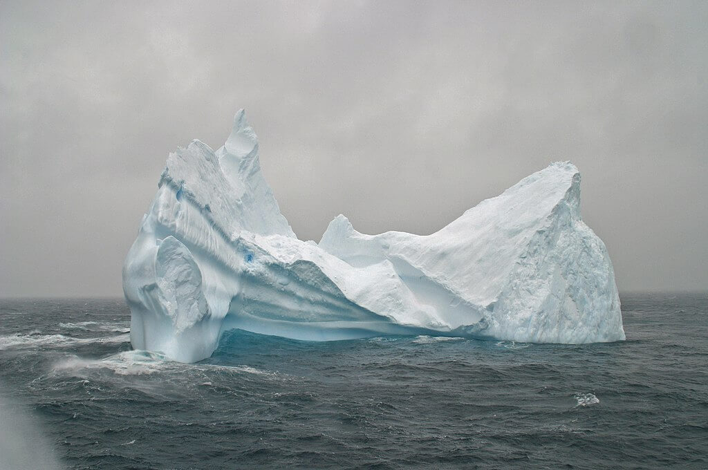
Cape Horn and the Drake Passage: The Sea Named for a Man Who Never Sailed It
At the very edge of the known world, where the vast expanse of the Atlantic and Pacific Oceans converge, lies a realm of untamed wilderness and maritime lore: Cape Horn, the Diego Ramírez Islands, and the legendary Drake Passage. These extreme latitudes, situated at the southernmost tip of South America, have long captured the imaginations of explorers and sailors, representing both the ultimate test of human endurance and the gateway to uncharted territories.
Cape Horn: The Sailor's Everest
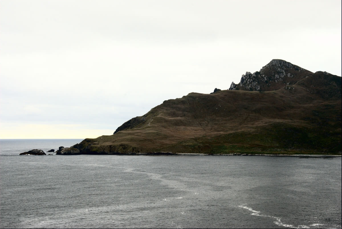
Jutting out from the small Hornos Island, part of Chile's Tierra del Fuego archipelago, Cape Horn is a legendary landfall long revered in maritime history. It was first rounded in 1616 by the Dutch expedition of Willem Schouten and Jacob Le Maire, who named it Kaap Hoorn after Schouten's home city of Hoorn in the Netherlands, a name later anglicized to Cape Horn; the widespread but etymologically unrelated notion that it refers to the shape of a horn is a coincidence of translation rather than the cape's actual namesake. Although not the southernmost point of South America, a distinction belonging to the Diego Ramírez Islands, Cape Horn marks the northern boundary of the Drake Passage, a treacherous strait that separates the continent from Antarctica.
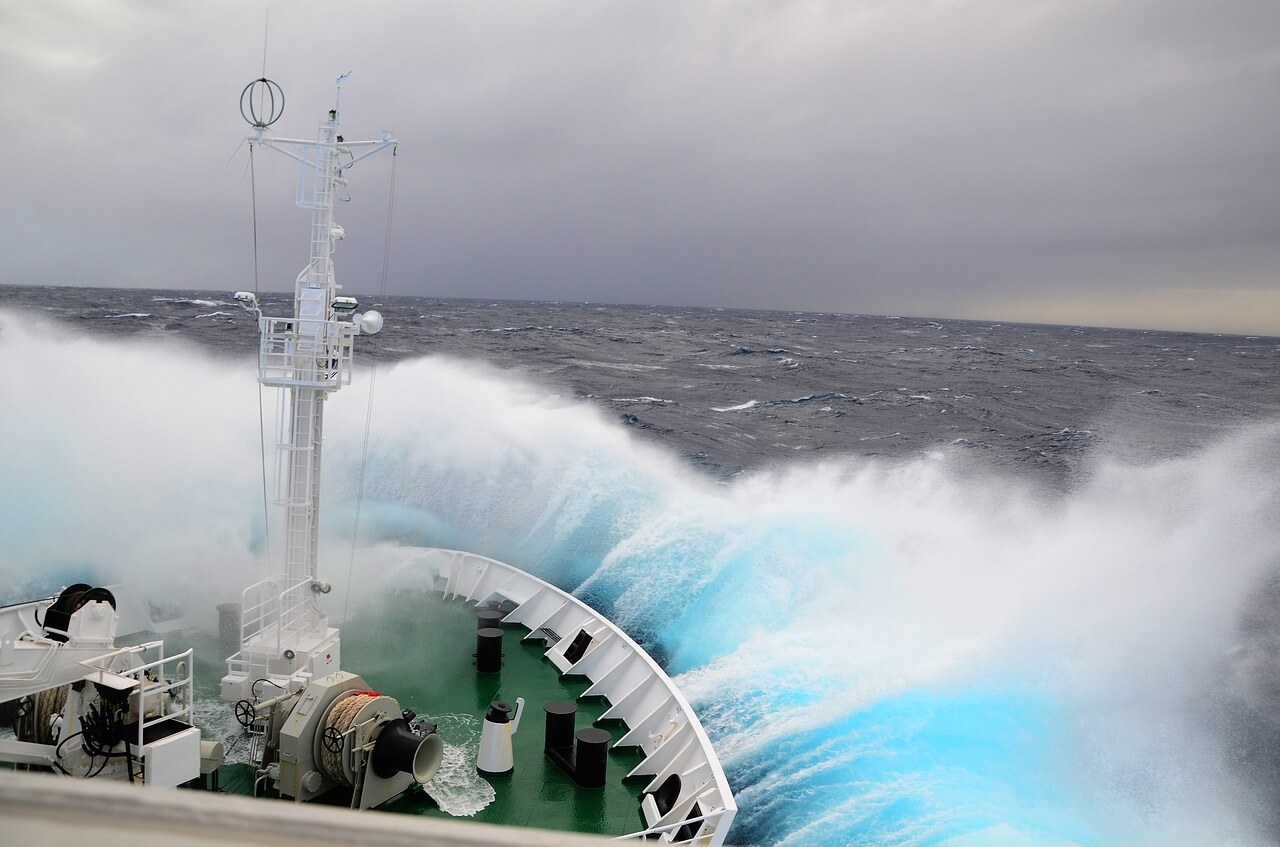
The waters around Cape Horn are notorious for their hazardous conditions, with strong winds, towering waves, treacherous currents, and icebergs conspiring to create a true sailor's graveyard; historians estimate several hundred ships and thousands of sailors have been lost attempting the passage over the centuries. Despite the opening of the Panama Canal in 1914 and the subsequent decline in commercial traffic around the Horn, the region remains a rite of passage for modern sailors. Those who complete the crossing under sail have traditionally earned the right to call themselves "Cape Horners," a designation carrying its own maritime folklore, including the custom of wearing a gold earring in the left ear, the ear that faced the Horn when sailing from east to west, and the right to fly an albatross flag, since the great seabirds that patrol these latitudes were long believed by sailors to carry the souls of those lost at sea.
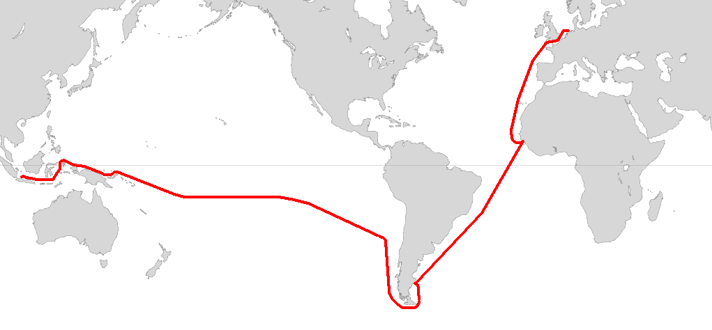
Route of the voyage of Willem Schouten and Jacob le Maire in 1615-1616.
The Diego Ramírez Islands: Sentinels of the South
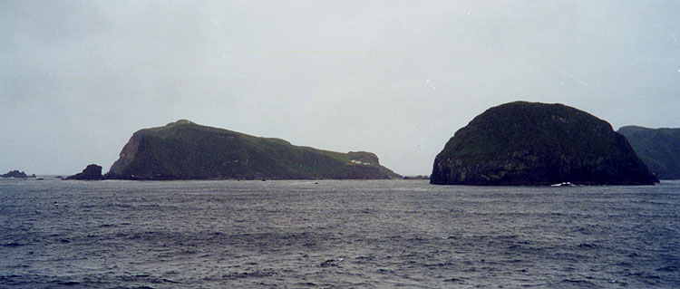
Approximately 105 kilometers (65 miles) west-southwest of Cape Horn, the Diego Ramírez Islands stand as the southernmost landmass of Chile and, indeed, of the entire Americas. This remote archipelago, divided into a northern group of six islets and a larger southern group, was first sighted by the Spanish Garcia de Nodal expedition in 1619 and named after the expedition's cosmographer, Diego Ramírez de Arellano. For 156 years afterward, until the discovery of the South Sandwich Islands in 1775, Diego Ramírez held the distinction of being the southernmost known land on Earth.
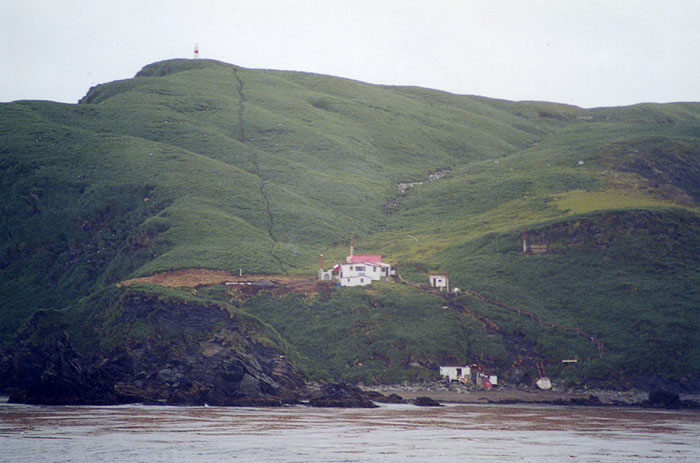
Despite their extreme latitude, the islands boast a surprising abundance of life. With a tundra climate and ample precipitation, these rugged isles serve as crucial nesting sites for numerous seabird species, including the black-browed albatross (Thalassarche melanophris), shy albatross (Thalassarche cauta), grey-headed albatross (Thalassarche chrysostoma), southern rockhopper penguin (Eudyptes chrysocome), and southern giant petrel (Macronectes giganteus). In recognition of this exceptional concentration of seabird life, Chile designated the surrounding waters a marine park in 2018, and in 2025 upgraded that protection to full national park status as the Diego Ramírez Islands and Drake Passage National Park, covering roughly 144,390 hectares (356,900 acres) and administered by Chile's National Forestry Corporation. The islands host a small, permanently staffed Chilean naval lighthouse and research station, among the most isolated inhabited outposts anywhere in South America.
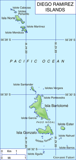
Map depicting the Diego Ramirez Islands.
The Drake Passage: Nature's Gauntlet
Separating Cape Horn from the Antarctic Peninsula, the Drake Passage is the widest and most treacherous route around the southern tip of South America. Spanning approximately 800 kilometers (500 miles) at its narrowest point, this turbulent body of water connects the southwestern Atlantic Ocean (Scotia Sea) with the southeastern Pacific Ocean.
The passage's English name honors Sir Francis Drake, whose 1578 voyage was blown south of the Strait of Magellan, demonstrating that open water, rather than a landmass, connected the two oceans at this latitude. Drake himself, however, never actually sailed the passage that bears his name. More than half a century earlier, in 1525, Spanish navigator Francisco de Hoces, commanding a ship in Loaísa's expedition, was similarly driven south by a storm and may have sighted the same open water first, a claim that has led many Spanish-speaking and Latin American sources to refer to the passage instead as Mar de Hoces (Sea of Hoces), a naming dispute that persists to this day even as "Drake Passage" remains the more widely used English name internationally.
The Drake Passage is also a geological marvel. Evidence suggests it was closed until around 41 million years ago, at which point the Antarctic and South American continents drifted apart, allowing the Atlantic and Pacific Oceans to join and establishing the Antarctic Circumpolar Current. This event not only transformed global climate patterns but also played a crucial role in the formation of Antarctica's ice cap and the continent's subsequent cooling, making the passage's opening one of the most consequential single geological events in the planet's climatic history.
Conclusion
From the legendary Cape Horn to the remote Diego Ramírez Islands and the treacherous waters of the Drake Passage, this region represents the ultimate frontier for maritime exploration, a place shaped as much by centuries of contested naming and national rivalry as by wind, water, and ice. As newly formalized national park status now recognizes, it is also home to some of the densest and most significant seabird colonies on Earth, a reminder that even the world's most fearsome maritime passage is, first and foremost, a living ecosystem worth protecting.
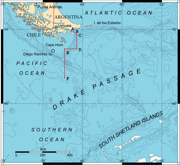
Map depicting the Drake Passage in relation to Cape Horn and the Diego Ramirez Islands. The boundary points A, B, C, D, E and F were accorded by the Treaty of Peace and Friendship of 1984 between Chile and Argentina.