The Río de la Plata: A Confluence of Majesty
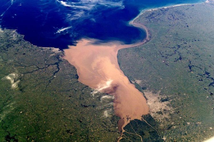
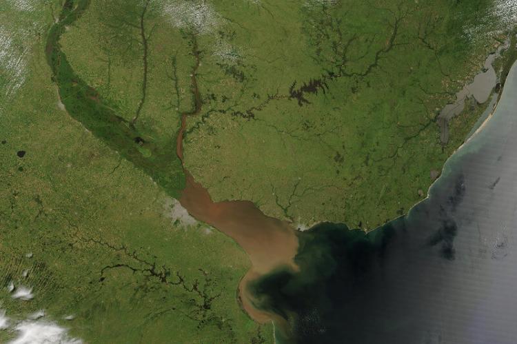
The Río de la Plata is a monumental estuary and drainage basin along South America's southeastern coastline. It is a tapering intrusion of the Atlantic Ocean between Uruguay and Argentina. This immense waterway is a testament to the continent's awe-inspiring natural grandeur.
Converging Waters: The Majesty of the Río de la Plata
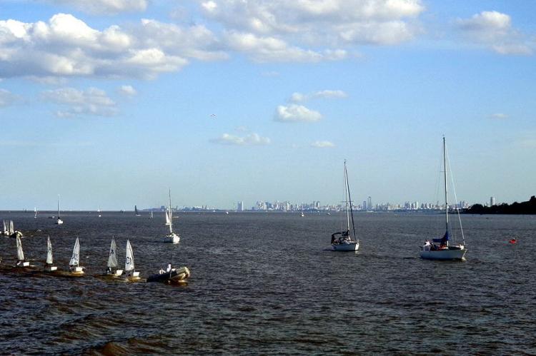
Carving a vast and imposing presence along the southeastern coastline of South America, the Río de la Plata stands as a monumental estuary and drainage basin, a tapering intrusion of the Atlantic Ocean stretching its embrace between Uruguay and Argentina. This immense waterway, often regarded as a gulf, a marginal sea, or even the widest river in the world, is a testament to the continent's awe-inspiring natural grandeur.
Confluence of Mighty Rivers
At the heart of the Río de la Plata's majesty lies a confluence of mighty rivers, each contributing grandeur to this vast estuary. The Paraná River, the Paraguay River, and the Uruguay River converge their waters, forming a funnel-shaped indentation that empties into the Atlantic Ocean. To those who revere it as a river, the Río de la Plata claims the title of the world's most expansive, with a staggering total area of approximately 35,000 square kilometers (13,500 square miles).
The Paraná River, the second longest river in South America, travels over 4,880 kilometers (3,000 miles) from its source in Brazil, passing through Paraguay and Argentina. The Paraguay River, originating in the Brazilian Highlands, traverses through the heart of South America, including the vast wetlands of the Pantanal, before merging with the Paraná. With its source in the Serra do Mar in Brazil, the Uruguay River flows southward, delineating the border between Argentina and Brazil and then between Argentina and Uruguay. The confluence of these rivers not only defines the Río de la Plata but also underpins the region's hydrological and ecological complexity.
A Drainage Basin of Continental Proportions
The Río de la Plata's influence extends far beyond its immediate shorelines, drawing sustenance from a drainage basin that spans a staggering 3,170,000 square kilometers (1,220,000 square miles). This vast hydrographical area, second only to the Amazon basin in South America, encompasses regions of southeastern Bolivia, southern and central Brazil, the entirety of Paraguay, most of Uruguay, and northern Argentina – a true continental treasure.
This drainage basin includes diverse ecosystems ranging from the Pantanal wetlands, the largest tropical wetland in the world, to the expansive Gran Chaco region. The interconnected river systems facilitate nutrient flow and sediment transport and support a wide variety of flora and fauna. This extensive network ensures that the Río de la Plata is a critical resource for biodiversity, influencing climatic and hydrological patterns across the continent.
Rivers of Might and Grandeur
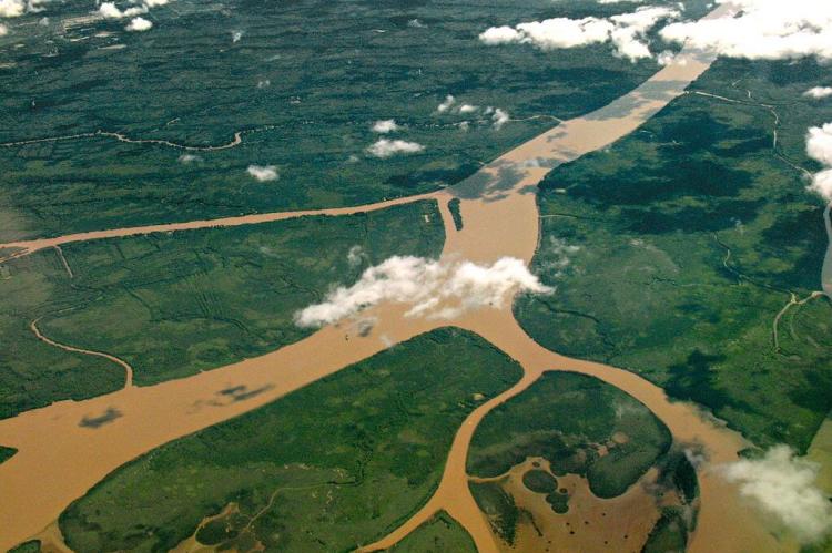
A network of mighty rivers weaves a tapestry of interconnected waterways within this immense drainage basin. The Paraná River and its tributaries, including the Paranaíba River, Grande River, Tietê River, Paranapanema River, Iguazu River, and the Salado River, contribute their waters to the Paraná Delta's expanse. The Paraguay River, flowing through the Pantanal wetland, receives the Pilcomayo River and the Bermejo River before joining the Paraná. The Uruguay River, too, plays its part, with the Pelotas River, Canoas River, Ibicuí River, and the Río Negro as its main tributaries. And not to be forgotten is the Salado del Sur River, another significant contributor to the Río de la Plata's grandeur.
These rivers form complex aquatic systems, supporting diverse marine life and facilitating regional hydrology. The Paraná Delta, in particular, is a dynamic and ecologically rich area, providing crucial breeding grounds for fish and bird species and acting as a buffer against floods.
Harnessing Nature's Power: Hydroelectric Marvels
The Río de la Plata basin is not merely a showcase of nature's majesty but also a testament to human ingenuity and the harnessing of its mighty waters. Several hydroelectric dams dot the landscape, including the Itaipu facility, the second-largest operating hydroelectric plant in the world, shared between Paraguay and Brazil on the Paraná River. The Itaipu Dam alone generates about 90 million megawatt-hours annually, supplying a significant portion of the energy needs for both countries.
Other significant hydroelectric projects in the basin include the Yacyretá Dam between Argentina and Paraguay and the Salto Grande Dam between Argentina and Uruguay. These projects provide renewable energy and play roles in water management, flood control, and agricultural irrigation, highlighting the multifaceted benefits of harnessing the river's power.
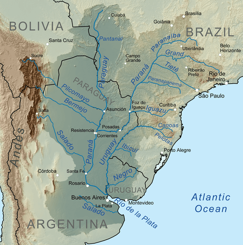
Map showing the Río de la Plata drainage basin, including major tributaries and cities.
A Nexus of Environmental and Economic Significance
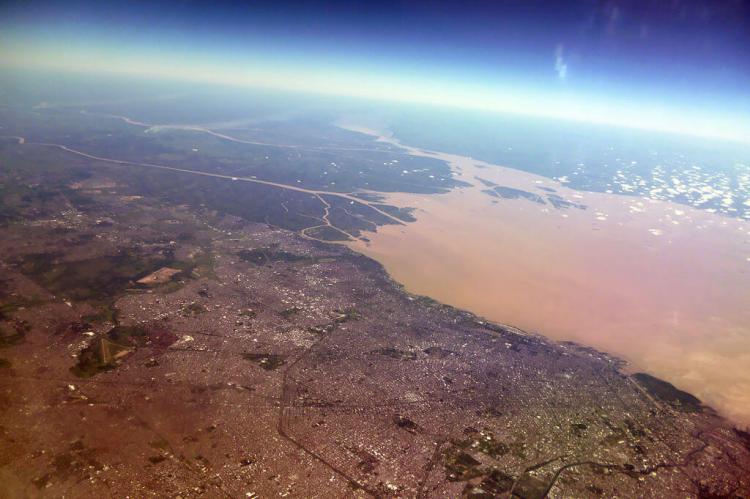
Beyond its awe-inspiring natural beauty, the Río de la Plata estuary holds immense environmental and economic significance for the region. Its waters sustain vast wetlands, diverse ecosystems, and countless species, while its tributaries provide vital resources for agriculture, industry, and human settlements. The estuary is a crucial maritime gateway, facilitating trade and commerce for the nations that call its shores home.
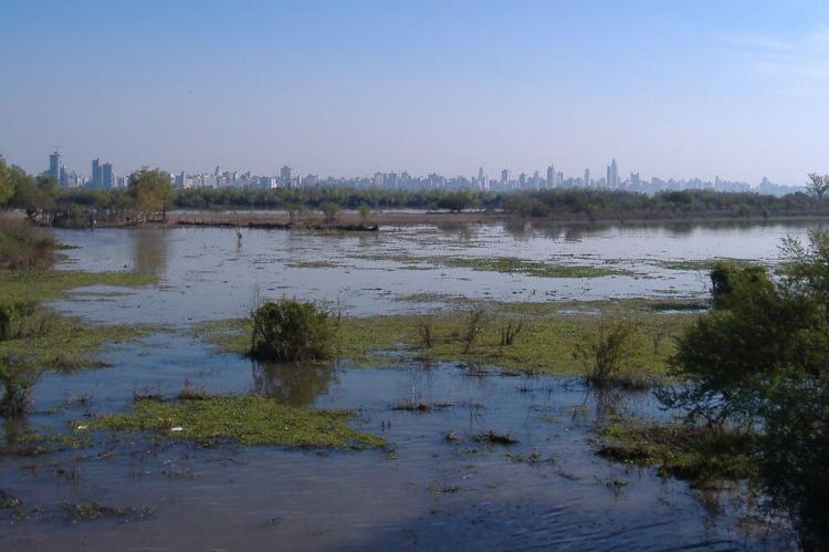
The port cities of Buenos Aires and Montevideo serve as major economic hubs, with the estuary providing navigable waters that support shipping and transportation. The region's fertile plains, irrigated by the river's tributaries, are among the most productive agricultural areas in the world, producing soybeans, corn, wheat, and livestock. Additionally, the wetlands and riverine forests along the Río de la Plata are biodiversity hotspots, supporting species such as the capybara, the marsh deer, and numerous bird species, including migratory birds that travel between continents.
Environmental Challenges and Conservation Efforts
The Río de la Plata basin faces several environmental challenges, including pollution, habitat destruction, and climate change. Industrial effluents, agricultural runoff, and urban sewage contribute to water pollution, affecting human health and aquatic life. Deforestation and land conversion for agriculture have led to habitat loss and fragmentation, impacting biodiversity and ecosystem services.
Climate change poses a significant threat, with changing rainfall patterns and rising sea levels potentially altering the basin's hydrology and increasing the risk of extreme weather events such as floods and droughts. Addressing these challenges requires coordinated conservation, sustainable development, and pollution control efforts.
Various initiatives aim to protect and restore the basin's ecosystems. These include establishing protected areas, reforestation projects, and improving water quality through better waste management practices. International cooperation among the basin's countries is crucial for effective conservation and management strategies.
Conclusion: A Majestic Waterway for the Ages
The Río de la Plata stands as a true marvel of the natural world, a confluence of mighty rivers that converge in a tapering embrace of the Atlantic Ocean. The grandeur of this waterway extends far beyond its immediate shorelines, drawing sustenance from a vast continental drainage basin encompassing diverse landscapes and ecosystems. Marveling at its majesty, it is crucial to recognize the delicate balance that must be maintained between human activities and the preservation of this invaluable natural resource. Ensuring the Río de la Plata remains a source of wonder and sustenance requires ongoing efforts to protect and conserve this remarkable estuary for future generations.
Understanding the complex interplay of natural and human factors that shape the Río de la Plata allows one to appreciate its full significance and work toward its preservation. The estuary's unique position as a natural wonder and a vital economic resource underscores the importance of sustainable practices that honor its past while safeguarding its future.
![Map of the Río de la Plata, River Plate or [La] Plata River, between Argentina and Uruguay in South America](/sites/default/files/inline-images/plata_buenos_aires_montevideo_map_opt%20%281%29.png)
Map depicting the Río de la Plata between Argentina and Uruguay in South America.
