El Salvador: Pre-Columbian Maya Ruins and Archaeological Sites
El Salvador has five archaeological parks, plus a Mesoamerican site. The Yucatán Peninsula and the Petén Basin/Maya Forest region of Belize, Guatemala and Mexico have become synonymous with Maya ruins; however, several sites in El Salvador are important.
Pre-Columbian Maya Ruins and Archaeological Sites in El Salvador
The Yucatán Peninsula and the Petén Basin/Maya Forest region of Belize, Guatemala and Mexico have become synonymous with Maya ruins; however, several archaeological sites in El Salvador are essential.
El Salvador has five archaeological parks: San Andrés, Casa Blanca, Tazumal, Joya de Cerén and Cihuatan. In addition, Cara Sucia is a Mesoamerican archaeological site in western El Salvador that is not open to the public. Quelepa is another important archaeological site whose remains are on privately owned land under cultivation.
The most important of these, Joya de Ceren ("The Pompeii of the Americas"), is located near the towns of San Juan Opico and Las Flores in La Libertad province and was buried by ash from the eruption of the Loma Caldera volcano between 600-650 A.D. In 1993, the site was declared a World Heritage Site by UNESCO.
Cara Sucia
Cara Sucia is a Mesoamerican archaeological site located in western El Salvador. The area was first settled in the Preclassic period. It was finally abandoned around 900 AD, in the Terminal Classic, when the Pipil people moved into the region, although there is no evidence of Pipil occupation at the site.
It is thought that during the Early Preclassic (1200–500 BC), the site was occupied by people who spoke a forerunner of the Mayan languages. During the Late Preclassic period, the site has evidence of contact with Chalchuapa and Kaminaljuyu in the Guatemalan Highlands.
The site is one of the most important archaeological sites in western El Salvador, but it has not been restored. It consists of several grass-covered mounds, some of which are very large. The site's architecture, ceramics and sculpture share stylistic similarities, indicating a link with the Cotzumalhuapa culture in Pacific Guatemala.
Cara Sucia is the southeasternmost regional center associated with this culture. In 1992, it was entered into the UNESCO World Heritage Tentative List, together with El Imposible National Park.
Casa Blanca
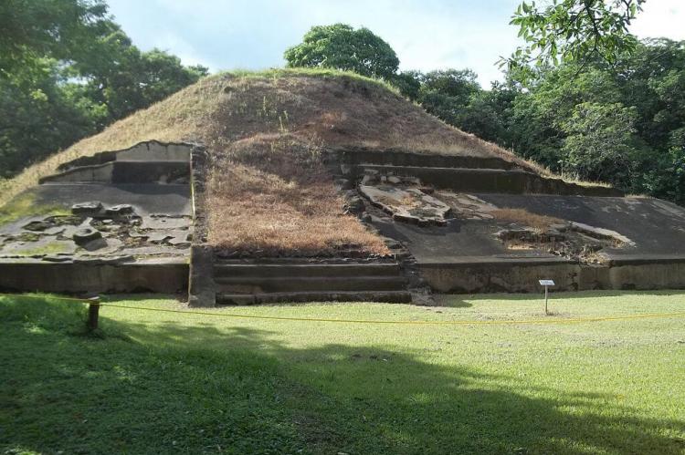
Casa Blanca is a pre-Columbian Maya archeological site in Chalchuapa, El Salvador. The government purchased the park in 1977 and was given the name of the coffee plantation upon which it was situated.
Casa Blanca is located in the Santa Ana department. It has been closed to the public and is undergoing restoration work. The site museum has exhibits that include Maya ceramics and other artifacts.
The site possesses several pyramids dating to the Late Preclassic period (500 BC-AD 250) and the Classic period (AD 250–900), but only two have been partially restored. This ruin is part of the Chalchuapa archaeological zone and displays influences from the Olmecs and Teotihuacan. It is closely related to the ruins of Tazumal and San Andrés.
Cihuatán
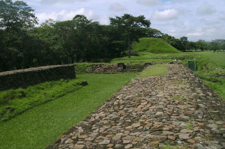
Cihuatán is a primary pre-Columbian archaeological site in central El Salvador. It was a vast city located in the extreme south of the Mesoamerican cultural area and has been dated to the Early Postclassic period of Mesoamerican chronology (c. 950–1200 AD).
Archaeological investigation of the site was undertaken in the mid to late 1970s by Karen Olsen Bruhns of San Francisco State University in conjunction with El Salvador's Administración de Patrimonio Cultural (Cultural Heritage Administration).
By 1980, 63 ha (155 acres) of the city had been mapped by the archaeological project, covering an area that included over 900 structures.
Cihuatán was a very large Mesoamerican city. The city possessed two principal ceremonial centers, the Eastern and Western Ceremonial Centers.
In 1978, the Western Ceremonial Center was cleared of vegetation and mapped. Excavations included a cluster of residential buildings hastily abandoned due to fire, resulting in the preservation of many household goods when the walls collapsed.
The ceremonial architecture of the site core is in a pan-Mesoamerican style; outside of the ceremonial groups, it is distinctively Maya.
Joya de Cerén
Joya de Cerén contains the remains of a pre-Hispanic farming village covered by a volcanic eruption in the seventh century A.D. This World Heritage Site is often called the "Pompeii of the Americas."
Read more here: Joya de Cerén Archaeological and World Heritage Site
Quelepa
Quelepa is an important archaeological site located in eastern El Salvador. The archaeological remains of Quelepa are on privately owned land under cultivation.
Generally considered to have been settled by the Lenca people, the site was founded around 400 BC, in the Late Preclassic period (500 BC-AD 250) on the banks of the Río San Esteban, a tributary of the Río Grande de San Miguel. Forty structures, divided into two groups of "east" and "west," stretch a little over one-half mile along the riverbank.
The inhabitants constructed a platform from plaster and pumice and rebuilt it several times. Artifacts recovered during the site excavations indicate that the local population depended upon subsistence agriculture; these artifacts included metates (a kind of mortar) and comales (a type of griddle).
The site belonged to the Mesoamerican cultural region. Quelepa means "stone jaguar" in the Lenca language, probably in reference to the large Jaguar Altar found at the site.
San Andrés
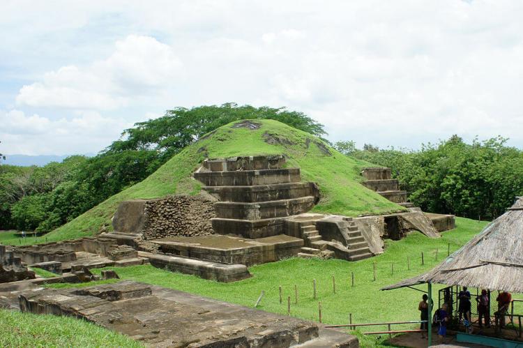
San Andrés is a pre-Columbian site in El Salvador, whose occupation began around 900 BC as an agricultural town in the valley of Zapotitán in the department of La Libertad.
This early establishment was vacated by 250 AD because of the enormous eruption of the caldera of Lago Ilopango. It was occupied again in the 5th Century, along with many other sites in the valley of Zapotitán.
Between 600 and 900 AD, San Andrés was the capital of a Maya polity with supremacy over the other establishments of Valle de Zapotitán.
The residential area has not yet been well studied. The investigations and excavations in San Andrés have been primarily of the political-ceremonial center and have revealed that it was divided into the South Seat (from which they governed) and the North Seat.
In 600 AD, the South Seat was filled with adobe (leaving a tunnel leading to the original seat) to construct the Acropolis, which contained ceremonial and political structures. Pyramids or structures are located at the ends to the South and East of the Acropolis.
Tazumal
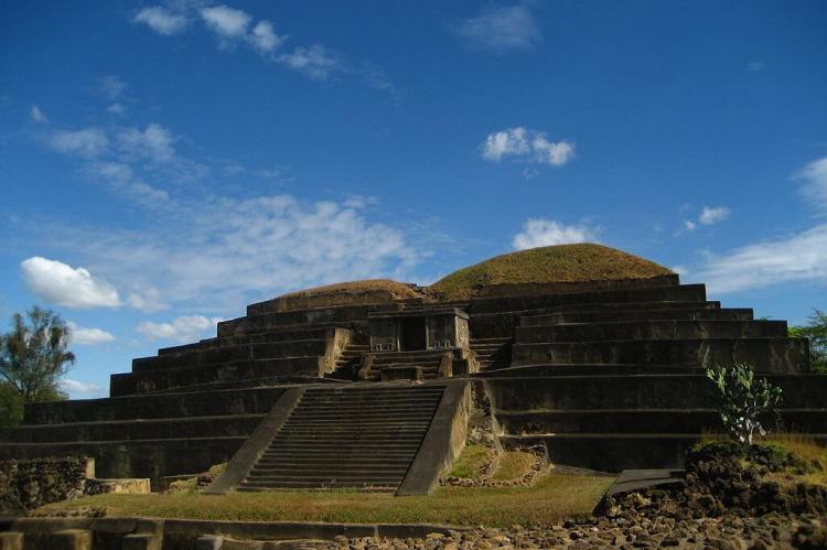
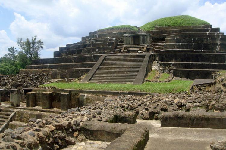
Tazumal, a pre-Columbian Maya archaeological site, is an architectural complex within the larger area of the ancient Mesoamerican city of Chalchuapa in western El Salvador.
The Tazumal group is located in the southern portion of the Chalchuapa archaeological zone. Archaeologist Stanley Boggs excavated and restored the Tazumal complex during the 1940s and 1950s.
Archaeological investigations indicate that Tazumal was inhabited from the Classic to the Postclassic periods. The site had links as far afield as central Mexico, the northern Yucatán Peninsula and lower Central America. Metal artifacts from the complex, dating to the 8th Century A.D., are among the earliest metal artifacts reported from Mesoamerica.
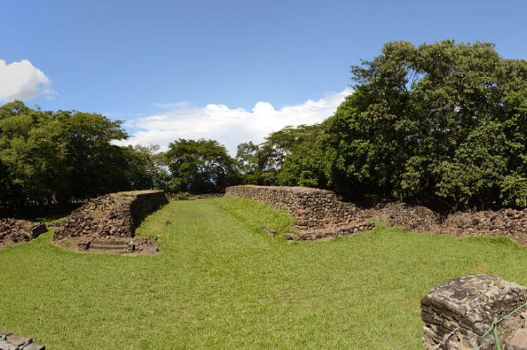
All the buildings in the Tazumal complex face west. Tazumal is believed to possess a Mesoamerican ballcourt based on the external appearance of two unexcavated mounds in the northwestern portion of the site within a 20th-century cemetery. One of the mounds is badly damaged. Green obsidian artifacts found at Tazumal indicate links with central Mexico.
