
The Orinoco River: South America's Arc of Life
The Orinoco River, one of South America's largest, flows through Venezuela and Colombia and serves as a crucial transportation waterway. It originates in the Sierra Parima mountains and empties into the Atlantic Ocean. The river supports rich ecosystems, Indigenous cultures, and human populations.
The Orinoco River: A Vital Lifeline of Northern South America
The Orinoco River rises in the Parima Mountains of southern Venezuela and sweeps in a great arc through Venezuela and Colombia before spreading into a vast delta on the Atlantic coast. It is the third-largest river on Earth by discharge, a waterway tied to the Amazon system through the Casiquiare, and a homeland for peoples such as the Warao, Piaroa, Ye'kwana and Yanomami. Its basin shelters river dolphins, giant otters and the critically endangered Orinoco crocodile, and it now faces mining, mercury contamination and oil-industry pressures that put much of that richness at risk.
Geography and Course of the Orinoco River
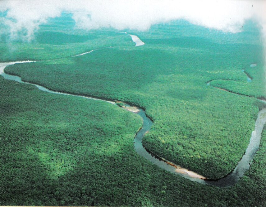
The river's hydrological source lies on Cerro Delgado-Chalbaud in the Parima Mountains, at an elevation of about 1,047 m (3,435 ft), within the Guiana Highlands. The source was located only in 1951, by a French-Venezuelan expedition led by Franz Rísquez Iribarren. From there the Orinoco flows west and north, then turns east, forming a huge arc that carries it past rainforest, savanna and rapids to the sea. Reported lengths range from about 2,140 km (1,330 mi) in recent compilations to 2,740 km (1,700 mi) in older references, depending on how the source and delta are measured. For a long stretch, the river forms the border between Venezuela and Colombia.
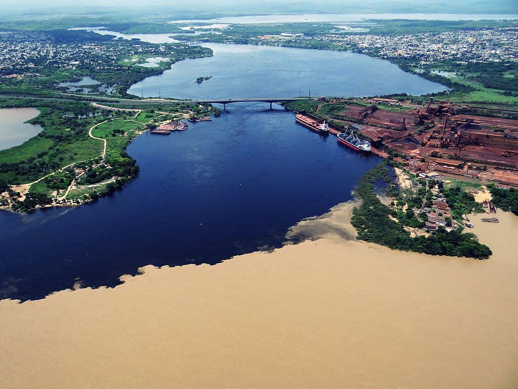
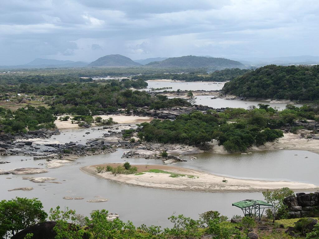
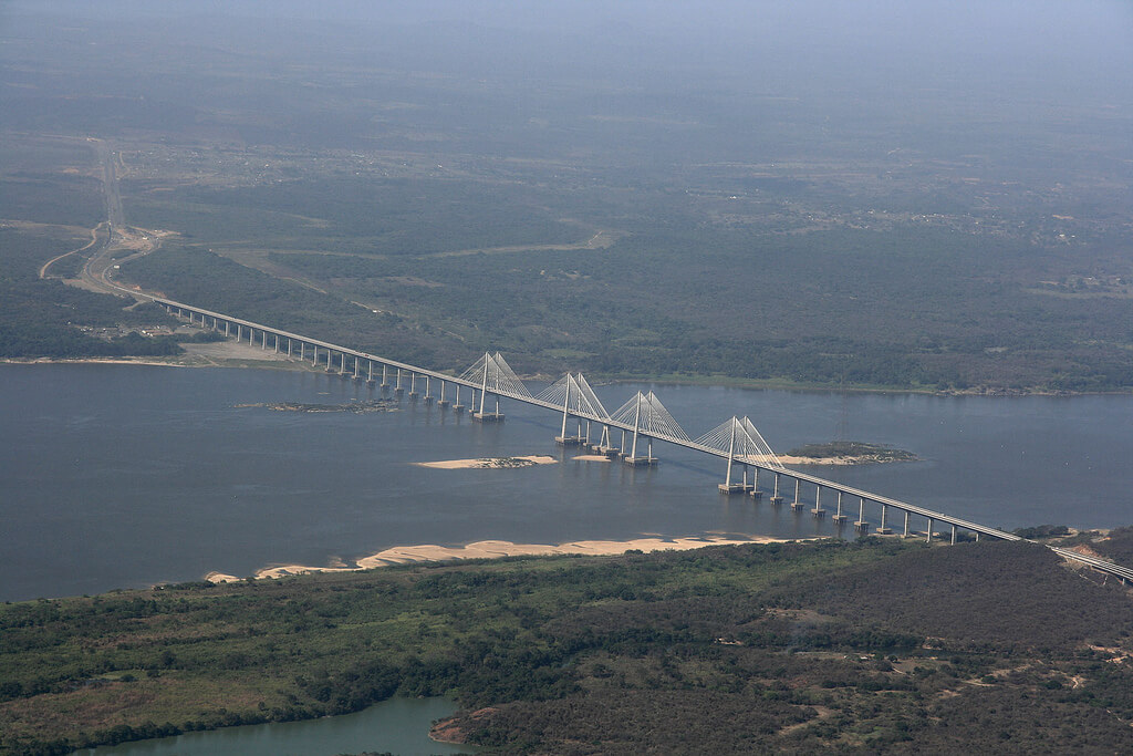
Its average discharge at the delta is roughly 39,000 m³/s (about 1.4 million cu ft/s), a volume exceeded only by the Amazon and the Congo. The flow swells dramatically in the rainy season, when the lower river and its tributaries flood the plains for months. Ocean-going vessels can reach Ciudad Bolívar, about 435 km (270 mi) upstream, where the river narrows, and the Angostura Bridge there, finished in 1967, was the first to span the river. Farther downstream, the Orinoquia Bridge, opened in 2006 near Ciudad Guayana, carries both road and rail traffic. Upstream, the Atures Rapids near Puerto Ayacucho block navigation and have long divided the river into a navigable lower course and a more remote upper one.
Christopher Columbus sighted the river's mouth on 1 August 1498, and in 1800 Alexander von Humboldt and Aimé Bonpland explored stretches of the upper river and recorded its pink river dolphins. The name is often traced to a Warao phrase meaning roughly "a place to paddle," a fitting description for a people who live by boat.
The Orinoco River Basin
The basin covers roughly 880,000 km² (340,000 sq mi) by WWF's reckoning, and more than 1,000,000 km² (390,000 sq mi) in some compilations, with roughly two-thirds in Venezuela and one-third in Colombia. It is bounded by the Andes to the west and north, the Guiana Highlands to the south and east, and the Amazon Basin across a low divide to the south. The great tributaries come from two very different landscapes. From the Andes and the plains flow the Guaviare, the largest by discharge at about 8,200 m³/s (290,000 cu ft/s), together with the Meta, Arauca and Apure, whose waters spread across the Llanos savannas. From the Guiana Highlands come the Caroní, the largest Venezuelan tributary, along with the Caura, Ventuari and Atabapo, whose dark, nutrient-poor waters drain ancient sandstone and granite.
The most famous link in the system is the Casiquiare, a natural channel that leaves the upper Orinoco and runs to the Río Negro, a tributary of the Amazon River. Water and fish can therefore pass between the two great river systems, a rare case of a river bifurcation connecting continental watersheds. The Casiquiare River has its own article.
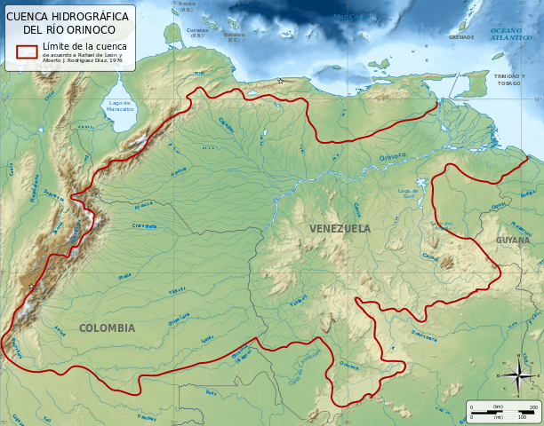
Map depicting the Orinoco Basin.
Ecology and Wildlife of the Orinoco River
More than 1,000 fish species have been recorded in the basin, and roughly 15 percent of them are found nowhere else. Characins and catfishes dominate, and the list includes the black-spot piranha (Pygocentrus cariba), the aquarium favorite known as the cardinal tetra (Paracheirodon axelrodi), and the red-tail catfish (Phractocephalus hemioliopterus). WWF counts about 1,300 bird species and about 250 mammal species in the basin.
The river's best-known reptile is the Orinoco crocodile (Crocodylus intermedius), one of the world's rarest crocodilians and listed as Critically Endangered. Hunters for the skin trade nearly wiped it out between the 1940s and 1960s. Perhaps 250 to 1,500 survive in the wild, with fewer than 500 adults in the largest population, in the Cojedes and Sarare regions of Venezuela. Large adults can reach about 4.2 m (14 ft), though most are shorter, and females average about 3 m (10 ft). Venezuela runs captive-breeding programs, and Colombia reintroduced 41 crocodiles to El Tuparro National Natural Park in 2015 and 2016.
The river and its floodplains also shelter the Amazon River dolphin or boto (Inia geoffrensis), the giant otter (Pteronura brasiliensis), the jaguar (Panthera onca), the harpy eagle (Harpia harpyja) and the Orinoco goose (Neochen jubata), along with capybaras and anacondas. Across the Llanos, seasonal floods concentrate fish, wading birds and caimans in vast numbers during the dry months.
The Orinoco Delta
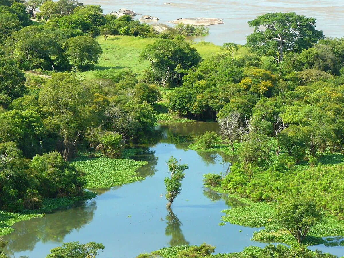
Near the Atlantic, the Orinoco fans out into a delta of roughly 22,500 km² (8,700 sq mi) by one measure, up to about 370 km (230 mi) wide, and cut by a maze of channels called caños. The surrounding Orinoco Delta swamp forests ecoregion covers about 27,972 km² (10,800 sq mi) and reaches from the Paria Peninsula across the delta floodplain to the Waini River in Guyana. Its permanently flooded forests include kapok (Ceiba pentandra), crabwood (Carapa guianensis), and greenheart (Chlorocardium rodiei), along with stands of moriche palm (Mauritia flexuosa) and açaí (Euterpe oleracea). Mangroves fringe the coast and give way inland to swamp forest and marsh.
Three Venezuelan national parks protect parts of the delta: Delta del Orinoco (3,310 km², or 1,278 sq mi), Turuépano (726 km², or 280 sq mi) and Mariusa (2,650 km², or 1,023 sq mi). UNESCO's Delta del Orinoco Biosphere Reserve covers 877,850 ha (8,779 km², or 3,389 sq mi) and records more than 2,000 plant species, 464 birds, and 210 fish species. WWF classifies the ecoregion as relatively stable and intact, with oil exploration named as the main future threat.
Indigenous Communities and Cultural Importance
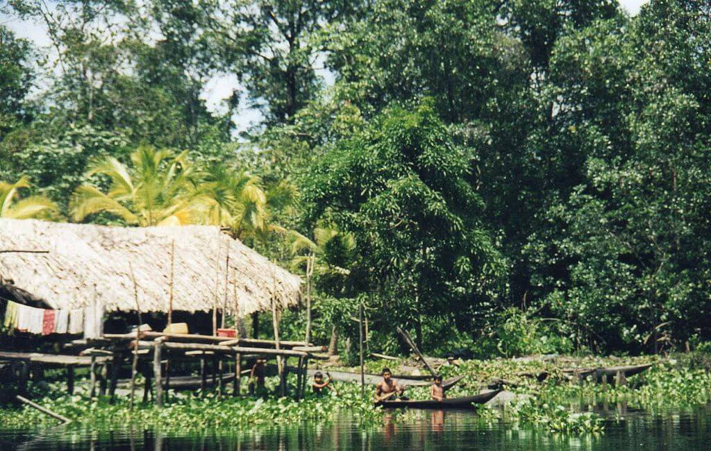
The Warao, whose name is usually translated as "people of the canoe," live in the delta. They build stilted, thatched houses above the floodplain and rely on fishing, hunting, and harvesting forest products, notably the moriche palm, whose fibers, fruit, and starch supply food and craft materials. UNESCO puts the number of Warao in the eastern delta at about 20,000. Upriver, the Piaroa, Ye'kwana, Yanomami, Sanema, Panare and other peoples live along the tributaries and in the forested highlands. Their territories overlap increasingly with mining, logging, and oil-industry frontiers, and many of these communities depend on river fish for protein, which makes them especially vulnerable to contamination. Colombian and Venezuelan Llaneros, whose cattle culture grew up on the seasonally flooded plains, form another strand of the basin's human story (see Venezuela: Cultural Landscape).
Economic and Environmental Significance
The Orinoco is eastern Venezuela's main transport artery. Its navigable lower course carries iron ore, bauxite, and other cargo from the Guayana region to the sea, and its tributaries link river towns in the Colombian plains. The Caroní, the largest Venezuelan tributary, is dammed for hydroelectric power and supplies much of Venezuela's electricity. South of the river lies the Orinoco Oil Belt, about 55,314 km² (21,357 sq mi), roughly 600 km (370 mi) long and 70 km (43 mi) wide, and holding extra-heavy crude. The USGS has assessed about 513 billion barrels as technically recoverable, and PDVSA has put producible reserves far lower, at up to 235 billion barrels. The oil is expensive to produce and refine, and spills and aging infrastructure have repeatedly harmed rivers and wetlands.
Mining poses the sharpest threat. In 2016, Venezuela created the Orinoco Mining Arc, a zone of 111,843 km² (43,183 sq mi), about 12 percent of the national territory, across Amazonas, Bolívar, and Delta Amacuro states, and opened it to gold, bauxite, coltan, and diamonds. It includes national parks, monuments, and Indigenous lands. Gold miners use mercury, which accumulates in fish and then in the people who eat them. Studies in the Caura basin found elevated mercury in 92 percent of 152 Indigenous women sampled, with an average hair level of 9.38 ppm against a WHO guideline of 2 ppm, and in the Caroní basin contamination was measured more than 200 km (125 mi) downstream of mining sites. Satellite analyses reported in Associated Press coverage in 2026 estimate that Venezuela lost about 480 km² (185 sq mi) to gold mining between 2018 and 2025. New oil and mining laws under discussion in 2026 may expand extraction, which environmental and Indigenous groups warn could add to the damage.
Conservation here depends on protecting the Llanos and delta wetlands, restoring crocodile and dolphin populations, and controlling mercury. Large dams planned for several tributaries could also alter the flood pulse the basin's fishes depend on.
Conclusion
The Orinoco joins the highlands of the Guiana Shield, the plains of the Llanos, the foothills of the Andes and the swamp forests of the delta into a single river system, and it ties them to the Amazon through the Casiquiare. Few rivers of its size remain intact, so decisions about mining, oil, and dams in the coming years will be decisive for the people and wildlife that depend on it.